October 15 , 2019 .
Indonesia , Merapi :
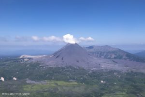
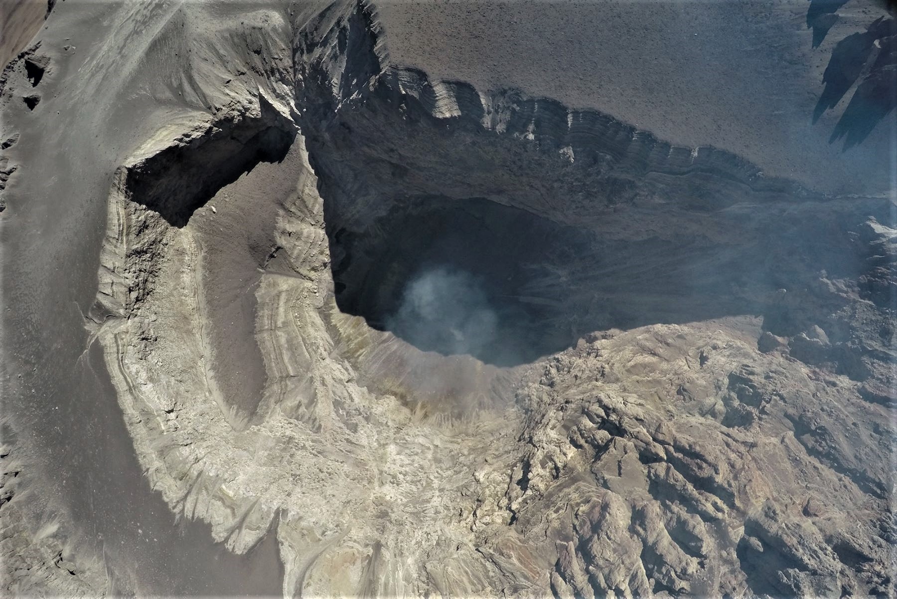
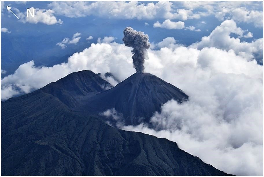
Eruption of Mount Merapi, October 14, 2019.
On Monday, October 14, 2019 at 16:31 WIB, an eruption was recorded on a seismogram with an amplitude of 75 mm and a duration of 270 seconds. The smoke column of the eruption rose to about 3000 m above the summit. To anticipate volcanic ash disturbances, an Orange color code (VONA) was issued with the Volcanoes Observation Notice for aviation. Ash rains were reported around Mount Merapi, in the dominant direction of the western sector, 25 km from the summit at about 18:05.
A significant increase in surveillance data was not observed before the event. This incident was caused by the accumulation of volcanic gases that were released suddenly.
The threat of danger from this incident is the same as before, namely hot avalanche clouds (APL) from materials from the lava dome. The results of the modeling show that if the current lava dome (468,000 m3) collapses, the drift of hot clouds will not exceed a radius of 3 km.
Communities should remain calm and practice their activities as usual outside the 3 km radius around the summit of Mount Merapi.
VOLCANO OBSERVATORY NOTICE FOR AVIATION – VONA.
Issued: October 14 ,2019
Volcano: Merapi (263250)
Current Aviation Colour Code: ORANGE
Previous Aviation Colour Code: orange
Source: Merapi Volcano Observatory
Notice Number: 2019MER02
Volcano Location: S 07 deg 32 min 31 sec E 110 deg 26 min 31 sec
Area: Special Region of Yogyakarta, Indonesia
Summit Elevation: 9498 FT (2968 M)
https://www.facebook.com/climbtomerapimerbabu/videos/2516876201866812/
Volcanic Activity Summary:
Eruption with ash cloud at 09h31 UTC (16h31 local), lasted for 4 minutes. Eruption has stopped.
Volcanic Cloud Height:
Best estimate of ash-cloud top is around 19098 FT (5968 M) above sea level, may be higher than what can be observed clearly. Source of height data: ground observer.
Other Volcanic Cloud Information:
Pyroclastic flow moving to southwest.
Remarks:
Eruption was recorded in seismograph for 270 s and amplitude 75 mm.
Source : Hanik Humaida / Chef de BPPTKG. Magma Indonésie .
Photo : BPPTKG.
Video : Merapi Merbabu info.
Peru , Ubinas :
Period of analysis: October 7 to 13, 2019. Arequipa, October 14, 2019.
Alert level: ORANGE
The Geophysical Institute of Peru (IGP) reports that the Ubinas volcano records a slight eruptive activity. To date, the energy of earthquakes associated with the rise of magma at the surface has decreased. Similarly, sporadic emissions of bluish gas (of magmatic origin) and water vapor, observed with surveillance cameras, are recorded. In this context, the possibility of occurrence of volcanic explosions and / or ash emissions is low; therefore, it is recommended to decrease the level of volcanic alert to yellow.
During the period from 7 to 13 October, the IGP recorded and analyzed a total of 3533 seismic events associated with the eruptive process of the Ubinas volcano, with a predominant seismicity of the volcano-tectonic (VT) type, related to the fracturing of rocks inside the volcano, with an average value of 380 events per day, all with magnitudes less than M2.1. The decrease in the number and energy of seismic signals (hybrid type) that would be related to the rise of magma has been recorded. These fell from 181 to 93 earthquakes per day during this period. In addition, there has been no volcanic explosion since September 12th.
Surveillance cameras recorded light and sporadic emissions of blue (magmatic) gas and water vapor at altitudes below 1,000 m above the volcano’s summit. The monitoring of the deformation of the volcanic structure, using GNSS data (processed with fast orbits), presents no anomalies. Surveillance by the MIROVA satellite recorded 3 thermal anomalies of low values (1 MW and 2 MW), related to the presence of a hot body under the crater of the volcano.
Source et photo : IGP Pérou.
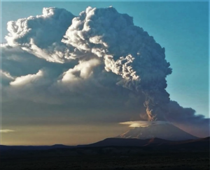
Ecuador , Reventador :
DAILY REPORT OF THE STATE OF THE REVENTADOR VOLCANO, OCTOBER 14, 2019
Information Geophysical Institute – EPN.
Superficial Activity Level: High, Surface Trend: No change.
Internal activity level: High, Internal trend: No change.
Seismicity (events): From 13 October 2019, 11:00 to 14 October 2019, 11:00:
Long Period Type (LP): 35 events
Explosions (EXP): 16 events
Tremors of emission: (TE): 8.
Harmonic tremors: (TA): 2.
Gas measurements (SO2): 310.0 +/- 22.0 tonnes / day.
Number of valid measures: 2
Rain / lahars: Not registered.
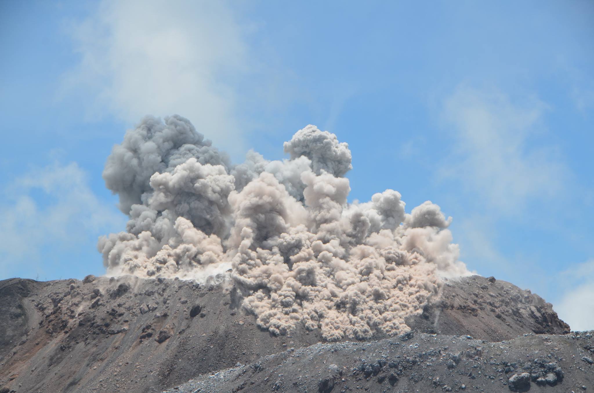
Ash Emission / Column: During the last 24 hours, several emissions of steam and ash exceeding 1,000 meters above the summit have been recorded, with the direction of dispersion being that of the West and North-West.
Other monitoring parameters: During the night and the morning, an incandescence was observed at the level of the crater.
Observations:
Currently, the volcano is covered.
Source et photo : IGEPN.
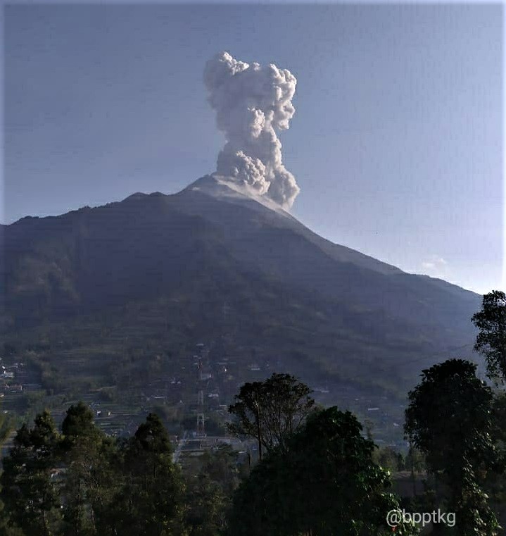
Indonesia , Ibu :
VOLCANO OBSERVATORY NOTICE FOR AVIATION – VONA.
Issued: 20191014/2310Z
Volcano: Ibu (268030)
Current Aviation Colour Code: ORANGE
Previous Aviation Colour Code: orange
Source: Ibu Volcano Observatory
Notice Number: 2019IBU11
Volcano Location: N 01 deg 29 min 17 sec E 127 deg 37 min 48 sec
Area: North Maluku, Indonesia
Summit Elevation: 4240 FT (1325 M)
Volcanic Activity Summary:
Eruption with volcanic ash cloud at 22h07 UTC (07h07 local)
Volcanic Cloud Height:
Best estimate of ash-cloud top is around 5520 FT (1725 M) above sea level, may be higher than what can be observed clearly. Source of height data: ground observer.
Other Volcanic Cloud Information:
Ash-cloud moving to south
Remarks:
Eruption and ash emission is continuing.
Source : Magma Indonésie .
Photo : 80 Jours voyages / Sylvain Chermette.