August 27 , 2018.
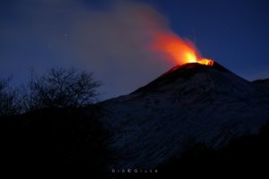
Italy / Sicily , Etna :
It’s not over yet … A very weak Strombolian activity was seen at 20:00 local time on August 26, 2018, at the « mouth of the saddle » of the new crater of Southeast Etna. The effusive activity on the northern flank of the new crater of the South-East also continues.
After a rapid fall, the volcanic tremor gradually reached the values of last night.
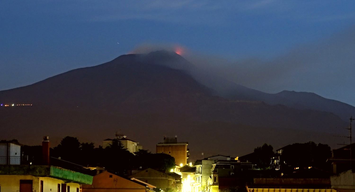
We returned to the situation before August 23, before the last eruptive episode of the new crater of South-East Etna: small explosions at « puttusiddu », the easternmost mouth of the new crater South East.
Source : Boris Behncke.
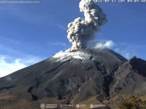
Indonesia , Merapi :
Level II Activity Level (WASPADA). The Merapi (2968 m of altitude) does not know of a continuous eruption.
Since yesterday and until this morning, the volcano could be observed clearly until it was covered with fog. The observed smoke is white, from low to medium pressure, rising up to 10 m above the peak. The wind is blowing slightly north and east.
According to the seismographs, on August 26, 2018, it was recorded:
4 avalanche earthquakes
6 earthquakes
8 low frequency earthquakes
12 hybrid earthquakes
1 shallow volcanic earthquake
2 local tectonic earthquakes
2 distant tectonic earthquakes
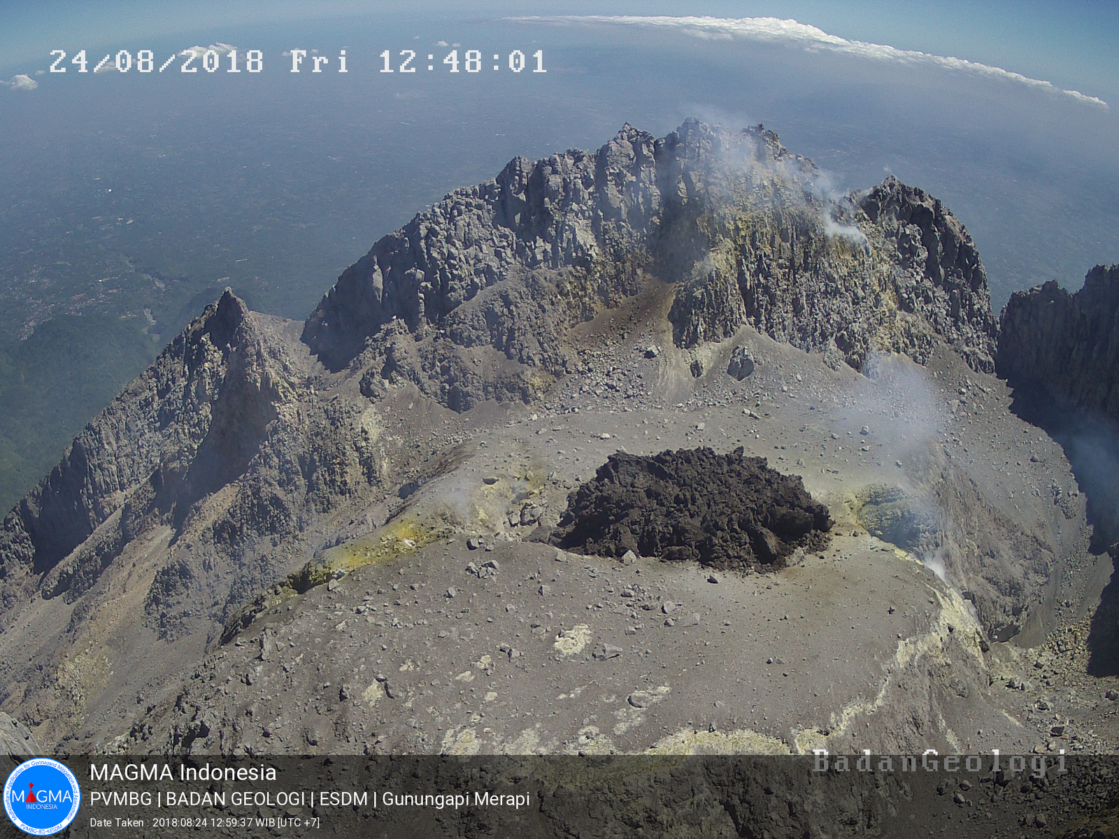
The dome growing at the summit on 24.08.2018, PVMBG / Magma Indonesia
Recommendations:
Climbing activities on Mount Merapi are temporarily not recommended, except for investigation and research related to disaster mitigation efforts.
A radius of 3 km around the summit must be emptied of the activities of the population.
People living in the area need to know more about Mount Merapi’s activities.
If there is a significant change in Mount Merapi activity, the status of Mount Merapi activity will be immediately reviewed.
Local governments are invited to socialize the current state of Mount Merapi to the public.
Source : PVMBG
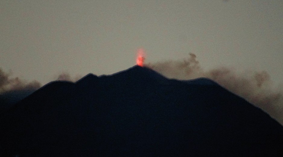
Hawai , Kilauea :
19°25’16 » N 155°17’13 » W,
Summit Elevation 4091 ft (1247 m)
Current Volcano Alert Level: WATCH
Current Aviation Color Code: ORANGE
Kīlauea summit and lower East Rift Zone
Seismicity and ground deformation are negligible at the summit of Kīlauea Volcano. On the volcano’s lower East Rift Zone (LERZ), a small lava pond was visible deep within the fissure 8 cone from a Hawaii County Fire Department overflight Saturday morning (8/25). A few ocean entries were oozing lava and laze plumes were minimal from HVO overflights at the beginning of this week (8/20, 21). Sulfur dioxide emission rates at both the summit and LERZ are drastically reduced; the combined rate is lower than at any time since late 2007. On Tuesday (8/21), the SO2 emissions from the LERZ were too low to measure although SO2 smells were noticed. Our next overflight is scheduled for tomorrow morning (8/27).
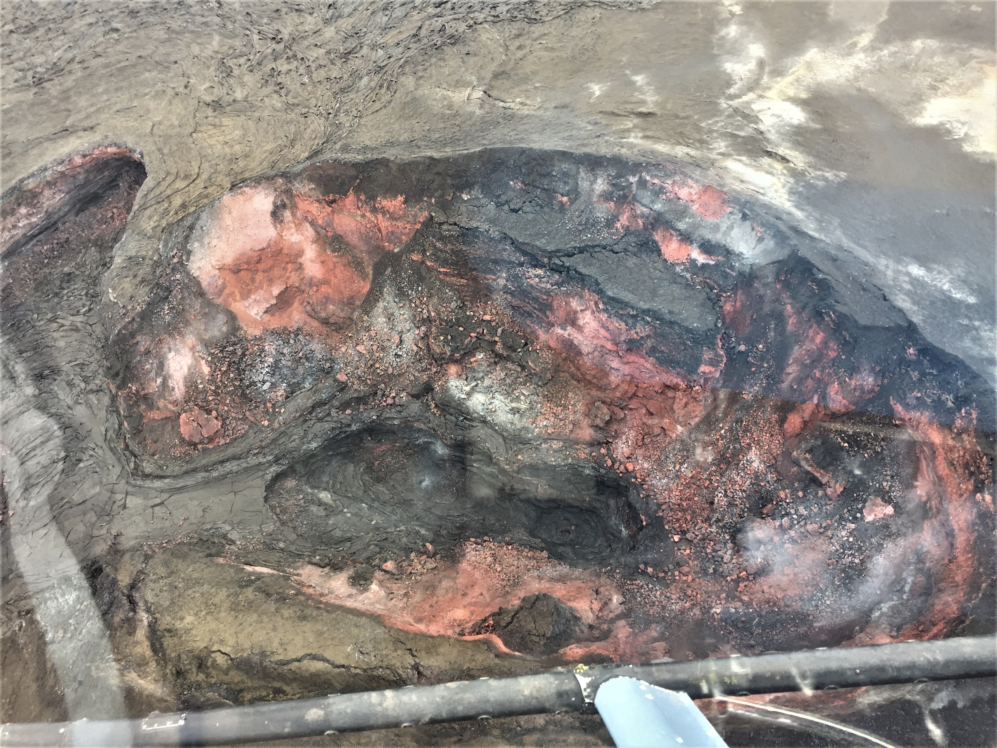
Southward facing aerial view of the fissure 8 cone. The two small areas of incandescence, gas jetting, and spatter from yesterday photograph appeared crusted over today.
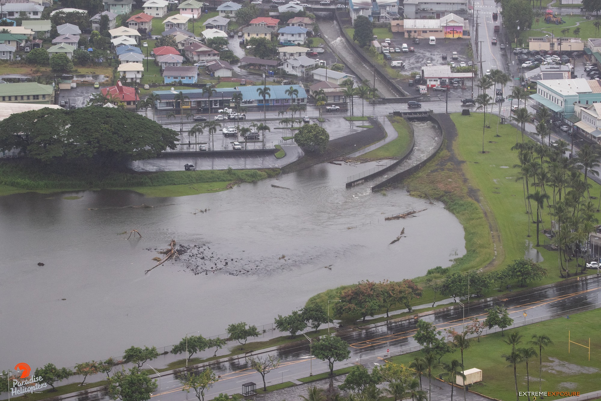
The passing of Tropical Storm Lane has left the Island of Hawaiʻi in a Flash Flood Watch. The hurricane/tropical storm had little effect on the eruption aside from minor rockfalls at the summit and increased steaming from Puʻu ʻŌʻō and LERZ vents; however, HVO lost communication with several monitoring stations on the east side of the island in the last two days but the losses only slightly reduce our ability to assess volcanic conditions. Whiteout conditions could occur on the new lava field due due to steam produced by heavy rainfall on still-hot lava flows.
The Hawaiian Volcano Observatory (HVO) will continue to closely monitor Kīlauea’s seismicity, deformation, and gas emissions for any sign of reactivation, and maintain visual surveillance of the summit and LERZ as best we can. Ground and drone crews are in the field today but continue to be hampered by weather conditions.
HVO will continue to issue daily updates and additional messages as needed. The next update will be issued tomorrow morning unless significant changes occur.
Source : HVO
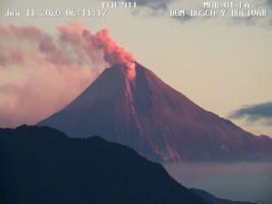
Guatemala , Fuego :
SPECIAL VULCANOLOGICAL BULLETIN BEFGO # 114-2018
Lahars in the ravines: LAS LAJAS, JUTE. Guatemala August 26, 2018, 2:20 pm (local time)
Type of activity: Vulcanian
Morphology: Composite stratovolcano
Geographical location: 14 ° 28’54˝ N Latitude; 90 ° 52’54˝Longitude W.
Height: 3,763msnm.
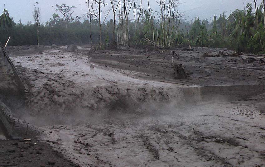
Because rainfall, which at this time is abundant in the upper part of the volcanic complex of the Fuego volcano, moderate lahars are generated and may increase in the next few minutes in the ravines of Las Lajas and Jute, which descend with volcanic materials and blocks 1 to 2 meters in diameter, branches and tree trunks, giving off a smell of sulfur.
This material has been deposited by constant eruptive activity and should continue to present this activity.
Due to the rains that can be generated in the afternoon and evening around the volcano, the possibilities that other lahars occur in one of the main canyons are not excluded.
Source : Insivumeh