August 27 , 2021.
Hawaii , Kilauea :
VOLCANO OBSERVATORY NOTICE FOR AVIATION (VONA)
Issued: August 26 , 2021
Volcano: Kilauea (VNUM #332010)
Current Color Code: YELLOW
Previous Color Code: ORANGE
Source: Hawaiian Volcano Observatory
Notice Number: 2021/H241
Volcano Location: N 19 deg 25 min W 155 deg 17 min
Area: Hawaii
Summit Elevation: 4091 ft (1247 m)
Volcanic Activity Summary:
Kīlauea volcano is not erupting. Over the past 24 hours, earthquake activity and ground deformation levels have decreased in the area beneath the southern part of Kīlauea’s summit caldera within the closed area of Hawaiʻi Volcanoes National Park. These observations indicate that the immediate potential for an eruption is diminished at this time.
The U.S. Geological Survey’s Hawaiian Volcano Observatory is lowering the Volcano Alert Level/Aviation Color Code for Kīlauea from WATCH/ORANGE to ADVISORY/YELLOW reflecting this decrease in activity levels.

While mapping volcanic gasses in Kīlauea caldera, HVO scientists got a view (looking west) of Halema‘uma‘u and the down-dropped block. The steep crater walls of Halema‘uma‘u are visible in the upper center and right portions of this photo, but the recently active lava lake is out of view below the eastern crater rim. The down-dropped block—in the center of the photo—was at the same height as the caldera floor in the foreground prior to subsiding more than 100 m (330 ft) in some places during the 2018 collapse events. South sulfur bank, the light-colored walls on the left side of the image, were also exposed during the 2018 collapses. The southeast flank of Mauna Loa is visible in the upper right.
Remarks:
The earthquake swarm that began beneath the south part of Kīlauea caldera, within Hawaiʻi Volcanoes National Park, on August 23, 2021, has waned. Within the past 24 hours, only 10 earthquakes have been detected in this area. The earthquake swarm began in that region at around 4:30 p.m. HST on August 23 and continued until the morning of August 25, 2021. 478 earthquakes were detected during this swarm; the rate of earthquakes detected per hour peaked at 28 events between 7 and 8 p.m. HST on August 24. Most of the earthquakes were between magnitude 1 and 2 and occurred approximately 1-2 km (0.6-1.2 mi) below the Earth’s surface.
The earthquake swarm was accompanied by change in the rate and style of ground deformation. Ground deformation in the Kīlauea summit region has leveled off within the past 24 hours and rapid inflation near the region of Kīlauea’s south caldera is no longer being observed.
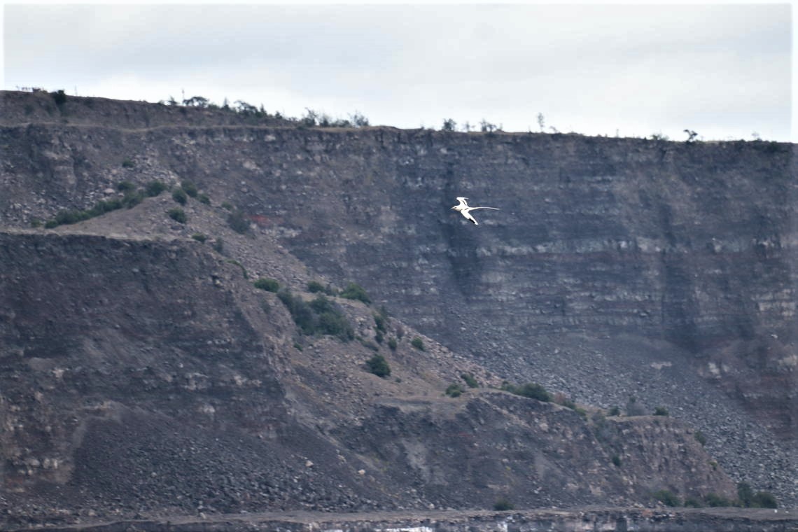
A koa‘e kea (white-tailed tropicbird) soars above Halema‘uma‘u, at the summit of Kīlauea. Typically, a few of these birds can be seen circling over the lava lake in Halema‘uma‘u during field visits.
Earthquake activity and ground deformation have decreased together to levels that indicate magma is no longer moving into the region of Kīlauea’s south caldera. These changes indicate reduced potential for an eruption at this time.
Kīlauea summit sulfur dioxide (SO2) emission rates remain at very low levels that have persisted since May 2021, when the most recent summit eruption ended. Concentrations of SO2 in ambient air, measured at stations in the Kīlauea summit region, show no changes. The most recent SO2 emission rates, measured on August 12, were 50 tonnes per day, close to levels associated with the non-eruptive period from late 2018 to late 2020 (less than 50 tonnes per day). This is significantly lower than emission rates that averaged over 800 tonnes per day from mid-February to mid-April when the summit eruption of Kīlauea was ongoing.
Source : HVO.
Photo : USGS / L. DeSmither . USGS/ M. Patrick.
Alaska , Pavlof :
55°25’2″ N 161°53’37 » W,
Summit Elevation 8261 ft (2518 m)
Current Volcano Alert Level: WATCH
Current Aviation Color Code: ORANGE
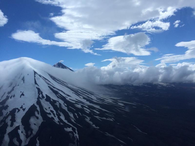
Pavlof Sister Volcano blanketed in clouds (foreground), with Pavlof Volcano in the background. This photo was taken during a helicopter flight on the way to take gas measurements at Pavlof.
Several small explosions occurred at Pavlof Volcano over the past 24 hours, detected in seismic data and by regional infrasound networks. While elevated surface temperatures were observed in satellite data, no ash emissions were seen. However, a few passing aircraft reported ash emissions yesterday. Additional small explosions accompanied by low-level ash emissions could occur at any time.
The level of unrest at Pavlof can change quickly and the progression to more significant eruptive activity can occur with little or no warning. Pavlof Volcano is monitored by local seismic and infrasound sensors, satellite data, web cameras, and remote infrasound and lightning networks.
Source : AVO
Photo : Mulliken, Katherine / Alaska Volcano Observatory / Alaska Division of Geological & Geophysical Surveys.
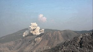
Kamchatka , Sheveluch :
VOLCANO OBSERVATORY NOTICE FOR AVIATION (VONA)
Issued: August 25 , 2021 .
Volcano: Sheveluch (CAVW #300270)
Current aviation colour code: ORANGE
Previous aviation colour code: orange
Source: KVERT
Notice Number: 2021-102
Volcano Location: N 56 deg 38 min E 161 deg 18 min
Area: Kamchatka, Russia
Summit Elevation: 3283 m (10768.24 ft), the dome elevation ~2500 m (8200 ft)
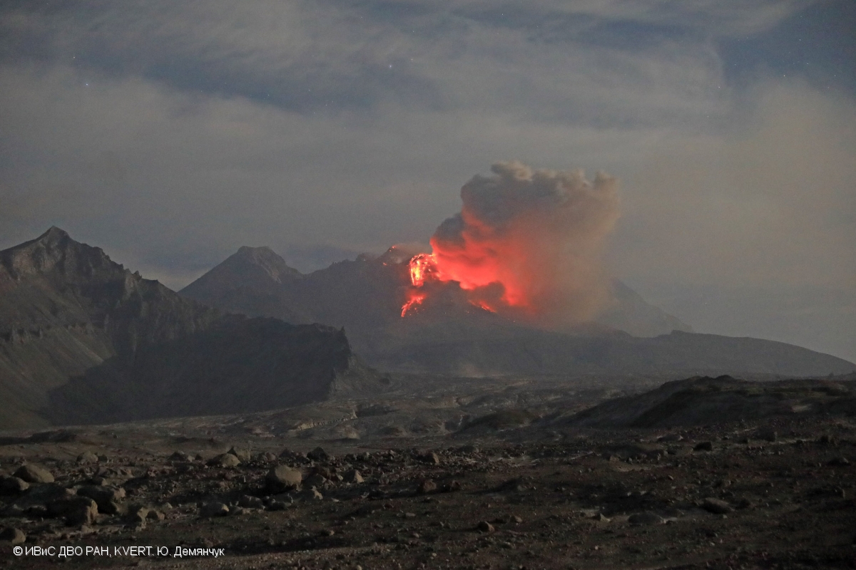
Squeezing out juvenile matter on the lava dome of Sheveluch volcano on 26 August, 2021.
Volcanic Activity Summary:
A growth of the lava dome continues, a strong fumarolic activity, and an incandescence of the lava dome and hot avalanches accompanies this process. Satellite data showed a gas-steam plume containing some amount of ash extending 100 km to the south-south-east from the volcano.
An extrusive eruption of the volcano continues. Ash explosions up to 10-15 km (32,800-49,200 ft) a.s.l. could occur at any time. Ongoing activity could affect international and low-flying aircraft.
Volcanic cloud height:
3000-3500 m (9840-11480 ft) AMSL Time and method of ash plume/cloud height determination: 20210824/2020Z – Himawari-8
Other volcanic cloud information:
Distance of ash plume/cloud of the volcano: 100 km (62 mi)
Direction of drift of ash plume/cloud of the volcano: SSE / azimuth 148 deg
Time and method of ash plume/cloud determination: 20210824/2020Z – Himawari-8
Source : Kvert .
Photo : Yu. Demyanchuk, IVS FEB RAS, KVERT.
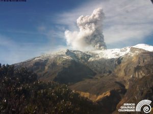
Costa Rica , Rincon de la Vieja / Turrialba / Poas / Irazu :
Volcanic Watch Program Weekly Bulletin, 23 August 2021.
Rincón de la Vieja volcano:
Latitude: 10.83 ° N; Longitude: 85.324 ° W;
Height: 1895 m.s.n.m.
Current activity level: 3 (erupting volcano)
Potentially associated hazards: lahars, gas, phreatic eruptions, proximal ballistic projections, ash falls, acid rain.
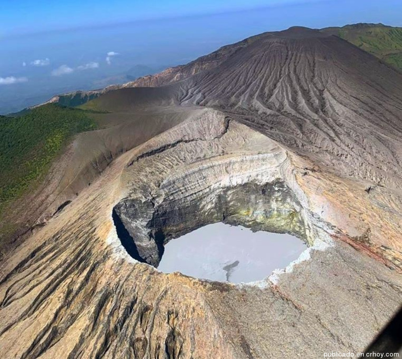
No eruption has been detected since August 14. A monochromatic 3.9 Hz tremor and some « Tornillos » type events were recorded. RSAM remains low. GPS geodetic tracking shows slight uplift, without extension, over a 6 month period and summit contraction in recent weeks
Turrialba volcano:
Latitude: 10.025 ° N; Longitude: 83.767 ° W;
Height: 3340 m.s.n.m.
Current activity level: 2 (active volcano)
Potentially associated hazards: gas, ash emission, Proximal ballistic projections, acid rain.
The last confirmed eruption took place on July 26. Seismic activity remains stable on a weekly average. The follow-up of the « tone codas » does not show any significant change. Geodetic GPS monitoring shows some increase with slight contraction over the last 6 months. No significant deformity has been detected in recent weeks except for a slight contraction of the top. The CO2 / SO2 and H2S / SO2 ratios of the gases do not show significant changes. The SO2 flow has a weekly average of 98 +/- 49 t / d, significantly lower than the previous week.
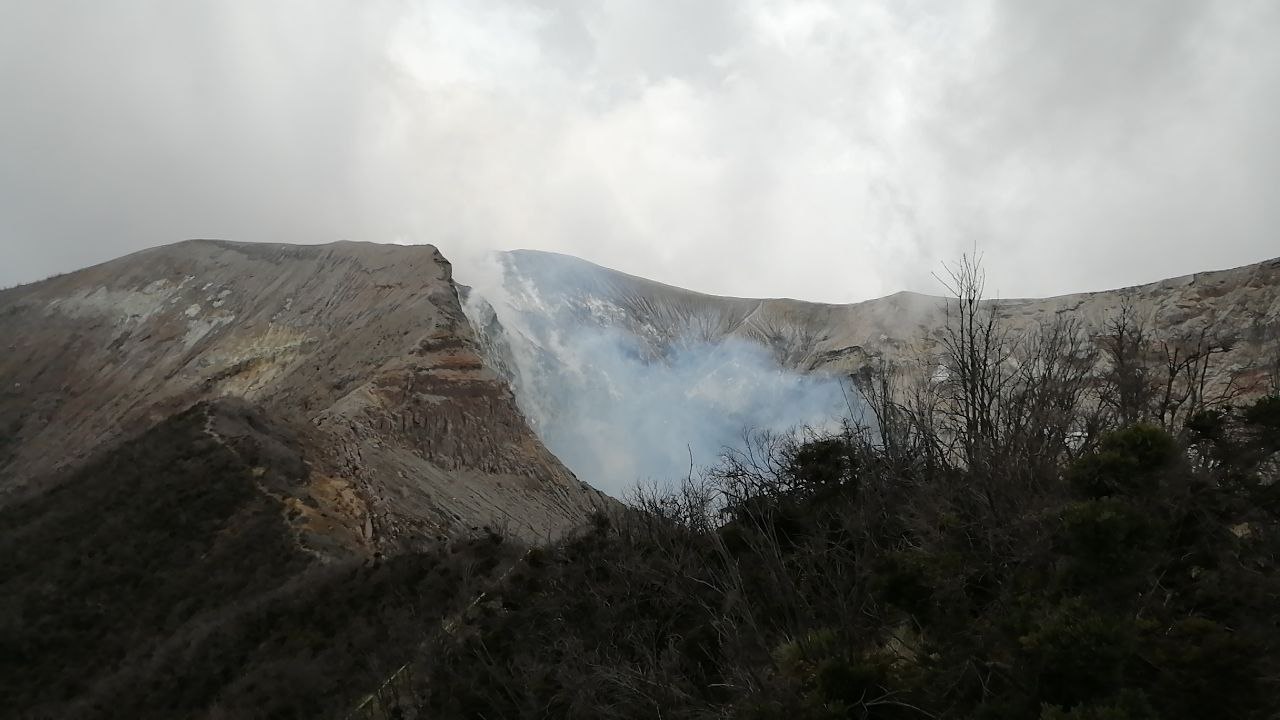
Poas volcano:
Latitude: 10.2 ° N; Longitude: 84.233 ° W;
Height: 2780 m.s.n.m.
Current activity level: 2 (active volcano)
Potentially associated hazards: gas, phreatic eruptions, proximal ballistic projections, lahars, acid rain.

No eruption was observed. Short tremors continue to be recorded approximately every 10 minutes, the regularity and amplitude of which are affected by the rains (the rain decreases
frequency of occurrence and amplitude). These tremors are synchronized with a fumarole to the south of the lake. The amplitude of this signal decreased significantly. Another fumarole was observed southwest of the lake, but could not be associated with any seismic signal. Geodetic GPS monitoring shows some extension and inflation over the last 3 months, more marked in June. The deformation seems stable since August. The focus of the deformation is centered below the crater at 1 km below sea level. SO2 / CO2 gas ratios showed a slight increase over the weekend, but returned to normal values. The SO2 concentration detected at the lookout reached 1 ppm once in the past week. The SO2 flow shows a weekly average of 80 +/- 48 t / d, very similar to previous weeks. The level of the hyperacid lake showed a slight increase.
Irazu volcano:
Latitude: 9.979 ° N; Longitude: 83.852 ° W;
Altitude: 3432 m.s.n.m.
Current activity level: 1 (active volcano)
Potentially associated risks: landslides, lahars, proximal ballistic projections, acid rain, ash falls, debris avalanches.
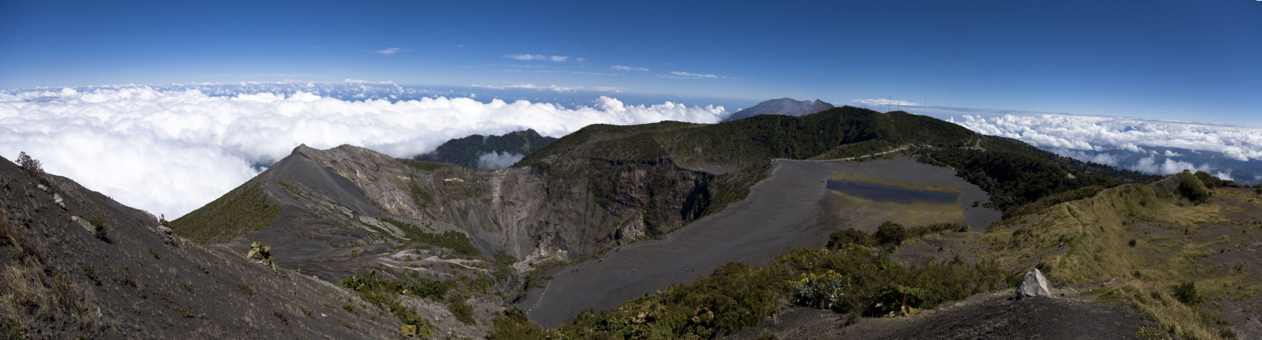
Seismicity remains low and mainly associated with tectonic activity. An LP type event was recorded last week. Gas monitoring in the fumarolic field on the northern flank of the volcano does not show any changes, the concentrations and ratios remain stable. The main landslide in the sector of the communication towers at the top of the Irazú presents a little variation but in general remains at low speed.
Source : Ovsicori .
Photos : Crhoy , Jean Paul Calvo /RSN , Jairo García , Rafael Golan / wikipedia.
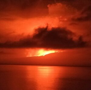
Mexico , Popocatepetl :
August 26, 11:00 a.m. (August 26, 4:00 p.m. GMT)
During the last 24 hours, thanks to the monitoring systems of the Popocatépetl volcano, 57 exhalations have been identified, some of which were accompanied by water vapor and volcanic gases. 31 minutes of low amplitude tremor were also recorded.
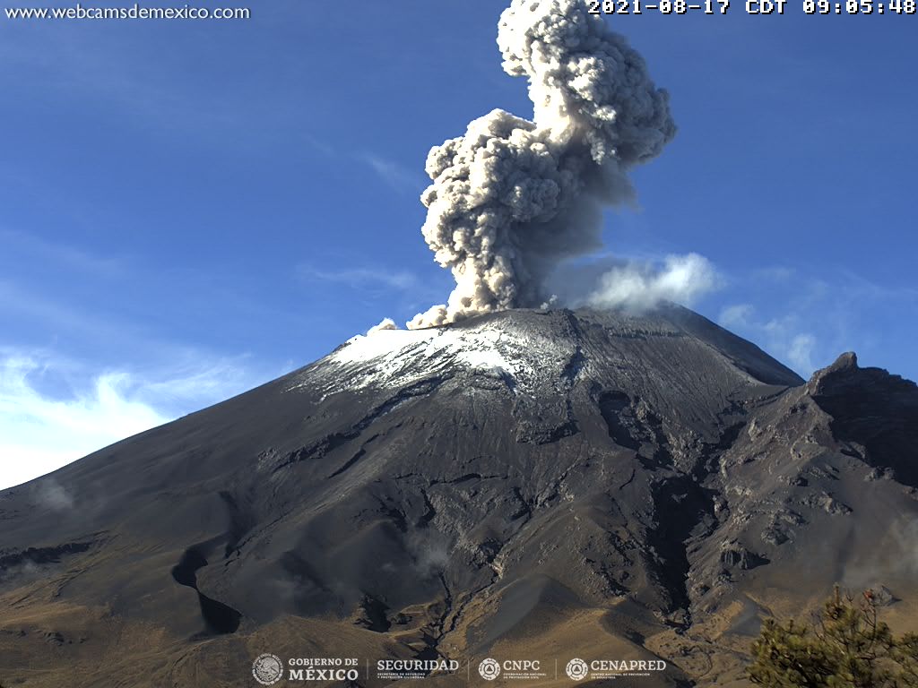
At the time of this report, the volcano is observed with a slight emission of water vapor and gas moving towards the west.
CENAPRED recommends NOT TO APPROACH the volcano and especially the crater, because of the danger of falling ballistic fragments and, in the event of heavy rains, to stay away from the bottom of the ravines because of the danger of mudslides and debris.
The Popocatépetl volcanic traffic light is in PHASE 2 YELLOW.
Source et photo : Cenapred .