November 20 , 2019.
Alaska , Shishaldin :
54°45’19 » N 163°58’16 » W,
Summit Elevation 9373 ft (2857 m)
Current Volcano Alert Level: WATCH
Current Aviation Color Code: ORANGE
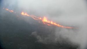
During the last 24 hours, seismicity at Shishaldin Volcano climbed to a level similar to that observed during other eruptive periods over the past few weeks, consistent with the resumption of eruptive activity at the volcano. This is further supported by strong surface temperatures observed in cloudy satellite images. Webcam images have been mostly obscured by clouds, but a couple of partly clear webcam images yesterday afternoon suggested a lava flow or lahar extending down the southeast flank of the volcano. No ash plumes have been detected.
Shishaldin is monitored by local seismic and infrasound sensors, satellite data, web cameras, a telemetered geodetic network, and distant infrasound and lightning networks.
Source : AVO.
Photo : Fee, David , Juillet 2019.
Colombia , Nevado del Ruiz :
Bulletin of activity of the Nevado del Ruiz volcano.
The level of activity continues at the level: Yellow activity level or (III): changes in the behavior of volcanic activity.
With regard to monitoring the activity of the Nevado del Ruiz volcano, the COLOMBIAN GEOLOGICAL SERVICE reports that:
The Nevado del Ruiz volcano continues to display unstable behavior. During the past week, some controlled parameters showed significant changes, reflecting greater instability of the volcanic system than the previous week. The variations are mainly distinguished in seismicity, associated with the movement of fluids within the volcanic canals and in the surface activity of the volcano. It is not excluded that the monitored parameters continue to change, indicating an acceleration of the process and therefore changes in the activity level of the volcano.

Seismicity related to fluid dynamics in the volcanic system showed a decrease in the number and energy of registered earthquakes, compared to the previous week. This type of seismicity showed significant changes in spectral characteristics and was characterized by the presence of continuous and sometimes harmonic volcanic tremors, as well as long-period (LP) and very long-period (VLP) earthquakes recorded individually or in conjunction with volcanic tremor pulses .The earthquakes had variable energy levels and were mainly located in the Arenas crater and its surroundings.
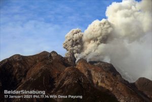
Some of these signals were associated with small emissions of gas and ash (see the animation and photos), confirmed by the cameras installed in the region of the volcano, according to the reports of the officials of the Parque Nacional Natural Los Nevados and the VAAC (Current Volcanic Ash Advisories).
The seismicity caused by rock fracturing has maintained similar levels, in number of earthquakes and released seismic energy, compared to the previous week. This type of seismicity was mainly located in the Arenas crater, in the West, South-South-West, South-East and North-East zones of the volcanic structure and, to a lesser extent, in the northern sector of the volcano. The depth of the earthquakes ranged from 0.3 to 7.1 km. A slight increase in this type of seismicity recorded on November 12 was located 3.4 km west of the crater. The maximum magnitude recorded during the week and during the seismic increase was 1.0 ML (local magnitude), which corresponds to the earthquake recorded on November 12 at 20:48 (local time) at 4.2 km depth.
It should also be noted that two episodes of drumbeat, volcano-tectonic, short-lived and very low-energy earthquakes occurred on 18 November. This type of seismicity is related to the processes of climbing and dome evolution on the surface of a volcano.
The volcano continues to emit water vapor and high levels of gas, mainly sulfur dioxide (SO2). These levels are estimated from data obtained from SCANDOAS stations and the processing of satellite images. In tracking the information provided by the MIROVA and NASA FIRMS portals, low-energy thermal anomalies were recorded on November 14, 16, 17 and 19.
On November 15, with the support of the Colombian zone force (FAC), an overflight of the Nevado del Ruiz volcano (see video was made, observing the continuous emission of gas, steam and ash from the Arenas crater. column of gas and vapor was dense, white to greyish and / or light brown, with low pressure and smells of sulfur gas were perceived.
The Nevado del Ruiz volcano continues its activity at the level of yellow activity, phenomena such as swarms of earthquakes, some felt, can occur at this level; with ash emissions; lahars; morphological changes; noises . Odors of volcanic gases, among others, can alter the quality of life of people in the area of volcanic influence. Although the instability of the volcano lasts for more than nine years, it is vitally important not to get used to its behavior and to be attentive to the official information that will be published by the Colombian geological service. Authorities in Caldas and Tolima departments are being urged to take extreme measures focused on risk reduction processes and disaster management as measures to prepare the future activity of Nevado del Ruiz volcano.
Source , photo et vidéos : SGC.
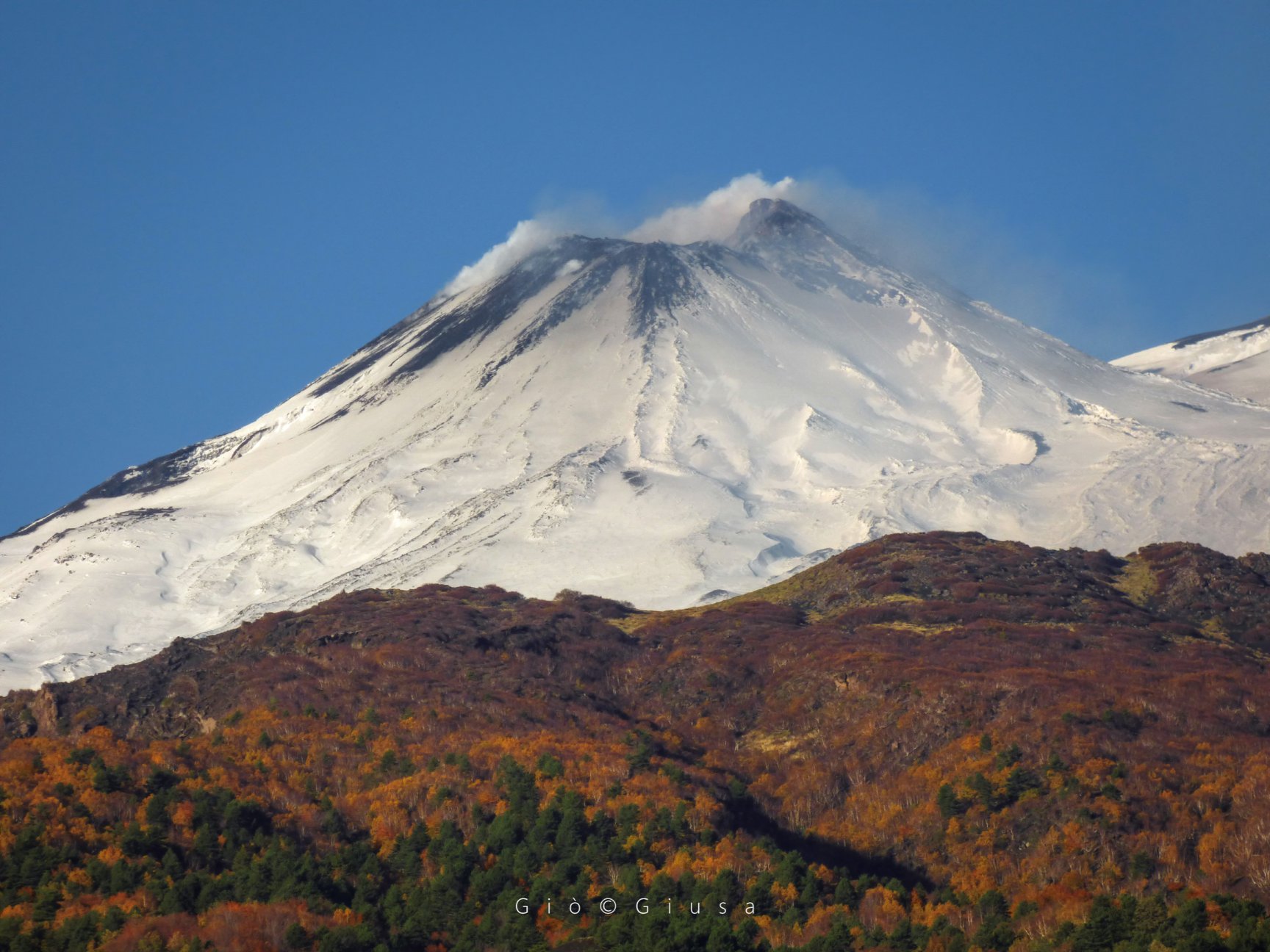
Italy / Sicily , Etna :
Weekly bulletin from November 11, 2019 to November 17, 2019 (published on November 19, 2019)
SUMMARY OF THE STATUS OF THE ACTIVITY
In light of the surveillance data, we highlight:
1) VOLCANOLOGICAL OBSERVATIONS: Strombolian intra-crateric activity at the level of the Northeast craters, Voragine and Bocca Nuova. Ordinary degassing activity of the New Southeast Crater.
2) SISMOLOGY: Modest seismic activity due to fracturing; slight average increase in volcanic tremor parameters.
3) INFRASONS: low infrasonic activity.
4) DEFORMATIONS: The inclination and GPS networks did not show any significant changes in the trends previously reported.
5) GEOCHEMISTRY: SO2 flows are at an average level. The CO2 fluxes on the ground are on medium-low values. The partial pressure of CO2 in the soil does not show any significant changes. Helium isotope ratio values show a further increase, reaching medium-high values (latest available data on October 30).
VOLCANOLOGICAL OBSERVATIONS
The monitoring of volcanic crater activity at the summit of Mount Etna during the week was carried out by analyzing the images of the network of surveillance cameras of the INGV section – Catania, Osservatorio Etneo (INGV-OE). ). Poor weather conditions persisted for most of the week and significantly reduced observations, which are therefore rare and discontinuous.
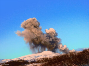
NSEC – New South East Crater, Etna East, November 18, 2019.
In particular, during the period under review, Etna activity was characterized by Strombolian activity in the Northeast Crater, Voragine and Bocca Nuova, associated with sporadic ash emissions. The New Southeast Crater was affected by an ordinary degassing activity, while Strombolian activity reported the previous week seems to have stopped.
SISMOLOGY:
Seismicity: During the week in question, 4 seismic events with a magnitude greater than or equal to 2 were recorded. These earthquakes are located at a depth between 6 and 22 km below sea level. The strongest event (Ml = 3.1), recorded on 13/11 at 13:26 UTC, was located east of the volcano (1.4 km north of Monte Fontane), 6.7 km from depth below the mean sea level.
Volcanic tremor: During the week in question, the average amplitude of volcanic tremor showed fluctuations around high values. The sources of the tremor are located below the craters of the summit, between 2500 and 3000 m above sea level…/…
Source : INGV.
Read the full article : file:///C:/Users/Utilisateur/AppData/Local/Packages/Microsoft.MicrosoftEdge_8wekyb3d8bbwe/TempState/Downloads/BollettinoEtna20191119%20(1).pdf
Photo : Gio Giusa.
Guatemala , Santiaguito :
Activity type: Pelean
Morphology: Complex of dacitic domes
Geographical location: 14 ° 44 ’33 ˝ Latitude North; 91 ° 34’13˝ west longitude
Height: 2500msnm
Atmospheric conditions: Clear
Wind: East at 5 km / h
Precipitation: 6.0 mm.
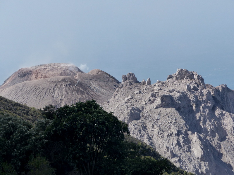
Activity:
Presence of a white degassing reaching an altitude of 2 900 meters and dispersing in the East. Fifteen low to moderate explosions are recorded in 24 hours, which emit ash columns at a height of 3,100 to 3,500 meters (10,170 to 1,1480 feet), dispersed to the southwest. Low to moderate avalanches are generated to the east, south and southwest flanks with distances to the base of the dome. Sulfur odors were detected at a distance of 8 to 10 km in the South direction.
Source : Insivumeh .
Photo : G Vitton.