August 15 , 2021 .
Alaska , Pavlof :
55°25’2″ N 161°53’37 » W,
Summit Elevation 8261 ft (2518 m)
Current Volcano Alert Level: WATCH
Current Aviation Color Code: ORANGE
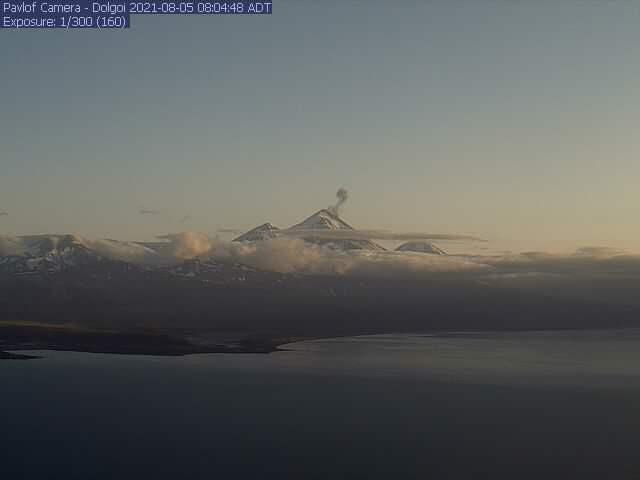
Three small explosions were detected on infrasound sensors from Pavlof Volcano over the past day. Web camera images this morning confirmed a small ash emission from the most recent of these. Like all other explosions observed during the current eruption, ash appeared to quickly dissipate and deposits were limited to areas near the vent.
The level of unrest at Pavlof can change quickly and the progression to more significant eruptive activity can occur with little or no warning. Pavlof Volcano is monitored by local seismic and infrasound sensors, satellite data, web cameras, and remote infrasound and lightning networks.
Source : AVO
Photo : Alaska Volcano Observatory , U.S. Geological Survey / Dolgoi webcam
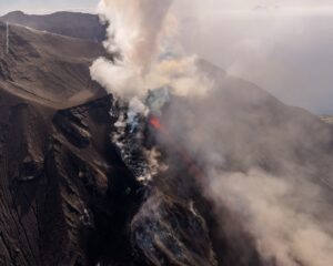
Kamchatka , Karymsky :
VOLCANO OBSERVATORY NOTICE FOR AVIATION (VONA)
Issued: August 14 , 2021
Volcano: Karymsky (CAVW #300130)
Current aviation colour code: ORANGE
Previous aviation colour code: orange
Source: KVERT
Notice Number: 2021-90
Volcano Location: N 54 deg 2 min E 159 deg 26 min
Area: Kamchatka, Russia
Summit Elevation: 1486 m (4874.08 ft)
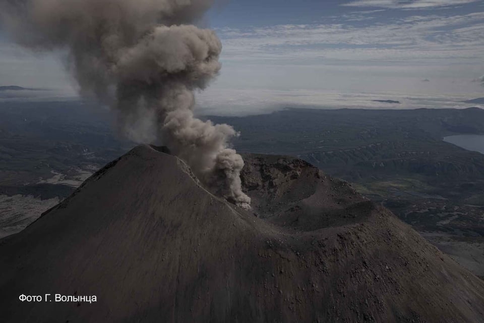
The explosive eruption of Karymsky volcano on 24 July, 2021.
Volcanic Activity Summary:
A moderate eruptive activity of the volcano continues. According to satellite data, an ash plume is extending for 57 km to the east-southeast of the volcano.
A moderate eruptive activity of the volcano continues. Ash explosions up to 19,700-23,000 ft (6-7 km) a.s.l. could occur at any time. Ongoing activity could affect low-flying aircrafts.
Volcanic cloud height:
1500-2000 m (4920-6560 ft) AMSL Time and method of ash plume/cloud height determination: 20210814/2330Z – Himawari-8
Other volcanic cloud information:
Distance of ash plume/cloud of the volcano: 57 km (35 mi)
Direction of drift of ash plume/cloud of the volcano: ESE / azimuth 122 deg
Time and method of ash plume/cloud determination: 20210814/2330Z – Himawari-8
Source : Kvert.
Photo : G. Volynets.
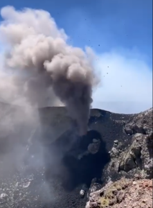
Guatemala , Santiaguito :
ACTIVITY:
It was observed from the web camera and recorded from the seismic station Stg8, the Dome Caliente with weak explosions and a few columns of moderate ash at 2800 meters above sea level (9186 feet) scattered to the south and southwest for 8 kilometers . Ashes fall in the villages of Las Marías, Calaguache and the Fincas in the region. The lava extrusion into the crater was maintained, forming lava promontories generating avalanches on the western and southern flanks.
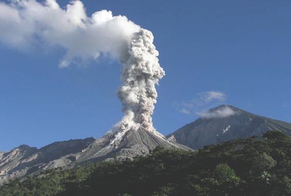
Due to the unstable material in the crater, there is a probability of generating moderate to strong pyroclastic flows, so one should not be present near or in the riverbeds near the slopes of the volcano. Moderate and heavy rains continue in the afternoon and evening, with the likelihood of continuing to generate lahars through the channels of the Cabello de Angel, Nimá I, Nimá II, Tambor rivers, tributaries of the Samalá River, there is therefore recommended to take precautions. (Information in the bulletin BESAN-102-2021).
Source : Insivumeh .
Photo : La Hora.
Mexico , Popocatepetl :
August 14, 11:00 a.m. (August 14, 4:00 p.m. GMT)
During the last 24 hours, according to the monitoring systems of the Popocatépetl volcano, 8 exhalations have been identified, some of them accompanied by water vapor, volcanic gases and ash. In addition, 1086 minutes of tremor were recorded.
During this morning and at the time of this report, the emission of volcanic gases with a westerly direction is observed.
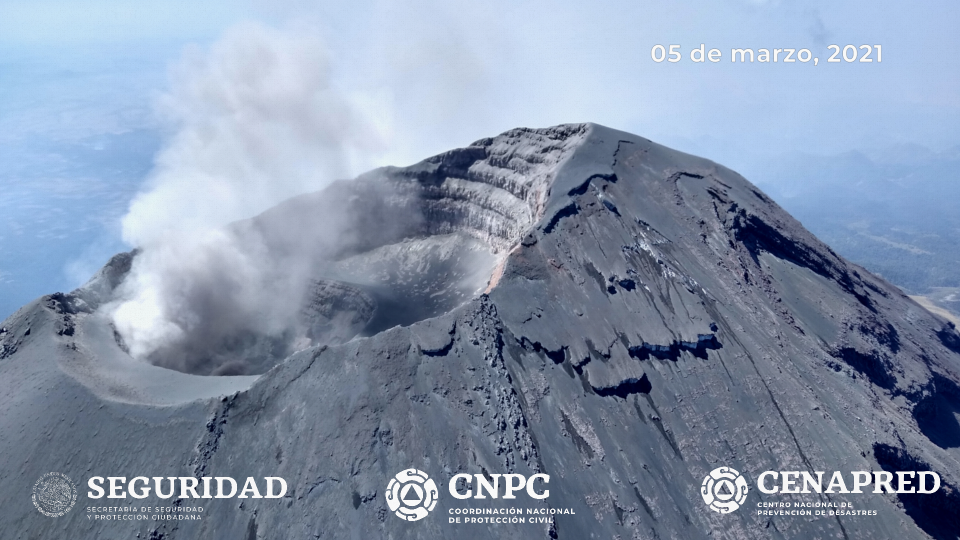
CENAPRED recommends NOT TO APPROACH the volcano and especially the crater, because of the danger of falling ballistic fragments and, in the event of heavy rains, to stay away from the bottom of the ravines because of the danger of water flow. sludge.
The Popocatépetl volcanic traffic light is in PHASE 2 YELLOW.
Source et photo : Cenapred .
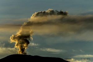
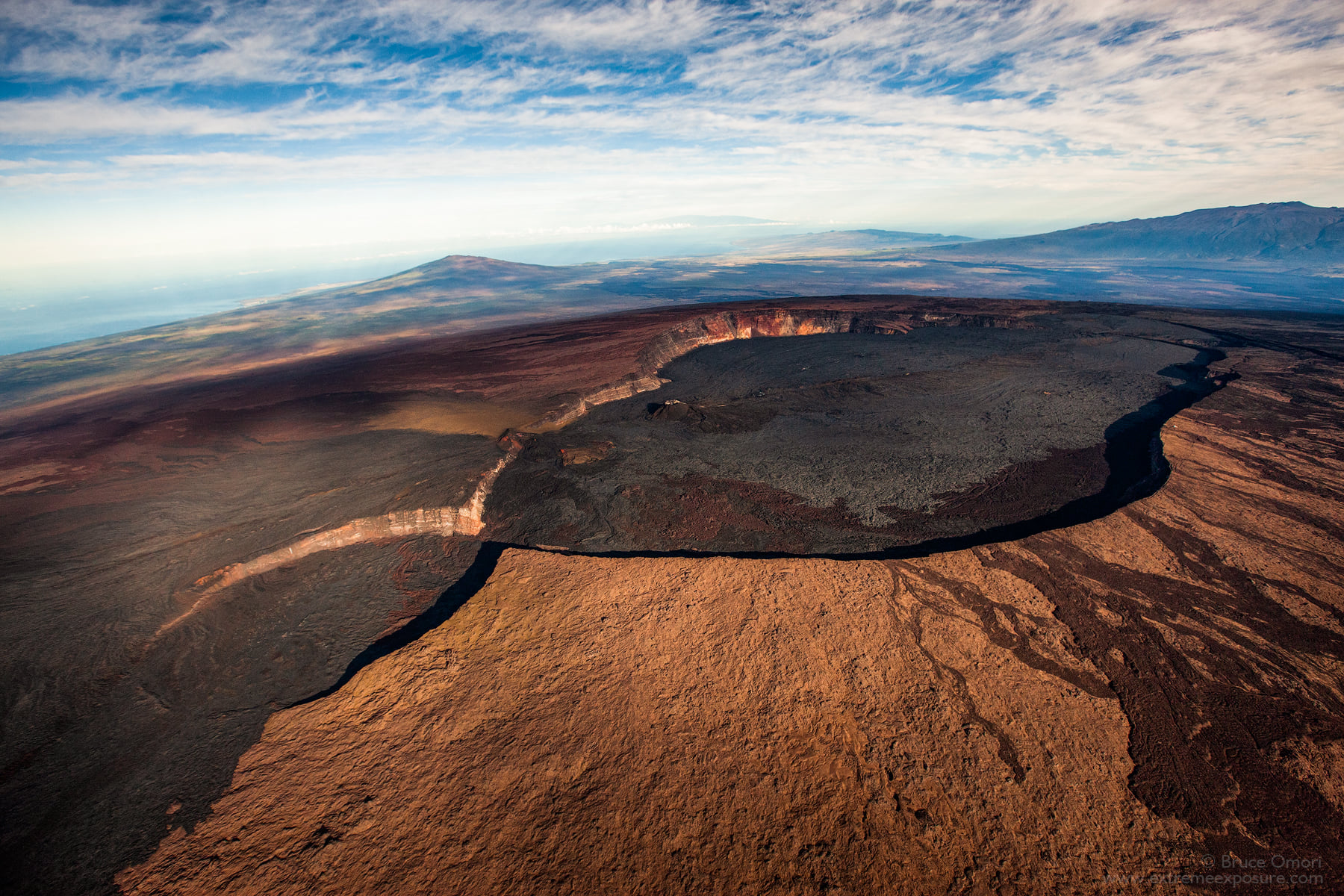
Hawaii , Mauna Loa :
19°28’30 » N 155°36’29 » W,
Summit Elevation 13681 ft (4170 m)
Current Volcano Alert Level: ADVISORY
Current Aviation Color Code: YELLOW
Activity Summary:
Mauna Loa Volcano is not erupting. Rates of seismicity, at the summit, have not changed significantly over the past week and remain above long-term background levels. Monitoring of ground deformation, gas discharge, and visual monitoring show no significant changes.
Observations:
During the past week, HVO seismometers captured 67 small-magnitude (below M2.5) earthquakes beneath the summit and upper flanks of Mauna Loa. The majority of these earthquakes occurred at shallow depths less than 8 kilometers (5 miles) below sea level.
Ground deformation, measured using Global Positioning System (GPS) measurements, confirm that the surface of the volcano has not moved appreciably over the past week.
Gas concentrations and fumarole temperatures at both the summit crater and Sulphur Cone on the Southwest Rift Zone show no unusual activity.
Web-cameras showed no changes at Mauna Loa summit or on the lower flanks over the past week.
Source : HVO.
Photo : Bruce Omori .