
June 2 , 2021.
Italy / Sicily , Etna :
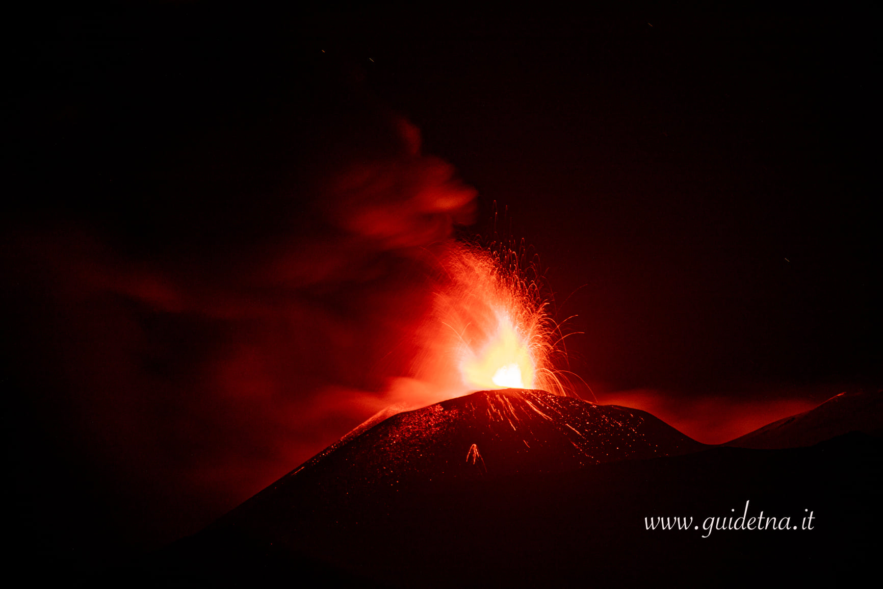
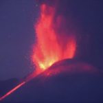
COMMUNICATION ON THE ACTIVITY OF ETNA, June 19, 2021, 20:57 (18:57 UTC).
The National Institute of Geophysics and Volcanology, Osservatorio Etneo reports that from around 18:40 UTC, a sudden increase in Strombolian activity is observed at the level of the Southeast Crater, which produces a continuous emission of ash. On the basis of the forecast model, the ash emission produced by the current activity is dispersed in the direction of the South. From 6.30 p.m. an overflow of lava directed towards the southwest began. The tendency to increase the mean amplitude of the volcanic tremor continues with very high values. The centroid of volcanic tremor sources is located in the Southeast Crater region at an altitude of about 2900-3000 m above sea level. The infrasonic activity has also intensified and shows a clear increasing trend, both in the rate of occurrence and the energy of infrasonic events.
From 19:00 UTC, the Strombolian activity of the Southeast Crater turned into a lava fountain. Based on the forecast model, the eruptive cloud produced by the current activity disperses in the southerly direction. The effusive activity produced by the lava overflow in the southwest direction continues to be well fed. The average amplitude of the volcanic tremor and the infrasound activity reached very high values.
COMMUNICATION ON THE ACTIVITY OF ETNA, June 19, 2021, 22:18 (20:18 UTC).
The National Institute of Geophysics and Volcanology, Osservatorio Etneo, reports that from the images of the surveillance cameras, it is observed that the explosive activity at the level of the Southeast Crater has ceased, the lava overflow that extends south-west direction remains active.
The average amplitude of the volcanic tremor, after reaching the maximum value at 19:20 UTC, suffered a rapid decrease, returning to the average level. The center of gravity of volcanic tremor sources remains located in the Southeast Crater area at an altitude of about 2900 m above sea level. The infrasound activity from around 19:35 UTC has also decreased quickly. It is currently at a low level both for the frequency of occurrence of transients and for their observed amplitudes.
Further updates will be communicated shortly.
Source : INGV.
Photo : Guide Alpine Vulcanologiche Etna
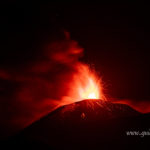
Italy , Stromboli :
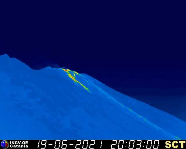
COMMUNICATION ON THE ACTIVITY OF STROMBOLI, June 19, 2021, 20:10 (18:10 UTC).
The National Institute of Geophysics and Volcanology, Osservatorio Etneo, announces that the monitoring networks recorded a variation of the monitored parameters at 20:07 (18:07 UTC).
In particular, there is a thermal anomaly on the surveillance cameras, which may be associated with a modest lava overflow from the North Crater area which began at 5:15 PM UTC.
COMMUNICATION ON THE ACTIVITY OF STROMBOLI, June 19, 2021, 20:39 (18:39 UTC).
The National Institute of Geophysics and Volcanology, Osservatorio Etneo, announces that the lava overflow which began at 5:15 p.m. UTC, occurred in conjunction with explosive activity in the northern sector, the lava front is cooling and affecting the upper part of the Sciara del Fuoco. The trend of the average amplitude of the volcanic tremor does not show significant variations and the values are maintained at the average level. The frequency and amplitude of transients attributable to explosive events do not show significant variations. GNSS and inclinometric networks show no significant changes. The TDF incline station data is updated at 16:30 UTC.
Further updates will be communicated promptly and in any event within 3 hours of this press release.
Source : INGV.
Indonesia , Ili Lewotolok :
Activity Level Level III (Siaga) since November 29, 2020 at 1:00 p.m. WITA. This increase in status was motivated by an eruption on November 27, 2020 at 05:57 WITA with a height of gray / black ash columns observed at 500 m above the peak (1923 m altitude) with a thick intensity, oriented towards the west. This eruption was recorded on a seismogram with a maximum amplitude of 34 mm and the duration of the eruption was not clearly observed because it was followed by continuous tremors. Eruptions still occur today.
The volcano is clearly visible until it is covered in fog. The smoke from the crater is white / gray with moderate to strong intensity, about 200-600 meters above the summit. The eruption was accompanied by bursts of glowing lava and weak to loud booms / rumbles. Incandescent lava ejections are recorded up to 300-500 m from the crater to the southeast. The eruption was accompanied by weak to strong rumblings, explosions of incandescent material 500 m above the summit, and 300 m to the southeast. The weather is sunny, the wind is light to moderate from the West. The air temperature is approximately 23.6-30.5 ° C.
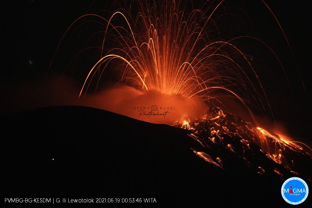
According to the seismographs of June 19, 2021, it was recorded:
21 eruption earthquakes / explosions
40 emissions earthquakes
3 harmonic tremors
34 Non-harmonic tremors
Continuous tremor with an amplitude of 0.5 to 1 mm (mainly 1 mm).
Source : PVMBG.
Photo : Jeffry Pugel /PVMBG – Magma Indonesia
Hawaii , Mauna Loa :
19°28’30 » N 155°36’29 » W,
Summit Elevation 13681 ft (4170 m)
Current Volcano Alert Level: ADVISORY
Current Aviation Color Code: YELLOW
Activity Summary:
Mauna Loa Volcano is not erupting. Rates of seismicity at the summit remain slightly elevated and above long-term background levels. Other Mauna Loa monitoring data streams show no significant change in deformation rates or patterns that would indicate increased volcanic hazard at this time.
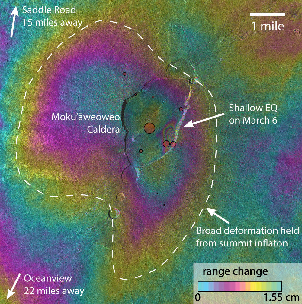
This image of the summit of Mauna Loa Volcano is derived from satellite-based interferometric synthetic aperture radar (InSAR) and is called an interferogram. Each cycle of colors from blue to green represent a change in the distance between the ground and the satellite (range change) of 1.55 cm. Interferograms are constructed from radar images taken on two different dates and show the amount deformation that occurred between the two acquisition dates. This image shows the overall inflation of Mauna Loa’s summit that occurred from November 2020 to March 2021. It also shows several fringes (color cycles) consistent with subsidence inside Moku‘āweoweo caldera and related to a shallow earthquake that was recorded on March 6, 2021. The red circles show the locations of earthquakes associated with that event as determined by HVO’s seismic network. Recent contraction that has been recorded on summit GPS stations has not yet been identified in any interferograms.
Observations:
During the past week, HVO seismometers recorded approximately 195 small-magnitude earthquakes below Mauna Loa, 46 of which were concentrated below the summit and upper-elevation flanks of the volcano, and 89 were located under the southeast flank. The largest earthquake in the past week occurred on June 10th at 19:12:06 HST as a M2.6 earthquake at 3.6 km (2.2 mi.) beneath Mauna Loa’s west flank. All other earthquakes over the past week were less than M2.5 and occurred mostly at depths of less than 8 km (5 mi) below ground level.
Global Positioning System (GPS) measurements show low rates of deformation in the summit region over the past week.
Gas concentrations (below 2 ppm SO2) and fumarole temperatures (below 100 degrees Celsius or 212 degrees Fahrenheit) at both the summit and at Sulphur Cone on the Southwest Rift Zone remain stable.
Webcam views have shown no changes to the volcanic landscape on Mauna Loa over the past week.
Source : HVO.
Mexico , Popocatepetl :
Summary of the last 24 hours, June 19, 11:00 (June 19, 16:00 GMT)
During the last 24 hours, according to the monitoring systems of the Popocatepetl volcano, 42 exhalations and 91 minutes of tremors have been identified. Due to the fact that during most of the period covered by this report, clouds prevailed in the area of the volcano, it was not possible to confirm the emission of water vapor and / or volcanic gases. .
At the time of this report, there is no visibility due to dense cloudiness.
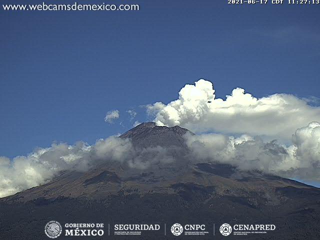
CENAPRED recommends NOT TO APPROACH the volcano and especially the crater, because of the danger of falling ballistic fragments and, in the event of heavy rains, to stay away from the bottom of the ravines because of the danger of mudslides and debris.
The Popocatépetl volcanic traffic light is in PHASE 2 YELLOW.
Source : Cenapred.
Photo : Webcamdemexico


No comment yet, add your voice below!