October 06 , 2020.
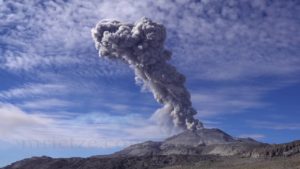
La Réunion , Piton de la Fournaise :
Seismicity
In September 2020, the OVPF recorded in the Piton de la Fournaise massif in total:
• 1648 superficial volcano-tectonic earthquakes (0 to 2.5 km deep below the summit) directly above the summit craters;
• 521 deep earthquakes (2.5 to 5 km deep);
• 759 collapses (in the Dolomieu Crater and at the ramparts of the Enclos Fouqué and the Rivière de l’Est).
The seismicity under the Piton de la Fournaise in September 2020 was marked by a gradual resumption of activity from September 21, with a total of 77 surface volcano-tectonic earthquakes and 4 deep earthquakes recorded between September 21 and 27. This resumption of seismicity preceded the seismic crisis of September 28 which began at 12:04 p.m. (local time; 8:04 a.m. UT) and which ended around 12:00 p.m. (local time; 8:00 UTC) on September 30. During this seismic crisis, 1551 superficial summit volcano-tectonic earthquakes, 472 deep volcano-tectonic earthquakes, 48 long periods, 217 earthquakes classified as « undetermined » (because of low magnitudes) and 543 landslides / surface collapses were recorded by the ‘OVPF.
This seismicity was localized under the summit and under the eastern flank of the volcano (between 1.6 and 5.2 km deep).
Following this seismic crisis, the seismicity still persisted on September 30, with an average of 4 earthquakes or landslides / hour.
Deformation
After more than two months of hiatus, inflation (swelling) of the building resumed around September 21. Thus between September 21 and 27 an elongation of about 0.6 cm max. of the base of the terminal cone was recorded. This phase of inflation was linked to a pressurization of the magmatic supply system located under the summit; between September 24 and 27 a
clear migration of the source at the origin of the deformations was observed between -5 km below sea level and 0.8 km above sea level, reflecting a rise of fluid from the depths to the magmatic reservoir on more superficial.
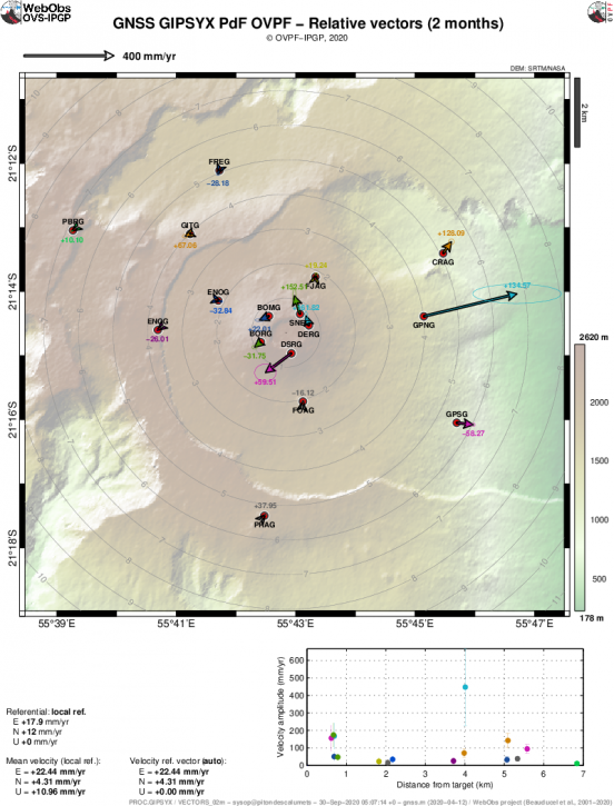
Ground displacements (expressed in speed) recorded on the GPS stations inside and around the Enclos Fouqué during the intrusion of September 28-30, 2020. The horizontal displacements are represented in vector form and the displacements verticals are indicated by the numerical values in color. The ellipse represents the measurement error (© OVPF-IPGP)
This resupply and pressurization of the most superficial storage system is at the origin of the seismic crisis of September 28-30. This seismic crisis was accompanied by rapid deformations of the ground, of around ten cm at the top of the volcano at 70 cm on the GPNG station located at an altitude of 1,414 m, reflecting the migration of a source of pressure to the east. at the origin of a displacement of the upper part of the Grandes Pentes towards the East.
…/…
Source : OVPF.
Read the full article :http://www.ipgp.fr/sites/default/files/ovpf_20201005_bullmensu.pdf
Photo : IPR
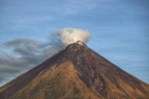
Peru , Sabancaya :
Analysis period: September 28 to October 4, 2020, Arequipa, October 5, 2020.
Alert level: ORANGE
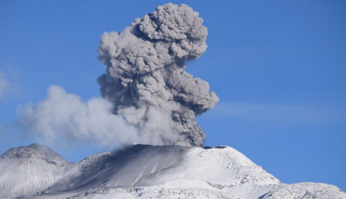
The Geophysical Institute of Peru (IGP) reports that the eruptive activity of the Sabancaya volcano remains at moderate levels; that is, with the continuous recording of explosions with columns of ash and gas up to 2.6 km altitude at the top of the volcano and their resulting dispersion. Therefore, for the following days, no significant change is expected in the eruptive activity.
The IGP recorded and analyzed the occurrence of 2339 earthquakes of volcanic origin associated with the circulation of magmatic fluids under the Sabancaya. An average of 40 low to medium intensity explosions were recorded daily.
During this period, Volcano-Tectonic (VT) earthquakes were located mainly in the North-East and North-West of Sabancaya, with magnitudes ranging from M2.3 to M3.9. The most representative earthquake (M3.9) occurred on September 28 at 2:03 p.m., 19 km northwest of Sabancaya and 10 km deep.
Monitoring the deformation of the volcanic structure, using GNSS data (processed with fast orbits), recorded a slight inflation of the south-eastern flank of Sabancaya and the northern sector of Hualca Hualca. Visual surveillance identified columns of gas and ash up to 2.6 km high at the top of the volcano, which were scattered towards the South-East, East, South-West and West sectors of Sabancaya. This activity has been corroborated by reports of ash fall in the districts of Huanca and Lluta. Satellite monitoring has identified 8 thermal anomalies with values between 1 MW and 13 MW, associated with the presence of a lava body on the surface of the volcano’s crater.
RECOMMENDATIONS
• Keep the volcanic alert level in orange.
• Do not approach within a radius of less than 12 km from the crater. In the event of an ash fall, cover your nose and mouth with wet rags or masks. Keep doors and windows of houses closed.
• Implement prevention and mitigation actions in the face of an increase in volcanic activity.
Source : IGP
Photo : Ingemmet.
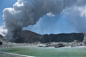
Costa Rica , Rincon de la Vieja :
Activity report of the Rincón de la Vieja volcano, October 03, 2020.
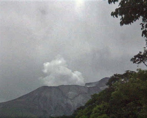
On October 03, 2020. at 10:55 local time, an eruption was recorded on the Rincón de la Vieja volcano, with a column that rose to 500 meters above the height of the crater and to 2416 m (meters above sea level, 7,924.48 ft).
Duration of activity: 1 minute.
Ash fall reported in: No ash fall reported
Sulfur odor reported in: No sulfur odor reported
Comments: A small hydrothermal eruption was recorded on the Rincón de la Vieja volcano at 10:55 am. The plume of gas and water vapor rose to 500 meters.
Activity report of the Rincón de la Vieja volcano, October 05, 2020.
On 05 October 2020 at 19:27 local time, an eruption was recorded on the volcano Rincón de la Vieja, the height reached by the column is unknown due to the visibility conditions of the site.
Duration of activity: 1 minute.
Ash fall reported in: No ash fall reported
Sulfur odor reported in: No sulfur odor reported
Comments: Cannot be confirmed by the webcam due to dark conditions.
Source : Ovsicori .
Photos : Ovsicori , Dr. Paulo Ruiz (réseau sismologique national) et Dr. Cyril Muller (ovsicori).
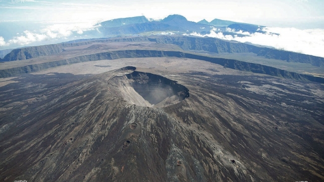
Ecuador , Sangay :
DAILY REPORT OF THE STATE OF SANGAY VOLCANO, Monday 05 October 2020.
Surface activity level: High, Surface trend: No change.
Internal activity level: High, Internal trend: No change.
Seismicity: From 04 October 2020, 11:00 to 05 October 2020, 11:00:
Long period type events: 20
Emission tremor: 25
Rains / lahars:
During the past 24 hours, there have been several episodes of rain in the area which did not generate signals associated with secondary lahars.
** In case of heavy rains, lahars can be generated in the Volcán, Upano rivers and other tributaries **
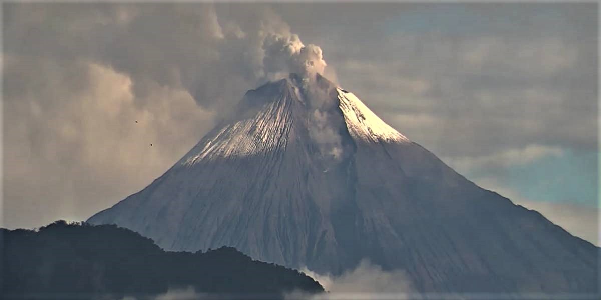
Emission / Ash Column: No emissions were seen through the cameras, however, the Washington VAAC reported 2 emission alerts observed by satellites, whose heights approached 900 meters above the crater level. The direction of the emissions was constant towards the northwest.
Other monitoring parameters: FIRMS recorded 20 thermal alerts on the Sangay in the last 24 hours.
MIROVA recorded 1 low thermal alert on the Sangay during the last 24 hours
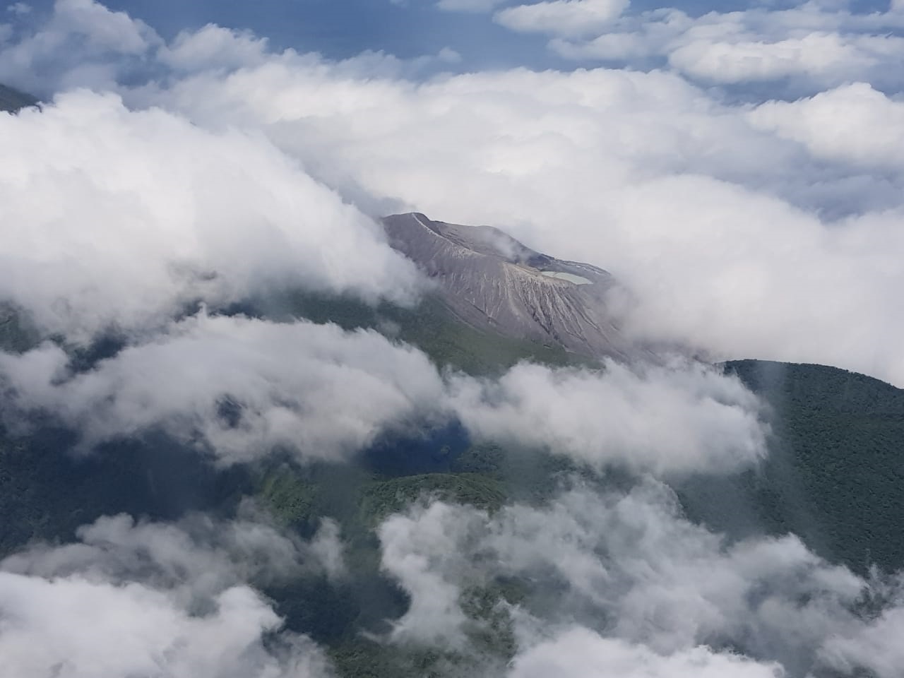
Observations: In images shared by ECU911, that from this morning only was partially clear, however, no surface activity was distinguished on the volcano, the remainder of the monitoring period up to this report it is remained cloudy. The seismic reference station has had transmission issues since around 5:40 TL today.
Alert level: yellow.
Source : IGEPN.
Photo : ECU911.