March 07 , 2020.
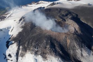
El Salvador , San Miguel ( Chaparrastique ) :
The activity of the Chaparrastic volcano maintained relative calm, indicating that the internal system of the volcano is in equilibrium. From Tuesday February 23 to date, the Network of local observers has not reported any case of noise and gas plumes emitted by the volcano. The recording of seismicity remained stable and the amplitude of the seismic signal indicates the presence of a micro-seismicity of very low amplitude, the above indicates that the volcano has returned to a period of normalcy.
In the past seven days, the number of earthquakes recorded on the volcano has fluctuated between 50 and 60 earthquakes per hour. It should be mentioned that these are microseisms of very low amplitude, which are not perceived by the population (Figure 1). Over the past few days, the amplitude of the seismic signal recorded at the VSM station, located on the northern flank at 1700 meters above sea level, has fluctuated between 40 and 98 RSAM units, in its average hour, 150 units being normal (Figure 2).
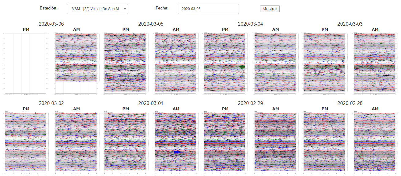
Figure 1. Seismicity record for the past seven days. Note the presence of microseisms of very low amplitude
Source: MARN
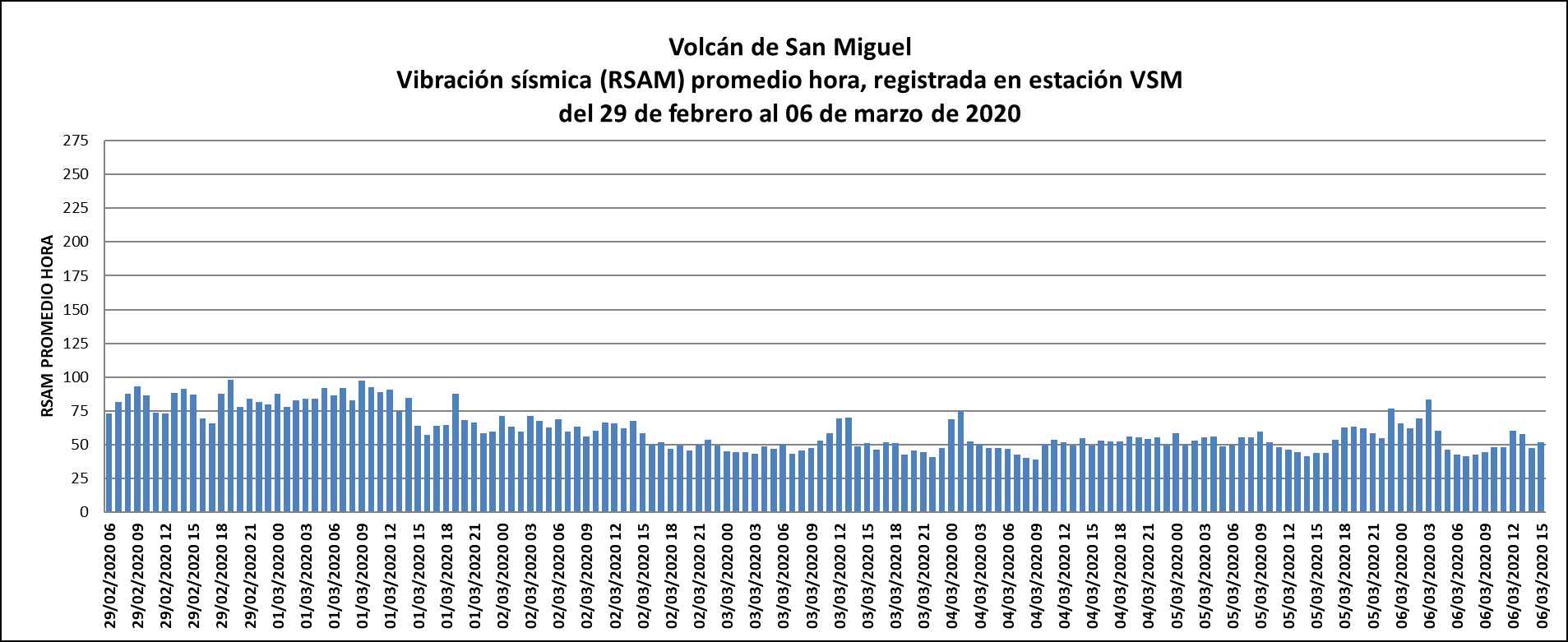
Figure 2. Variation in the seismic amplitude recorded during the last seven days at the VSM station
Source: MARN
The flow of sulfur dioxide emitted by the volcano remains similar to the previous days (Figure 3), varying over the past seven days, between 517 and 808 tonnes per day. It should be mentioned that the wind direction conditions the gas plume, preferably transported to the southwest flank of the volcano.
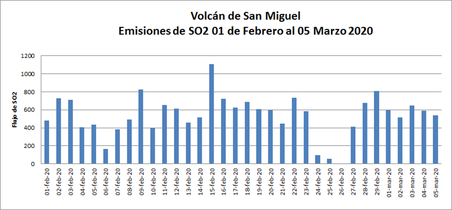
Figure 3. SO2 flow, until March 5. The sulfur dioxide emitted by the crater of the volcano, with slight fluctuations exceeding the threshold.
Source: MARN
This report closes the process started on February 21, followed by the emission of ash for 25 minutes on Saturday February 22. To date, the system has regained its balance
The Ministry of the Environment and Natural Resources (MARN) provides 24/7 surveillance of the volcano and close communication with the Directorate General of Civil Protection and local observers. We call on local residents, tourists and mountaineers to stay away from the volcano crater due to the small gas and ash emissions that may occur in the future, given the sudden nature of the activity increased volcano in recent years. .
Source : Marn .
Photo : laprensagrafica.
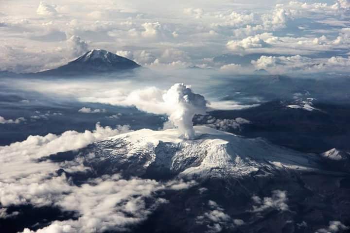
Colombia , Nevado del Ruiz :
Weekly activity bulletin of the Nevado del Ruiz volcano
The level of activity continues at the level of yellow activity or (III): changes in the behavior of volcanic activity.
Regarding the monitoring of the activity of the Nevado del Ruiz volcano, the COLOMBIAN GEOLOGICAL SERVICE reports that:
The Nevado del Ruiz volcano continues with an unstable behavior. During the past week, some of the parameters monitored have shown variations reflecting the instability of the volcanic system. An acceleration of the volcanic process and therefore changes in the level of activity of the volcano is not excluded.
Seismicity related to fluid dynamics, inside volcanic conduits, showed an increase in the number of recorded events and maintained similar levels of released seismic energy, compared to the previous week. This seismic activity was characterized by the presence of continuous volcanic tremors, pulses of volcanic tremor (TR), earthquakes of the long period type (LP) and of the very long period type (VLP) recorded individually or jointly with volcanic tremor pulses. The earthquakes presented varying energy levels and spectral content. Some of these signals were associated with small emissions of gas and ash, which were confirmed by cameras installed in the volcano area, reports by staff of the Colombian Geological Service, officials of the Nevados National Natural Park in the region and reports published by the VAAC (Current Volcanic Ash Advisories).
It should also be noted, the occurrence of an episode of seismicity of the “drumbeat” type, earthquakes of the long period (LP) type, of short duration and of low energy level, recorded on February 27. This type of seismicity is linked to the process of ascension and evolution of domes on the surface of a volcano.
The seismicity generated by the fracturing of rocks (volcano-tectonic type) decreased in number of earthquakes and increased in released seismic energy, compared to the previous week. This type of seismicity was located in the sectors of the Arenas crater, to the Southeast, Southwest and to a lesser extent, to the Northeast of the volcano. The depths of the earthquakes ranged from 0.3 to 7.0 km. The maximum magnitude recorded during the week was 2.0 ML (local magnitude), corresponding to the earthquake recorded on February 26 at 8:03 a.m. (local time), located in the Arenas crater, at a depth of 1.5 km .
The deformation of the volcanic surface, measured from GNSS (Global Navigation Satellite System) stations, did not show any significant change or deformation process during the week. However, it is important to note that some minor changes have been observed in the data obtained by the inclinometers.
Source : SGC.
Photo : Auteur Inconnu.
Alaska , Great Sitkin :
52°4’35 » N 176°6’39 » W,
Summit Elevation 5709 ft (1740 m)
Current Volcano Alert Level: ADVISORY
Current Aviation Color Code: YELLOW
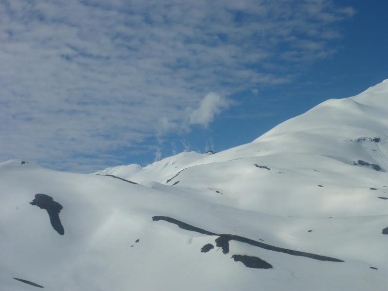
A view up toward the degassing summit dome of Great Sitkin, while on approach into the thermal springs on the south flank. Though the degassing is weak, it was an exceptionally still day and the gas was clearly observed rising vertically from several vents. A coherent gas plume was also observed at about the same time by a geology crew on Adak.
Unrest continues at Great Sitkin. Seismicity at Great Sitkin has been slightly elevated for much of the past week. On Friday, 6 March, 2020 at 6:31 AM AKST (15:31 UTC) a relatively large and shallow magnitude 3.5 earthquake occurred 1 km from the summit. Seismicity since has returned to levels comparable to earlier in the week. Although this earthquake represents a significant increase in the seismic activity at the volcano, it does not mean that an eruption is imminent. There have been no signs of activity in satellite data over the past week, although observations were limited by cloud cover. AVO is closely monitoring the volcano for other signs of unrest that may indicate increased activity or likelihood of an eruption.
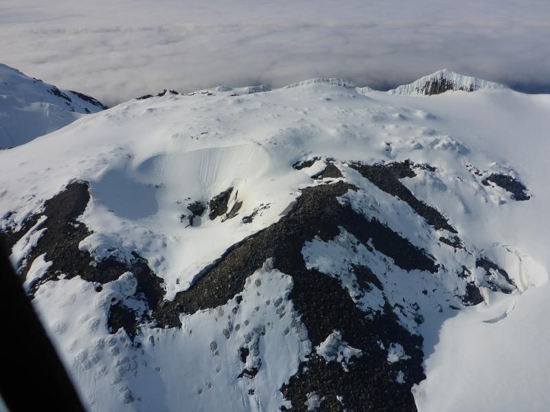
View of the summit dome at Great Sitkin during a gas flight. Very weak diffuse degassing observed all around the margins of the dome and also within the small crater on top. View is roughly to the north.
Great Sitkin Volcano is monitored with a local real-time seismic network, which will typically allow AVO to detect changes in unrest that may lead to an explosive eruption. Rapid detection of an ash-producing eruption would be accomplished using a combination of seismic, infrasound, lightning, and satellite data.
Great Sitkin Volcano is a basaltic andesite volcano that occupies most of the northern half of Great Sitkin Island, a member of the Andreanof Islands group in the central Aleutian Islands. It is located 43 km (26 miles) east of the community of Adak. The volcano is a composite structure consisting of an older decapitated volcano and a younger parasitic cone with a 2-3 km diameter summit crater. A steep-sided lava dome, emplaced during an eruption in 1974, occupies the center of the crater. Great Sitkin erupted at least three times in the 20th century, most recently in 1974. That eruption produced a lava dome and at least one ash cloud that likely exceeded an altitude of 25,000 ft above sea level. A poorly documented eruption occurred in 1945, also producing a lava dome that was partially destroyed in the 1974 eruption. Within the past 280 years a large explosive eruption produced pyroclastic flows that partially filled the Glacier Creek valley on the southwest flank.
Source : AVO.
Photos : Clor, Laura ( juin 2019) .
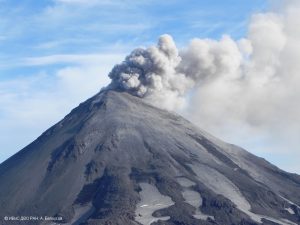
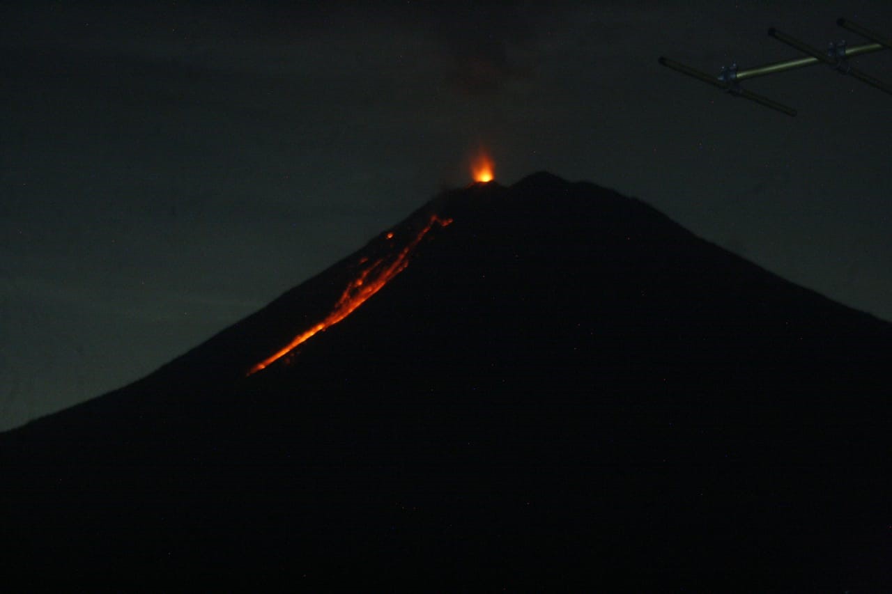
Indonesia , Semeru :
Level of activity at level II (WASPADA). G. Semeru (3,676 m above sea level) is experiencing a continuous eruption. The last eruption occurred on March 5, 2020 with an eruption column height not observed.
The volcanoes are clearly visible until it is covered with fog. The smoke from the crater is white / gray with medium intensity, rising to about 50-200 meters above the summit. The weather is sunny / cloudy, the winds are weak to moderate, oriented towards the South.
An incandescence is observed at night when the visuals of the mountain are clear.
According to the seismographs of March 6, 2020, it was recorded:
28 explosion / eruption earthquakes
4 avalanche earthquakes.
7 harmonic earthquakes.
Recommendation:
The communities must not carry out activities within a radius of 1 km and in the area up to 4 km in the sector of the South-South-East slopes of the active crater which is an opening area of the active crater of G. Semeru (Jongring Seloko) as a channel for sliding warm clouds.
VONA: The last VONA ORANGE color code has been sent, published on March 05, 2020 at 07:40:00 WIB.
Source : PVMBG.