January 26 , 2021 .
Italy , Stromboli :
PRESS RELEASE ON STROMBOLI’S ACTIVITY [UPDATE n. 4]
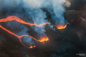
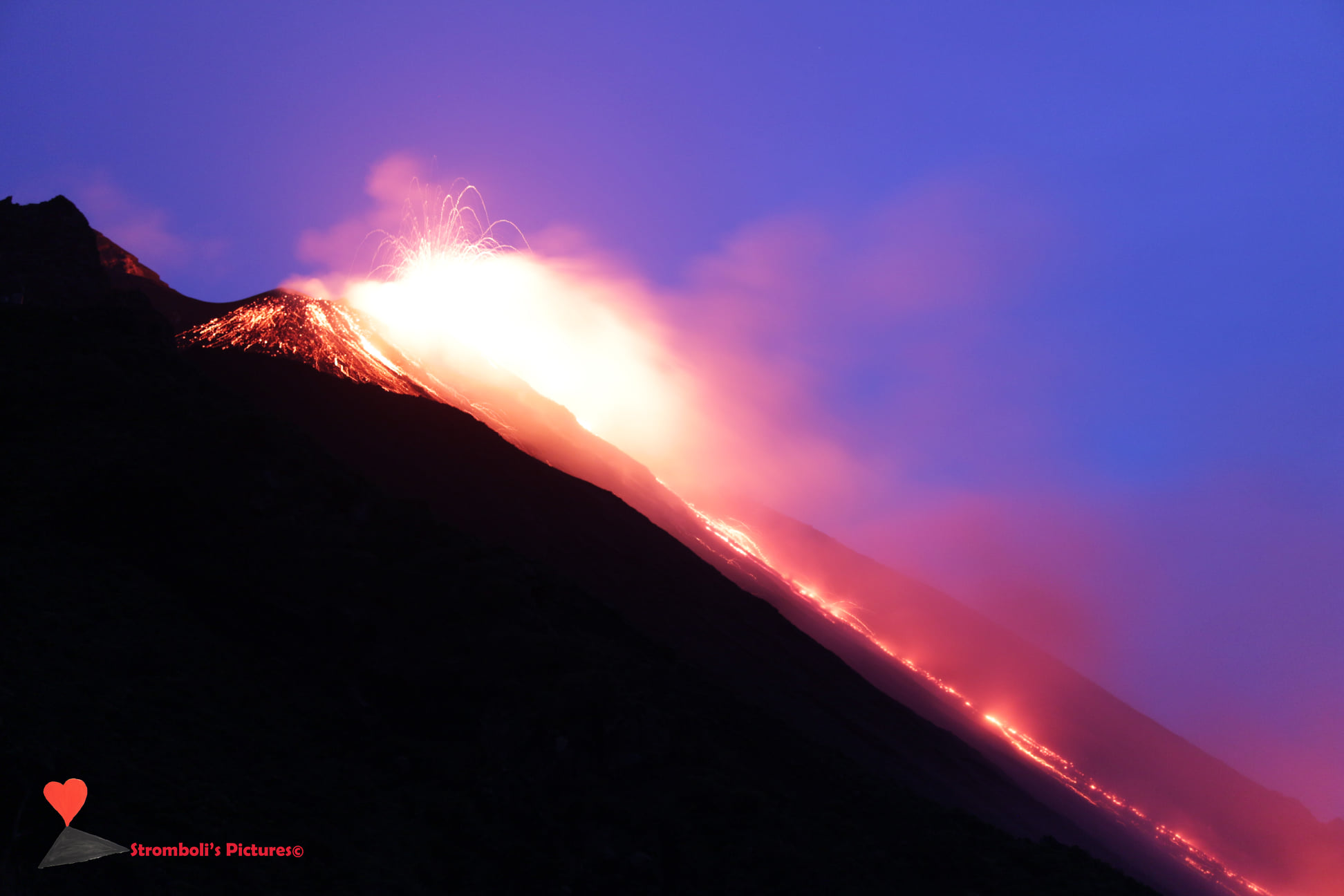
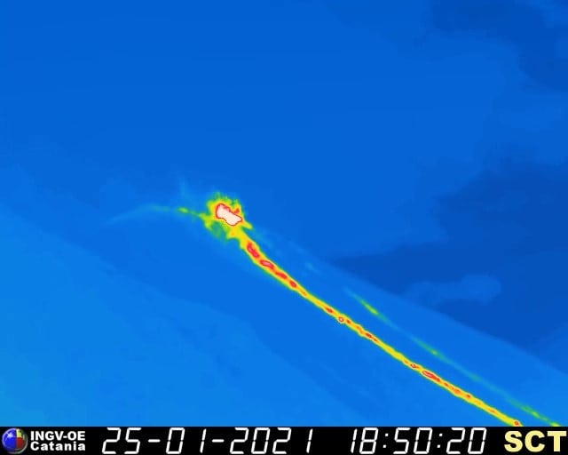
The National Institute of Geophysics and Volcanology, Osservatorio Etneo, announces that the lava overflow from the area of the North crater continues, feeding a lava flow whose front is at an altitude of about 500 m. Many incandescent blocks stand out from the front of the flow, roll along the Sciara del Fuoco to reach the coast.
Intense Strombolian activity is also observed in the North and Central South crater areas.
From a seismic point of view, the amplitude of the volcanic tremor, the frequency and the energy of the transients attributable to the explosive events show a stationary image.
The available data on soil deformation do not show significant changes. Timpone del Fuoco’s tilt sensor stopped broadcasting since yesterday.
PRESS RELEASE ON STROMBOLI’S ACTIVITY [UPDATE n. 5]
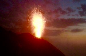
The National Institute of Geophysics and Volcanology, Osservatorio Etneo, announces that the images taken by the surveillance cameras show that the lava flow emitted by the area of the North crater is no longer fed. On the other hand, normal explosive activity continues from three or four vents in the area of the North crater, with episodes of weak « splash » (continuous projection of pieces of lava). The explosive activity in the Center-South crater area appears to be very low.
Currently the amplitude of the volcanic tremor, the frequency and the energy of the explosive events show a stationary image, comparable to that observed in the period preceding the publication of the 1st press release.
The soil deformation data show no significant change. The inclinometric station of Timpone del Fuoco is operational again.
PRESS RELEASE ON STROMBOLI’S ACTIVITY [UPDATE n. 6]
The National Institute of Geophysics and Volcanology, Osservatorio Etneo, announces that the monitoring networks recorded the return of parameters to normal activity at 19:46 (18:46 UTC).
Further updates will be communicated shortly.
Source : INGV.
Photo : Stromboli’s pictures via facebook.
Peru , Sabancaya :
Analysis period: from January 18, 2021 to January 24, 2021, Arequipa, January 25, 2021.
Alert level: ORANGE
The Geophysical Institute of Peru (IGP) reports that the eruptive activity of the Sabancaya volcano remains at moderate levels, that is to say with the recording of an average of 32 daily explosions, with columns of ash and gas up to 3.5 km altitude above the summit of the volcano and their subsequent dispersion. Therefore, for the following days, no significant change is expected in the eruptive activity.
The IGP recorded and analyzed the occurrence of 12,148 earthquakes of volcanic origin, associated with the circulation of magmatic fluids inside the Sabancaya volcano. An average of 32 explosions were recorded daily of low to medium intensity. During this period, Volcano-Tectonic (VT) earthquakes associated with rock fractures were located mainly in the North-East and North-West of Sabancaya and presented magnitudes between M1.9 and M2.7.
The monitoring of the deformation of the volcanic structure using GNSS techniques (processed with fast orbits) does not present any significant anomalies. However, in general, an inflation process has been observed in the south-eastern sector of Sabancaya and the northern sector (around the Hualca Hualca volcano). Visual surveillance made it possible to identify columns of gas and ash up to 3.5 km altitude above the summit of the volcano, which were dispersed towards the South, South-East, North-West, West and Southwest of Sabancaya.
RECOMMENDATIONS
• Keep the volcanic alert level in orange.
• Do not approach within a radius of less than 12 km from the crater.
Source : IGP.
Photo : Ingemmet.
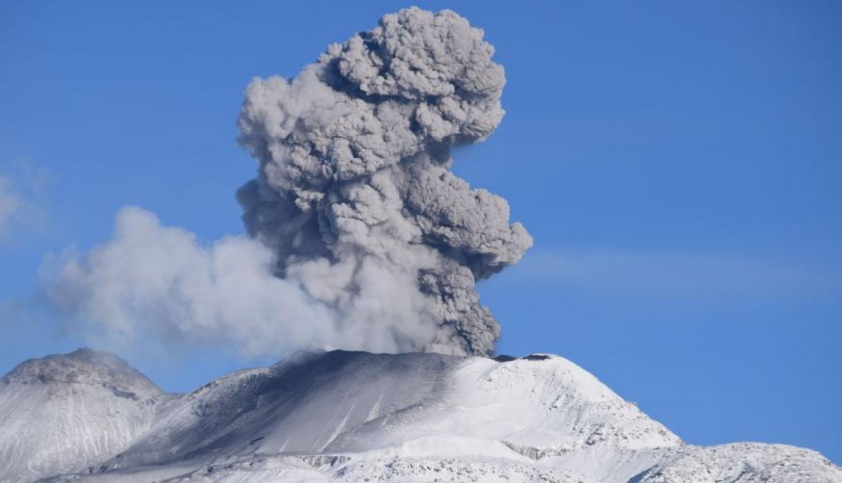
Kamchatka , Klyuchevskoy :
56.06 N, 160.64 E;
Elevation 4750 m (15580 ft)
Aviation Colour Code is ORANGE
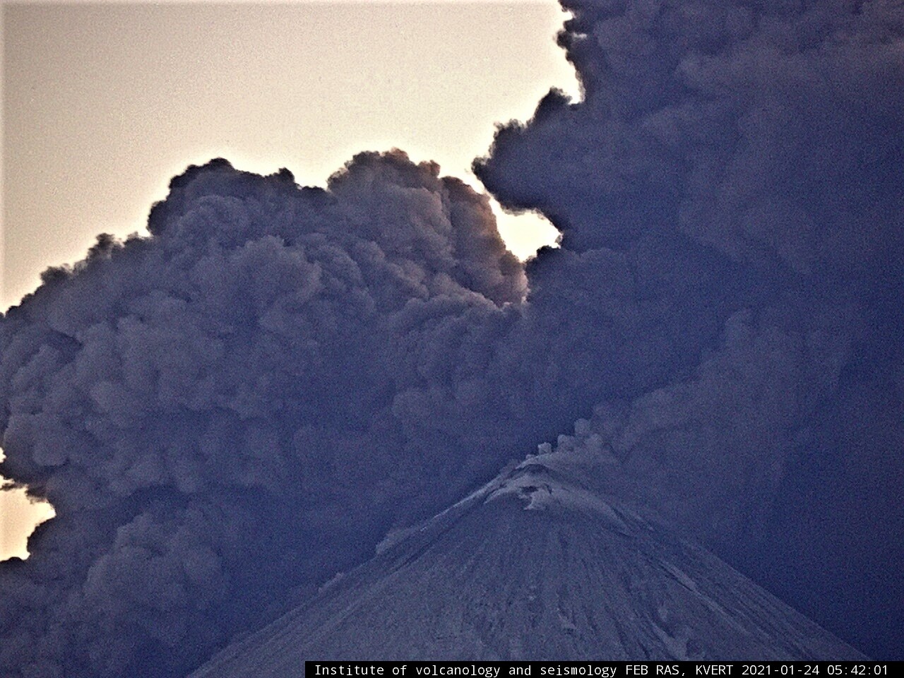
Ash clouds over Klyuchevskoy volcano on 24 January, 2021.
The intense effusing of lava flow from the summit volcanic crater, and the formation of the lateral break at an altitude of ~ 2200 m a.s.l., led to the collapse of large masses of pyroclastics from the sides of the Apakhonchich chute. The ash cloud rose up to 8500 m a.s.l.
A moderate explosive-effusive eruption of the volcano continues. The Strombolian and gas-steam activity were observed. A lava flow continues to effuse along Apakhonchich chute. Satellite data showed a large bright thermal anomaly in an area of the volcano. The intense effusing of lava flow from the summit volcanic crater, and the formation of the lateral break at an altitude of ~ 2200 m a.s.l., led to the collapse of large masses of pyroclastics from the sides of the Apakhonchich chute. The ash cloud rose up to 9.6 km a.s.l., and drifted for 80 km to the north, and north-east of the volcano.
Source : Kvert .
Photo : IVS FEB RAS. Kvert.
Indonesia , Merapi :
Level of activity level III (SIAGA) since November 5, 2020 at 12:00 WIB. The Merapi volcano (2968 m altitude) erupted continuously. The last eruption took place on June 21, 2020 with a height of the eruption column at 6000 m above the summit. It was observed that the color of the ash column was gray.
The volcano is clearly visible until it is covered in fog. The crater emits white smoke with a moderate to thick height at around 50-300 meters above the summit. The weather is sunny to rainy, with weak to moderate winds to the northeast and east. Two avalanches were observed with a maximum slide distance of 800 m to the southwest, 43 lava avalanches with a slide distance of 300 to 800 m to the southwest and 4 hot avalanche clouds with a sliding distance of 600 to 1299 m to the southwest with a column of smoke 300-400 m above the summit.
According to the seismographs of January 25, 2021, it was recorded:
• 4 hot cloud avalanche earthquakes
• 137 avalanche earthquakes
• 38 earthquakes of emissions
• 15 hybrid / multi-phase earthquakes.
Observation of hot cloud avalanches, January 25, 2021 from 6 p.m. to midnight WIB.
– On January 25, 2021 at 8:24 p.m. WIB, hot avalanche clouds were recorded on a seismogram with an amplitude of 30 mm and a duration of 103 seconds, a column height of 400 m, a sliding distance of 1000 m southwest to the Top of the Kali Krasak and Boyong.
– On January 25, 2021 at 8:33 p.m. WIB, hot avalanche clouds were recorded on a seismogram with an amplitude of 20 mm and a duration of 65 seconds, a column height of 300 m, a sliding distance of 600 m towards the southwest towards the top of the Kali Krasak and Boyong.
– On January 25, 2021 at 9:03 p.m. WIB, hot avalanche clouds were recorded on a seismogram with an amplitude of 27 mm and a duration of 106 seconds, a column height of 400 m, a sliding distance of 1000 m to the southwest towards the Top of the Kali Krasak and Boyong.
The current potential dangers are in the form of lava avalanches and hot clouds in the South-South-West sector covering the Boyong, Bedog, Krasak, Bebeng and Putih rivers with a maximum distance of 5 km. During this time, the ejection of volcanic material during an explosive eruption can reach a radius of 3 km around the summit.
The community should not carry out any activity in areas of potential danger.
Sources : PVMBG, BPPTKG.