February 22 , 2020 .
Indonesia , Merapi :
Activity report of the Merapi volcano, February 14-20, 2020
OBSERVATION RESULTS
visual
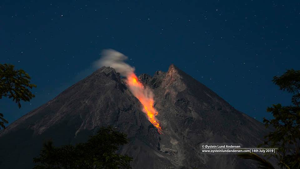
The weather around Mount Merapi is generally sunny in the morning, while the afternoon until evening is foggy. There is white smoke, fine to thick with low pressure. A maximum smoke height of 400 m was observed from the Mount Merapi observation post in Kaliurang on February 14, 2020 at 5:40 a.m.
Morphological analysis of the crater area based on photographs of the Southeast sector showed a slight morphological change. The volume of the lava dome based on measurements using aerial photography with drones on February 19, 2020 amounted to 291,000 m3, a reduction of 116,000 m3 compared to the measurement data of November 12, 2019.
Seismicity:
20 emission earthquake (DG),
1 shallow volcanic earthquake (VTB),
95 multi-phase earthquakes (MP),
45 avalanche earthquakes. (RF)
15 low frequency earthquakes (LF)
19 tectonic earthquakes (TT).
The seismic intensity this week is lower than last week.
Deformation:
The deformation of G. Merapi which was monitored by EDM and GPS this week did not show any significant change.
Rain and lahars:
This week, February 15, 2020, there was rain at the Mount Merapi observation post with the highest rain intensity of 62 mm / hour at the Kaliurang post.
Conclusion:
Based on the results of the visual and instrumental observations, it was concluded that:
1. The lava dome is currently in a stable state.
2. The volcanic activity of Mount Merapi is still quite high and is determined by the level of activity « WASPADA ».
3. The current potential danger is in the form of hot clouds from the collapse of the lava dome and eruptions of volcanic material resulting from explosions.
Source : BPPTKG.
Photo : Oystein Lund Andersen
Alaska , Semisopochnoi :
51°55’44 » N 179°35’52 » E,
Summit Elevation 2625 ft (800 m)
Current Volcano Alert Level: WATCH
Current Aviation Color Code: ORANGE
Seismic activity increased at the end of last week, prompting an increase in the Color Code / Alert Level to Orange / Watch. Short, energetic bursts of seismic tremor have occurred intermittently all week but have not been associated with any other signs of eruptive activity. No eruption clouds were observed in clear to cloudy satellite images this week. No infrasound signals were detected on regional stations during periods of elevated seismicity. Explosive activity has occurred intermittently at Semisopochnoi over the last year and could resume without advance warning.
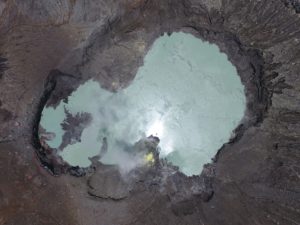
Mt Cerberus from the east. AVO seismic station CERB is on the triangular hilltop in the lower left. Photos of Semisopochnoi Island taken in May 2017 during AVO station maintenance activities and supported by U.S. Coast Guard.
Semisopochnoi is monitored with an on-island seismic network and remotely by satellite and lightning sensors. Furthermore, an infrasound array on Adak Island may detect explosive emissions from Semisopochnoi with a 13 minute delay if atmospheric conditions permit.
Remote Semisopochnoi volcano occupies the largest, young volcanic island in the western Aleutians. The volcano is dominated by an 8-km (5-mile) diameter caldera that contains a small lake and a number of post-caldera cones and craters. The age of the caldera is not known with certainty but is likely early Holocene. The last known eruption of Semisopochnoi occurred in 1987, probably from Sugarloaf Peak on the south coast of the island, but details are lacking. Another prominent, young post-caldera landform is Mount Cerberus, a three-peaked cone cluster in the southwest part of the caldera. The island is uninhabited and part of the Alaska Maritime National Wildlife Refuge. It is located 65 km (40 mi) northeast of Amchitka Island and 200 km (130 mi) west of Adak.
Source : AVO.
Photo : Kaufman, Max.
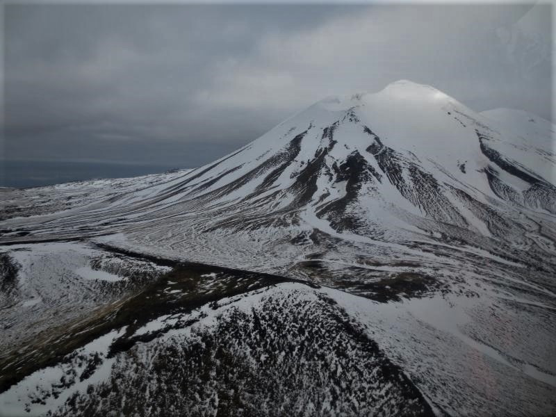
El Salvador , San Miguel ( Chaparrastique) :
From 7:00 p.m. on February 20 and until 7:50 a.m. on Friday 21, the Network of local observers reported the occurrence of a series of rumblings from the volcano. Monitoring data indicates that the San Miguel volcano has exhibited a change in behavior, highlighted by the increase in the amplitude of microseisms and light gas emissions from its central crater. The seismicity recorded on the volcano shows signs that may be related to fractures and small internal explosions of the volcano, which indicates an increase in its internal pressure, with the possibility of the appearance of a more significant degassing which can be accompanied by small emanations of ash, which, if they occur, will preferably be transported to the southwest flank of the volcano.
The seismicity of the last seven days recorded in the VSM station is illustrated in Figure 1.
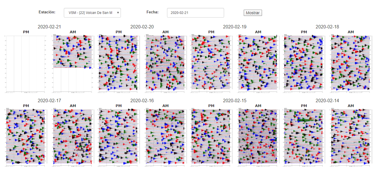
Figure 1. Seismicity of the volcano recorded from February 14 to 21, 2020, associated with fractures and small internal explosions due to the movement of gases and fluids. The number of earthquakes oscillates between 10 and 15 earthquakes per hour, which is normal in this volcano.
The number of recorded earthquakes varies between 10 and 15 earthquakes per hour. This value is considered normal, however, the amplitude of the earthquakes detected indicates greater energy, which results in instability in the internal system of the volcano (see Figure 2).
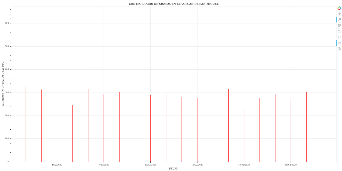
Figure 2. Seismic behavior of the Chaparrastique volcano during the last hours.
Regarding the classification of recorded earthquakes, changes associated with larger impulse events have been observed, highlighting the occurrence of small fractures in the duct of the volcanic system.
In FIG. 3, the red dots correspond to the microseisms recorded. Those that appear at the top of the black line (frequency index) are classified as earthquakes associated with fracturing. If they appear at the bottom of the black line, they are classified as earthquakes associated with fluid movements in the internal system of the volcano. Note the upward trend on February 15.
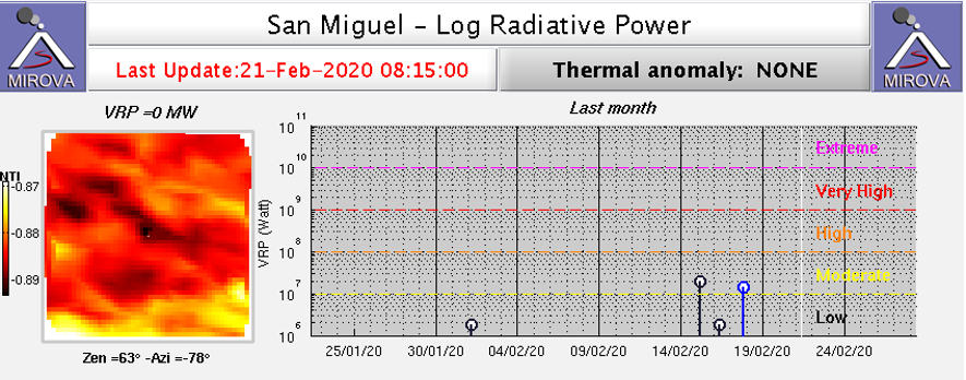
Figure 3. The frequency index indicates an increase in the frequency content of earthquakes on February 15, more evident on February 20.
The satellite image of thermal anomaly for today, obtained on the MIROVA website (http://www.mirovaweb.it/?action=volcanoDetails&volcano_id=343100) does not show anomalies for the San Miguel volcano.
The flow of sulfur dioxide emitted from the crater of the volcano increased, reaching the upper limit of the normal threshold (620 tonnes / day), reflecting the increase in the internal pressure of the volcanic system, so that a degassing pulse is observed from the crater
The sulfur dioxide emissions from the volcano recorded by the monitoring station located in San Jorge are shown in Figure 4.
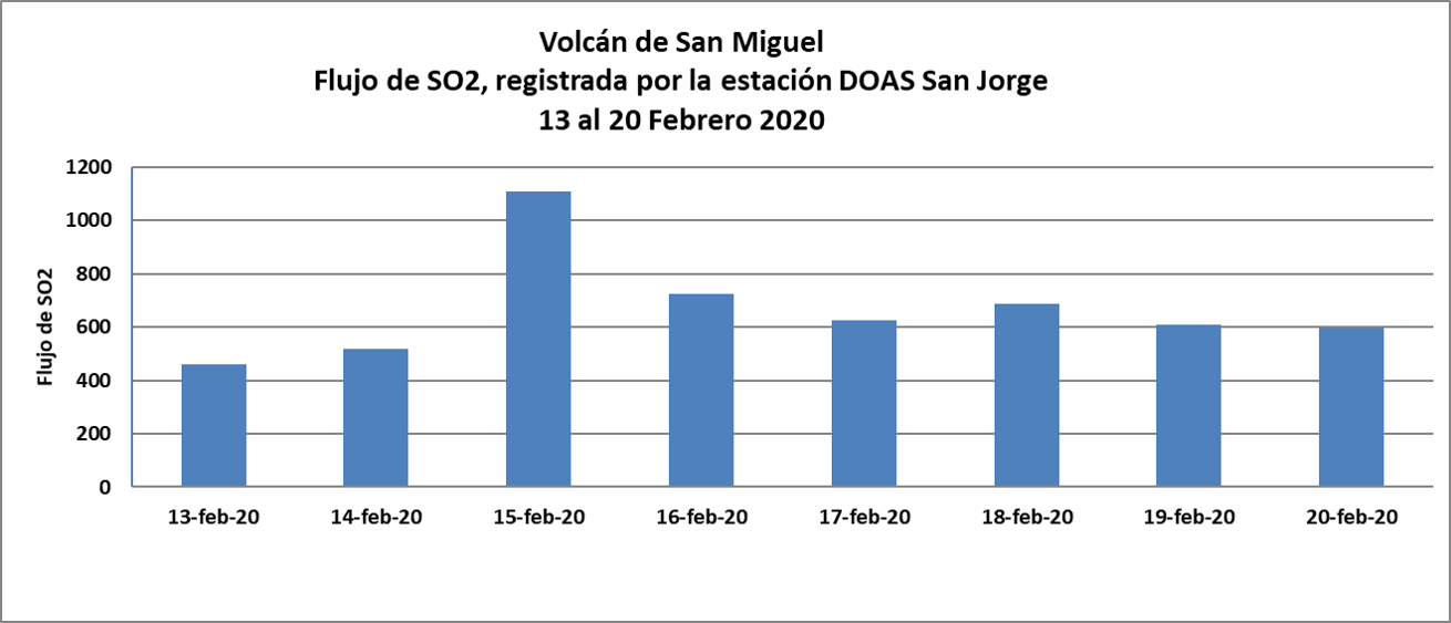
Figure 4. SO2 flow, from February 13 to 20, the flow of sulfur dioxide emitted by the crater of the volcano increased above the normal threshold set at 620 tonnes / day.
The image of the volcano captured by the webcam located in the Pacayal volcano (Figure 5), shows the occurrence of gas and vapor pulses emitted by the crater of the volcano.
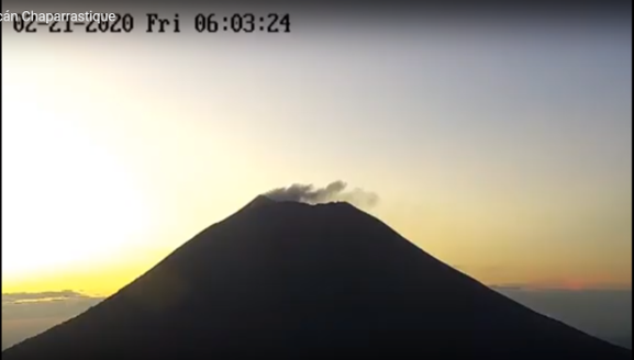
Figure 5. Plume of gas and vapor from the volcano, captured today Friday February 21 at 6 h 03.
The monitoring parameters indicate that the volcano is in imbalance, because suddenly small internal explosions occur. These variations are continuously monitored and, if there are conditions that show increased activity, with potential danger to the population, they will be announced in due course.
In the event of an increase in activity, the most likely scenario would be the emission of gases, which could be accompanied by small pulses of ash and move towards the southwest flank.
Source: MARN.
Read the whole article : https://www.marn.gob.sv/informe-especial-1-aumenta-la-actividad-del-volcan-de-san-miguel/
Guatemala , Fuego :
Type of activity: Vulcanian
Morphology: composite stratovolcano
Location: 14 ° 28’54˝ Latitude N; 90 ° 52’54˝ Longitude W.
Height: 3,763 msnm.
Atmospheric conditions: Clear
Wind: northeast at 4 km / h
Precipitation: 0.0 mm.
Visible and audible activity of a white degassing at an approximate height of 4,200 meters above sea level (13,780 feet) dispersing in a west and northwest direction. This activity generates 8 to 15 low to moderate explosions per hour which expel the columns of gray ash at a height of 4500 to 4800 m above sea level (14,764 to 15,748 feet) dispersing over about 15 to 25 kilometers towards the West and North West. Incandescent pulses from the crater, 200 to 400 meters high were observed at night during the first hours, with moderate avalanches around the crater towards the Seca, Taniluya, Ceniza, Santa Teresa, Trinidad, Las Lajas ravines. Part of the ejected material descends towards the edge of the vegetation. Low to moderate rumblings are reported generating shock waves that cause vibrations in the doors and windows of houses in communities near the volcano. Sustained degassing generates sounds similar to a train locomotive for 6 to 8 minutes. Due to the activity, ash falls continue in Sangre de Cristo, San Pedro Yepocapa, La Soledad and the surrounding area.
Source : Insivumeh .
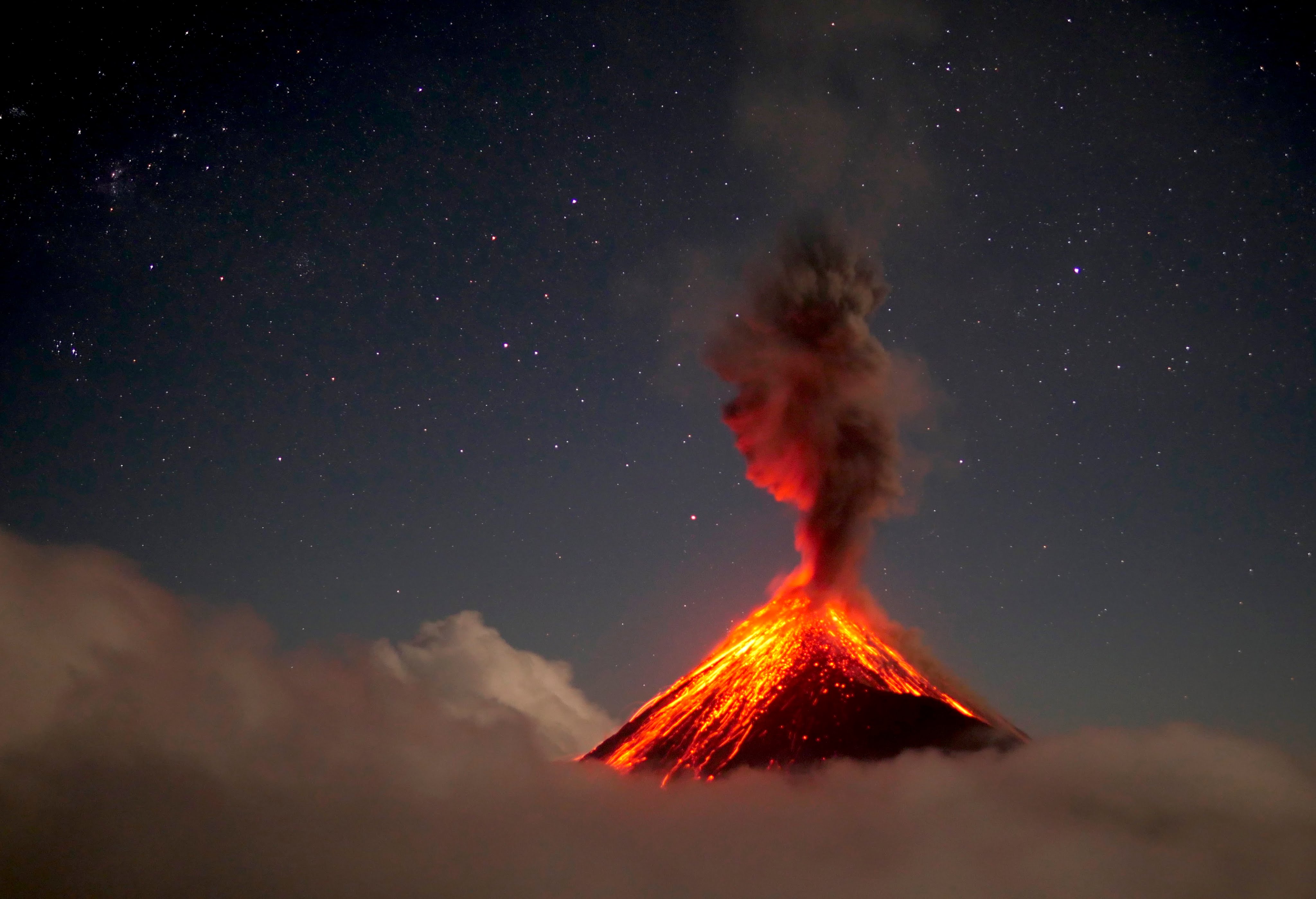
Photo : 660citynews.com.