November 16 , 2018.
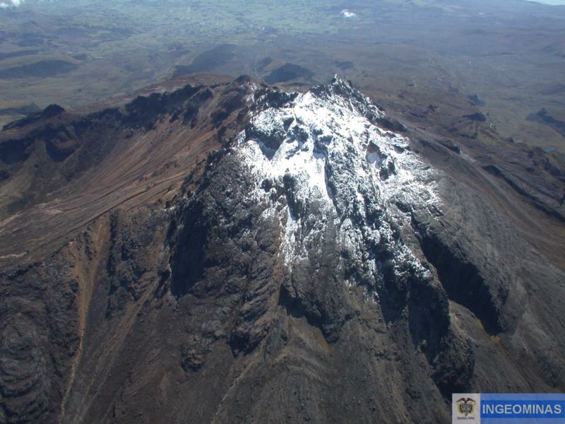
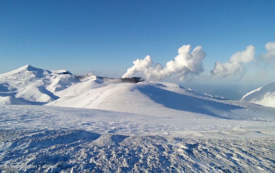
Colombia , Galeras :
Weekly activity bulletin of the Galeras volcano.
The level of activity of the volcano continues as follows: LEVEL YELLOW ■ (III): CHANGES IN THE BEHAVIOR OF THE VOLCANIC ACTIVITY.
Following the activity of the VOLCÁN GALERAS, the COLOMBIAN GEOLOGICAL SERVICE (SGC) informs that:
For the period from 6 to 12 November 2018, the seismicity of the Galeras volcano continued to show low levels of occurrence, similar to those reported in previous weeks, but an increase in released seismic energy was recorded, which was caused mainly by VT-type earthquakes (volcano-tectonic earthquakes, associated with fracturing of the cortical material inside the volcano), located at an average distance of 12 km towards the west-northwest of the volcano , at a depth between 9 and 12 km below the summit (4200 msnm), and which had a local magnitude between M0.6 and M3.1 on the Richter scale. On November 6 and 7, residents of the municipalities of Consacá, Sandoná, Samaniego and Ancuya (Department of Nariño) reported that two of these events had been felt, with a local magnitude of M3.1 and M2.4 respectively. The remaining seismicity, with a predominance of VT-like events, was scattered over distances of up to 14 km, depths of less than 9 km, and a maximum local magnitude of M1.7.
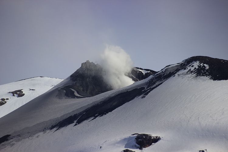
During the week under review, we observed white gas emissions, low pressure, low height and variable direction due to wind action.
The other geophysical and geochemical parameters of Galeras volcano monitoring did not show any significant variations.
The COLOMBIAN GEOLOGICAL SERVICE is attentive to the evolution of the volcanic phenomenon and will continue to inform in a timely manner of the observed changes.
Source : SGC
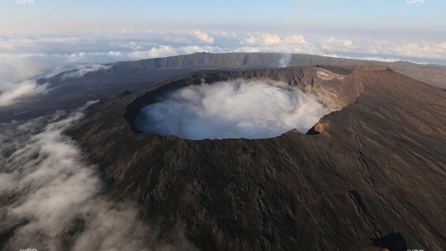
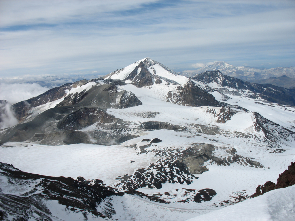
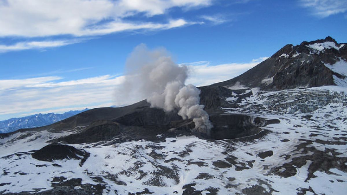
Chile, Copahue :
During this period, 171 seismic events classified as volcano-tectonic (VT) were recorded, associated with fracturing processes of rigid materials. The event with the greatest energy obtained a local magnitude equal to M 2.7 and was located 8 km east-northeast (ENE) of active crater El Agrio, 3.1 km deep .
Similarly, 27 earthquakes associated with fluid dynamics were recorded under the volcanic building, classified as long-period (LP) events, with a maximum displacement value (DRC) of 4.7 cm2. In addition, 14 Very Long Period (VLP) earthquakes were recorded with a maximum reduced displacement value of 2.9 cm2.
The continuous tremor signal showed oscillations in its amplitude between low and medium intensity values with dominant frequencies between 1 and 3 Hz mainly.
IP cameras installed near the volcano recorded a constant degassing of the active crater (El Agrio) at a maximum height of 1300 m with white color emissions and incandescence during the night period, when weather conditions allowed to observe the volcano. .
According to the analysis of data obtained from four geodetic monitoring stations, there is almost no displacement of the volcanic building during the evaluated period. The same thing is observed in the lines of surveillance that cross the active crater. Calculated rates of change have a maximum of 0.07 cm / month, so there is no evidence of a significant deformation process associated with activity on the volcano.
Sulfur Dioxide (SO2) emissions from Differential Absorption Spectrometry (DOAS) equipment at Mellizas, located 5 km east-northeast of the active crater, had an average value of 953 + / – 156 t / day, with a maximum value of 1823 t / day reported on October 21st. SO2 emissions are considered moderate if one looks at the current state of the volcano.
One (1) thermal warning was reported in the area associated with the volcanic building during the period considered, with a volcanic radiative power (VRP) of 1 MW on October 22, value considered low according to data processed by observation medium infrared. volcanic activity (MIROVA) (http://www.mirovaweb.it/) and near-real-time thermal monitoring of global hot spots (MODVOLC) (http://modis.higp.hawaii.edu/) .

The process of constant volcano – tectonic activity (VT) in the vicinity of the El Agrio crater continues, with low magnitude events. At the same time, the interaction of the hydrothermal system with the magmatic system persists, with white emissions and incandescence during the night period, when weather conditions allowed the observation of the volcano. Under these conditions, it is likely that the occurrence of phreatic explosions or weak Strombolian explosions that would affect the vicinity of the crater occur, as recorded in previous years.
Therefore, the alert level is maintained at the level:
YELLOW LEVEL: Changes in the behavior of volcanic activity – Probable time for an eruption: WEEKS / MONTH.
Observation: A zone of assignment is considered to be a radius of 1 kilometer around the crater.
Source : Sernageomin .
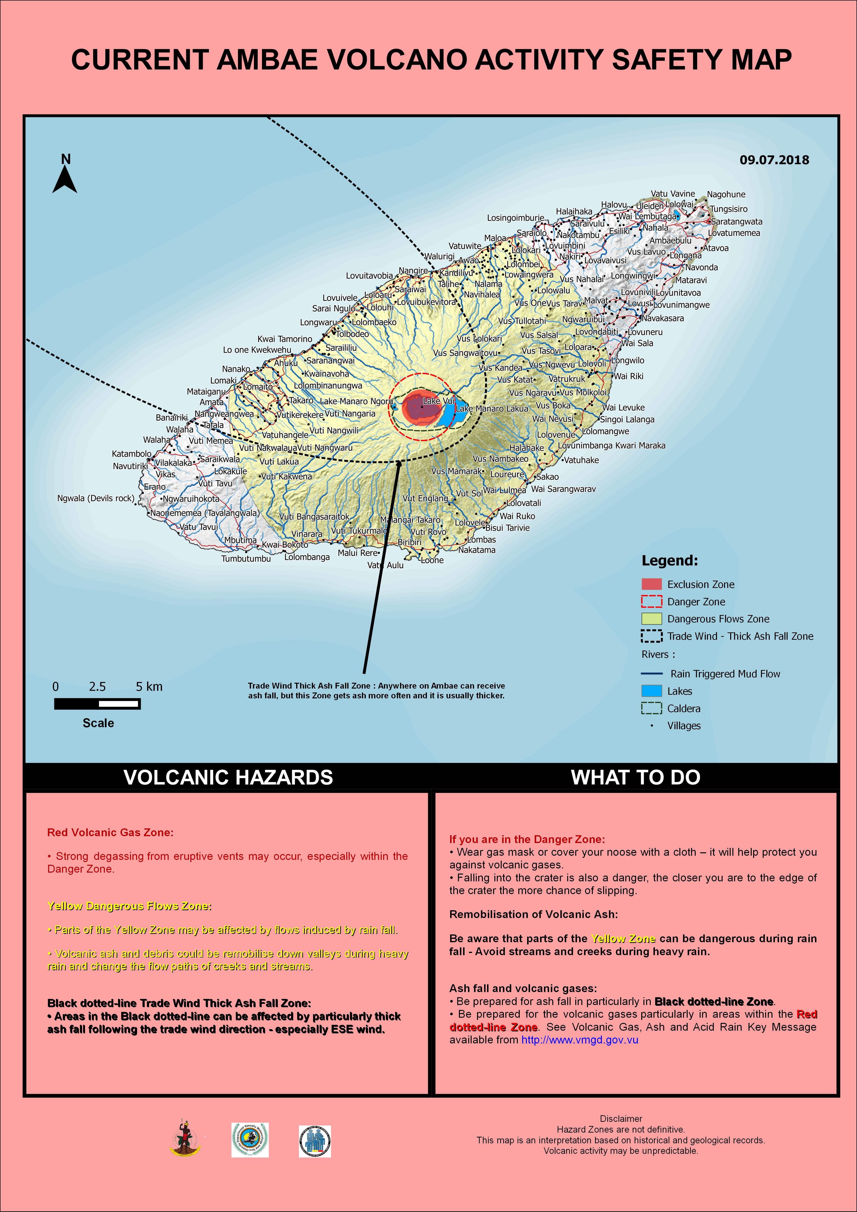
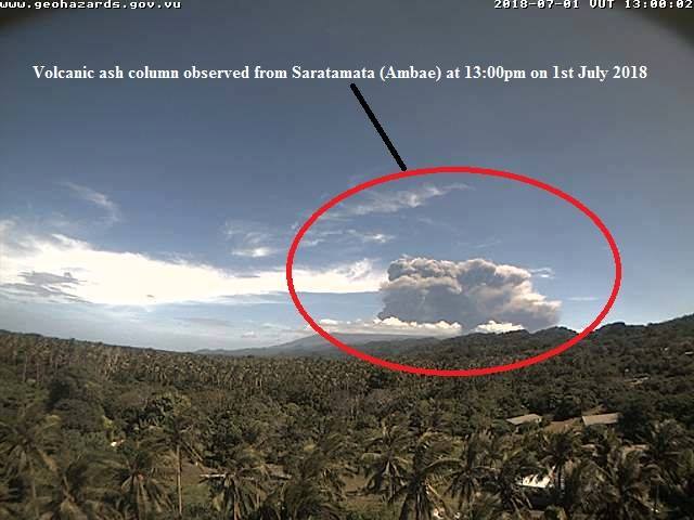
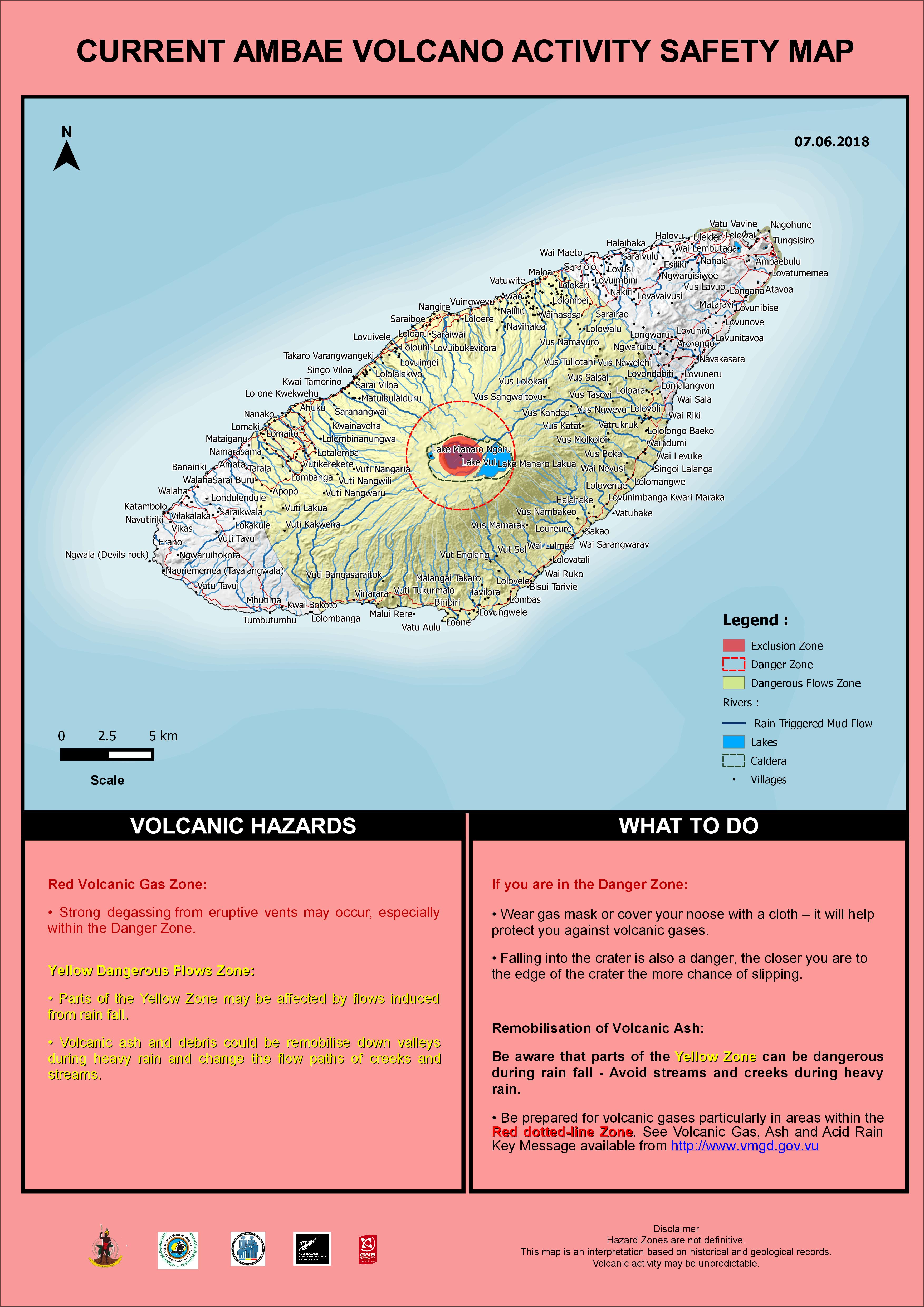
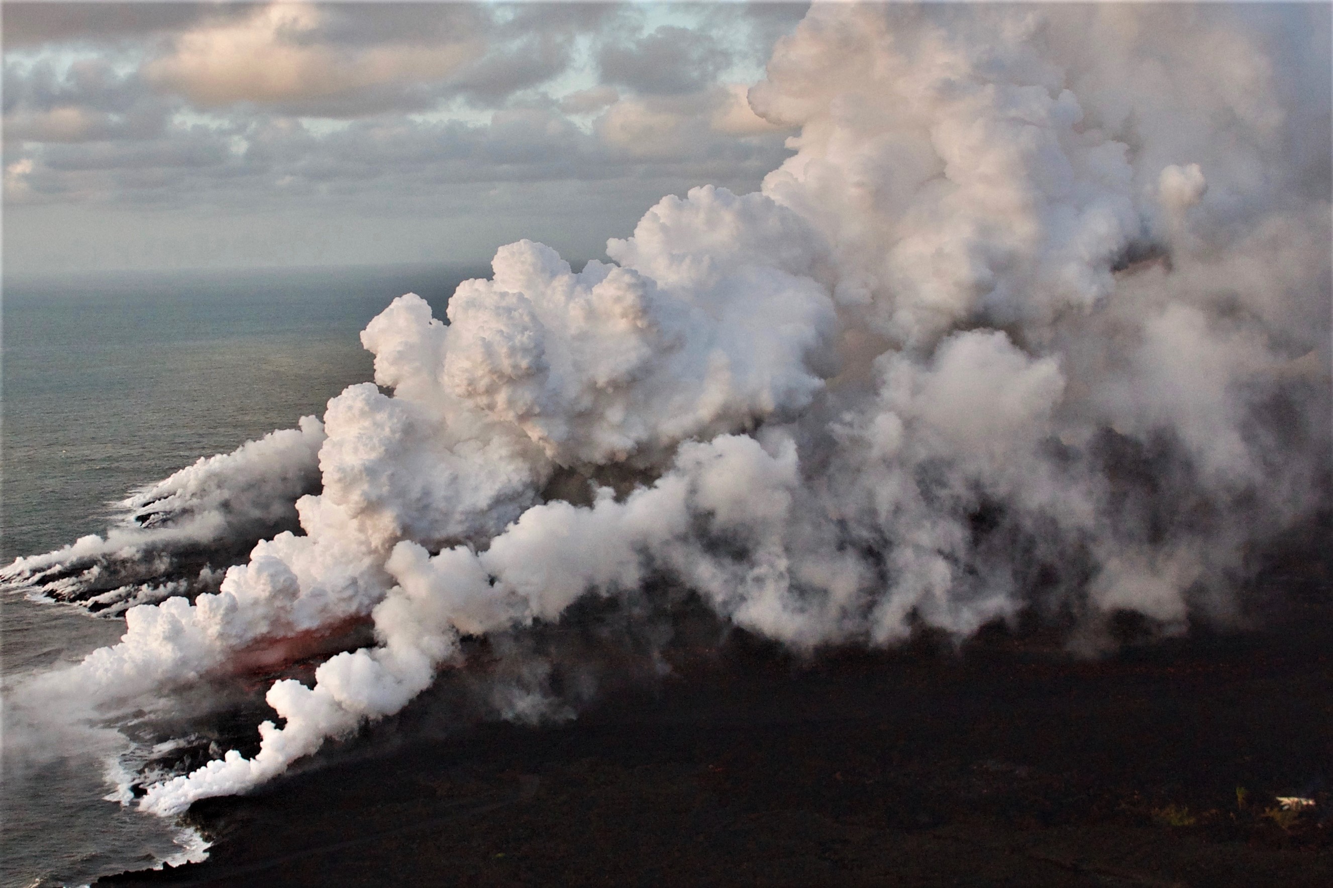
Vanuatu Archipelago, Ambae :
15°24’0”S 167°50’0”E
Summit 4908ft (1496m)
Current Vanuatu Volcano Alert Level: Level 2
Ambae volcano is continuing in the level of major unrest state. The Volcanic Alert Level remains at Level 2 .
Ambae volcano activity becomes stable. The current volcanic activity is consistent with Volcanic Alert Level 2. Possible imminent eruption could occur at any time in such major unrest state. The Danger Zone for life safety is limited at 2 km radius from the active vent and areas located in the Yellow Zone (See Map below).
Observations in October and November 2018 confirm that the volcanic cloud emitted are white colour, means only steam.
The presence of ash that has fallen on Ambae during the last eruption will continue to change the behaviour of streams and creeks when it rains. The creeks and streams can produce floods and carry a lot more debris (sands, gravel and boulders). The flow path of streams and creeks could change due to the flood debris. Landslide may occur at some areas during heavy rain fall.
These observations and the analysis of seismic data confirm that the volcano activity is in the major unrest state. The volcano activity consist of ongoing emission of steam and/or volcanic gases. The local population and visitors can smell the volcanic gas while approaching the volcano.
Significant impact of ashes and gases emission to villages at Ambae started in March and July, when the Volcanic Alert level was raised to Level 3. Observations of the current activity are consistent with the Alert Level 2 activity. Level 2 indicates ‘Major unrest; Danger is now at 2 km around the volcanic vents and areas inside the Yellow Zone’ . The possibility that the Ambae volcano activity escalate to the level of minor eruption is now low .
Source : Geohazards Vanuatu.
Photo : Philippe Carillo .
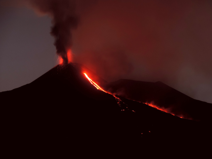
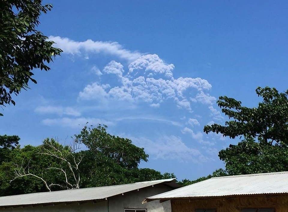
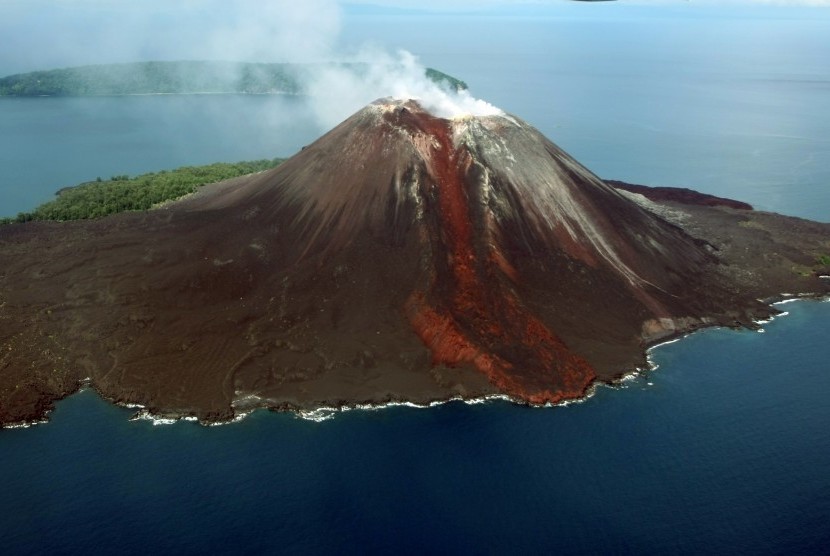
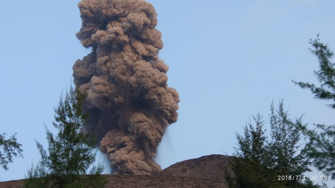
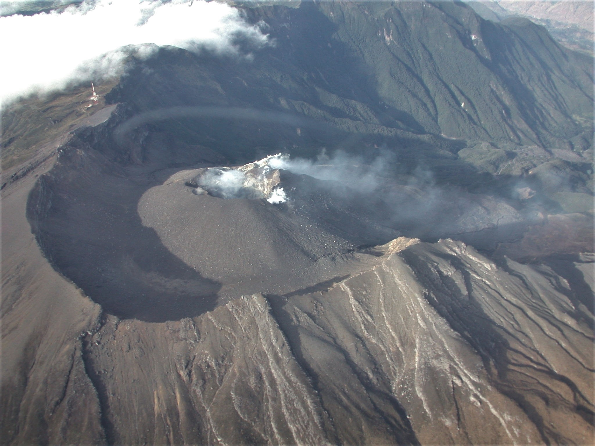
Indonesia , Anak Krakatau :
INFORMATION ABOUT G. ANAK KRAKATAU.

Mount Anak Krakatau, Lampung, was erupted on November 16, 2018 at 05:24 WIB. The height of the ash column was observed at ± 600 m above the summit (± 938 m above sea level). The column of ash was observed with a black color, a strong intensity, thick, oriented to the Northeast. This eruption is recorded on a seismogram of maximum amplitude of 58 mm and a duration of ± 3 minutes 32 seconds. Currently, the Anak Krakatau is in the Status Level II (Waspada) with recommendations: People / tourists are not allowed to approach the crater within a radius of 2 km.
DATA SOURCES: KESDM, Geology Agency, PVMBG Anak Krakatau Volcano Observation Post https://magma.vsi.esdm.go.id/
Photo : G Vitton
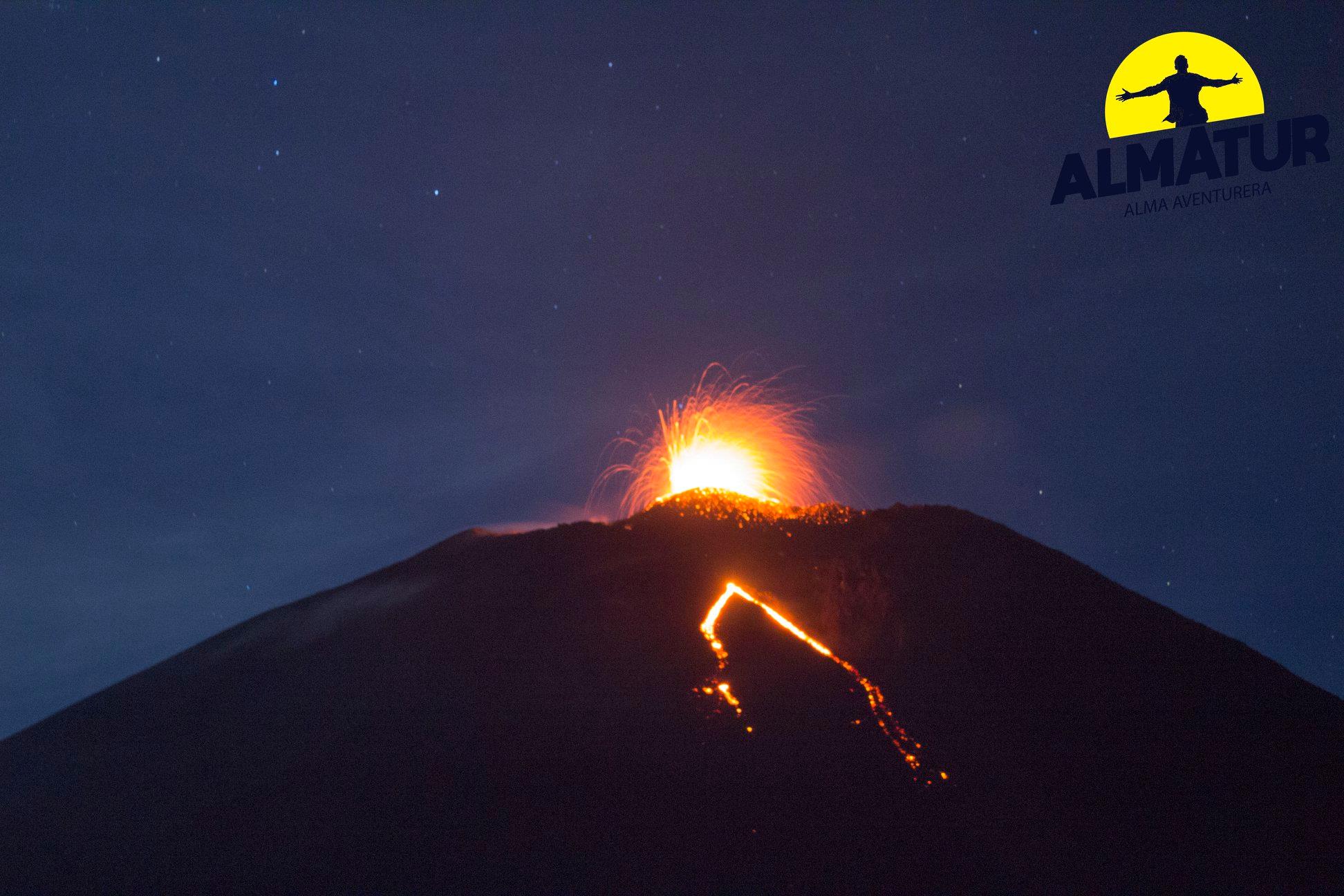
Guatemala , Fuego :
Type of activity: Vulcanian
Morphology: Composite Stratovolcan
Geographical location: 14 ° 28’54˝ N Latitude; 90 ° 52’54˝ Longitude O.
Height: 3,763msnm
Weather conditions: Clear weather
Wind: North East 13 km / h
Precipitation: 0.0 mm
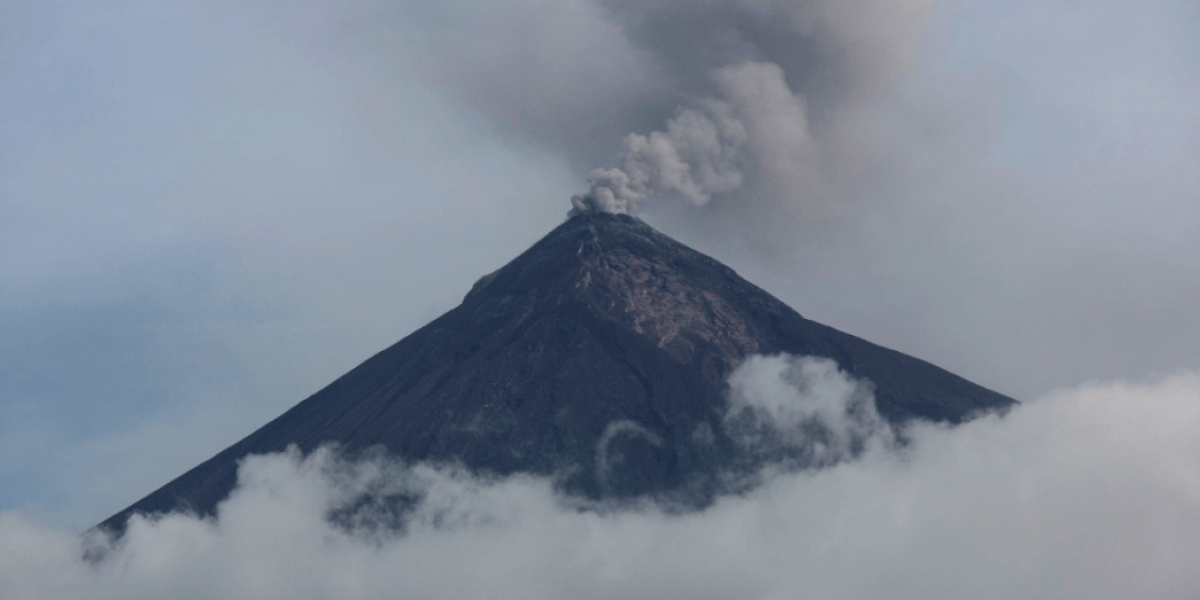
Activity:
White degassing fumaroles are observed at 4300 m altitude (14108 feet). There are 8 to 13 low to moderate explosions per hour, which eject columns of gray ash at an approximate height of between 4500 and 4700 meters (14764 to 15420 feet), which disperse in a westerly, northwesterly and South-West, for a distance of approximately 10 km to 20 kilometers. Degassing sounds are noted with intervals of 1 to 4 minutes. Incandescent pulses located at an approximate height of 200 to 300 meters above the crater generate weak avalanches around the crater and towards the main ravines. Ash falls are reported in the communities of Panimache I and II, Morelia, Santa Sofia, Palo Verde, Sangre de Cristo and others located in this direction. Due to the presence of wind, thin materials can be seen to disperse to the west.
Source : Insivumeh