June 09 , 2024 .
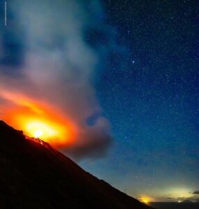
Iceland , Reykjanes Peninsula :
Grindavíkurvegur went under lava for the third time since the volcanic activity started at Sundhnúkur . Little movement of the lava tongue since noon
Updated 8. June at 16:20 UTC
Continuing activity in one crater which remains relatively stable.
Last night, the lava flow increased north of Sýlingarfell and towards Grindavíkurvegur.
The lava tongue reached the road around half past ten this morning.
The front of the lava field is about 800 meters away from the hot water pipelines.
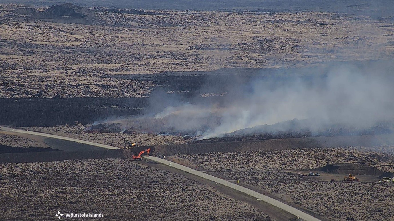
The picture was taken at 10:10 this morning by a camera owned by the Icelandic Meteorological Office, located on Þorbjörn. It shows the lava front moving towards Grindavíkurvegur and workers in the area closing an opening in the protective barrier L1.
The eruption on the Sundhnúksgígaröð continues and it has now been ten days since it started. Since Tuesday, June 4th, one crater has been active. In the past few days, the lava has mostly flowed northwest and thickened near Sýlingarfell, as well as slowly flowing north past Sýlingarfell and west. Night to Saturday, the lava flow north of Sýlingarfell towards the west and towards Grindavíkurvegur, increased. This morning, Saturday, efforts were made to close the gap in the protective barrier at Grindavíkurvegur, and around half past ten, the lava tongue reached the road just north of the barrier. Lava has also flowed down along the barrier and is very thick near it, crumbling over the barrier in places. The speed of the lava flow has decreased since noon. The front of the lava field has reached about 800 meters away from the hot water pipelines and is slowly moving towards them.
It can be concluded that the current surge is over, but it is expected that it will continue to move slowly forward. The situation will be closely monitored, and another surge cannot be ruled out in the coming days.
Source et photo : IMO
Colombia , Nevado del Huila :
Popayan, June 8, 2024, 10:00 a.m.
Regarding the monitoring of the activity of the NEVADO DEL HUILA VOLCANO, the COLOMBIAN GEOLOGICAL SERVICE (SGC), an entity attached to the MINISTRY OF MINES AND ENERGY, reports that:
Since yesterday at 12:30 a.m. local time and up to the time of publication of this bulletin, there has been a significant increase in seismicity associated with fluid dynamics inside the Nevado del Huila volcano, both in energy and number of events, which intensified today at 5:45 a.m. local time. The occurrence of two (2) events at 9:45 a.m. yesterday and 6:45 a.m. today local time stands out for their energy level.
The climatic conditions of heavy cloudiness and rain between yesterday and today did not allow us to observe the upper part of the volcano thanks to the satellite sensors and webcams installed for monitoring surface activity.
Data obtained through other monitoring techniques shows no change at this time.
The alert status of the volcano remains at YELLOW: active volcano with changes in the behavior of the base level of monitored parameters and other manifestations.
Popayán, June 8, 2024, 1:00 p.m.
Regarding the monitoring of the activity of the NEVADO DEL HUILA VOLCANO, the COLOMBIAN GEOLOGICAL SERVICE (SGC), an entity attached to the MINISTRY OF MINES AND ENERGY, reports that:
From today at 11:10 a.m. until the time of publication of this bulletin, a seismic signal associated with a flood of the Páez River was recorded. In the areas of Yusayú and Tóez
(municipality of Páez, in the department of Cauca) an increase in the flow of the river with an appreciable mud content was reported. The origin of this river flood is still uncertain, but it could be due to possible mass movements in areas near the volcano or to volcanic activity, which remains to be confirmed once visual records become available. .
At 10 a.m. today, the Colombian Geological Service released an extraordinary bulletin reporting increased seismic activity inside the Nevado del Huila volcano.
The alert status of the volcano remains at YELLOW: active volcano with changes in the behavior of the base level of monitored parameters and other manifestations.
Source : SGC
Photo : Parque Nacional
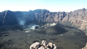
Chile , Villarica :
Seismology
The seismological activity of the period was characterized by the recording of:
A continuous tremor signal associated with the fluid dynamics inside the volcano, which presented during the period an energy variation, evaluated with the RSAM parameter, between 0.8 and 1.9 μm/s, values considered above their base level.
54 seismic events of type VT, associated with the fracturing of rocks (Volcano-Tectonics). The most energetic earthquake had a Local Magnitude (ML) value equal to 3.1, located 2.5 km east-northeast of the volcanic edifice, at a depth of 4.4 km relative to to the crater.
13,356 LP-type seismic events, associated with fluid dynamics inside the volcanic system (Long Period). The size of the largest earthquake evaluated from the Reduced Displacement (RD) parameter was equal to 54 cm2.
1682 TR type seismic events, associated with the dynamics maintained over time of fluids inside the volcanic system (TRemor). The size of the largest earthquake evaluated from the Reduced Displacement (RD) parameter was equal to 41 cm2.
Fluid geochemistry
No anomalies have been reported in emissions of sulfur dioxide (SO2) into the atmosphere in the area near the volcano, according to data published by the Tropopheric Monitoring Instrument (TROPOMI) and the Ozone Monitoring Instrument (OMI) Sulfur Dioxide Group.
Thermal anomalies by satellites
During the period, thermal radiance anomalies were recorded from Sentinel 2 L2A on May 2, 09, 12 and 14, with a maximum area of 36,900 m2 as reported by NHI Tools on May 12.

Geodesy
The analysis of geodetic data, based on data from 5 GNSS stations, indicates that:
– Based on the trends and directions of movements, we do not observe a general pattern of deformation at the level of the volcanic edifice which suggests relevant changes at depth.
– The horizontal and vertical displacement rates have moderate magnitudes and generally maintain the trends observed during the previous period, with maximum rates of 0.6 cm/month, the stations located to the east of the volcanic edifice being those with the greatest vertical displacement.
– The variation of the distance between the different GNSS stations maintains its increasing or decreasing trends, at maximum rates of 0.45 cm/month and -0.3 cm/month, respectively, observing rates higher than the cyclical variations annuals.
Surveillance cameras
From surveillance cameras installed on the volcano, degassing was observed recurrently, when climatic conditions permitted, with the development of gas columns visible up to 1040 m above the level of the crater on May 14 . Most of them showed a predominance of water vapor. On May 15, columns containing pyroclasts were recorded, highlighting that which occurred at 4:30 p.m. UTC with 260 m of elevation above the crater and dispersion of ash deposits towards the South. On May 14, Strombolian activity was observed, with a proximal impact, inside and on the edge of the crater and whose height reached a maximum of 100 m. As for nocturnal incandescence, it was observed constantly, except on days of greatest cloudiness.
Satellite geomorphological analysis
Thanks to the photo-interpretation of Planet Scope Scene, SkySat Collect and Sentinel 2 L2A satellite images, the permanence of the tephra ring, product of the accumulation of pyroclasts resulting from the activity, with an average diameter of 70 m.Inside, the lava lake is observed with sporadic surface variations due to the partial solidification of its surface, estimating an exposed lake area which varies between 260 and 443 m2.
The recording of tremor-type seismicity continues, associated with fluid dynamics inside the volcano. The RSAM value varied between 1 and 2 um/s, values considered above its basic threshold. Recording of discrete activities also continues, with a REAV issued for VT events with an ML of 3.1, located within the caldera. Regarding deformation, GNSS stations maintain movement trends similar to those observed in recent years. On the other hand, low intensity surface activity was observed with Strombolian explosions and the emission of specific pyroclasts whose extent is contained within the crater. We therefore maintain:
YELLOW TECHNICAL ALERT: Changes in the behavior of volcanic activity.
Source : Sernageomin
Photo : in-cyprus philenews.com/
Philippines , Kanlaon :
KANLAON VOLCANO ADVISORY , 8 June 2024 , 09:30 PM
Notice of elevated volcanic SO2 gas flux at Kanlaon Volcano.
Volcanic sulfur dioxide (SO2) gas emission from the summit crater of Kanlaon based on campaign Flyspec measurements today, 8 June 2024, averaged 4,397 tonnes/day. This is the highest emission this year measured by campaign survey and the second highest land-based measurement for Kanlaon. The volcano has been degassing increased concentrations of volcanic SO2 this year at an average rate of 1,458 tonnes/day, but emission since the 3 June 2024 eruption has been particularly elevated at a current average of 3,347 tonnes/day. In addition, above background volcanic earthquake has persisted at an average of 33 events/day since the eruption. Ground deformation data from continuous GPS and electronic tilt measurements have been recording medium-term inflation of the Kanlaon edifice since March 2022 and a shorter-term inflation of the eastern flank since 2023, indicating slow pressurization within the volcano. The overall monitoring parameters indicate that degassing of magma may be driving current unrest, causing increased volcanic gas emission, swelling of the edifice and occasional volcanic earthquake activity.

The public is reminded that Alert Level 2 prevails over Kanlaon. This means that there is current unrest driven by shallow magmatic processes that could eventually lead to explosive eruptions at the summit crater. The public is strongly advised to be vigilant and avoid the four (4) kilometer-radius Permanent Danger Zone (PDZ) to minimize risks from volcanic hazards such as pyroclastic density currents, ballistic projectiles, rockfall and others. In case of ash fall events that may affect communities downwind of Kanlaon’s crater, people should cover their nose and mouth with a damp, clean cloth or dust mask. Civil aviation authorities must also advise pilots to avoid flying close to the volcano’s summit as ash and ballistic fragments from sudden eruption can be hazardous to aircraft. Communities living beside river systems on the southern and western slopes, especially those that have already experienced lahars and muddy streamflows, are advised to take precautionary measures when heavy rainfall over the volcano has been forecast or has begun. DOST-PHIVOLCS maintains close monitoring of Kanlaon Volcano and any new development will be immediately communicated to all concerned stakeholders.
Source et photo : Phivolcs
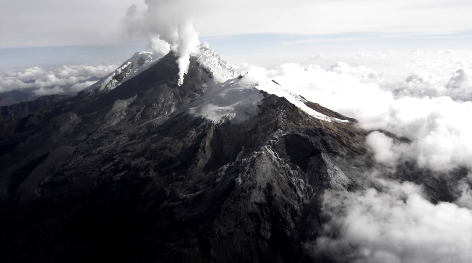
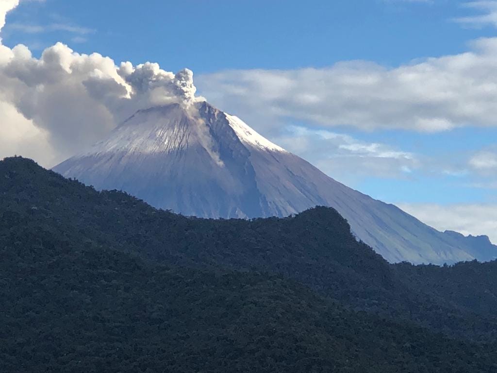
Ecuador , Sangay :
DAILY REPORT ON THE STATE OF THE SANGAY VOLCANO, Saturday June 8, 2024.
Information Geophysical Institute – EPN.
Surface activity level: High, Surface trend: No change
Internal activity level: High, Internal trend: No change
Seismicity: From June 7, 2024, 11:00 a.m. to June 8, 2024, 11:00 a.m.:
Due to data transmission problems, it was not possible to count volcanic events.
Precipitation/Lahars:
Rains were recorded in the volcano area without generating mudslides and debris. **In the event of heavy rains, these could remobilize the accumulated material, generating flows of mud and debris which would descend down the sides of the volcano to flow into adjacent rivers.
Emissions/ash column:
By monitoring satellite images, continuous gas emissions were detected, with a height of less than 800 meters above the crater level in the west direction. The Washington-VAAC agency has not published reports regarding the volcano’s activity.
Gas:
The Mounts satellite system has not recorded sulfur dioxide (SO2) values in the last 24 hours
Observation:
Through camera monitoring, it was observed that the volcano remained completely cloudy and with unfavorable weather conditions.
Alert level: yellow
Source : IGEPN
Photo : Carlos Riera