January 06 , 2024.
Iceland , Reykjanes Peninsula :
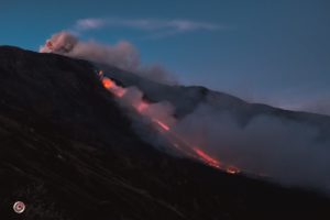
Land rise near Svartsengi continues to be measured at similar rates as in previous days. The volcanic activity in Fagradalsfjall and near Svartsengi has widespread effects on seismic activity across the Reykjanes Peninsula
Updated 5 January at 14:30 UTC
The rate of land uplift near Svartsengi continues to decrease. Experts gathered at the Meteorological Office this morning confirmed this through an analysis of GPS data. As previously reported, this signals a rise in magma pressure, increasing the likelihood of a new dike intrusion and potential eruption. However, it cannot be ruled out that this may alternatively suggest a decrease in magma inflow.
Approximately 490 earthquakes have occurred near the magma conduit since Tuesday, January 2. Among these, 14 had magnitudes exceeding 1.0, with the largest measuring 1.8 north of Hagafell. On Wednesday, January 3, a magnitude 4.3 earthquake occurred near Trölladyngja, followed shortly by a magnitude 3.5 earthquake and numerous aftershocks; about 900 earthquakes have been measured in the area.
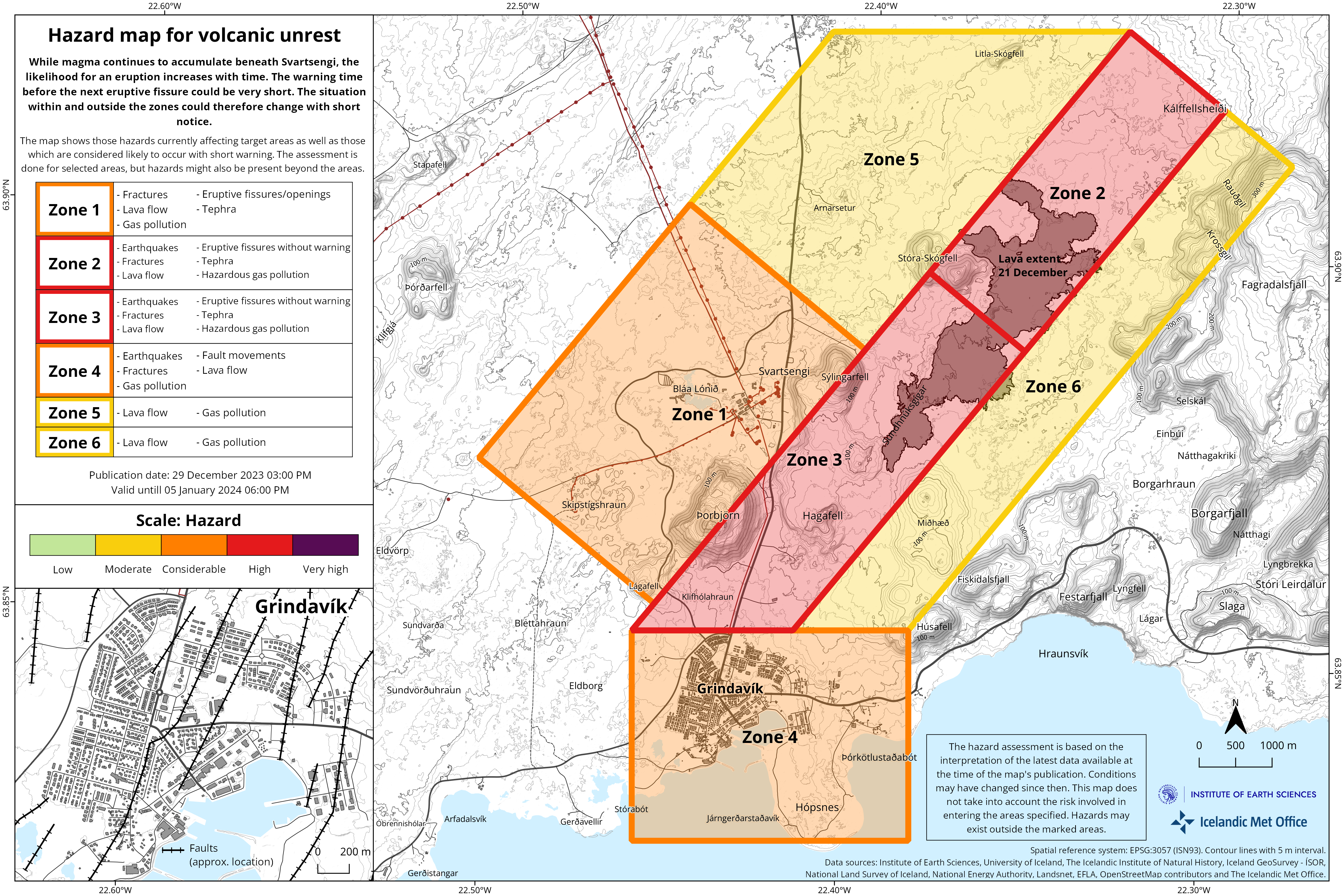
The seismic activity near Trölladyngja on January 3 occurred along a recognized fault line where larger earthquakes have previously happened multiple times. There is no indication that these earthquakes are directly linked to magma movements. Nevertheless, the notable changes in the landscape associated with volcanic activity in Fagradalsfjall, the land uplift near Svartsengi, the magma conduit near Sundhnúk on November 10, and the eruption on December 18 have been measured across western Reykjanes and influence seismic activity throughout the entire region.
According to their evaluation, scientists conclude that in the event magma reaches the surface, the most probable site for a subsequent eruption would again be Sundhnúksgígaröðinni, situated between Stóra-Skógfell and Hagafell. However, it is important to remember that dike intrusions do not always culminate in an eruption, as evidenced by the activity at Fagradalsfjall and also during the Krafla fires.
Source : IMO
Kamchatka , Ebeko :
VOLCANO OBSERVATORY NOTICE FOR AVIATION (VONA)
Issued: January 06 , 2024 .
Volcano: Ebeko (CAVW #290380)
Current aviation colour code: ORANGE
Previous aviation colour code: orange
Source: KVERT
Notice Number: 2024-03
Volcano Location: N 50 deg 41 min E 156 deg 0 min
Area: Northern Kuriles, Russia
Summit Elevation: 1156 m (3791.68 ft)
Volcanic Activity Summary:
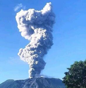
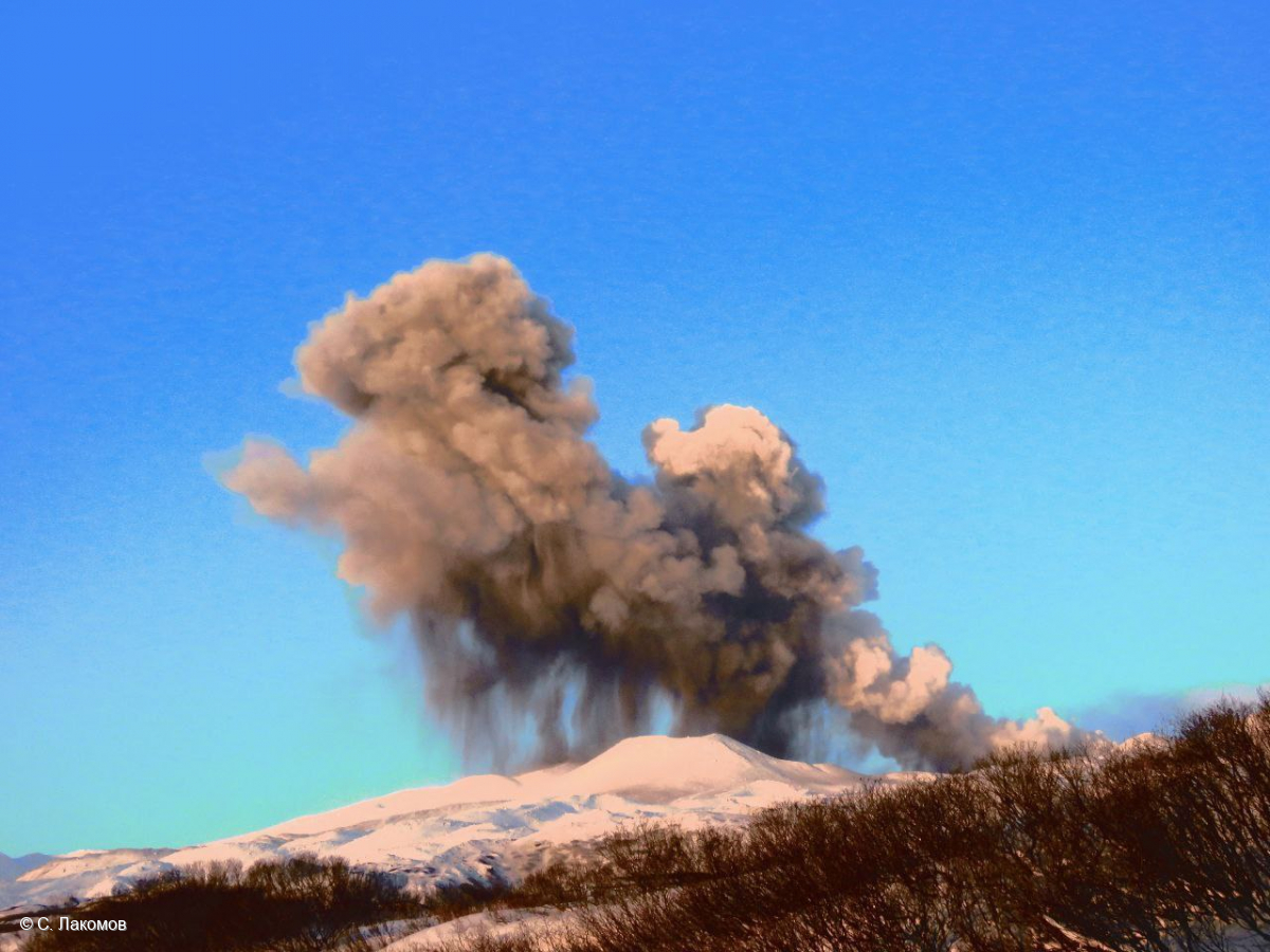
A moderate explosive eruption of the volcano continues. According to visual data from Severo-Kurilsk, explosions sent ash up to 2 km a.s.l., and ash cloud drifted to the south-east of the volcano.
A moderate explosive eruption of the volcano continues. Ash explosions up to 6 km (19,700 ft) a.s.l. could occur at any time. Ongoing activity could affect low-flying aircraft and airport of Severo-Kurilsk.
Volcanic cloud height:
1800-2000 m (5904-6560 ft) AMSL Time and method of ash plume/cloud height determination: 20240106/0226Z – Visual data
Other volcanic cloud information:
Distance of ash plume/cloud of the volcano: 5 km (3 mi)
Direction of drift of ash plume/cloud of the volcano: SE
Time and method of ash plume/cloud determination: 20240106/0226Z – Visual data
Start time of explosion and how determined: 20240106/0226Z – Visual data
Source : Kvert
Photo : S. Lakomov
Indonesia , Lewotobi Laki-Laki :
VOLCANO OBSERVATION NOTICE FOR AVIATION (VONA)
Published: January 6, 2024
Volcano: Lewotobi Laki-laki (264180)
Current aviation color code: ORANGE
Previous aviation color code: orange
Source: Lewotobi Laki-laki Volcano Observatory
Notice number: 2024LWK009
Volcano location: S 08 degrees 32 min 20 sec E 122 degrees 46 min 06 sec
Area: East Nusa Tenggara, Indonesia
Summit altitude: 5069 FT (1584 M)
Summary of volcanic activity:
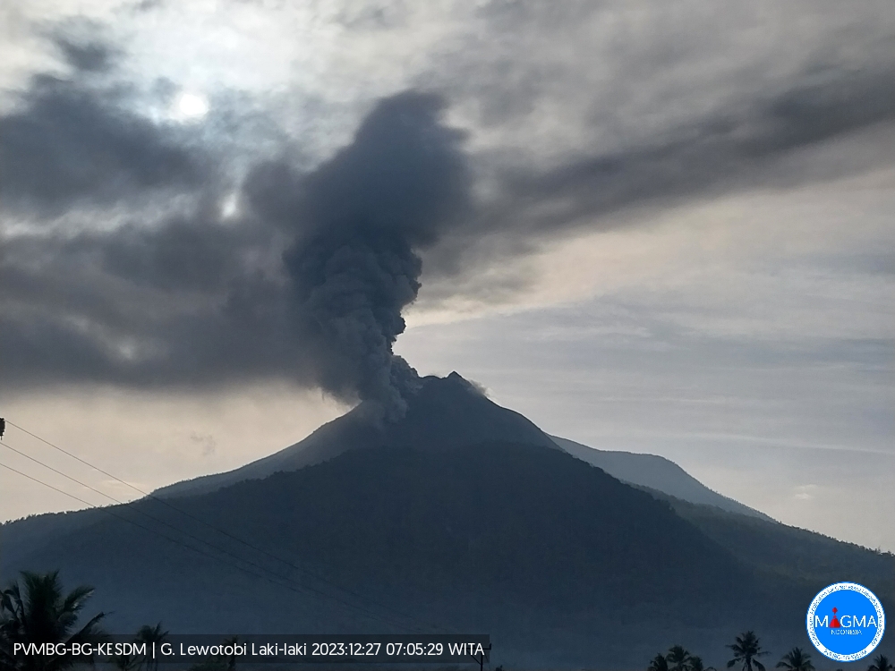
Eruption at 05:10 UTC (1:10 p.m. local).
Height of Volcanic Clouds:
No ash clouds are observed.
Other information about volcanic clouds:
No ash clouds are observed.
Remarks :
The eruption and emission of ash continues. Eruption recorded on seismogram with a maximum amplitude of 47 mm. Tremor recorded on seismogram with a maximum amplitude of 7 mm.
Source : Magma Indonésie .
Photo : Magma Indonésie ( archive).
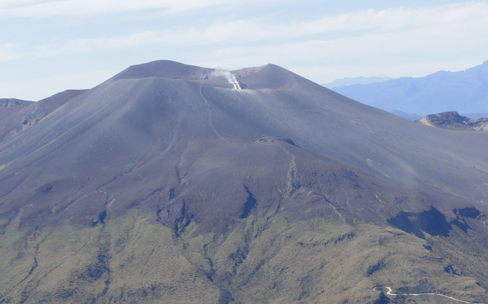
Colombia , Puracé :
Popayan, January 5, 2024, 5:15 p.m.
From the monitoring of the activity of the PURACE VOLCANO – LOS COCONUCOS VOLCANIC CHAIN, the MINISTRY OF MINES AND ENERGY through the COLOMBIAN GEOLOGICAL SERVICE (SGC) reports that:
From 2:50 p.m. local time today until the time of issuance of this bulletin, there has been a strong recurrence of seismic events mainly associated with the movement of
fluids in the volcanic conduits, located less than 2 km deep under the crater of the Puracé volcano, their magnitudes being low for the moment. The degassing observed through surveillance cameras shows an increase during the afternoon; Likewise, the measured values of carbon dioxide (CO2) this morning showed a sudden increase, which decreased throughout the day and at the time of publication of this bulletin, it continues to decrease.
Volcano alert status remains at YELLOW: Active volcano with changes in baseline behavior of monitored parameters and other manifestations.
In a Yellow alert state, the volcano may present a slight or moderate increase in its activity above the baseline behavior level, depending on the parameters monitored (seismicity of fractures and fluids, fumarole activity, gases (SO2 and CO2) , deformation, odors, noises, temperature, superficial manifestations, minor and sporadic emissions of ash, pressure waves).
Source et photo : SGC
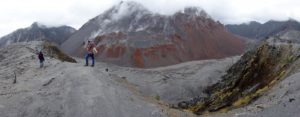
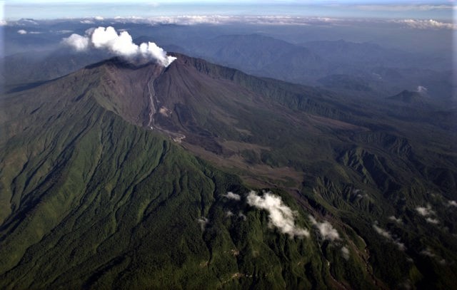
Ecuador , Reventador :
DAILY REPORT ON THE STATE OF THE REVENTADOR VOLCANO, Friday January 5, 2024.
Information Geophysical Institute – EPN.
Surface activity level: Moderate, Surface trend: No changes
Internal activity level: Moderate, Internal trend: No changes
Seismicity: From January 4, 2024, 11:00 a.m. to January 5, 2024, 11:00 a.m.:
The following table shows the number of seismic events from the reference station in the last 24 hours.
Explosion (EXP) 58
Long Period (LP) 7
Tremor (TRE) 12
Tremor harmonic (TRARM) 10
Precipitation/Lahars:
Rainfall is not recorded. **In the event of heavy rains, these could remobilize the accumulated materials, generating mud and debris flows which would descend the sides of the volcano and flow into adjacent rivers.
Emissions/ash column:
Due to weather conditions, it was not possible to observe gas and ash emissions through the surveillance camera network; However, the GOES-16 satellite system detected an emission of gas and ash with a column height equal to 800 meters above the crater level, in the southwest direction. Likewise, the VAAC in Washington issued two reports corresponding to new emissions of gas and ash whose columns did not exceed 1,315 meters above the level of the crater, which was moving towards the South-West and West -South West.
Other monitoring parameters:
During the last 24 hours, the FIRMS satellite system recorded 1 thermal anomaly; while the MIROVA-VIIRS satellite system detected 1 weak thermal anomaly.
Observation:
Since yesterday afternoon and until the submission of this report, the volcano remains completely cloudy.
Alert level: Orange.
Source : IGEPN.
Photo : Patricio Ramon, 2005 (Instituto Geofisca, Escuela Politecnica Nacional).