April 13 ,2024.
Iceland : Reykjanes Peninsula :
The Sundhnúka eruption remains constant. The uprising has continued at a similar pace since early April.
Updated April 12 at 2:15 p.m.
The eruption that began on March 16 remains constant
The uprising has continued at a similar pace since early April.
The risk assessment is valid until April 16.
There is always a risk of gas pollution. Residents in the area are advised to monitor air quality.
The eruption that began in the Sundhnúks crater series on the evening of March 16 is still ongoing. A crater remains active as it has been since April 5. Lava continues to flow south from the crater but does not go far and the lava bed continues to build up near the crater. There are no clear signs of lava advancing on the dikes north of Grindavík, Suðurstrandarveg or Melhólsnámu.
The uprising at Svartsengi continues at a similar pace, but in early April its speed increased compared to the period from the March 16 eruption to the end of the month. This indicates that the majority of magma flowing beneath Svartsengi is gathering there, causing an increase in pressure and land mass. However, during the eruption there is still an open connection between the Svartsengi magma collection area and the Sundhnúks crater series, and some magma flows there to the surface. Variations in land mass are visible from one day to the next, but overall the speed has been constant since early April.
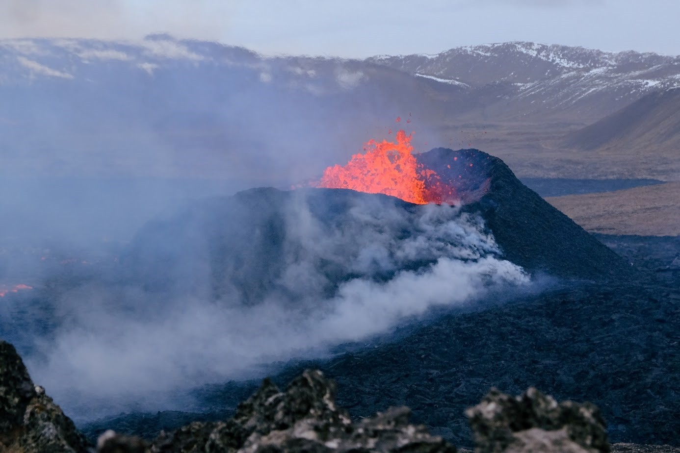
Photo taken on Wednesday, April 10, showing the active crater as seen from Sundhnúk.
The risk assessment remains unchanged and is valid until 3:00 p.m. on April 16.
There is still a risk of gas pollution from the volcanic eruption, which may cause pollution in the Reykjanes Peninsula, and we advise residents in the area to monitor air quality and familiarize themselves with the response to air pollution caused by the volcanic eruption.
The weather forecast today is for a North wind at 8-13 m/s, but slower tomorrow. The gas pollution then moves south. It will change direction towards the West late tomorrow, and the gas pollution will then reach the East.
Source : IMO Iceland
Photo : Jón Bjarni Friðriksson/Veðurstofa Íslands
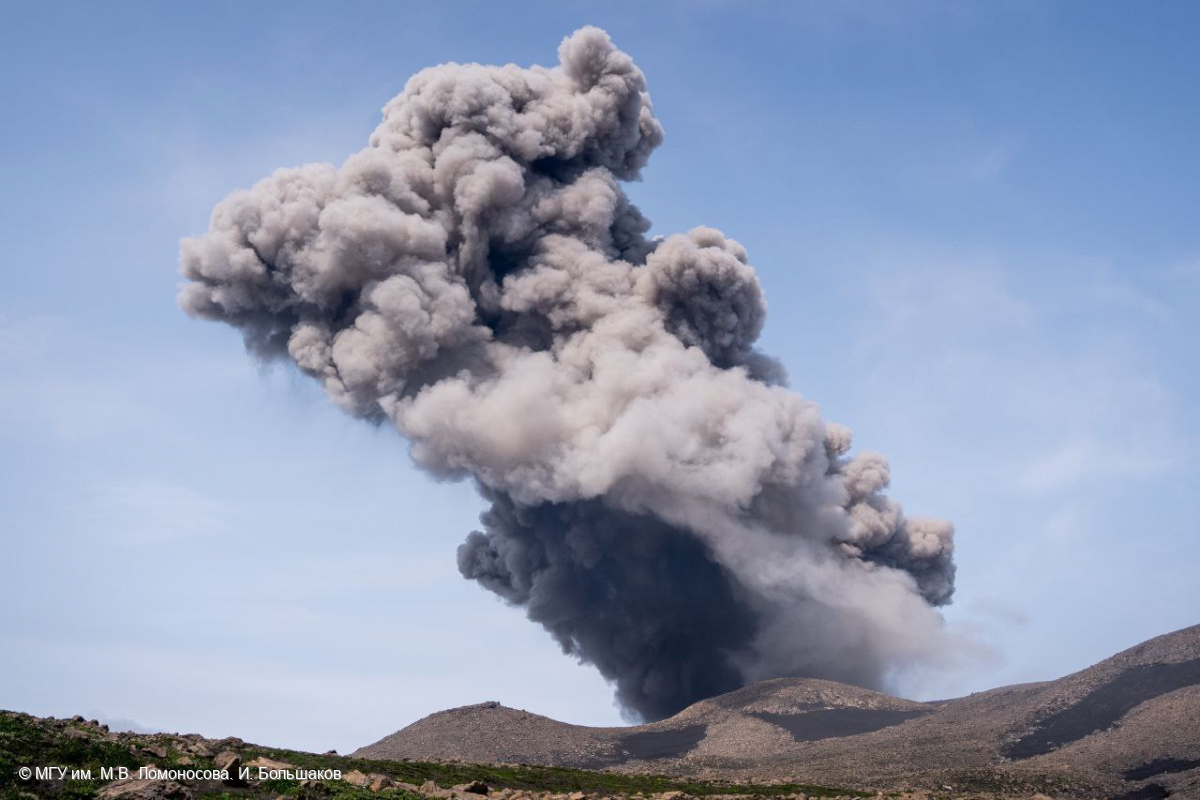
Russia / Kuril Islands , Ebeko :
VOLCANO OBSERVATORY NOTICE FOR AVIATION (VONA)
Issued: April 13 ,2024
Volcano: Ebeko (CAVW #290380)
Current aviation colour code: ORANGE
Previous aviation colour code: orange
Source: KVERT
Notice Number: 2024-19
Volcano Location: N 50 deg 41 min E 156 deg 0 min
Area: Northern Kuriles, Russia
Summit Elevation: 1156 m (3791.68 ft)
Volcanic Activity Summary:
A moderate explosive eruption of the volcano continues. According to visual data from Severo-Kurilsk, explosion sent ash up to 2.5 km a.s.l., and ash cloud drifted to the south-east of the volcano.
A moderate explosive eruption of the volcano continues. Ash explosions up to 6 km (19,700 ft) a.s.l. could occur at any time. Ongoing activity could affect low-flying aircraft and airport of Severo-Kurilsk
Volcanic cloud height:
2500 m (8200 ft) AMSL Time and method of ash plume/cloud height determination: 20240412/2352Z – Visual data
Other volcanic cloud information:
Distance of ash plume/cloud of the volcano: 7 km (4 mi)
Direction of drift of ash plume/cloud of the volcano: SE
Time and method of ash plume/cloud determination: 20240412/2352Z – Visual data
Source : Kvert
Photo : I. Bolshakov. M.V. Lomonosov MGU.
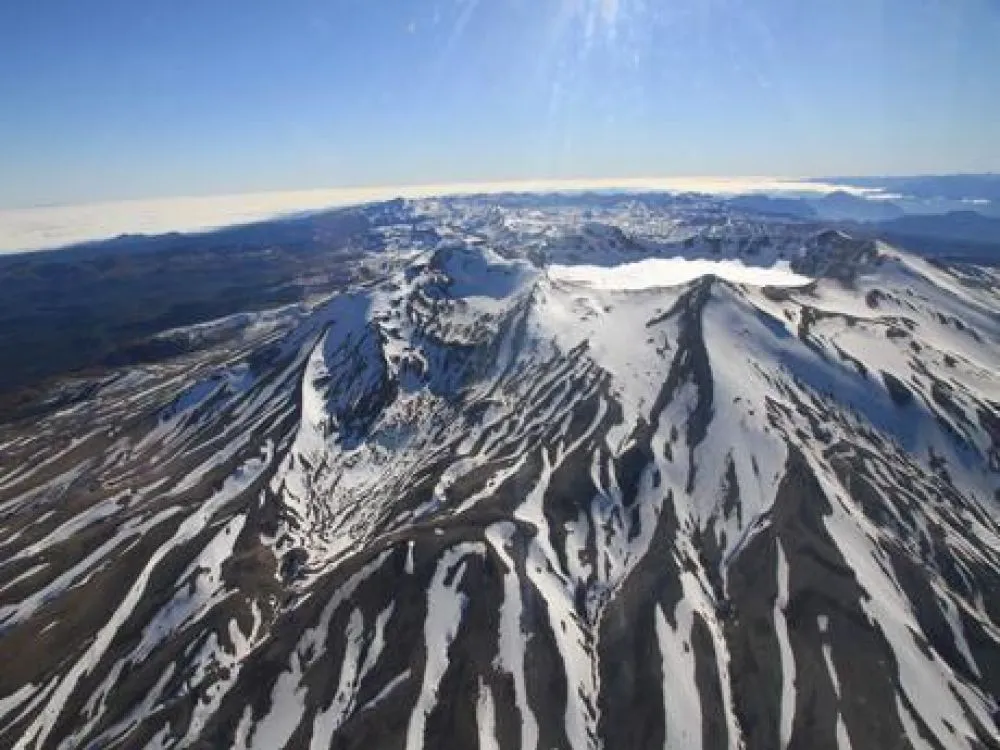
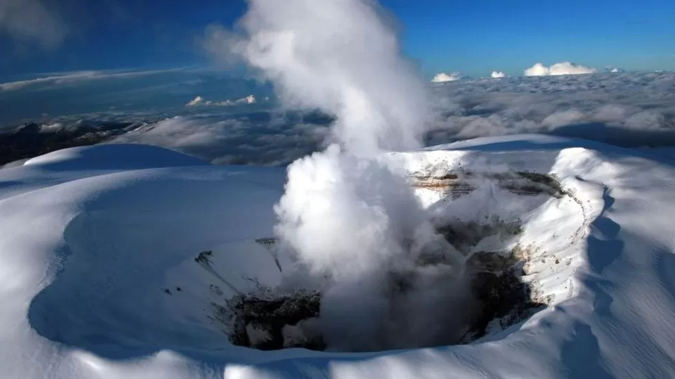
Chile , Puyehue-Cordon Caulle :
Seismology
The seismological activity of the period was characterized by the recording of:
382 seismic events of type VT, associated with the fracturing of rocks (Volcano-Tectonics). The most energetic earthquake had a Local Magnitude (ML) value equal to 2.3, located 2.9 km north-northeast of the volcanic edifice, at a depth of 3.8 km from the crater .
4 LP type seismic events, associated with fluid dynamics inside the volcanic system (Long Period). The size of the largest earthquake evaluated from the Reduced Displacement (RD) parameter was equal to 11 cm2.
1 TR type seismic event, associated with the dynamics maintained over time of fluids inside the volcanic system (TRemor). The size of the earthquake evaluated from the Reduced Displacement (RD) parameter was equal to 6 cm2.
1 TO type seismic event, associated with fluid dynamics inside the volcanic system characterized by its particular waveform (TOrnillo). The size of the earthquake (DR) was equal to 5 cm2.
1 HB type seismic event, associated with both rock fracturing and fluid dynamics within the volcanic system (Hybrid). This earthquake had a Reduced Displacement (DR) value of 47 cm2 and a Local Magnitude (ML) value equal to 1.2, located 7.6 km northwest of the volcanic edifice, at a depth of 5 .9 km from the crater.
Fluid geochemistry
No anomalies have been reported in the emissions of sulfur dioxide (SO2) into the atmosphere in the area near the volcanic complex, according to data published by the Tropospheric Monitoring Instrument (TROPOMI) and the Ozone Monitoring Instrument (OMI) Sulfur Dioxide Group.
Geodesy
Geodetic activity was characterized by:
– Medium-high magnitudes in the variation rates of the horizontal and vertical components of GNSS monitoring stations, with a maximum of 1.4 cm/month.
– Medium to high rate of change in the monitoring lines, with the North-South line reaching a maximum of 1.3 cm/month.
– Thanks to InSAR, the deformation pattern observed instrumentally since 2017 by OVDAS is clearly observed, reaching a cumulative variation of 8 cm over the last 3 months.
In conclusion, the continuation of the inflationary process recorded by the OVDAS since 2017 is evident, with a configuration and rates of variation equivalent to those recorded previously.
Surveillance cameras
The images provided by the fixed camera, installed near the volcanic complex, did not record degassing columns or variations linked to surface activity.
Activity remained at levels considered low, suggesting stability of the volcanic complex.
The technical volcanic alert is maintained in:
GREEN TECHNICAL ALERT: Active volcano with stable behavior – There is no immediate risk
Source et photo : Sernageomin
Colombia , Nevado del Ruiz :
Weekly activity bulletin: Nevado del Ruiz Volcano
Regarding the monitoring of the activity of the NEVADO DEL RUIZ VOLCANO, the MINISTRY OF MINES AND ENERGY, through the COLOMBIAN GEOLOGICAL SERVICE (SGC), reports that:
In the week of April 2 to 9, 2024, the volcano continued with unstable behavior. Compared to the previous week, the main variations in the monitored parameters were:
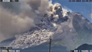
– Seismic activity associated with the fracturing of rocks within the volcanic edifice has increased in the number of earthquakes recorded and decreased in the seismic energy released. The earthquakes were located in the Arenas crater and on the different flanks of the volcano, mainly at distances less than 6 km from the crater. Seismicity showed a greater concentration of events in the crater and on the northwest flank. The depths of the events varied between less than 1 and 8 km from the volcano summit. The highest magnitudes of the week were 1.5 and 1.4, corresponding to the earthquakes recorded on April 4 at 2:55 a.m. and April 8 at 4:30 p.m. in the Arenas crater, at an approximate depth of 2 km. In addition, an increase in seismicity was observed linked to the activity of the lava dome (protuberance or mound) located at the bottom of the crater. Energy levels of this type of seismicity remained low.
– Seismicity linked to fluid dynamics inside volcanic conduits has decreased in the number of earthquakes recorded and increased in the seismic energy released. Most seismic signals were associated with pulsatile emissions of ash and gas into the atmosphere. Additionally, they had low to moderate energy levels. Thanks to the cameras used to monitor the volcano, several ash emissions and some temperature changes of the emitted material associated with some of these seismic signals have been confirmed. It should be noted that over the last 24 hours an increase in this type of activity and a longer duration of the signals have been observed.
On the volcano, the emission of water vapor and gas into the atmosphere continued. Sulfur dioxide (SO2) outgassing rates were variable and showed an increase from the previous week. The maximum height of the gas or ash column was approximately 1,500 m in height and 3,100 m in dispersion. These values were estimated at the summit of the volcano on April 4, during the emission of ash recorded at 4:13 p.m. The direction of dispersion of the gas column was predominant towards the northwest and west-northwest flanks of the volcano.
– When monitoring surface activity from satellite monitoring platforms, several thermal anomalies were detected at the bottom of Arenas Crater with low to moderate energy levels.
Source et photo : SGC
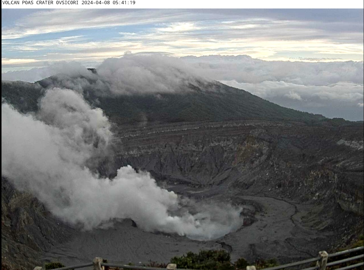
Costa Rica , Poas :
Latitude: 10.20°N;
Longitude: 84.23°W;
Altitude: 2687 m
Current activity level: Warning
Possible manifestations: Small eruptions, bubbles or geysers, significant gas emission, increase in temperature (incandescence), seismic swarms or volcanic tremor,
slight inflation-extension of the volcanic edifice.
Following the rains, we observed a reduction in ash emissions on Saturday April 6, followed by a small explosive eruption on Sunday April 7 and the reappearance of bubbles (small phreatic eruptions) in the middle of the week. The intensity of the bubbles gradually increases. This increase continued until the water content in the C vent decreased sufficiently to allow further emission of ash, which occurred on the morning of Thursday, April 11. The amplitude of the seismic tremor decreased during the continuous emission of
ashes that occurred between March 30 and April 6. On April 7, two small eruptions were recorded (without visual confirmation) then the amplitude of the seismic tremor increased. The frequency of tremors decreased on April 10, accompanying a new eruptive phase characterized by thousands of small phreatic eruptions. These occurred approximately every 3 s, according to the infrasound recordings. The tremor frequency (1 Hz) disappeared when the eruptive style definitively changed towards the continuous emission of dry ashes. Subsequently, the amplitude of the acoustic signal also disappeared. Since yesterday until the time of this report, a slight increase in tremor amplitude has been observed.
When tremor amplitudes are low, long-period earthquakes are recorded. Brief tremors are sometimes recorded. For several days, the contraction has stopped and no vertical deformation is observed.
Over the past few weeks, degassing has been relatively stable or gradually decreasing. Based on data recorded by the MultiGAS permanent station, the highest peaks in SO2 concentrations (~15ppm) and SO2/CO2 ratio (~2.4) occurred during the last week of March. This week the concentration is around 7 ppm while the SO2/CO2 ratio has a weekly average of 2.0 ± 0.6. The H2S/SO2 ratio demonstrated a slight decrease to a weekly average of 0.39 ± 0.08 compared to the previous week (0.58 ± 0.35). SO2 concentrations at the Visitor Viewpoint reached 4.7 ppm this week, reflecting a decrease from the maximum values recorded over the past two weeks (8.3 ppm was recorded on March 23). The weather conditions did not allow continuous but occasional measurements of the SO2 flux. After a maximum of 675 ± 270 t/d on March 22, the flow rates measured on April 2 and 10 were 248 ± 61 and 51 ± 29 t/d, respectively. No significant increase has therefore been observed over the last 3 weeks. SO2 is still detected in the atmosphere thanks to satellite observation but the mass is decreasing compared to the previous week. On April 7, after the rains of recent days, residents of Bajos del Toro reported the presence of diluted ash in the region’s rivers, such as the Desagüe River.
Source et photo : Ovsicori.