
January 30 , 2024 .
Peru , Sabancaya :
Analysis period: from January 22, 2024 to January 28, 2024, Arequipa, January 29, 2024
Alert level: ORANGE
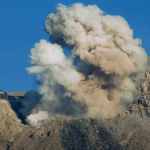
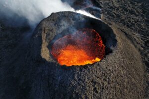
The Geophysical Institute of Peru (IGP) reports that the eruptive activity of the Sabancaya volcano remains at moderate levels, that is, with the recording of an average of 47 daily explosions, with columns of ash and of gas up to 2000 m altitude above the summit of the volcano. Consequently, the volcanic alert level remains at the ORANGE level
The IGP recorded and analyzed the occurrence of 343 earthquakes of volcanic origin, associated with the circulation of magmatic fluids inside the Sabancaya volcano, as well as earthquakes linked to the fracturing of rocks. An average of 47 explosions were recorded daily.
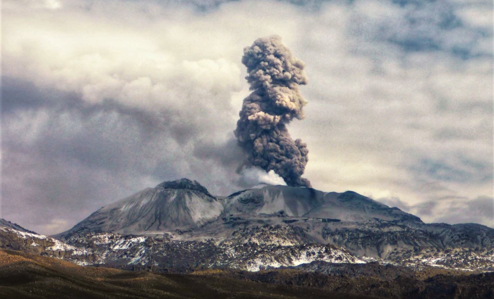
Columns of ash and gas have been observed at an altitude of up to 2000 m above the summit of the volcano. The predominant direction of these emissions was towards the West and North West sectors of the volcano over a distance of less than 10 KM.
We continue to record a slight inflation process in the northern sector (around the Hualca Hualca volcano).
Satellite recordings identified the presence of 5 thermal anomalies, with a maximum value of 23 MW, associated with the presence of a lava body on the surface of the volcano crater.
RECOMMENDATIONS
• Keep the volcano alert level in orange.
• Do not approach within a radius of less than 12 km from the crater.
Source : Cenvul
Photo : Andina
Indonesia , Semeru :
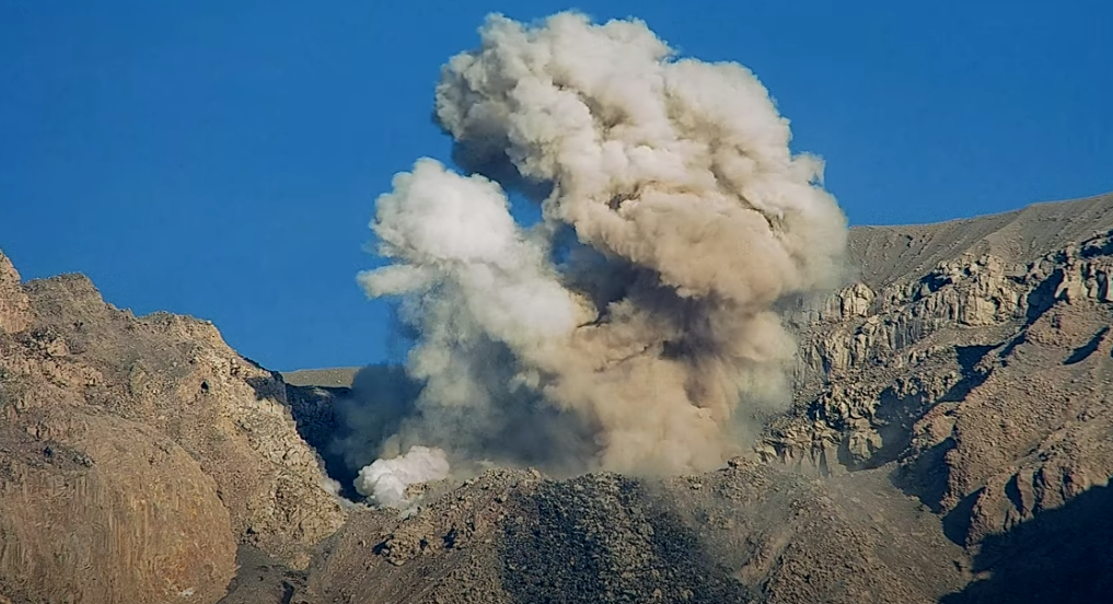
Mount Semeru erupted on Tuesday, January 30, 2024 at 10:53 WIB. The height of the eruptive column was not observed. The eruption was recorded on a seismograph with a maximum amplitude of 23 mm and a duration of 102 seconds.
VOLCANO OBSERVATORY NOTICE FOR AVIATION – VONA
Issued : January 29 , 2024
Volcano : Semeru (263300)
Current Aviation Colour Code : ORANGE
Previous Aviation Colour Code : orange
Source : Semeru Volcano Observatory
Notice Number : 2024SMR061
Volcano Location : S 08 deg 06 min 29 sec E 112 deg 55 min 12 sec
Area : East java, Indonesia
Summit Elevation : 11763 FT (3676 M)
Volcanic Activity Summary :
Eruption with volcanic ash cloud at 21h58 UTC (04h58 local).
Volcanic Cloud Height :
Best estimate of ash-cloud top is around 12723 FT (3976 M) above sea level or 960 FT (300 M) above summit. May be higher than what can be observed clearly. Source of height data: ground observer.
Other Volcanic Cloud Information :
Ash cloud moving to northeast. Volcanic ash is observed to be gray. The intensity of volcanic ash is observed from medium to thick.
Remarks :
Eruption recorded on seismogram with maximum amplitude 22 mm and maximum duration 98 second.
Source et photo : Magma Indonésie.
Alaska , Gareloi / Takawangha :
Monday, January 29, 2024, 2:13 PM AKST (Monday, January 29, 2024, 23:13 UTC)
AVO is once again receiving ground-based monitoring data for five volcanoes in the Adak area. The data had been unavailable since January 2 due to a storm-related power failure at our telecommunication link in Adak. Power was restored on January 28, and as a result realtime data flow has been restored. AVO can once again seismically monitor these volcanoes, assess volcanic unrest, and quickly confirm or dismiss reports of activity.
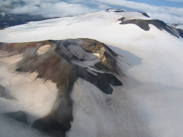
For Tanaga, Takawangha, and Gareloi, which were previously at UNASSIGNED due to the outage, we are changing the Aviation Color Code and Volcano Alert Level to GREEN/NORMAL.
Great Sitkin and Kanaga remain at ORANGE/WATCH and YELLOW/ADVISORY, respectively.
Source : AVO
Photo : Takawangha / Coombs, M. L.
Hawaii , Kilauea :
Monday, January 29, 2024, 8:52 AM HST (Monday, January 29, 2024, 18:52 UTC)
19°25’16 » N 155°17’13 » W,
Summit Elevation 4091 ft (1247 m)
Current Volcano Alert Level: ADVISORY
Current Aviation Color Code: YELLOW
Activity Summary:
Kīlauea volcano is not erupting. An increase in seismicity in the south caldera region that started on Saturday is continuing, but has remained steady. Kīlauea summit remains pressurized; in recent months unrest has escalated quickly, and an eruption could occur in the future with little warning.
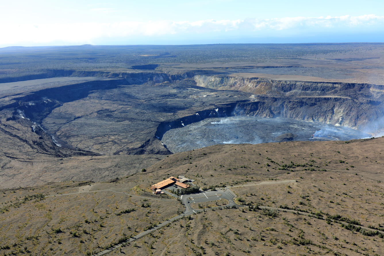
Summit Observations:
South caldera seismicity was slightly quieter yesterday, but still elevated above background. The cluster of activity continues and in general, rates have been fairly steady since Saturday morning. Periods of increased seismicity can be expected to continue during repressurization of the summit magma reservoir, which has been ongoing since the end of the September 2023 eruption.
Kīlauea’s summit region remains at a high level of inflation. Tiltmeters near Sand Hill and Uēkahuna bluff indicate ongoing inflationary tilt localized to the south caldera area. After a brief decrease yesterday, at midnight last night they returned to showing similar rates as on Saturday.
Sulfur dioxide (SO2) gas emission rates remain low. Field measurements indicated an SO2 emission rate of approximately 70 tonnes per day on January 17, which was similar to measurements in October, November, and early December.
Source : HVO
Photo : USGS / K. Mulliken ( archive 2022).
Costa Rica , Rincon de la Vieja / Poas :
Rincón de la Vieja Volcano
Latitude: 10.83
Length:-85.324
Altitude: 1,916 meters above sea level
Activity observed:
No eruption is recorded. The volcanic tremor is maintained with two frequency bands, the first is continuous with frequencies around 3.6 Hz and the second is discontinuous and frequencies between 1 and 3 Hz. Small events of water vapor expiration and gas are recorded, in addition to some earthquakes of low frequency volcanic (LP) and Tornillos. The volcanic edifice continues to show slight inflation.
Environmental conditions:
The winds blow from the West and the summit remains cloudy.
Activity Level: Caution (3)
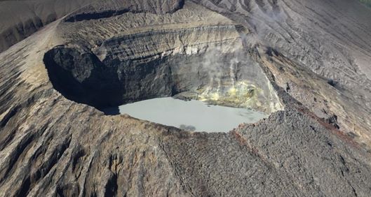
Poas Volcano
Latitude: 10.2
Length: -84233
Altitude: 2,687 meters above sea level
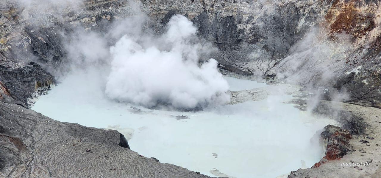
Activity observed:
No significant eruptions were recorded, only small geyser-like events, less frequent than those recorded over the weekend. Fumarole activity to the south of the lake appears more vigorous, while fumaroles to the north appear weaker. No significant concentration of SO2 gas is recorded from the visitors’ point of view, while the multigas station maintains values below 10 parts per million. A slight increase in the H2S/S02 ratio is observed.
Environmental conditions:
The winds move the air masses towards the West and the summit is partly cloudy.
Activity Level: Warning (2)
Source : Ovsicori
Photos : Chris Allen de Sunquest Helitours , Ovsicori .

No comment yet, add your voice below!