June 25 , 2023.
Hawaii , Kilauea :
Saturday, June 24, 2023, 8:17 AM HST (Saturday, June 24, 2023, 18:17 UTC)
19°25’16 » N 155°17’13 » W,
Summit Elevation 4091 ft (1247 m)
Current Volcano Alert Level: WATCH
Current Aviation Color Code: ORANGE
Activity Summary:
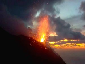
The summit eruption at Kīlauea volcano is paused, following a rapid decline in vent and lava lake activity Monday afternoon. All recent eruptive activity was confined to Halemaʻumaʻu crater within the summit caldera at Kīlauea, and no unusual activity has been noted along the volcano’s East Rift Zone or Southwest Rift Zone.
Halemaʻumaʻu crater Observations:
Currently no lava is actively erupting in Halemaʻumaʻu crater. Overnight webcam views showed some incandescence from previously erupted lava as the lava proceeds to cool.
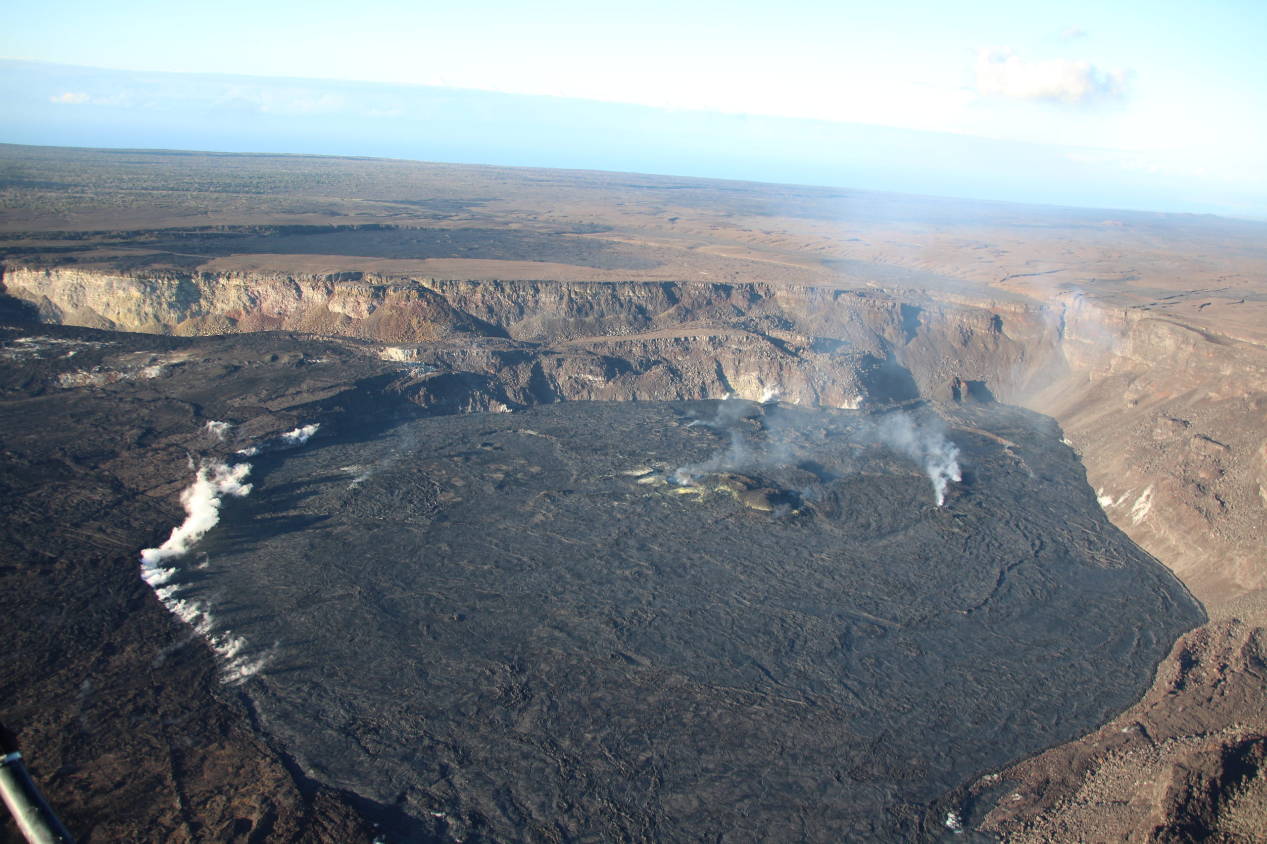
View looking south over Halemaʻumaʻu crater at the Kīlauea summit, captured during a helicopter overflight on Thursday, June 22, 2023. The cone built up during the most recent eruption is visible on the southwest (center-right) wall of the crater. Although the eruption paused on June 19, 2023, the helicopter crew observed a minor ooze-out of lava on the northeast (bottom-right) margin of the recently erupted lava. This indicates that while no new lava is erupting, there is still minor lava circulation in places under the solidified crust. This is expected as the recently dynamic system cools downs.
Summit Observations:
Simultaneous with the pause in the eruption, seismic activity (including eruptive tremor) in the summit region has been low. Over the last 24 hours, summit tiltmeters have measured slight gradual inflation. A sulfur dioxide (SO2) emission rate of approximately 160 tonnes per day was measured on Thursday, June 22.
Rift Zone Observations:
No unusual activity has been noted along the East Rift Zone or Southwest Rift Zone; steady but low rates of ground deformation and seismicity continue along both. Measurements from continuous gas monitoring stations in the middle East Rift Zone—the site of 1983–2018 eruptive activity—remain below detection limits for SO2.
Source : HVO
Photo : USGS / N. Deligne.
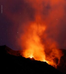
Philippines , Mayon :
MAYON VOLCANO BULLETIN 25 June 2023 8:00 AM
In the past 24-hour period, very slow effusion of lava from the summit crater of Mayon Volcano continued to feed lava flows and collapse debris on the Mi-isi (south) and Bonga (southeastern) gullies. The lava flows have advanced to revised approximate lengths of one thousand three hundred (1300) meters and one thousand two hundred (1200) meters along Mi-isi and Bonga gullies, respectively, from the summit crater while collapse debris have deposited to three thousand three hundred (3300) meters from the crater. A total of sixteen (16) dome-collapse pyroclastic density current (PDC) that lasted three (3) minutes, two hundred fifty seven (257) rockfall events, and twenty-four (24) volcanic earthquakes were recorded by the Mayon Volcano Network.
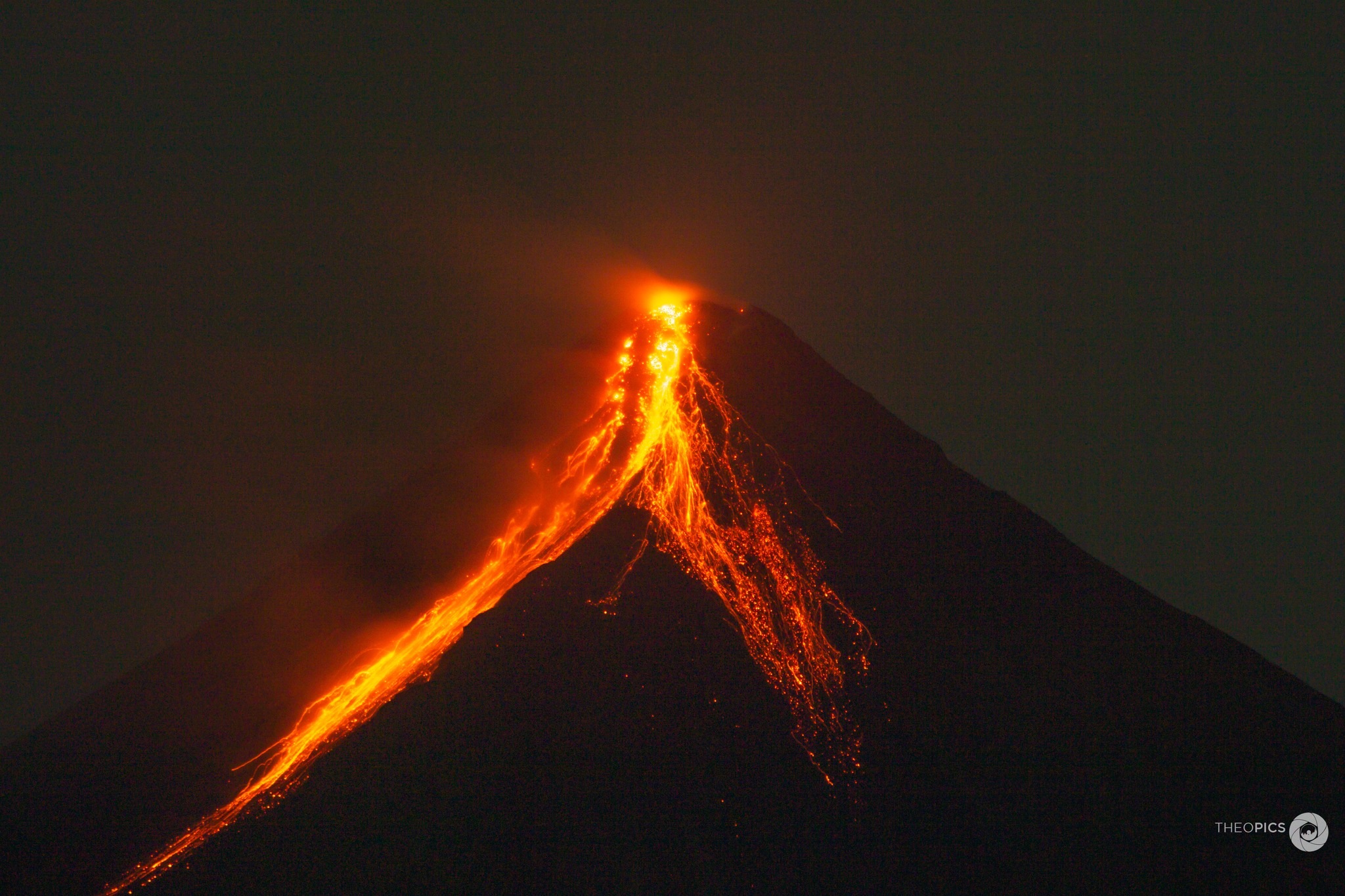
Continuous moderate degassing from the summit crater produced steam-laden plumes that rose 600 meters before drifting west-southwest and southwest. Sulfur dioxide (SO2) emission averaged 663 tonnes/day on 24 June 2023. Short-term observations from EDM and electronic tiltmeter monitoring show the upper slopes to be inflating since February 2023. Longer-term ground deformation parameters based on EDM, precise leveling, continuous GPS, and electronic tilt monitoring indicate that Mayon is still inflated, especially on the northwest and southeast.
Alert Level 3 is maintained over Mayon Volcano, which means that it is currently in a relatively high level of unrest as magma is at the crater and hazardous eruption within weeks or even days is possible.
Source : Phivolcs
Photo : Teopics
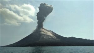
Indonesia , Lokon – Empung :
In a press release PVMBG reported increased emissions at Lokon-Empung on 13 June with dense white plumes rising 400 m above the rim of Tompaluan Crater and drifting S; a total of 12 earthquakes indicating emissions were recorded by the seismic network. The emissions were followed by a period of continuous tremor during 18h35-21h00. White steam-and-gas emissions of variable densities rose as high as 500 m and drifted N, W, and S during 14-20 June.
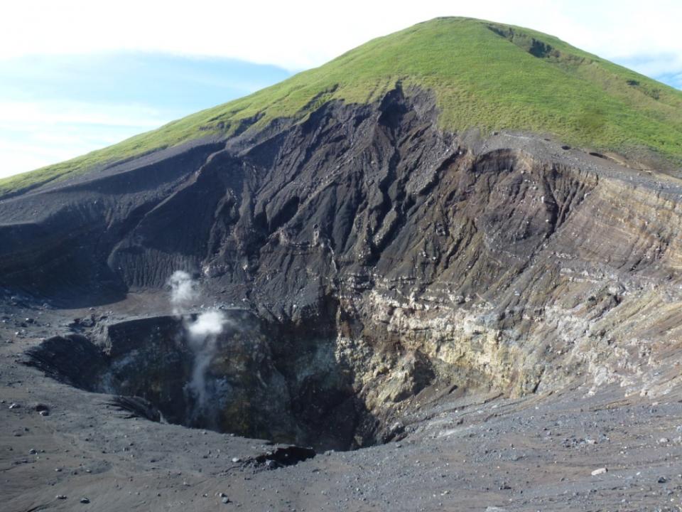
During 2023 white emissions generally rose 20-150 m above the crater rim and seismicity was generally dominated by 1-2 daily shallow volcanic earthquakes. The volcano Alert Level remained at 2 (on a scale of 1-4) and the public was reminded not to approach the crater within a radius of 1.5 km.
Source : GVP
Photo : wikimapia
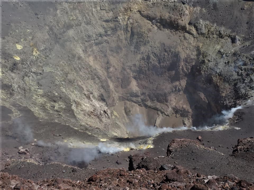
Chile , Lascar :
Special report on volcanic activity (REAV), Antofagasta region, Lascar volcano, June 20, 2023, 10:30 a.m. local time (mainland Chile).
The National Service of Geology and Mines of Chile (Sernageomin) publishes the following PRELIMINARY information, obtained through the monitoring equipment of the National Volcanic Monitoring Network (RNVV), processed and analyzed at the Volcanological Observatory of the Southern Andes ( Ovdas):
On Sunday June 18, 2023, 09:25 local time (13:25 UTC on 06/18/2023), monitoring stations installed near the Lascar volcano recorded an increase in seismic activity associated with the fracturing of rocks in the volcanic system ( type VT), located around the volcano.
The characteristics of the earthquakes after its analysis are as follows:
ORIGINAL TIME: 09:25 local time (13:25 UTC 06/18/2023)
LATITUDE: 23.37°S
LONGITUDE: 67.72°E
DEPTH: 4.1km
LOCAL MAGNITUDE: 2.7 (ML)
No changes were observed in the other monitoring parameters.
COMMENTS:
The reported increase in activity is consistent with the volcano’s current alert level.
The volcanic technical alert remains at the Yellow level.
Source : Sernageomin
Photo : Eric Jo
Colombia , Chiles / Cerro Negro :
Weekly activity bulletin of the volcanic complex of Chiles and Cerro Negro (CVCCN)
Regarding the monitoring of the activity of the VOLCANOES CHILES AND CERRO NEGRO, the MINISTRY OF MINES AND ENERGY through the COLOMBIAN GEOLOGICAL SERVICE (SGC) informs that:
In the week between June 13 and 19, 2023, seismic activity showed a significant decrease in occurrence and energy released compared to previous weeks, but without returning to daily levels that were recorded before the start. of the increase in seismic activity on March 9. The dominance of low magnitude earthquakes, associated with the fracture of rock in the volcanic edifice, and the recording of some earthquakes related to the movement of fluids in the volcanic system have been maintained.
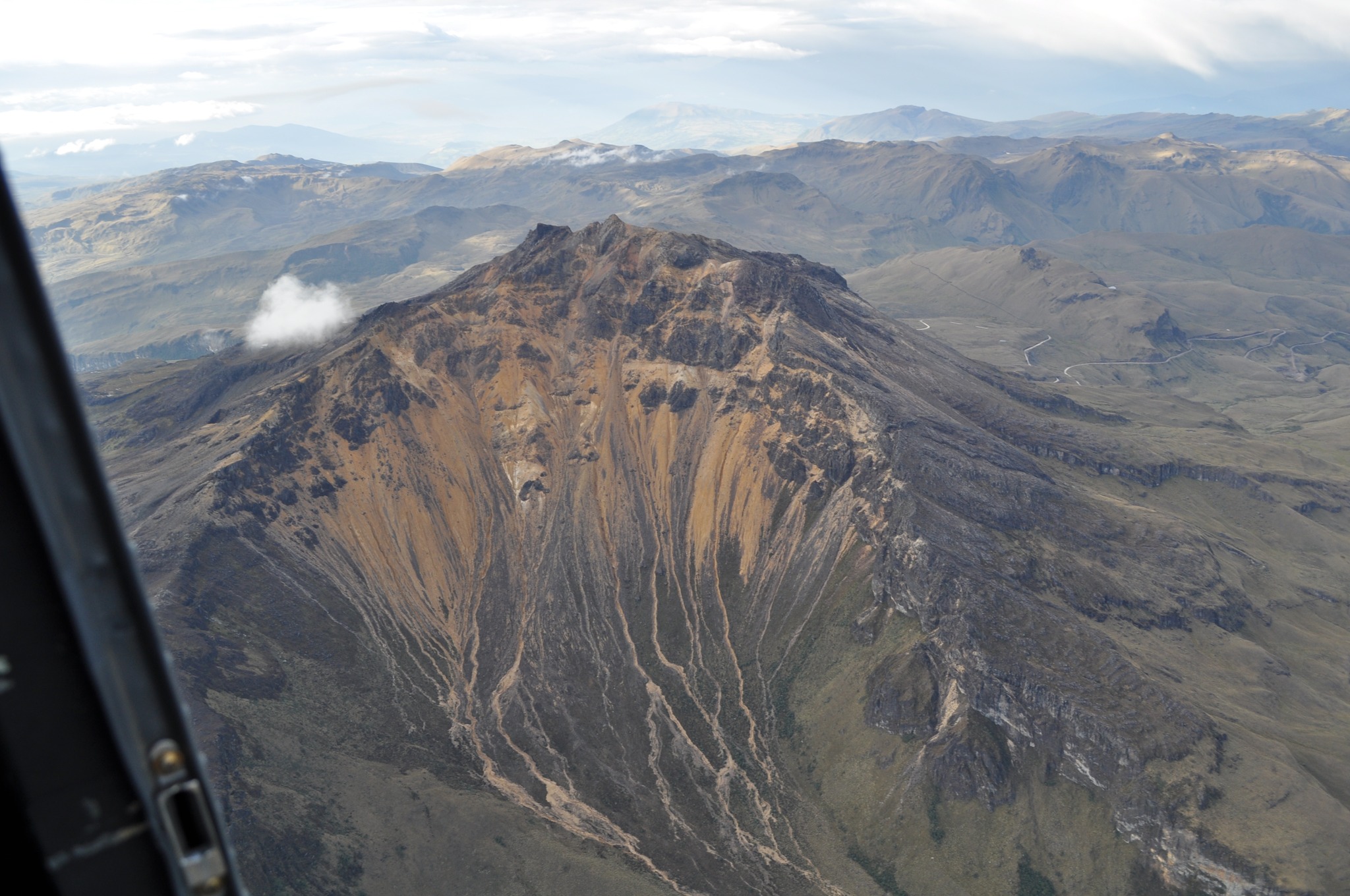
The vast majority of earthquakes were located south of the Chiles volcano, at epicentral distances between 1 and 3 km, approximately, with depths between 3 and 8 km from its summit (4700 m altitude) and a maximum magnitude of 1.9. No felt earthquakes were reported.
The soil deformation processes continue in the volcanic edifice, detected instrumentally by the sensors installed on the volcanoes and also by remote satellite sensors.
Based on the behavior of the activity in this volcanic region, the possibility of occurrence of earthquakes of considerable energy that can be felt by the inhabitants of the zone of influence remains.
The activity level of the volcanoes remains at:
YELLOW LEVEL ■ (III): CHANGES IN THE BEHAVIOR OF VOLCANIC ACTIVITY
Source et photo : SGC