May 21 , 2020.
Italy , Stromboli :
Weekly bulletin from May 11, 2020 to May 17, 2020 (issue date May 19, 2020)
SUMMARY OF THE STATUS OF THE ACTIVITY
In light of the monitoring data, it is underlined:
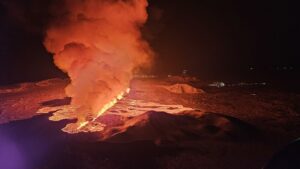
1) VOLCANOLOGICAL OBSERVATIONS: Normal strombolian explosive activity accompanied by a degassing activity. The hourly frequency of explosions fluctuated between low values (3 events / h on May 16) and medium-low values (9 events / h on May 13). It should be noted that such low frequency values were not recorded during an entire analysis period from the first ten days of June 2019. The intensity of the explosions was mainly low in the area of the North and medium crater in the Central-South crater area.
2) SEISMOLOGY: The seismological parameters do not present significant variations.
4) DEFORMATIONS: Data from the Stromboli soil deformation monitoring networks did not show any significant changes last week.
5) GEOCHEMISTRY: The flow of SO2 is at an average level. The last measurement of the CO2 / SO2 ratio is at an average value (last update on 02/09/2020). The isotopic ratio of helium remains on average values (last update of 09/03/2020). There is no update on the CO2 released by the soil.
6) SATELLITE OBSERVATIONS: The thermal activity in the summit area is at a medium-low level.
VOLCANOLOGICAL OBSERVATIONS
The analysis of the images recorded by the cameras placed at an altitude of 400m, at an altitude of 190m and at Punta dei Corvi made it possible to characterize the eruptive activity of Stromboli. During the reporting period, the explosive activity was mainly produced by at least 3 (three) eruptive vents located in the area of the North crater and by at least 2 (two) eruptive vents located in the area of the Center-South crater . All the mouths are placed inside the depression which occupies the terrace of the crater.
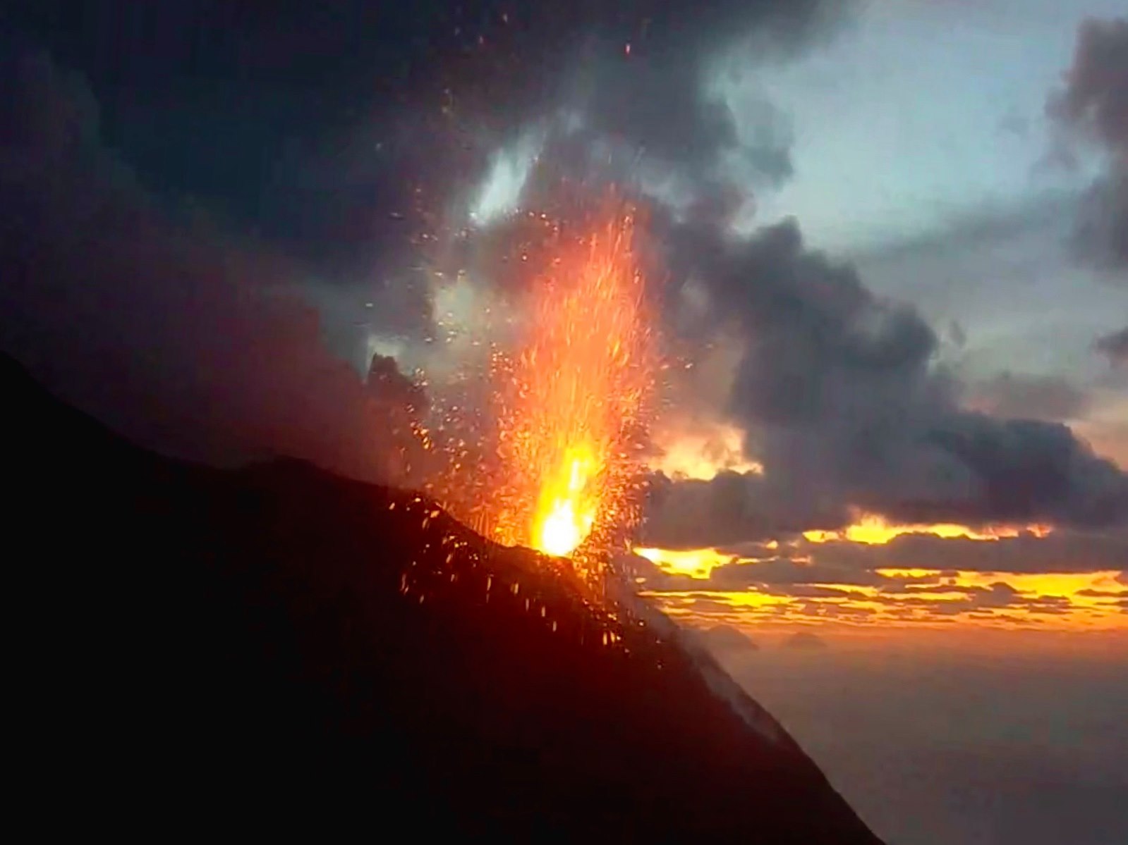
In the North zone, the explosions were mainly of low intensity (less than 80 m in height), with emission of coarse materials (lapilli and bombs). The average frequency of explosions in the North zone varied between 3 and 7 events / h.
The explosive activity of the Center-South zone produced explosions of mainly coarse material (lapilli and bombs) sometimes mixed with finer materials (ash), with an average intensity (less than 150 m high). The frequency of explosions in the Center-South zone varied between less than 1 and 5 events / h.
The amplitude of the volcanic tremor had values between low and medium-low.
Source : INGV.
Read the whole article : file:///C:/Users/Utilisateur/AppData/Local/Packages/Microsoft.MicrosoftEdge_8wekyb3d8bbwe/TempState/Downloads/BollettinoStromboli20200519%20(1).pdf
Photos : Web cam.
Russia / Kuriles Islands , Ebeko :
VOLCANO OBSERVATORY NOTICE FOR AVIATION (VONA).
Issued: May 21 , 2020
Volcano: Ebeko (CAVW #290380)
Current aviation colour code: ORANGE
Previous aviation colour code: orange
Source: KVERT
Notice Number: 2020-89
Volcano Location: N 50 deg 41 min E 156 deg 0 min
Area: Northern Kuriles, Russia
Summit Elevation: 3791.68 ft (1156 m)
Volcanic Activity Summary:
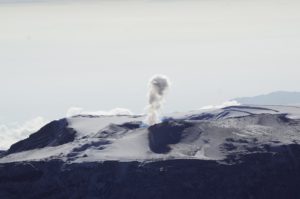
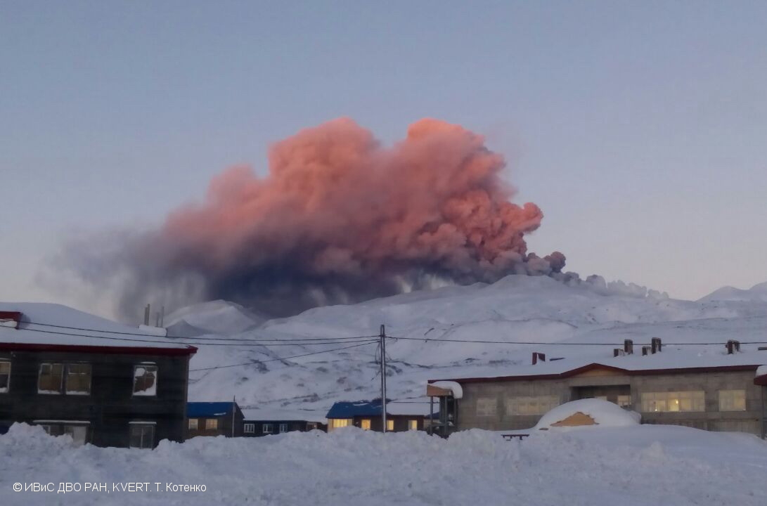
A moderate eruptive activity of the volcano continues. According to visual data by volcanologists from Severo-Kurilsk, explosion sent ash up to 2.6 km a.s.l., an ash cloud is drifting to the south-east of the volcano.
A moderate eruptive activity of the volcano continues. Ash explosions up to 19,700 ft (6 km) a.s.l. could occur at any time. Ongoing activity could affect low-flying aircraft and airport of Severo-Kurilsk.
Volcanic cloud height:
8528 ft (2600 m) AMSL Time and method of ash plume/cloud height determination: 20200521/0525Z – Visual data
Other volcanic cloud information:
Distance of ash plume/cloud of the volcano: 3 mi (5 km)
Direction of drift of ash plume/cloud of the volcano: SE / azimuth 130 deg
Time and method of ash plume/cloud determination: 20200521/0525Z – Visual data
Source : Kvert .
Photo : T. Kotenko, IVS FEB RAS, KVERT ( 2017) .
Colombia , Nevado del Ruiz :
Weekly activity bulletin of the Nevado del Ruiz volcano
The level of activity continues at the level of yellow activity or (III): changes in the behavior of volcanic activity.
Regarding the monitoring of the activity of the Nevado del Ruiz volcano, the COLOMBIAN GEOLOGICAL SERVICE reports that:
The seismicity linked to the dynamics of the fluids, inside the volcanic conduits, presented a decrease in terms of number of events and seismic energy released, compared to the previous week. This seismic activity was characterized by the occurrence of continuous volcanic tremors, tremor pulses, earthquakes of the long period type and of the very long period type. These earthquakes presented varying energy levels and spectral content. Some of these signals were associated with small emissions of gas and ash, some confirmed by cameras installed in the area of the volcano.
The seismicity generated by the fracturing of rocks showed an increase in the number of earthquakes and maintained similar levels of released seismic energy, compared to the previous week. This type of seismicity was mainly located in the West, South-South-West, South-East and North-East sectors of the volcano and to a lesser extent in the Arenas crater. The depth of the earthquakes ranged from 0.6 to 6.7 km. The maximum magnitude recorded during the week was 1.0 ML (local magnitude), corresponding to the earthquake recorded on May 17 at 3:49 a.m. (local time), located 4.3 km southwest of the Arenas crater, 3.6 km deep.
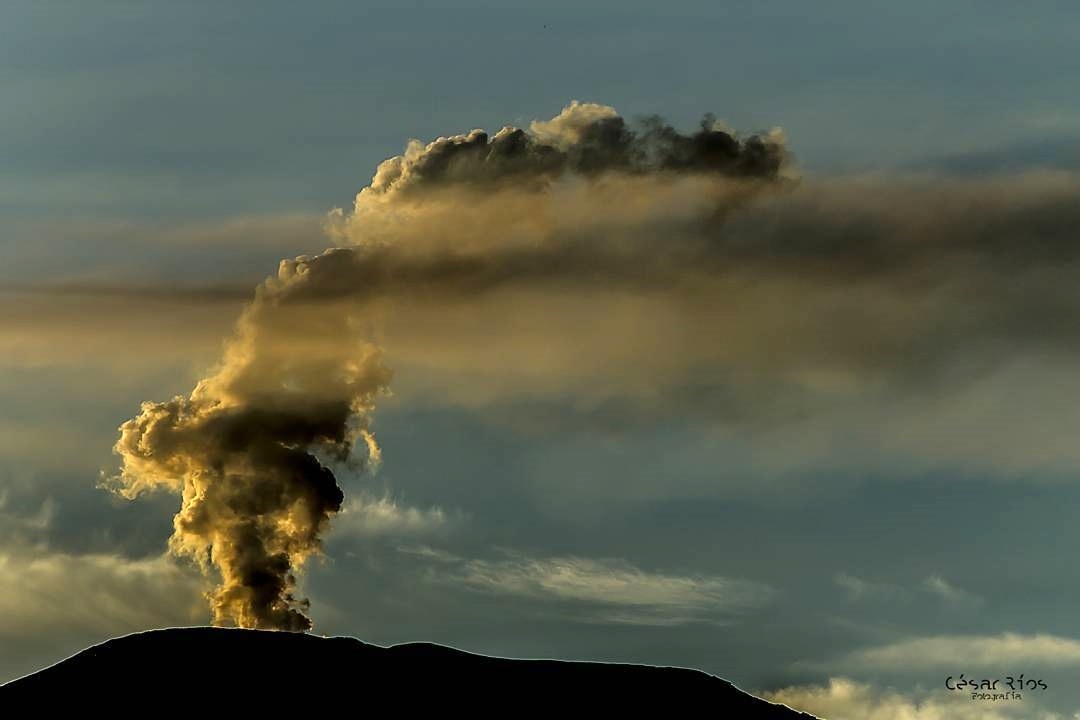
By monitoring the information provided on the Mirova and NASA FIRMS web portals, it has been reported a low energy thermal anomaly on the volcano in the past week.
The Nevado del Ruiz volcano continues at a yellow activity level.
Source : SGC.
Photo : Cesar Rios.
Indonesia , Dukono :
VOLCANO OBSERVATORY NOTICE FOR AVIATION – VONA.
Issued: May 21 , 2020
Volcano: Dukono (268010)
Current Aviation Colour Code: ORANGE
Previous Aviation Colour Code: orange
Source: Dukono Volcano Observatory
Notice Number: 2020DUK33
Volcano Location: N 01 deg 41 min 35 sec E 127 deg 53 min 38 sec
Area: North Maluku, Indonesia
Summit Elevation: 3933 FT (1229 M)
Volcanic Activity Summary:
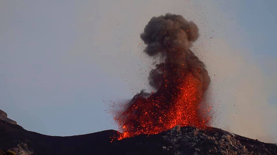
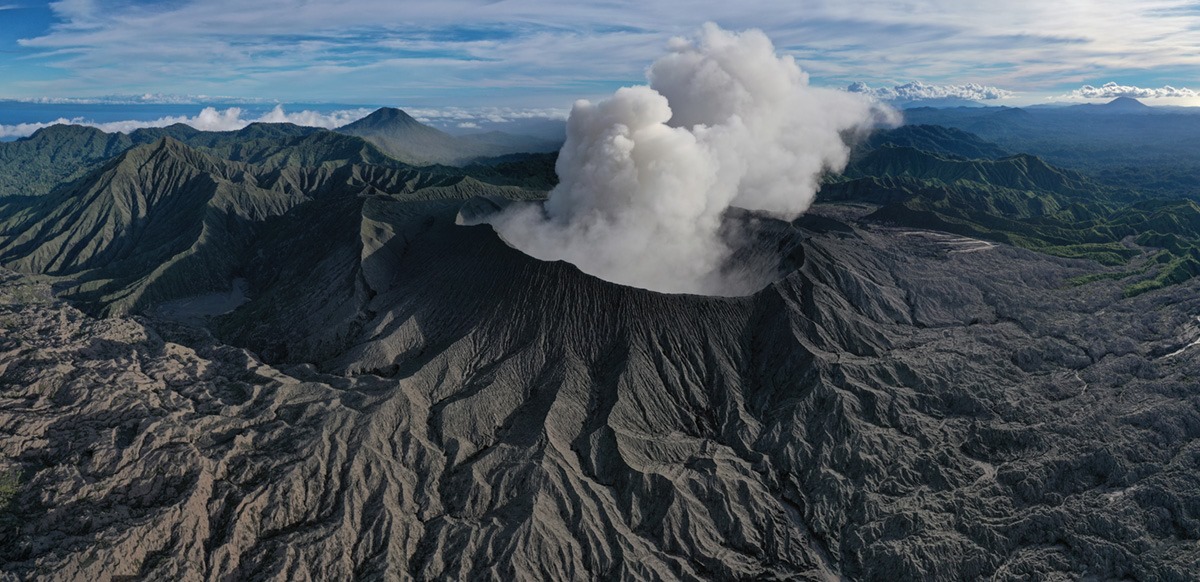
Eruption with volcanic ash cloud at 03h33 UTC (12h33 local).
Volcanic Cloud Height:
Best estimate of ash-cloud top is around 5213 FT (1629 M) above sea level, may be higher than what can be observed clearly. Source of height data: ground observer.
Other Volcanic Cloud Information:
Ash-cloud moving to west
Remarks:
Eruption and ash emission is continuing.
Source : Magma Indonésie .
Photo : Martin Rietze .
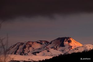
Japan , Aira ( Sakurajima ) :
31.593°N, 130.657°E
Elevation 1117 m
JMA reported that during 11-18 May incandescence from Minamidake Crater (at Aira Caldera’s Sakurajima volcano) was visible nightly. There were 10 explosive events with plumes rising as high as 2 km above the crater rim. Material was ejected 600-900 m away from the crater. The Alert Level remained at 3 (on a 5-level scale).
The Aira caldera in the northern half of Kagoshima Bay contains the post-caldera Sakurajima volcano, one of Japan’s most active. Eruption of the voluminous Ito pyroclastic flow accompanied formation of the 17 x 23 km caldera about 22,000 years ago. The smaller Wakamiko caldera was formed during the early Holocene in the NE corner of the Aira caldera, along with several post-caldera cones. The construction of Sakurajima began about 13,000 years ago on the southern rim of Aira caldera and built an island that was finally joined to the Osumi Peninsula during the major explosive and effusive eruption of 1914. Activity at the Kitadake summit cone ended about 4850 years ago, after which eruptions took place at Minamidake. Frequent historical eruptions, recorded since the 8th century, have deposited ash on Kagoshima, one of Kyushu’s largest cities, located across Kagoshima Bay only 8 km from the summit. The largest historical eruption took place during 1471-76.
Source: Japan Meteorological Agency (JMA) , GVP.