June 16 , 2023.
Hawaii , Kilauea :
Wednesday, June 14, 2023, 7:25 AM HST (Wednesday, June 14, 2023, 17:25 UTC)
19°25’16 » N 155°17’13 » W,
Summit Elevation 4091 ft (1247 m)
Current Volcano Alert Level: WATCH
Current Aviation Color Code: ORANGE
Activity Summary:
Kīlauea volcano is erupting. Eruptive activity is confined to Halemaʻumaʻu crater within the summit caldera at Kīlauea. No unusual activity has been noted along the volcano’s East Rift Zone or Southwest Rift Zone.
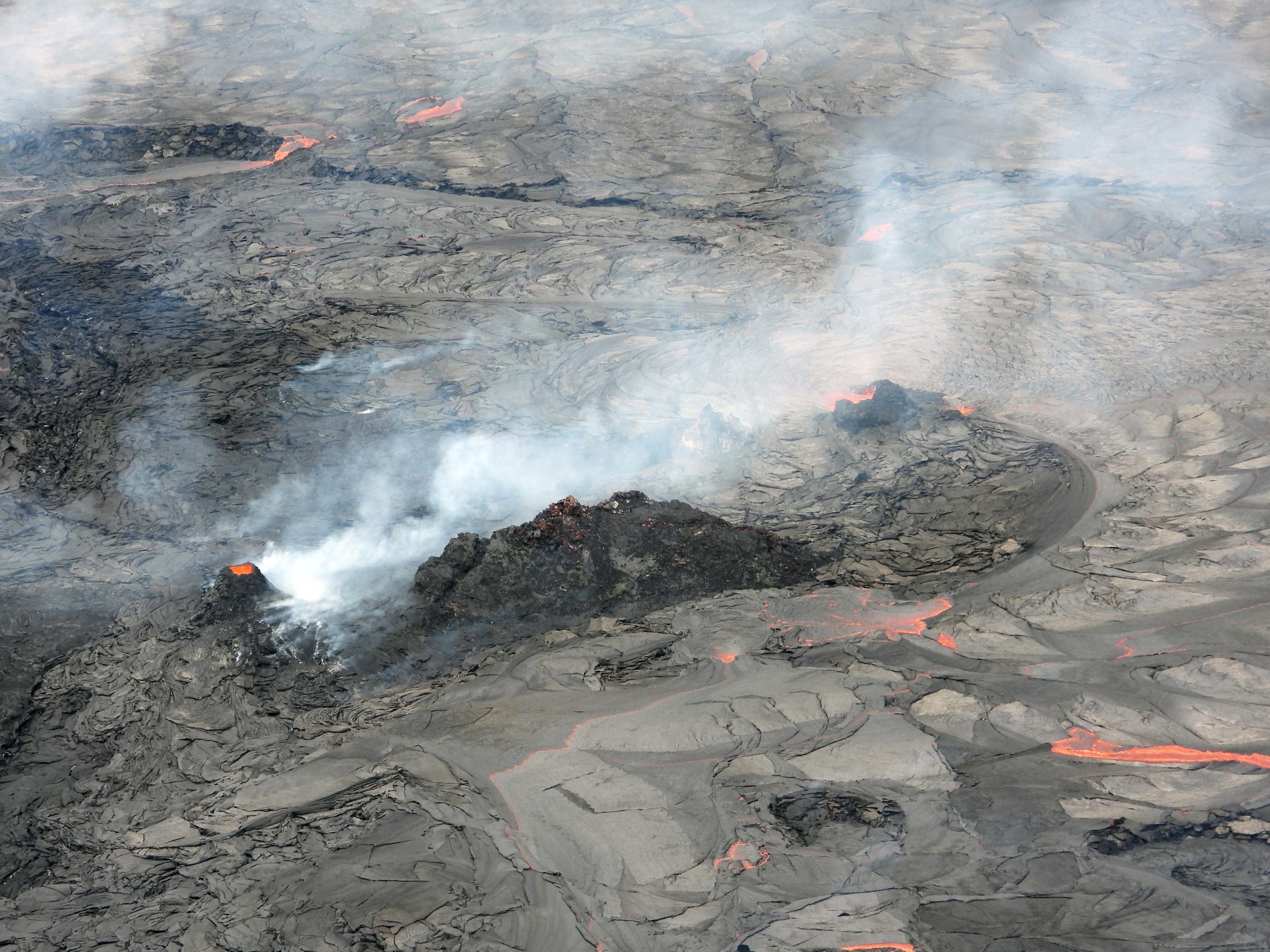
Lava continues to flow in the summit crater Halema‘uma‘u at Kīlauea volcano, but surface activity is focused on the western end of the lava lake. This telephoto view shows the northeastern part of the surface activity. A glowing vent with spattering deep inside the vent can be seen on the left. Fumes are coming off around the base. Lava bubbles in low spatter burst in the low horseshoe shaped vent shrouded in fumes to the right and flows out in a clockwise motion around the vent area.
Halemaʻumaʻu crater Eruption Observations:
The eruptive vent in the southwest wall of Halemaʻumaʻu continues effusing into the lava lake in the far southwestern portion of the crater. Intermittent spattering at this vent was visible in overnight webcam views. Other eruptive vents within the southwestern lava lake—previously taking the form of dome fountains—shut down yesterday morning, following several days of waning activity. There has been another source of lava effusion near the western eruptive vent from the January–March 2023 eruption, but it is only weakly active at this time.
The southwestern lava lake has been shrinking over recent days, although its surface is slowily rising, with an elevation increase of approximately 0.5 meters (1.5 feet) over the past day. Lava circulation also continues within the central basin that became the focus of effusion during both the 2021–2022 and early 2023 eruptions. No active lava has been observed in the northern or eastern portions of the crater over the past day.
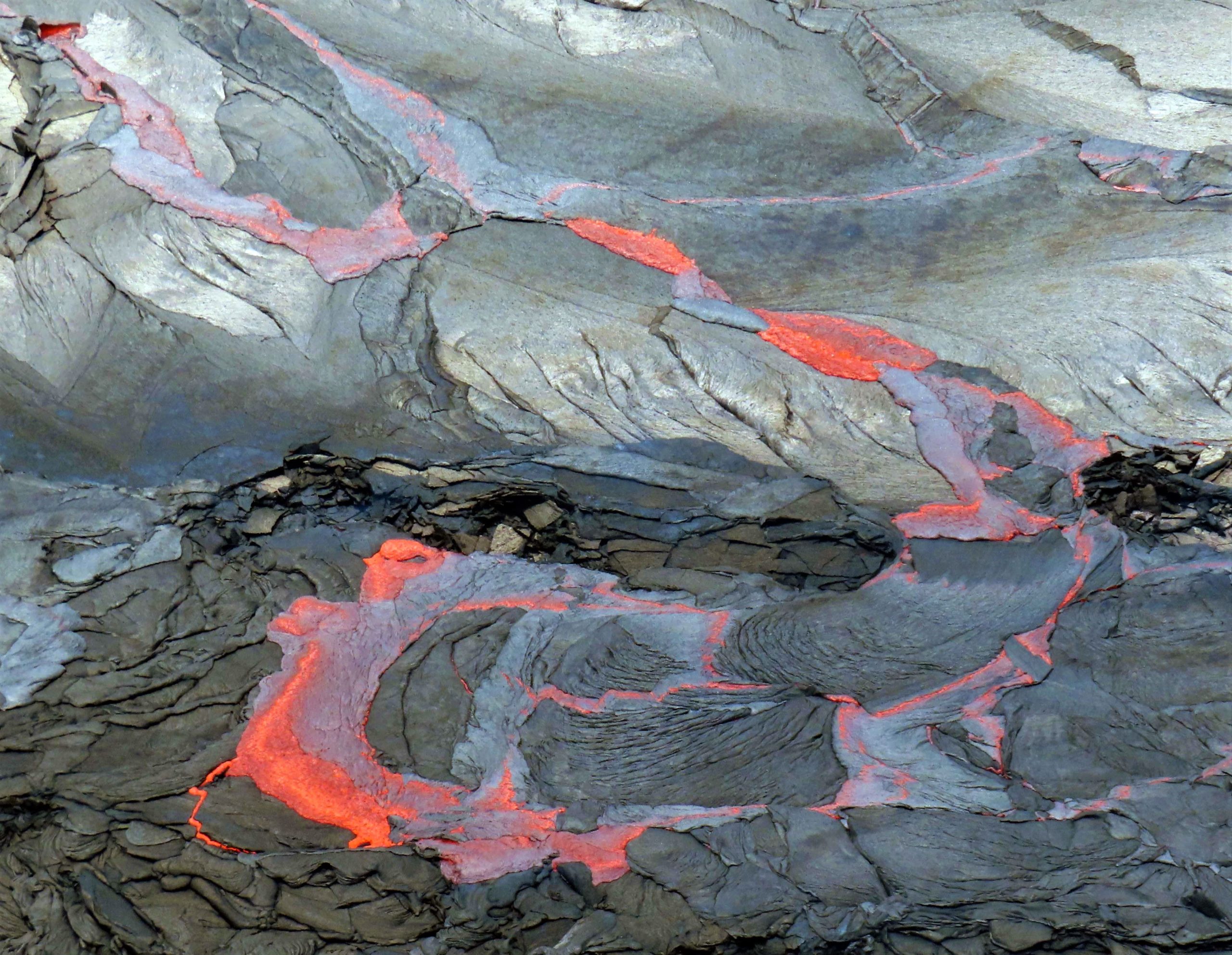
The lava on the surface of Halema‘uma‘u crater is hot and fluid even though it quickly grows a dark crust. When the crust forms, it becomes denser than the fluid lava below and starts to sink into it. The fluid red lava below forms thin lobes above the sinking crust. We call this process crustal foundering—an overturn of the crust. It only takes seconds before the red exposed lava also crusts over and darkens again.
Summit Observations:
Summit tiltmeters briefly tracked moderate inflation starting late yesterday morning, but it slowed in the afternoon and tilt is trending slightly deflationary so far today. Summit seismic activity is dominated by eruptive tremor—a signal resulting from fluid movement, and commonly associated with eruptive activity. Volcanic gas emissions in the area remain elevated; a sulfur dioxide (SO2) emission rate of approximately 5,300 tonnes per day was measured yesterday, Wednesday, June 14.
Rift Zone Observations:
No unusual activity has been noted along the East Rift Zone or Southwest Rift Zone; steady but low rates of ground deformation and seismicity continue along both. Measurements from continuous gas monitoring stations in the middle East Rift Zone—the site of 1983–2018 eruptive activity—remain below detection limits for SO2.
Source : HVO
Photos: USGS / J. Schmith
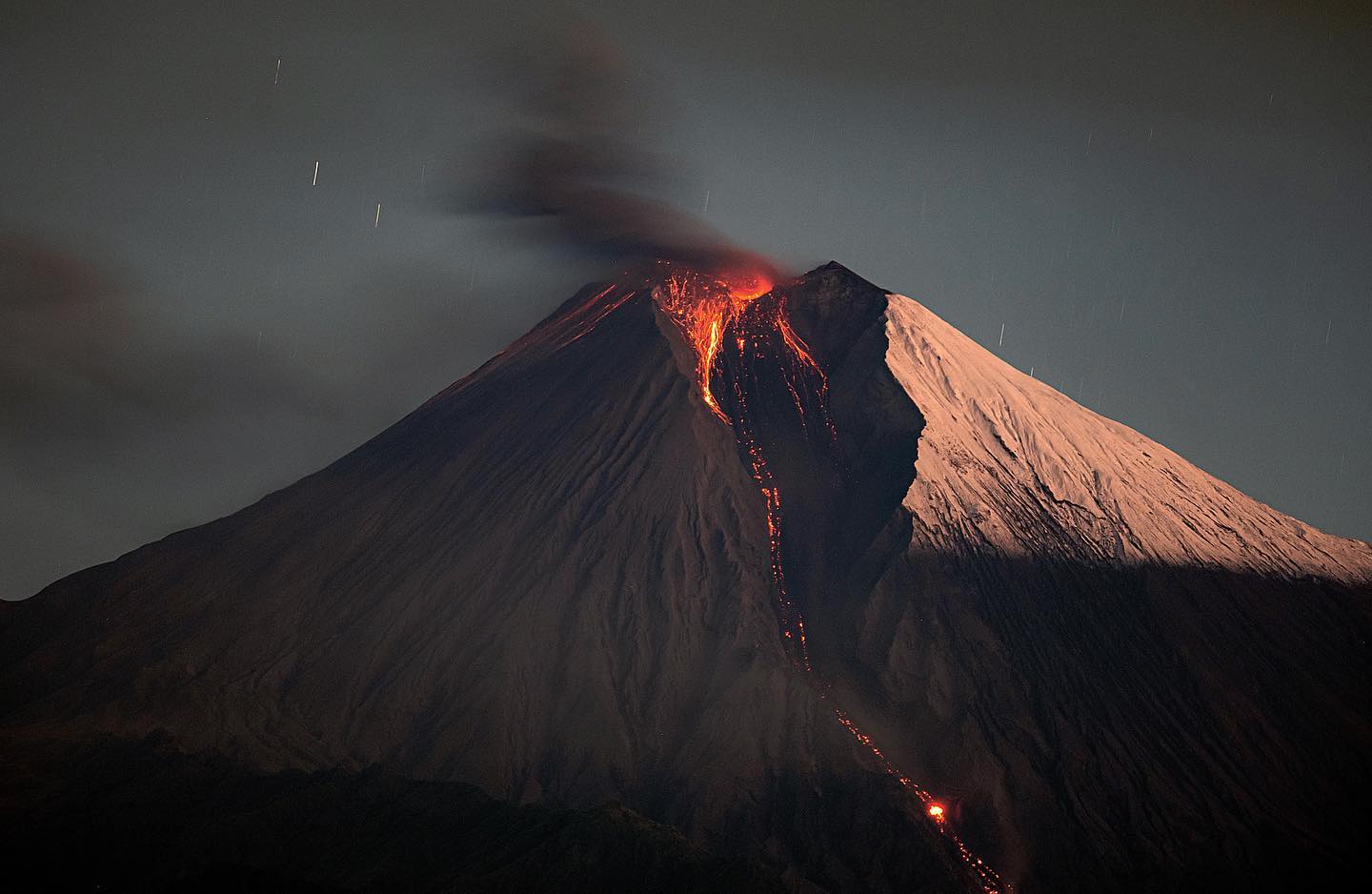
Philippines , Mayon :
MAYON VOLCANO BULLETIN: 16 June 2023 8:00 AM
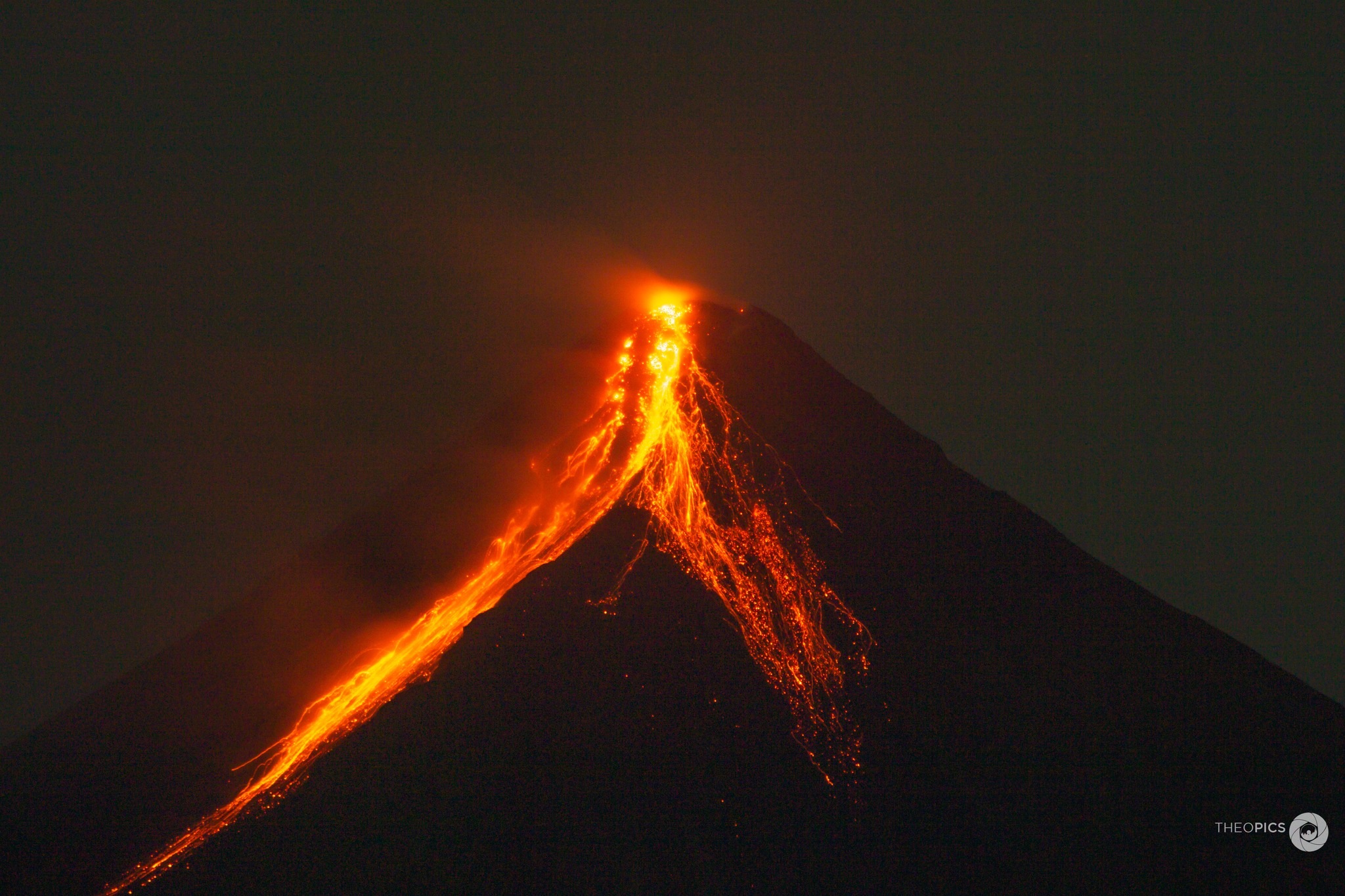
In the past 24-hour period, very slow effusion of lava from the summit crater of Mayon Volcano continued to feed lava flows and collapse debris on the Mi-isi (south) and Bonga (southeastern) gullies. The lava flows have advanced to approximately one (1) kilometer from the summit crater while collapse debris have deposited to two (2) kilometers from the crater. A total of thirteen (13) dome-collapse pyroclastic density currents (PDC), three-hundred seven (307) rockfall events, and four (4) volcanic earthquakes were recorded by the Mayon Volcano Network. PDCs lasted two (2) to six (6) minutes and were emplaced on the Mi-isi and Bonga Gullies within one (1) kilometer of the crater. The largest PDC event since 8 Jun 2023 occurred at 11:18 PM on 15 June and deposited material within the upper one (1) kilometer of these gullies. Traces of ashfall dispersed from the PDCs were reported in Sitio Buga, Brgy. Nabonton, City of Ligao and Purok 7, Brgy. San Francisco, Municipality of Guinobatan. Continuous moderate degassing from the summit crater produced steam-laden plumes that rose 750 m before drifting to the general west and north-northeast. Sulfur dioxide (SO2) emission averaged 826 tonnes/day on 15 June 2023. Short-term observations from EDM and electronic tiltmeter monitoring show the upper slopes to be inflating since February 2023. Longer-term ground deformation parameters based on EDM, precise leveling, continuous GPS, and electronic tilt monitoring indicate that Mayon is still inflated, especially on the northwest and southeast.
Alert Level 3 is maintained over Mayon Volcano, which means that it is currently in a relatively high level of unrest as magma is at the crater and hazardous eruption within weeks or even days is possible. It is therefore recommended that the 6-km radius Permanent Danger Zone (PDZ) be evacuated due to the danger of PDCs, lava flows, rockfalls and other volcanic hazards. Increased vigilance against pyroclastic density currents, lahars and sediment-laden streamflows along channels draining the edifice is also advised. Heavy rainfall could generate channel-confined lahars and sediment-laden streamflows in channels where PDC deposits were emplaced. Civil aviation authorities must also advise pilots to avoid flying close to the volcano’s summit as ash from any sudden eruption can be hazardous to aircraft. Based on the current prevailing wind pattern, ash fall events may most likely occur on the south side of the volcano.
DOST-PHIVOLCS maintains close monitoring of Mayon Volcano and any new development will be communicated to all concerned stakeholders.
Source : Phivolcs
Photo : Teopics
Italy , Stromboli :
WEEKLY BULLETIN, from June 05, 2023 to June 11, 2023. (issue date June 13, 2023)
ACTIVITY STATUS SUMMARY
In the light of the monitoring data, it is highlighted:
1) VOLCANOLOGICAL OBSERVATIONS: During this period, normal Strombolian activity was observed with splashing activity at the S2 sector. The total hourly frequency is within the average values (6-11 events/h). The intensity of the explosions was mainly low and medium in both the North crater area and the South Center crater area.
2) SEISMOLOGY: The seismological parameters monitored do not show any significant variations.
3) GROUND DEFORMATIONS: Ground deformation monitoring networks show no significant variations.
4) GEOCHEMISTRY: The flow of SO2 is between a medium and medium-low level.
There are no updates on CO2 flux data in the Pizzo area
There are no C/S data updates in the plume.
There is no update on the isotope ratio of helium in groundwater.
5) SATELLITE OBSERVATIONS: The thermal activity observed from the satellite was generally weak.

VOLCANOLOGICAL OBSERVATIONS
During the observation period, the eruptive activity of Stromboli was characterized by the analysis of the images recorded by the surveillance cameras of the INGV-OE at an altitude of 190m (SCT-SCV) and of the Pizzo. The explosive activity was mainly produced by two eruptive vents located in the North zone of the crater and by four vents located in the Center-South zone.
Observations of explosive activity captured by surveillance cameras
In the northern zone of the crater (N), characterized by a vent located in the N1 sector and one in the N2 sector, the explosive activity was of low intensity (the eruptive products reached a height of less than 80 m) and medium ( i the eruptive products have reached a height of less than 150 m). The eruptive products consisted mainly of coarse materials (bombs and lapilli) sometimes mixed with fine materials (ash). The average frequency of explosions varies between 1 and 6 events/h. Within the Center-South (CS) zone, sector S1 shows weak high-pressure degassing sometimes associated with the emission of coarse materials, while sector C does not give rise to explosive activity. Sector S2, characterized by three active vents, mainly showed low and medium intensity explosive activity emitting coarse materials mixed with fine materials, sometimes accompanied by weak projection activity. Overall, the average frequency of explosions in the CS zone varied between 3 and 6 events/h
Source : INGV
Photo : Stromboli stati d’animo
Colombia , Puracé – Chaîne volcanique de Los Coconucos :
Weekly bulletin of activity of the Puracé volcano – Volcanic chain of Los Coconucos.
From the monitoring of the activity of the PURACÉ VOLCANO – VOLCANIC CHAIN OF LOS COCONUCOS, the MINISTRY OF MINES AND ENERGY through the COLOMBIAN GEOLOGICAL SERVICE (SGC) reports that:
During the week of June 6 to 12, 2023, the seismic activity showed a similar trend to that observed in previous weeks, both in energy released and in the number of events recorded, maintaining the predominance of motion-related seismic events fluids in the volcanic conduits, which were located mainly under the crater of the Puracé volcano. This activity was accompanied by localized deformations in the upper part of the volcanic chain.
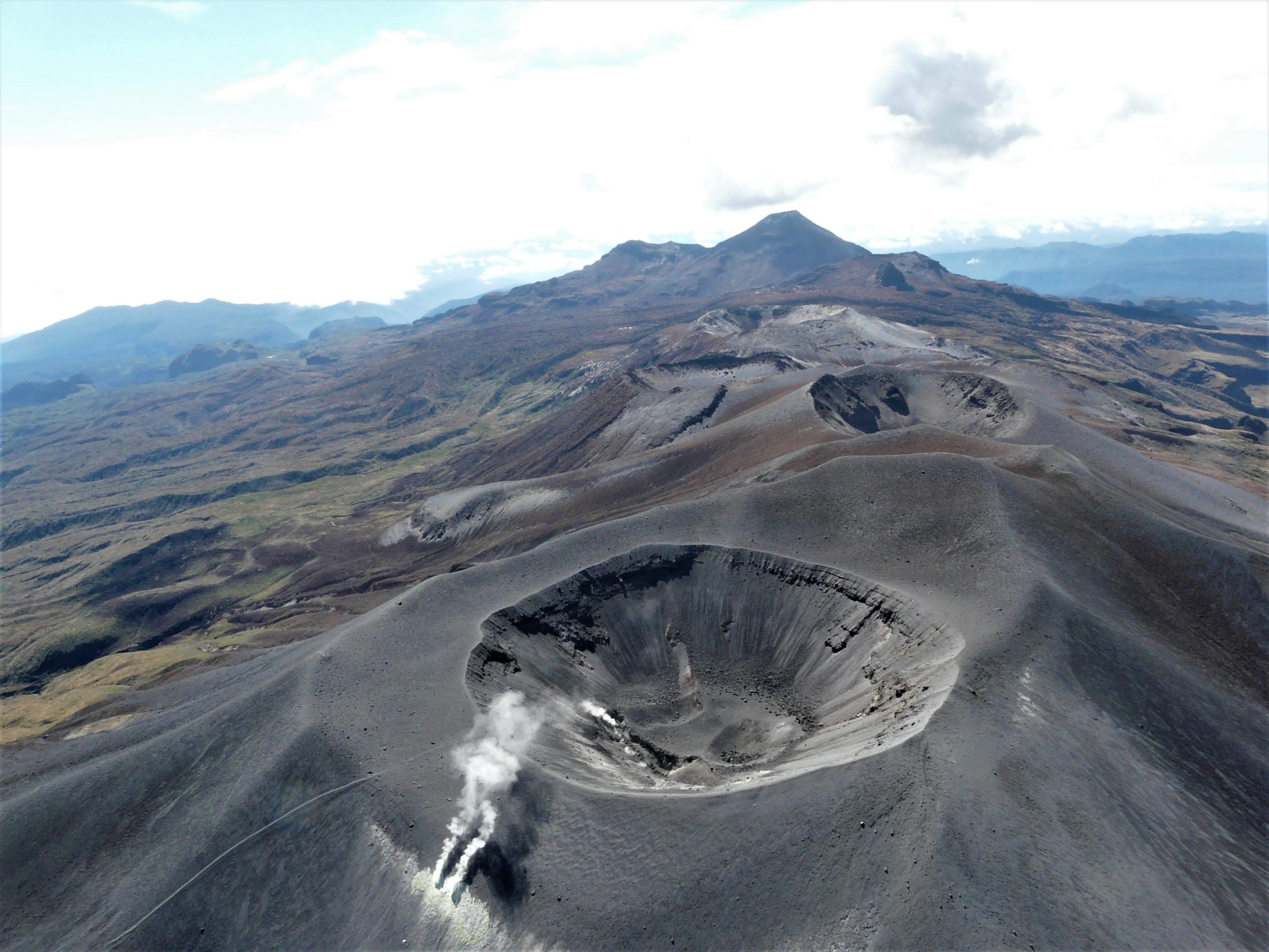
Likewise, degassing continued to be highlighted in the upper part of the volcano with a white column, preferentially oriented towards the northwest, with stable values in the fluxes of sulfur dioxide (SO2). The concentration of carbon dioxide (CO2) in the crater area of the Puracé volcano remained at high values compared to its baseline.
The other parameters measured and used for the diagnosis of volcanic activity did not show significant changes during the period evaluated.
The activity level of the volcano remains at YELLOW LEVEL (III): CHANGES IN THE BEHAVIOR OF VOLCANIC ACTIVITY
The COLOMBIAN GEOLOGICAL SERVICE will continue to be attentive to the evolution of the volcanic phenomenon and will provide timely information on any changes that may occur.
Source et photo : SGC
Ecuador , Sangay :
DAILY REPORT OF THE STATE OF SANGAY VOLCANO, Thursday June 15, 2023.
Information Geophysical Institute – EPN.
Surface Activity Level: High, Surface Trend: Unchanged
Internal activity level: High, Internal trend: No change
Seismicity: From June 14, 2023, 11:00 a.m. to June 15, 2023, 11:00 a.m.:
Below is the count of seismic events recorded by the reference station over the past 24 hours.
Explosion Event (EXP): 945.
Rains / Lahars:
No rain or lahars were recorded in the area.
Emission / Ash Column:
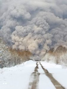
Various gas and ash emissions were observed at heights less than 500 meters above crater level in a southwesterly direction. The GOES-16 satellite detected a cloud with a weak ash load that reached 1.8 km above crater level, facing west.
Gas:
The MOUNTS system detected 145.6 tons of sulfur dioxide (SO2), measured on 2023-06-14 at 1:18 p.m. TL.
Observation:
Most of the time, the volcano remained cloudy, which made it impossible to observe surface activity. The SGR reported a slight ash fall in the municipality of Palmira, canton of Guamote.
Alert level: Orange.
Source : IGEPN.
Photo : Eqphos_fotografía