January 05 , 2019 .
Indonesia , Anak Krakatau :
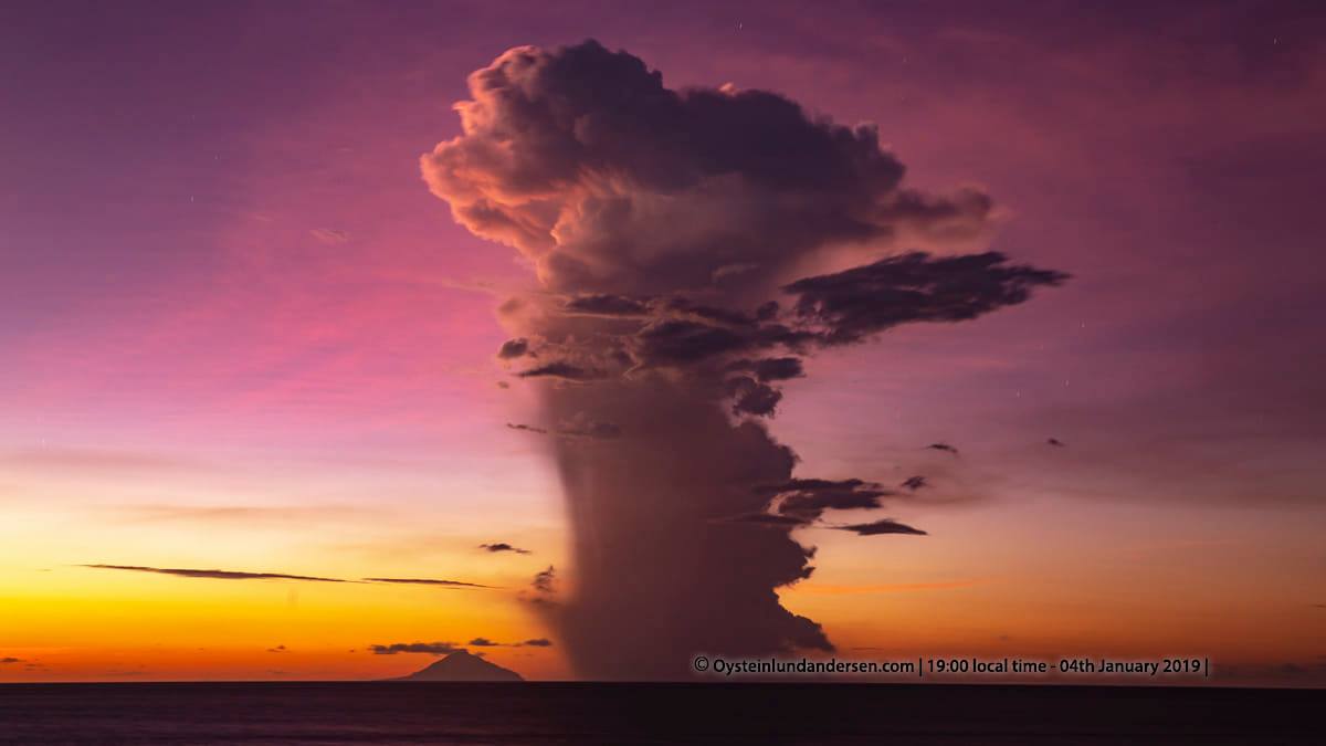
Eruption of Mount Anak Krakatau at Lampung on 5 January 2019 at 1111 WIB with a height of ash column observed at ± 1500 m above the summit (± 1 610 m above sea level). The column of ash was gray, of thick intensity and inclined towards the South-West. This eruption is recorded on a seismogram with a maximum amplitude of 18 mm and a duration of ± 1 minute 5 seconds.
Currently, Anak Krakatau is at level III (SIAGA) with these recommendations: people / tourists are not allowed to approach within a radius of 5 km around the crater.
VOLCANO OBSERVATORY NOTICE FOR AVIATION – VONA.
Issued: January 05 , 2019
Volcano: Anak Krakatau (262000)
Current Aviation Colour Code: ORANGE
Previous Aviation Colour Code: orange
Source: Anak Krakatau Volcano Observatory
Notice Number: 2019KRA09
Volcano Location: S 06 deg 06 min 07 sec E 105 deg 25 min 23 sec
Area: Lampung, Indonesia
Summit Elevation: 352 FT (110 M)
https://www.facebook.com/100015396632882/videos/498698367320047/
Volcanic Activity Summary:
Eruption with ash clouds at 04:11 UTC (11:11 local time). The eruption lasted for 65 seconds.
Volcanic Cloud Height:
Best estimate of ash-cloud top is around 5152 FT (1610 M) above sea level, may be higher than what can be observed clearly. Source of height data: ground observer.
Other Volcanic Cloud Information:
Ash cloud is moving to west-southwest
Remarks:
Eruption recorded on seismogram with maximum amplitude 18 mm and maximum duration 65 second.
Source : PVMBG , Magma Indonesia .
Vidéo : Кирилл Баканов
Photo : Øystein Lund Andersen.
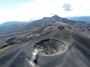
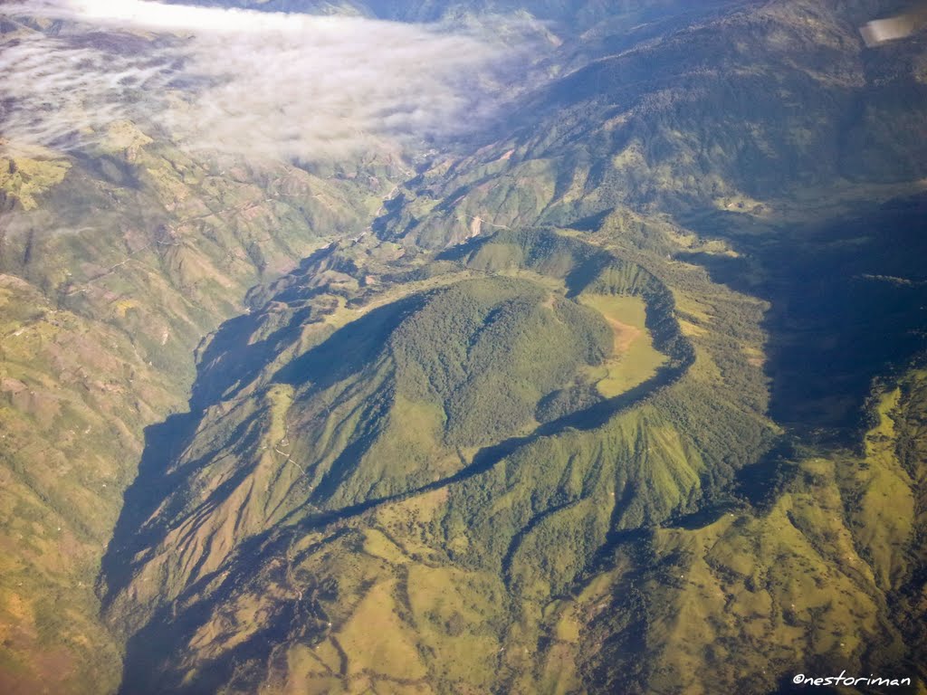
Colombia , Cerro Machin :
Weekly activity bulletin of Cerro Machín volcano
The level of activity continues at the level: Yellow activity level or (III): changes in the behavior of volcanic activity.
Regarding the monitoring of the activity of the Cerro Machín volcano, the COLOMBIAN GEOLOGICAL SERVICE announces that:
During the past week, the Cerro Machín volcano has recorded seismic activity associated with rock fracturing. This seismic activity showed a slight increase in both the number of earthquakes and the seismic energy released. The earthquakes were located mainly west of the dome at depths between 2.4 and 4.4 km.
The highest magnitude recorded was 1.1 ML (local magnitude) corresponding to the earthquake on December 29 at 00:25 (local time), located west of the main dome at a depth of 3.6 km.
The COLOMBIAN GEOLOGICAL SERVICE is attentive to the evolution of the volcanic phenomenon and will continue to inform in a timely manner of any changes that may occur.
Source : SGC.
Photo : Nestoriman.
Costa Rica , Turrialba / Poas :
Daily report on the state of volcanoes. OVSICORI-UNA, Date: 04 January 2019, Updated at: 10:56:00 AM.
Turrialba Volcano:
On January 4, 2019, at 9:30 am local time, there was an eruption on the Turrialba volcano, with a column that rose 100 meters above crater height and 3,440 meters above sea level. sea level. (11283.2 ft).

Duration of the activity: in progress.
The seismic activity is lower than yesterday.
At the time of this report, the winds blow from the northwest.
Passive and prolonged eruptions are maintained with very diluted ash emissions in the column of gas and aerosol. The plume is weak with a low density of gas and aerosol. The glow inside the crater disappeared last night. Seismicity remains dominated by a few low frequency, low amplitude volcanic earthquakes. No ash or smell of sulfur has been reported.
Poas Volcano:
On January 4, 2019, at 11:04 local time, an eruption is recorded on the Poas volcano, with a column that rises 200 meters above crater height and 2908 meters above sea level. (9538.24 ft).
Duration of the activity: 2 minutes.
The seismic activity is similar to that of yesterday.
At the time of this report, the winds blow towards the West.
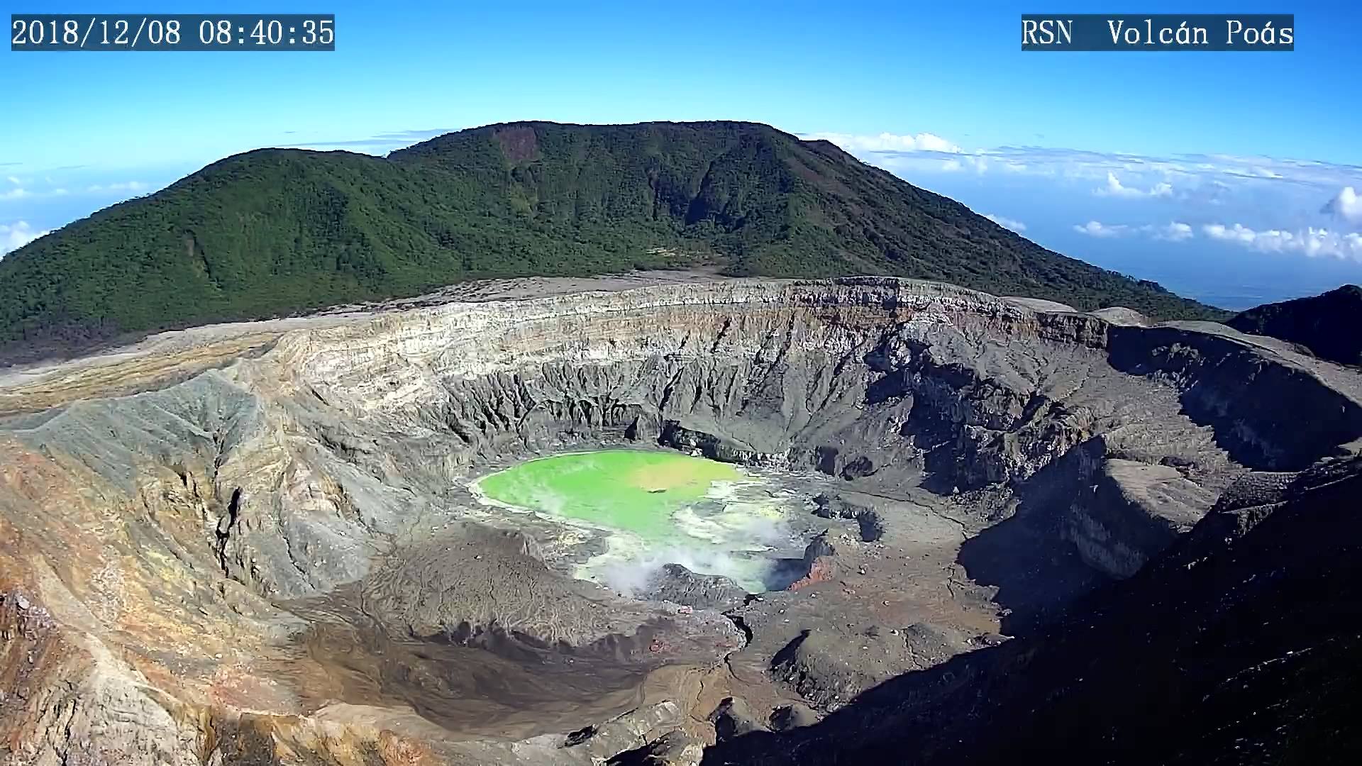
There are fewer steam eruptions than in previous days, however, the lack of communication with the camera in the crater of the volcano prevents confirmation of the occurrence of steam eruptions or to determine their characteristics. Similarly, without a camera, the evolution of the level or the color of the lake can not be evaluated. The ratio between CO2 / SO2 gases and the concentrations of CO2 and SO2 emitted by fumaroles shows values with marked fluctuations between January 1 and January 4, 2019: CO2 / SO2 varies between 1 and 6.5, whereas SO2 concentrations ranged from 2.8 ppm to 20 ppm. These fluctuations indicate that the hydrothermal system underlying the crater is still disturbed by the degassing and crystallization of the magma body that has reached the surface and generated the fresh lava eruptions of the first half of 2017.
Source : Ovsicori.
Photos : Ovsicori , RSN
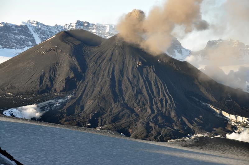
Russia , Kourils Islands , Ebeko :
VOLCANO OBSERVATORY NOTICE FOR AVIATION (VONA).
Issued:20190105/0439Z
Volcano:Ebeko (CAVW #290380)
Current aviation colour code:ORANGE
Previous aviation colour code:orange
Source:KVERT
Notice Number:2019-10
Volcano Location:N 50 deg 41 min E 156 deg 0 min
Area:Northern Kuriles, Russia
Summit Elevation:3791.68 ft (1156 m)

Volcanic Activity Summary:
A moderate explosive activity of the volcano continues. Visual data from Severo-Kurilsk showed an explosion sent ash up to 3.5 km a.s.l., an ash plume is drifting to the east from the volcano.
A moderate eruptive activity of the volcano continues. Ash explosions up to 19,700 ft (6 km) a.s.l. could occur at any time. Ongoing activity could affect low-flying aircraft and airport of Severo-Kurilsk.
Volcanic cloud height:
9840 ft (3000 m) AMSL Time and method of ash plume/cloud height determination: 20190105/0438Z – Visual data
Other volcanic cloud information:
Distance of ash plume/cloud of the volcano: 2 mi (3 km)
Direction of drift of ash plume/cloud of the volcano: E / azimuth 85 deg
Time and method of ash plume/cloud determination: 20190105/0438Z – Visual data
Source : Kvert.
Photo : Кирилл Баканов
Alaska , Veniaminof :
AVO/USGS Volcanic Activity Notice
Current Volcano Alert Level: ADVISORY
Previous Volcano Alert Level: WATCH
Current Aviation Color Code: YELLOW
Previous Aviation Color Code: ORANGE
Issued: Friday, January 4, 2019, 10:53 AM AKST
Source: Alaska Volcano Observatory
Notice Number: 2019/A10
Location: N 56 deg 11 min W 159 deg 23 min
Elevation: 8225 ft (2507 m)
Area: Alaska Peninsula
Volcanic Activity Summary:
Eruptive activity at Veniaminof has paused or stopped over the past week. Therefore AVO is lowering the Aviation Color Code to YELLOW and the Volcano Alert Level to ADVISORY. Seismic events continue, indicative of continued unrest.
Recent Observations:
[Volcanic cloud height] None
[Other volcanic cloud information] Unknown
[Lava flow] Paused
Remarks:
Pauses in eruptive activity are common at Veniaminof and resumed lava effusion and/or ash emissions could resume at any time without significant seismic precursors.
Source : AVO
Photo : McGimsey, R. G.