January 24 , 2023.
New Zealand , White Island :
VOLCANIC ACTIVITY BULLETIN , Tue Jan 24 2023 4:30 PM;
Volcanic Alert Level remains at 2
Aviation Colour Code remains at Yellow
A recent gas and observation flight confirms that active vents are continuing to emit a weak-moderate steam and gas plume.
On 16 January 2023, GNS Science volcanologists completed a gas measurement and observation flight. They observed the normal weak-moderate gas and steam plume at the island. The gas output has declined from the 6 December 2022 observations to now a low 33 ± 4 tonnes/day of sulphur dioxide (SO2) and moderate 705 ± 89 tonnes/day of carbon dioxide (CO2).
The observations from the flight have confirmed that the steam and gas plume continues to originate from the same vent locations as in December 2022. Discharge rates have also remained similar. There is no evidence of ash emission or other eruptive activity from these vents. Aside from minor water level fluctuations, the lake is little changed either.
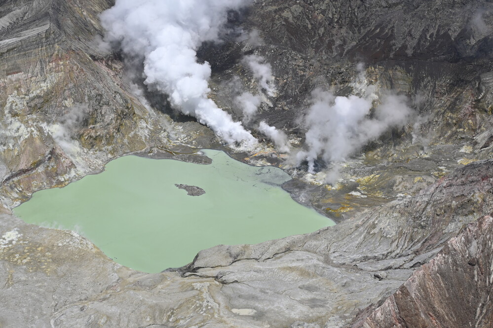
View of the active vent area producing moderate steam and gas emission, 16 January 2023.
Over the last 3-months, InSAR (satellite) data has detected minor (<1cm) subsidence in the vicinity of the 2019 eruption vent and continued localised uplift within the Main Crater floor. Intermittent movement of the 1914 landslide has also been observed.
The VAL remains at Level 2 (moderate to heightened unrest) and the Aviation Colour Code remains at Yellow, acknowledging the current level of activity, but also continuing to acknowledge the greater level of uncertainty in our interpretation due to the current lack of consistent, useful real-time data.
As the weather allows, we will under-take additional gas and observation flights to the island until we can service our on-island equipment and power supplies. We still have intermittent access to webcams images from the island, providing some level of visual monitoring between our flights.
The Volcanic Alert Level reflects the current level of volcanic unrest or activity and is not a forecast of future activity. While Volcanic Alert Level 2 is mostly associated with volcanic unrest hazards (including discharge of steam and hot volcanic gases, earthquakes, landslides, and hydrothermal activity), potential for eruption hazards also exists and eruptions can still occur with little or no warning.
Source : Geonet / Yannik Behr / Duty Volcanologist
Photo : Geonet
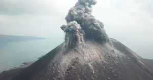
Russia / Kuril Islands , Ebeko :
VOLCANO OBSERVATORY NOTICE FOR AVIATION (VONA)
Issued: January 23 , 2023
Volcano: Ebeko (CAVW #290380)
Current aviation colour code: ORANGE
Previous aviation colour code: orange
Source: KVERT
Notice Number: 2023-14
Volcano Location: N 50 deg 41 min E 156 deg 0 min
Area: Northern Kuriles, Russia
Summit Elevation: 1156 m (3791.68 ft)
Volcanic Activity Summary:
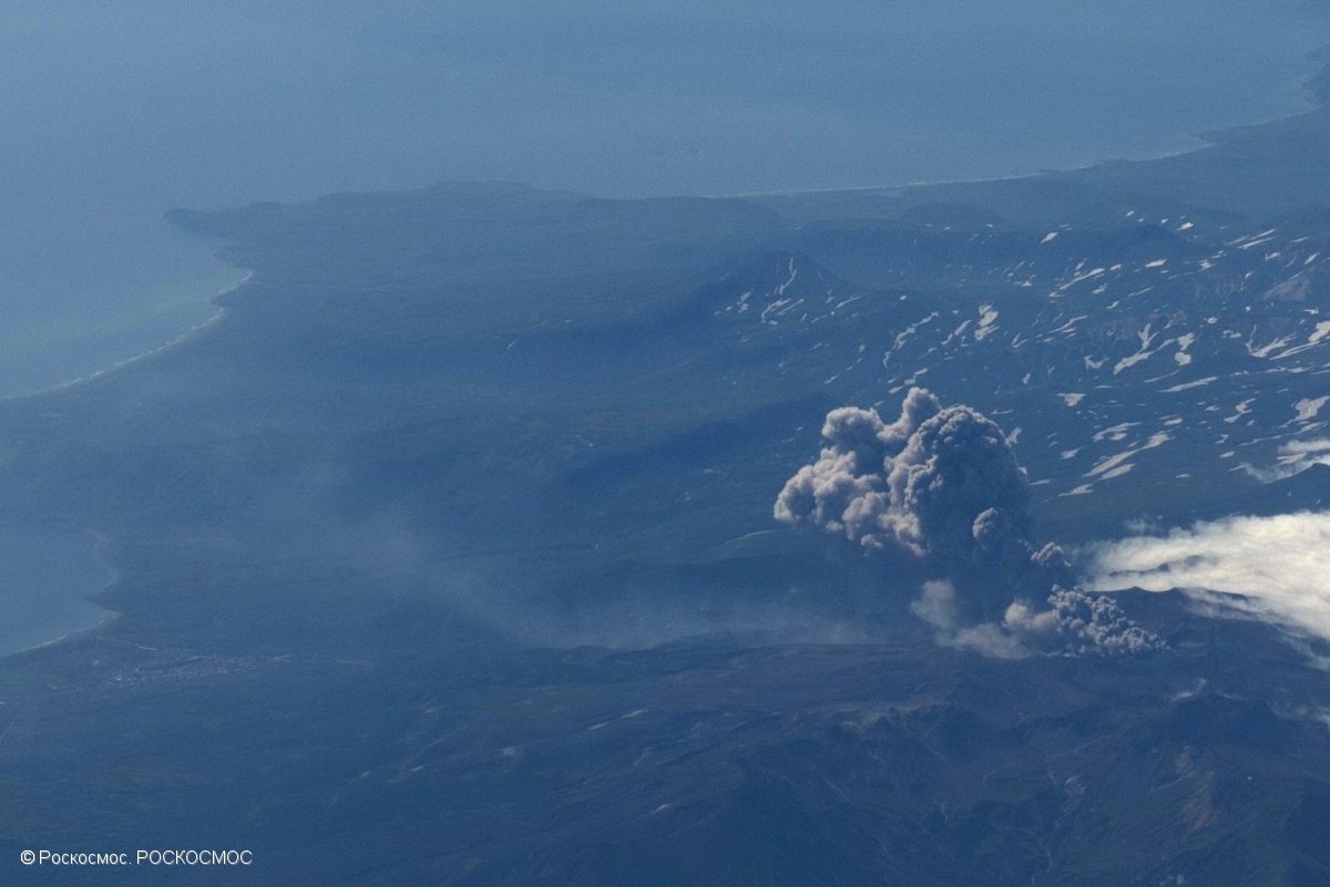
A moderate explosive activity of the volcano continues. According to visual data by volcanologists from Severo-Kurilsk, an explosion sent ash up to 3.7 km a.s.l., an ash cloud is drifting to the north-east of the volcano.
A moderate eruptive activity of the volcano continues. Ash explosions up to 6 km (19,700 ft) a.s.l. could occur at any time. Ongoing activity could affect low-flying aircraft and airport of Severo-Kurilsk.
Volcanic cloud height:
3700 m (12136 ft) AMSL Time and method of ash plume/cloud height determination: 20230123/0449Z – Visual data
Other volcanic cloud information:
Distance of ash plume/cloud of the volcano: 5 km (3 mi)
Direction of drift of ash plume/cloud of the volcano: ENE / azimuth 75 deg
Time and method of ash plume/cloud determination: 20230123/0449Z – Visual data
Source : Kvert.
Photo : Roskosmos
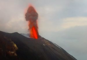
Peru , Sabancaya :
Analysis period: from January 16, 2023 to January 22, 2023, Arequipa, January 23, 2023.
Alert level: ORANGE
The Geophysical Institute of Peru (IGP) reports that the eruptive activity of the Sabancaya volcano remains at moderate levels, that is to say with the recording of an average of 60 daily explosions, with columns of ash and of gas up to 1.6 km altitude above the summit of the volcano and their subsequent dispersion. Therefore, for the following days, no significant change is expected in eruptive activity.
The IGP recorded and analyzed the occurrence of 468 earthquakes of volcanic origin, associated with the circulation of magmatic fluids inside the Sabancaya volcano. An average of 60 explosions was recorded daily, in addition to recording Volcano-Tectonic (VT) type events associated with rock fracturing inside the Sabancaya volcano.

Monitoring the deformation of the volcanic structure using GNSS techniques (processed with fast orbits) does not show any significant anomalies. However, in general, an inflation process was observed in the northern sector (surroundings of the Hualca Hualca volcano). Visual surveillance identified columns of gas and ash up to 1.6 km above the summit of the volcano, which were scattered towards the southwest and west sectors of Sabancaya. Satellite recordings have identified the presence of 6 thermal anomalies, with a maximum value of 5 MW, associated with the presence of a lava body on the surface of the volcano’s crater.
RECOMMENDATIONS
• Keep the volcanic alert level orange.
• Do not approach within a radius of less than 12 km from the crater.
Source : Cenvul
Photo : Ingemmet
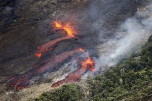
Chile , Villarica :
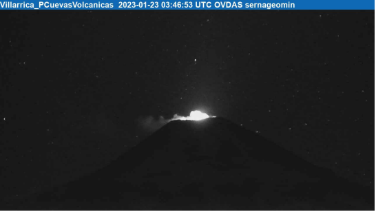
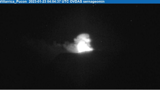
Special Report on Volcanic Activity (REAV), La Araucanía and Los Ríos regions, Villarrica volcano, January 23, 2023, 02:15 a.m. local time (mainland Chile)
The National Geology and Mining Service of Chile (Sernageomin) announces the following PRELIMINARY information, obtained through the monitoring equipment of the National Volcanic Monitoring Network (RNVV), processed and analyzed at the Observatory of Volcanoes of the Southern Andes (Ovdas):
On Monday January 23, 2023, at 00:45 local time (03:45 UTC), monitoring stations installed near the Villarrica volcano recorded Strombolian explosions with a height of incandescent materials of 100 m above the crater, these explosions being related to an earthquake associated with fluid dynamics within the volcanic system. (type LP).
The characteristics of the 1st earthquake, after its analysis, are as follows:
ORIGINAL TIME: 00:45 local time (03:45 UTC)
REDUCED TRAVEL: 70.8 (cm*cm)
ACOUSTIC SIGNAL: 1.7 Pascals (Pa) reduced to 1 km
The characteristics of this activity are as follows:
MAXIMUM HEIGHT OF THE COLUMN: 60 meters above the point of emission
DIRECTION OF DISPERSION: Southeast (SE).
The characteristics of the 2nd earthquake, after its analysis, are as follows:
ORIGINAL TIME: 01:04 local time (04:04 UTC)
REDUCED TRAVEL: 71.4 (cm*cm)
ACOUSTIC SIGNAL: 1.8 Pascals (Pa) reduced to 1 km
The characteristics of this activity are as follows:
MAXIMUM HEIGHT OF THE COLUMN: 100 meters above the point of emission
DIRECTION OF DISPERSION: Southeast (SE).
COMMENTS:
As previously reported, during the morning, Strombolian explosions were recorded at a height of around 100 m above the crater. The observed explosions are characterized by the emission of incandescent materials on the surroundings of the crater. In relation to seismic activity, the parameters recorded on previous days continue.
The volcanic technical alert is maintained at the Yellow level.
Source et photos : Sernageomin.
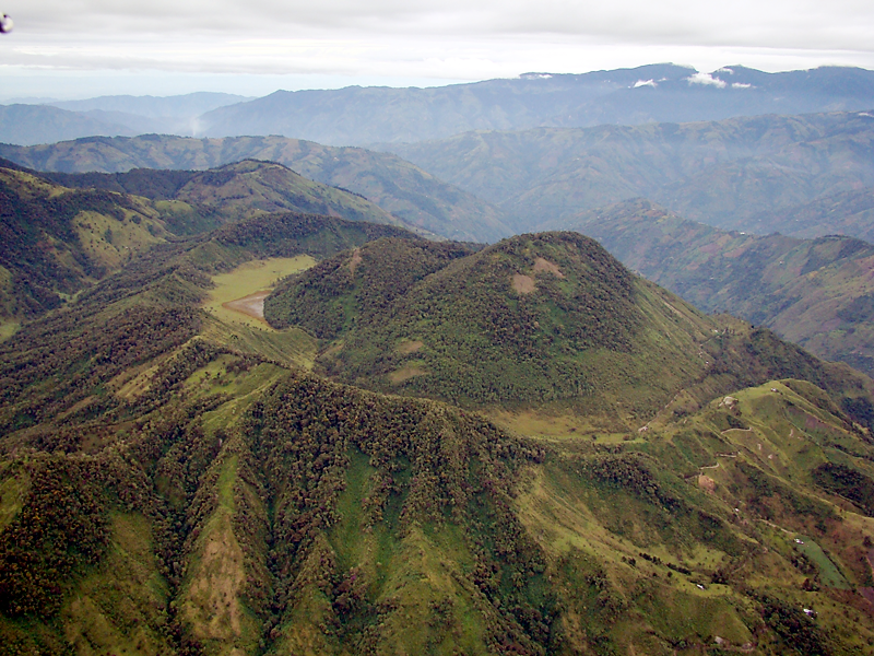
Colombia , Cerro Machin :
Manizales, January 21, 2023 (08:30 local time)
Subject: Cerro Machín volcano activity bulletin. The yellow activity level or (III) is maintained: changes in the behavior of volcanic activity.
Regarding the monitoring of the activity of the Cerro Machín volcano, the COLOMBIAN GEOLOGICAL SERVICE reports that:
On January 21, 2023 from 6:57 a.m., there is an increase in seismic activity associated with the fracturing of the rock in the volcanic edifice. The seismic events of 06:57 and 07:09 (local time) stand out, with magnitudes of 3.2 and 3.0 ML (local magnitude), located 0.3 km west of the main dome, at depths of 4 ,3 and 4.5 km. These events were reported as felt by the inhabitants of the area of influence of the volcano, as well as in the municipality of Cajamarca (Tolima).
It should be noted that increases in seismic activity and felt seismic events, such as those recorded today, are considered in the yellow activity level in which the volcano is currently located. The other monitored parameters show no significant changes.
The COLOMBIAN GEOLOGICAL SERVICE remains attentive to the evolution of the volcanic phenomenon and will continue to report in a timely manner any changes that may occur.
Source et photo : SGC.