September 03 , 2019.
La Réunion , Piton de la Fournaise :
Seismicity:
In August 2019, the OVPF recorded at the level of the Piton de la Fournaise massif in total:
• 1455 superficial volcano-tectonic earthquakes (0 to 2 km deep) beneath the summit craters;
• 8 deep earthquakes (> 2 km deep);
• 341 collapses (in the crater Dolomieu and at the ramparts of Enclos Fouqué).
The volcano-tectonic activity under the Piton de la Fournaise summit in August 2019 was mainly marked by the seismic crisis that preceded the 11-15 August eruption (with 1289 earthquakes recorded on the 11th of August). During this seismic crisis, the earthquakes were located under the Southeast edge of the summit and under the south-southeast flank of the volcano (inside the Enclos Fouqué) at the level of the sector intruded by the deep magma and at the level of the zone where the eruptive fissures opened after approximately 9h20 of seismic crisis.
During the 10 days preceding the eruption, from August 1st to 10th, a progressive increase in seismicity was recorded, going from 2 superficial volcano-tectonic earthquakes on August 2nd to 33 on August 9th.
Deformation:
As was the case after the eruption of June 11-13, 2019, inflation (swelling) of the building resumed directly following the end of the eruption of July 29-30, 2019. So between July 30 and August 10 an elongation of about 2 cm max. of the base of the terminal cone has been recorded. This phase of inflation is linked to a pressurization of the superficial magmatic reservoir located at 1.5-2km depth below the summit, and preceded the eruption of August 11-15.
The injection of the dyke leading to the eruption was accompanied by rapid deformations, decimetry.
Following the end of the eruption of August 11-15, the inflation (swelling) of the building resumed immediately.
Geochemistry of gases:
CO 2 concentration in the soil.
In the far field (Plaine des Cafres and Plaine des Palmistes sectors): a new increase in CO2 concentrations in the soil has been recorded since the beginning of April 2019, reaching intermediate levels, and having preceded the last three eruptions in June, July and August 2019 . Since the eruption of June 11-13, CO2 flows have started to decline.
Composition of summit fumaroles by MultiGas method:
The MultiGas station located at the top is currently out of service.
SO 2 flux in the air in the Enclos Fouqué by DOAS method:
Although the conditions were not optimal (south-facing plume at low altitude, off-grid), the OPVF NOVAC stations located on the edge of the Enclos Fouqué did detect the eruption plume. August 11-15 with relatively low flows, less than 1.1 kiloton / day.
Phenomenology :
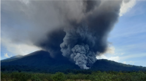
The month of August 2019 was marked by an eruption, from August 11 to 15, located on the South-South-East flank of the building (inside the Enclos Fouqué), and characterized by the opening a complex of two eruptive fissures at 1700 m and an eruptive fissure at 1500 m altitude.
Balance sheet:
The continued inflation of the building registered following the end of the eruption of 29-30 July 2019, the CO2 fluxes in the ground as well as the progressive increase of the seismicity between July 30th and August 10th were the witnessing a deep magma recharge and a pressurization of the superficial magmatic reservoir. This pressurization led to the eruption of August 11-15, 2019, which drained, once again, only very partially this reservoir (about 3 million m3).
Source : OVPF.
Read the article : http://www.ipgp.fr/sites/default/files/ovpf_20190902_bullmensu.pdf
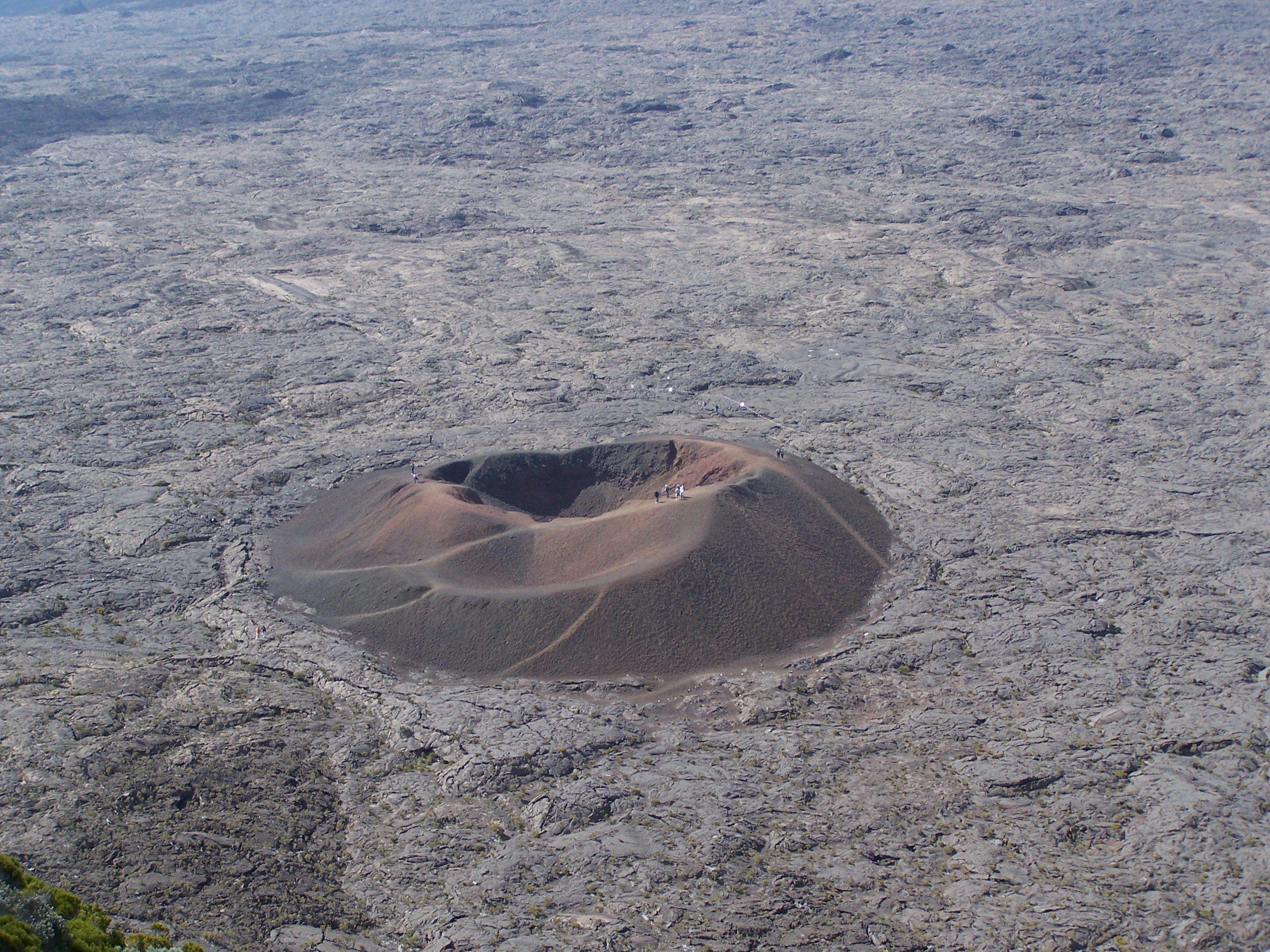
Photos : Tunnels de lave Réunion : Rando-Volcan , G Vitton.
Italy , Stromboli :
SUMMARY OF ACTIVITY
In light of the surveillance data, we highlight:
VOLCANOLOGICAL OBSERVATIONS:
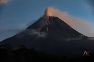
1) Normal explosive activity of Strombolian type accompanied by degassing activities.
2) SISMOLOGY: The seismological parameters do not show any significant changes.
3) DEFORMATIONS: There is no significant change in the permanent GNSS and Inclinometric networks.
4) GEOCHEMISTRY: The flow of SO2 indicates a degassing regime at an average level.
VOLCANOLOGICAL OBSERVATIONS
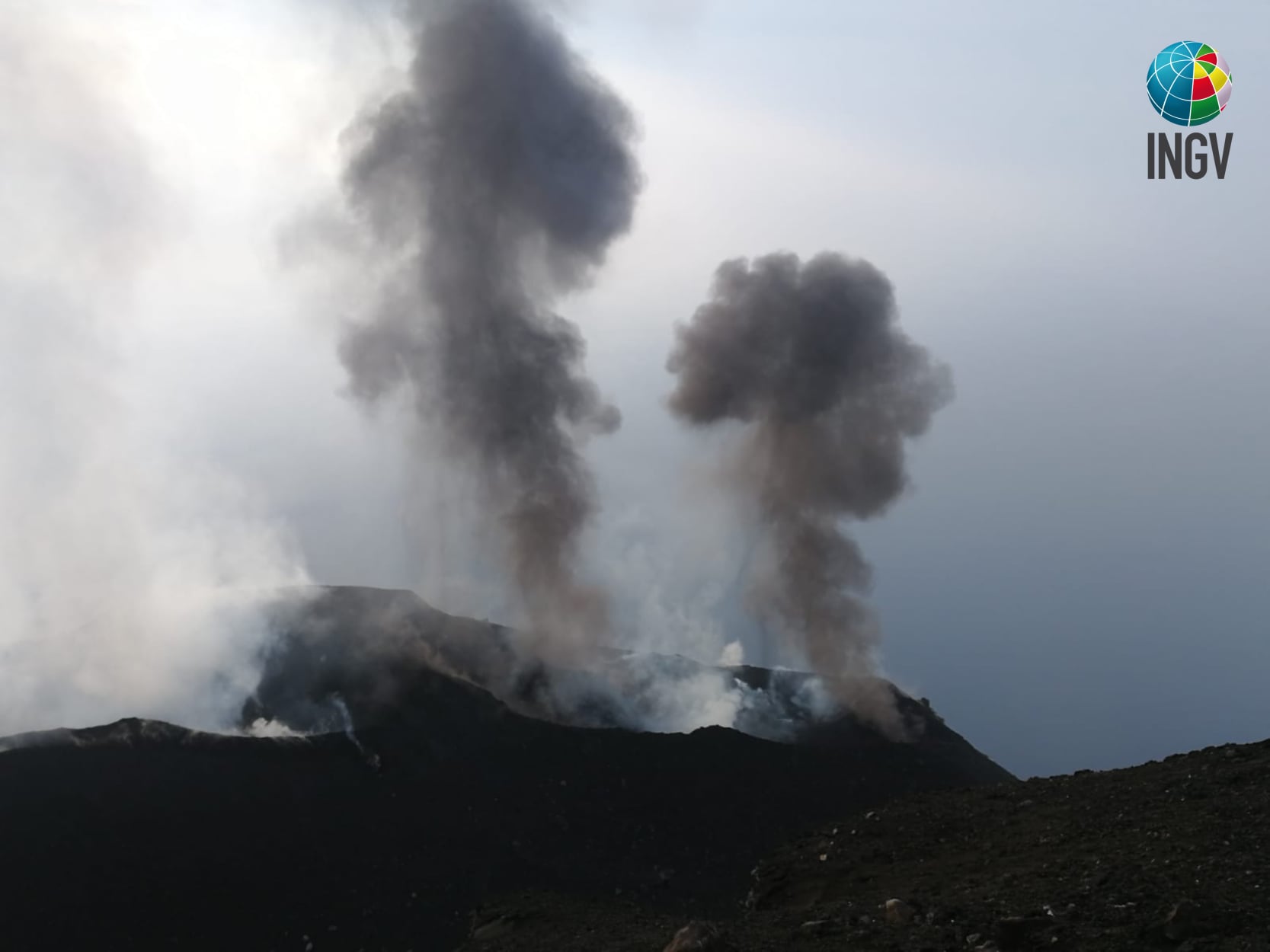
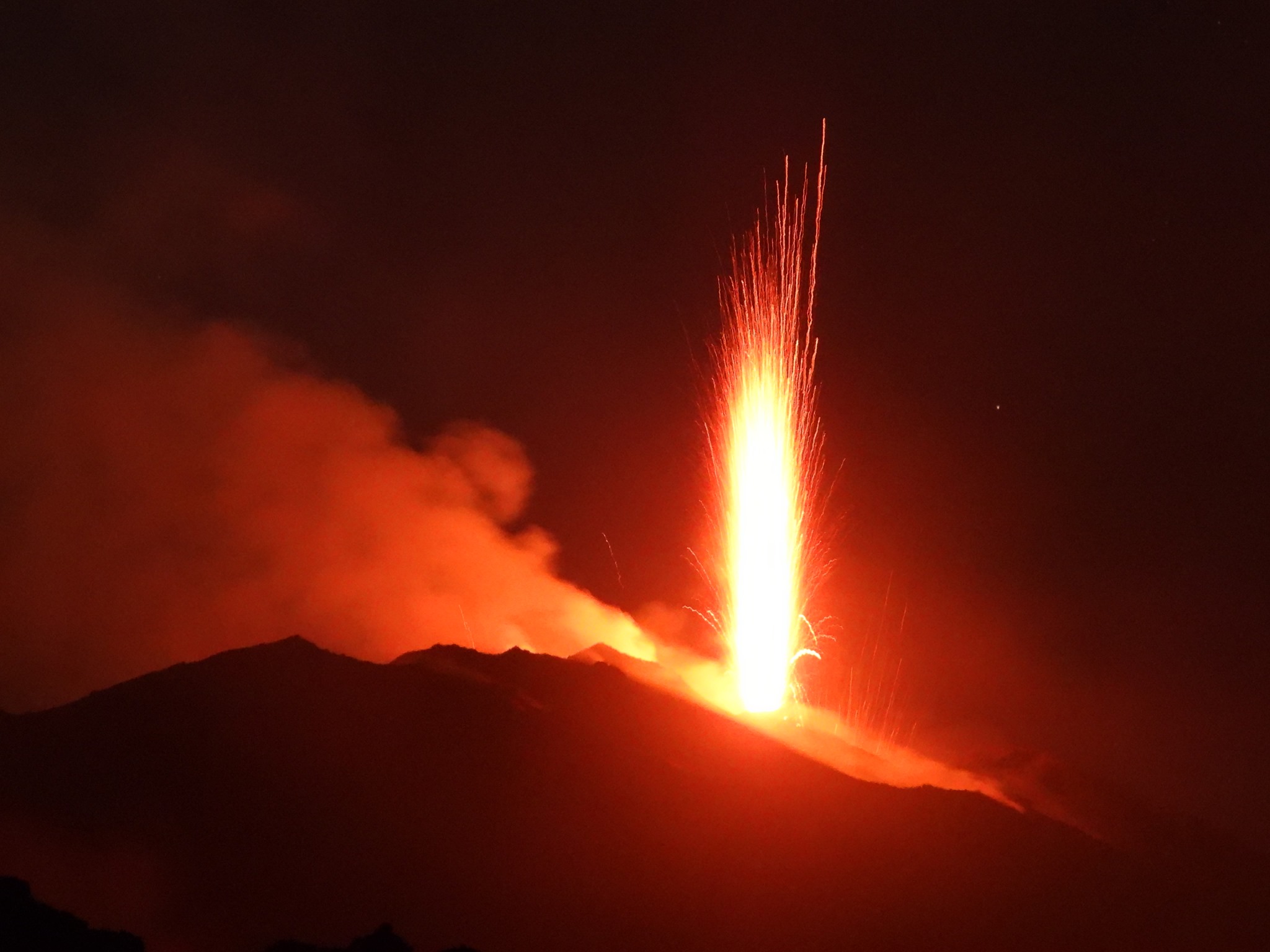
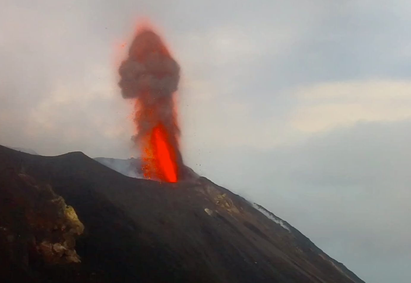
The eruptive activity of Stromboli was characterized by the analysis of thermal and visible images recorded by the cameras located at 400 meters, Punta dei Corvi and at 190 meters of altitude. Data recorded over the past 24 hours indicate that explosive activity has affected the North and Center – South zones of the crater terrace. The average total frequency of occurrence was between 30 and 32 events / h (very high frequency). In the zone, between 7 and 11 events / h of low intensity explosions (less than 80 m high) emitting coarse materials, with sometimes intense splashes in the southern part, were observed in the North zone. In the Center-South region, there was an average blast frequency of 20 to 25 events / h emitting coarse materials mixed with fine ash with heights ranging from low to medium-high (sometimes the products reached 200 m from above).
In conclusion, the observations indicate that the explosive activity was at a medium level compared to the ordinary characteristics of Stromboli.
Seismology
The bulletin is established with data acquired from a maximum of 7 stations. The seismic activity recorded during the last 24 hours has the following characteristics: No seismic signal associated with a landslide has been recorded.
The number of very long duration (VLP) events provides a weekly average of about 30 events / hour. The magnitude of VLP events showed generally low values, with rare events of low to medium amplitude. The magnitude of the earthquakes showed generally low values, with moderately low events starting at 04:00 UTC on 02/09.
Dilatometric data:
Note: Due to connectivity issues, it was not possible to download the dilatometer data, which will be updated as soon as the technical problem is resolved.
Source : INGV Vulcani.
Read the article: file:///C:/Users/Utilisateur/AppData/Local/Packages/Microsoft.MicrosoftEdge_8wekyb3d8bbwe/TempState/Downloads/BollettinoGiornalieroStromboli20190902%20(1).pdf
Photos : INGV , Boris Behncke ( 12 Aout 2019) , Webcam .
Peru , Ubinas :
Period of analysis: August 27 to September 2, 2019, Arequipa, September 2, 2019
Alert level: ORANGE
The Geophysical Institute of Peru (IGP) reports that the Ubinas volcano continues its eruptive process. To date, there is seismic activity associated with rising magma; similarly, ash, gas and water vapor emissions from surveillance cameras continue. In addition, after the analysis of the satellite images, the presence of moderate thermal anomalies in the crater area indicating the proximity of the magma to the surface was detected. According to this scenario, explosive activity and / or ash emissions are expected in the coming days.
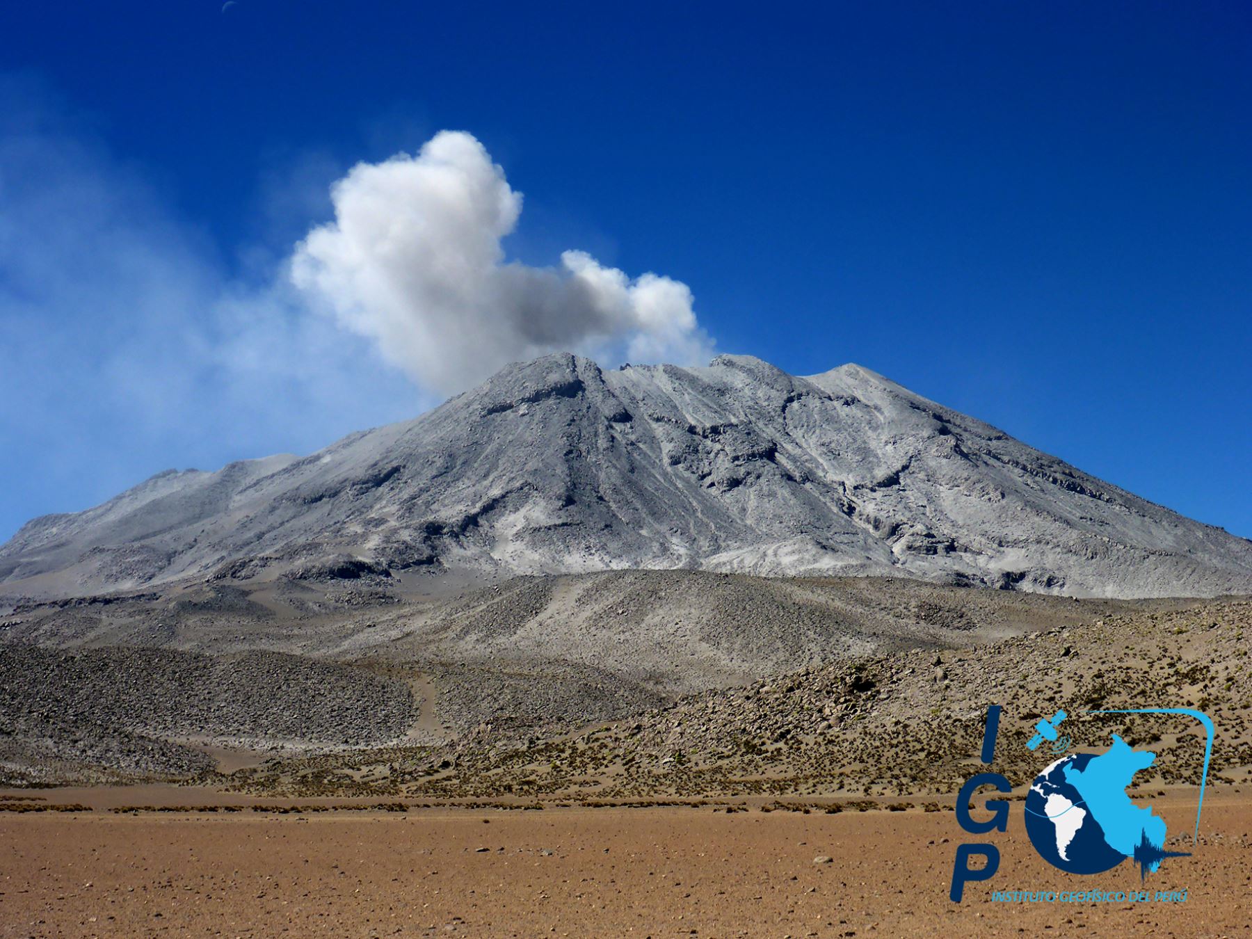
The IGP recorded and analyzed a total of 2828 seismic events associated with the eruptive process of the Ubinas volcano, most of the volcano – volcanic (VT) type, with magnitudes less than M2.3. During this period of analysis, the number of seismic signals in relation to the rise of magma (LP and hybrid types) and rock fracturing processes (VT types) increased slightly, with an average of 118 and 225 events per day, respectively. During this period, no volcanic explosion was recorded.
On September 1 at 21:45, moderate and continuous ash emissions were recorded, corroborated by the appearance of a Tremor-type signal that occurred at the same time. The Ubinas volcano surveillance cameras recorded continuous emissions of gas and water vapor with heights of less than 1,000 meters above the summit of the volcano. Satellite monitoring, using information from the MIROVA system, identified the presence of 3 thermal anomalies up to 3 MW, which would indicate the proximity of the magma to the crater surface.
The monitoring of the deformation of the volcanic structure, using GNSS data (processed with fast orbits), presents no anomalies.
Source : IGP Perou.
Kamchatka , Sheveluch :
PETROPAVLOVSK-KAMCHATSKY – The Sheveluch volcano, located in Russia’s Kamchatka Territory, spewed a column of ash 5.5 kilometers (3.4 miles) above sea level into the sky on Tuesday morning, the Kamchatka Volcanic Eruption Response Team said.
« On Tuesday morning, Sheveluch volcano was registered to spew a column of ash to the altitude of 5,500 meters above the sea level. The ash cloud is stretching 83 kilometers to the southeast of the volcano, » the agency said.
According to the local branch of the Russian Emergencies Ministry, no ash fallout has been registered in nearby settlements.
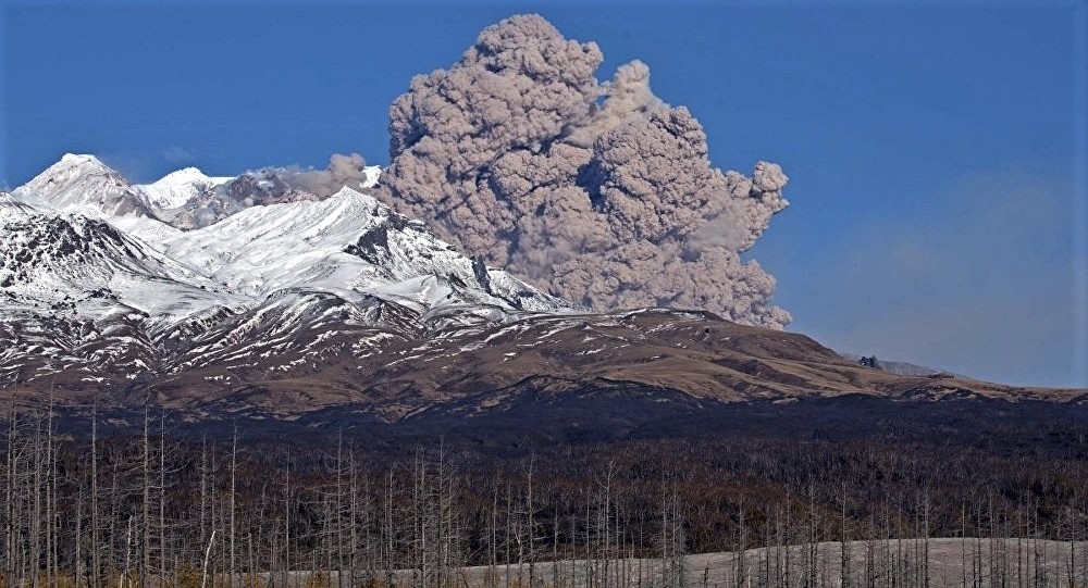
VOLCANO OBSERVATORY NOTICE FOR AVIATION (VONA)
Issued: September 02 , 2019
Volcano: Sheveluch (CAVW #300270)
Current aviation colour code: ORANGE
Previous aviation colour code: orange
Source: KVERT
Notice Number: 2019-129
Volcano Location: N 56 deg 38 min E 161 deg 18 min
Area: Kamchatka, Russia
Summit Elevation: 10768.24 ft (3283 m), the dome elevation ~8200 ft (2500 m)
Volcanic Activity Summary:
A growth of the lava dome continues, a strong fumarolic activity and an incandescence of the dome blocks and hot avalanches accompanies this process. According to satellite data, an ash cloud up to 5.5 km a.s.l. drifted to the south-east from the volcano.
Explosive-extrusive eruption of the volcano continues. Ash explosions up to 32,800-49,200 ft (10-15 km) a.s.l. could occur at any time. Ongoing activity could affect international and low-flying aircraft.
Volcanic cloud height:
16400-18040 ft (5000-5500 m) AMSL Time and method of ash plume/cloud height determination: 20190902/2045Z – NOAA 19 (4m5)
Other volcanic cloud information:
Distance of ash plume/cloud of the volcano: 52 mi (83 km)
Direction of drift of ash plume/cloud of the volcano: ESE / azimuth 110 deg
Time and method of ash plume/cloud determination: 20190902/2045Z – NOAA 19 (4m5)
Start time of explosion and how determined: 20190902/1930Z – Satellite data
Sources : sputniknews.com , Kvert.
Photo : IVS FEB RAS/Y. Demyanchuk.
Guatemala , Santiaguito :
SPECIAL VOLCANOLOGICAL BULLETIN # 63-2019 Guatemala September 2, 2019, 4:00 pm (local time).
LAHAR LOW TO MODERATE IN THE RIVER CABELLO OF ANGEL TRIBUTARY TO THE RIO NIMÁ I
Precipitation over the past few days in the country is currently leading down to the Santiaguito volcano, a lahar in the tributary of the Nimá I river, the Rio Cabello de Ángel.
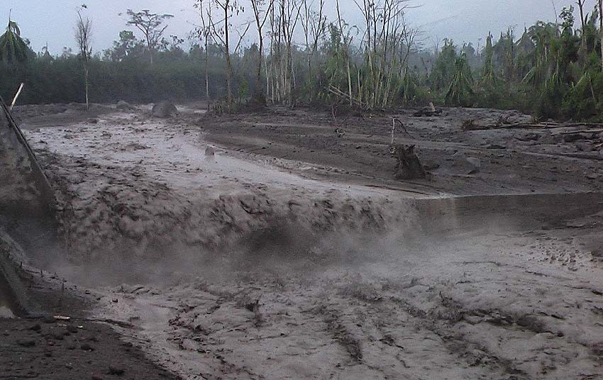
This lahar descends in the form of pulses and carries pasty materials, blocks 1 to 2 meters in diameter, branches and tree trunks. It is 15 meters wide, 2 to 3 meters high and causes erosion around the channel.
The rains that can be generated in the hours that follow around the volcano can cause the descent of lahars in the area, especially in the tributaries of the Samalá River. It is therefore necessary to take precautions with the cars on the Castillo Armas bridge and in the flood areas such as Vuelta del Niño and others.
Source : Insivumeh.
Photo : Caroline Sarrazin , Rés-EAUx .