July 05 , 2022.
Guatemala , Fuego :
SPECIAL VOLCANOLOGICAL BULLETIN
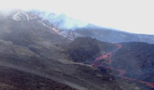
The effusive activity of the Fuego volcano recorded a gradual increase from the night of July 2, generating periods of constant and abundant degassing that last from a few minutes to a few hours. This generated the formation of a new lava flow more than 1000 meters long in the direction of the Ceniza ravine, also generating, according to the recordings of the seismic stations and what is reported by the Fuego Volcano Observatory (OVFGO) , pyroclastic flows that descend into the Ceniza ravine and with a high probability that they also descend into neighboring ravines, such as Trinidad.
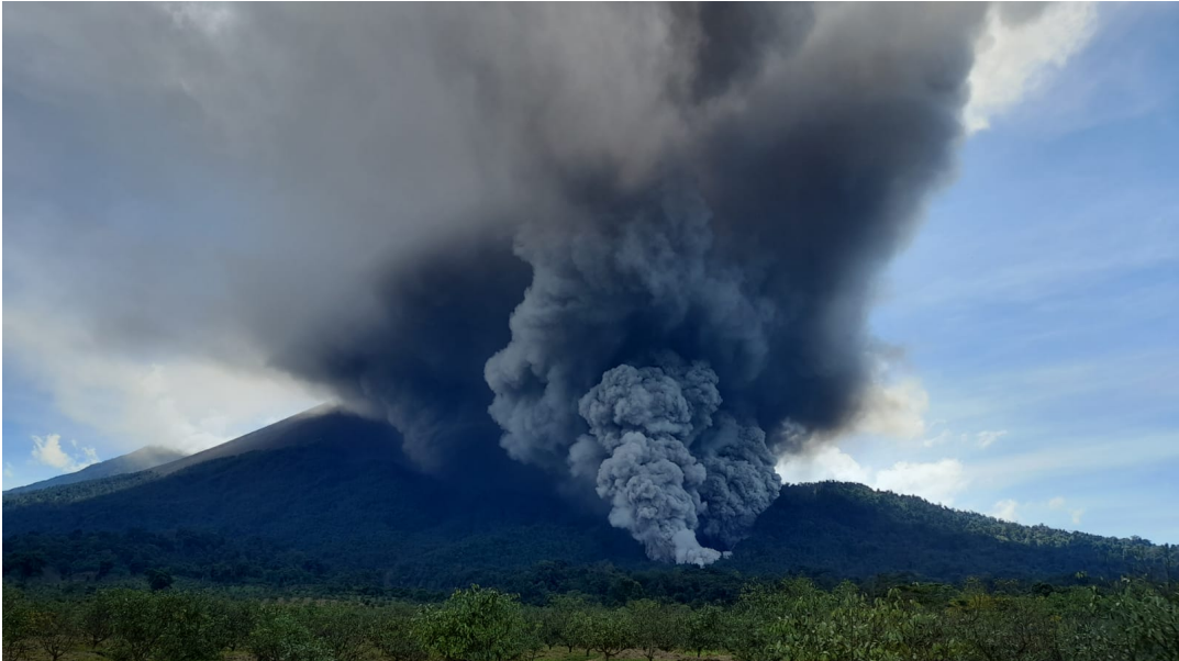
Figure 1: Photograph of a pyroclastic flow descending the Ceniza ravine.
Currently, you can see tall columns of ash coming from the crater and curtains of ash that reach up to 5,000 meters high, formed by the descent of pyroclastic flows that travel about 6 km. Low to moderate train locomotive type noises are heard almost constantly around the volcano. This will continue to cause fine ash to fall in communities near these ravines, such as Panimaché I and II, Morelia, Santa Sofia, Yucales, Palo Verde, El Porvenir, La Rochela, Guadalupe, El Zapote.
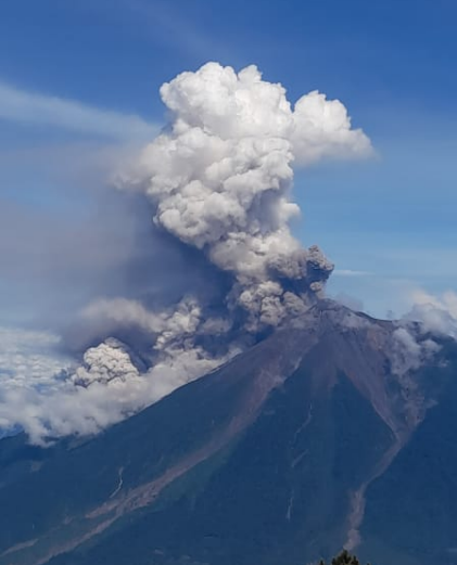
Figure 2: Pyroclastic flows descending the Ceniza ravine, seen from the Agua volcano
This activity can generate new lava flows in more ravines, as well as produce violent ash-laden explosions. It is likely that pyroclastic flows will continue to be generated, which could affect communities near the ravines of Ceniza and Trinidad, such as La Rochela, La Asunción, Guadalupe, Zapote, which is why you should not stay near or in the ravines of the volcano.
INSIVUMEH maintains visual and instrumental monitoring of volcanic activity through seismic stations, volcano spotters and web cameras.
Source : Insivumeh.
Indonesia , Semeru :
VOLCANO OBSERVATORY NOTICE FOR AVIATION – VONA
Issued : July 04 , 2022
Volcano : Semeru (263300)
Current Aviation Colour Code : ORANGE
Previous Aviation Colour Code : orange
Source : Semeru Volcano Observatory
Notice Number : 2022SMR171
Volcano Location : S 08 deg 06 min 29 sec E 112 deg 55 min 12 sec
Area : East java, Indonesia
Summit Elevation : 11763 FT (3676 M)
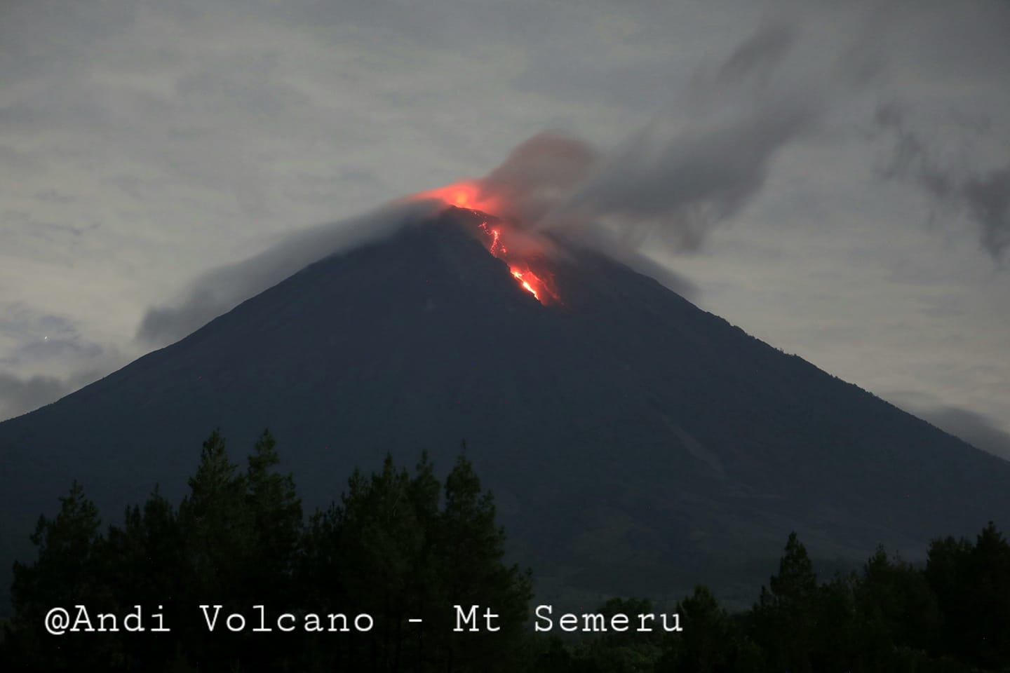
Volcanic Activity Summary :
Eruption with volcanic ash cloud at 22h34 UTC (05h34 local)
Volcanic Cloud Height :
Best estimate of ash-cloud top is around 14963 FT (4676 M) above sea level, may be higher than what can be observed clearly. Source of height data: ground observer.
Other Volcanic Cloud Information :
Ash-cloud moving to north
Source : Magma Indonésie.
Photo : Andi volcanist.
Hawaii , Kilauea :
19°25’16 » N 155°17’13 » W,
Summit Elevation 4091 ft (1247 m)
Current Volcano Alert Level: WATCH
Current Aviation Color Code: ORANGE
Activity Summary:
The summit eruption of Kīlauea volcano, within Halemaʻumaʻu crater, continued over the past 24 hours. All recent lava activity has been confined to the crater, and no indications this is likely to change. No significant changes have been noted at the summit or in either rift zone.
Summit Observations:
Eruption of lava from the Halemaʻumaʻu western vent into the active lava lake continued over the past 24 hours. All activity is confined to the vent and the lava lake. The height of the lave lake lowered very slightly yesterday as the deflationary tilt event bottomed out. Overflight measurements on June 17, 2022, indicated that the crater floor had seen a total rise of about 120 meters (394 feet. Summit tiltmeters measured deflationary tilt that slowed yesterday and appears to have stopped deflating this morning, consistent with the deflation phase of a summit deflation-inflation (DI) event. The summit tilt has dropped approximately 4 microradians and the lava lake level dropped approximately 3-4 meters since the event began on July 1. A sulfur dioxide (SO2) emission rate of approximately 1,100 tonnes per day (t/d) was measured on June 30, 2022.
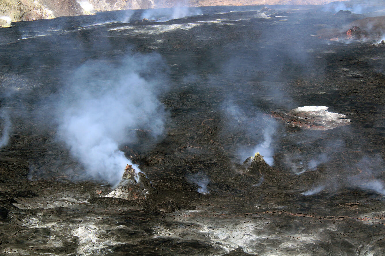
Two hornitos degassing on the surface of Halema‘uma‘u, taken during a Kīlauea summit helicopter overflight on the morning of June 17, 2022. Hornitos are small, rootless cones that are fed by the tube network within the lava lake. These features are several tens of feet tall (less than 30 meters). Hornitos are more prevalent on the eastern side of Halema‘uma‘u, where the tube network beneath the crust controls the movement of lava within the crusted over lake in this sector of the summit area.
Rift Zone Observations:
No unusual activity has been noted along the East Rift Zone or Southwest Rift Zone; steady low rates of ground deformation and seismicity continue along both. Measurements from continuous gas monitoring stations downwind of Puʻuʻōʻō in the middle East Rift Zone remain below detection limits for SO2, indicating that SO2 emissions from Puʻuʻōʻō are negligible.
Source : HVO
Photo : USGS / L. Gallant.
Peru , Sabancaya :
Analysis period: from June 27, 2022 to July 03, 2022, Arequipa, July 04, 2022.
Alert level: ORANGE
The Geophysical Institute of Peru (IGP) reports that the eruptive activity of the Sabancaya volcano remains at moderate levels, that is to say with the recording of an average of 22 daily explosions, with columns of ash and of gas up to 2.2 km altitude above the summit of the volcano and their subsequent dispersion. Therefore, for the following days, no significant change is expected in eruptive activity.
The IGP recorded and analyzed the occurrence of 305 earthquakes of volcanic origin, associated with the circulation of magmatic fluids inside the Sabancaya volcano. An average of 22 explosions was recorded daily, in addition to recording Volcano-Tectonic (VT) type events associated with rock fracturing inside the Sabancaya volcano.

Monitoring the deformation of the volcanic structure using GNSS techniques (processed with fast orbits) does not show any significant anomalies. However, in general, an inflation process was observed in the northern sector (surroundings of the Hualca Hualca volcano). Visual surveillance identified columns of gas and ash up to 2.2 km above the summit of the volcano, which were scattered towards the Southeast, East and South, North and North- West of Sabancaya. Satellite recordings have identified the presence of 10 thermal anomalies, with a maximum value of 41 MW, associated with the presence of a lava body on the surface of the volcano’s crater.
RECOMMENDATIONS
• Keep the volcanic alert level orange.
• Do not approach within a radius of less than 12 km from the crater.
Source : Cenvul
Photo : Zintia Roxana Fernández Licla .
Russia / Kuril Islands , Chikurachki :
VOLCANO OBSERVATORY NOTICE FOR AVIATION (VONA)
Issued: July 05 , 2022
Volcano: Chikurachki (CAVW #290360)
Current aviation colour code: GREEN
Previous aviation colour code: yellow
Source: KVERT
Notice Number: 2022-62
Volcano Location: N 50 deg 19 min E 155 deg 27 min
Area: Northern Kuriles, Russia
Summit Elevation: 1816 m (5956.48 ft)
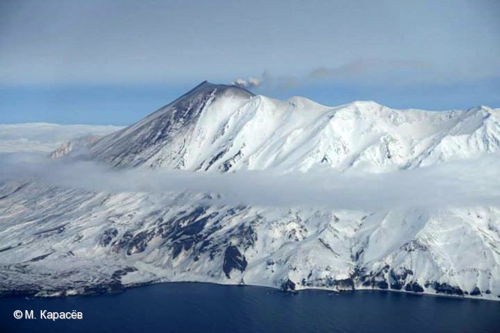
Volcanic Activity Summary:
A gas-steam activity of Chikurachki volcano continues. Satellite data by KVERT shows the explosive eruption on 30 June – 01 July ended. KVERT continues to monitor Chikurachki volcano.
A gas-steam activity of the volcano continues. Ongoing activity could affect low-flying aircraft.
Volcanic cloud height: NO ASH CLOUD PRODUSED
Other volcanic cloud information: NO ASH CLOUD PRODUSED
Source : Kvert.
Photo : M. Karasev ( 2015) .