January 30 , 2021.
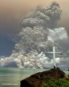
La Martinique , Montagne Pelée :
Weekly report on the activity of Mount Pelée for the period from January 22, 2021 to January 29, 2021.
The seismicity of volcanic origin has slightly decreased during the last week. None of these earthquakes were felt by the population.
Between January 22, 2021 at 4 p.m. UT (local time + 4 hours) and January 29, 2021 at 4 p.m. UTC (local time + 4 hours), the OVSM recorded at least 14 volcano-tectonic earthquakes of magnitude less than or equal to 1 , located at shallow depth within the volcanic edifice, between 1800 m below sea level and 1000 m above sea level. This volcano-tectonic type seismicity associated with high frequency signals is associated with micro-fracturing in the volcanic edifice.
During this reporting period, the OVSM recorded 1 isolated long-period type earthquake. This type of signal containing low frequencies is associated with the migration of fluids in the volcanic edifice.
During phases of volcanic reactivation, it is common for periods of higher seismic activity to alternate with phases of weaker seismicity. The seismicity of volcanic origin remains however clearly above the average base level recorded between January 1, 2015 and April 2019 (date of the start of its increase).
The alert level remains at the yellow level: Vigilance.
Source : Direction de l’OVSM IPG.
Photo : observatoire.
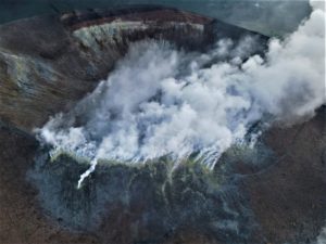
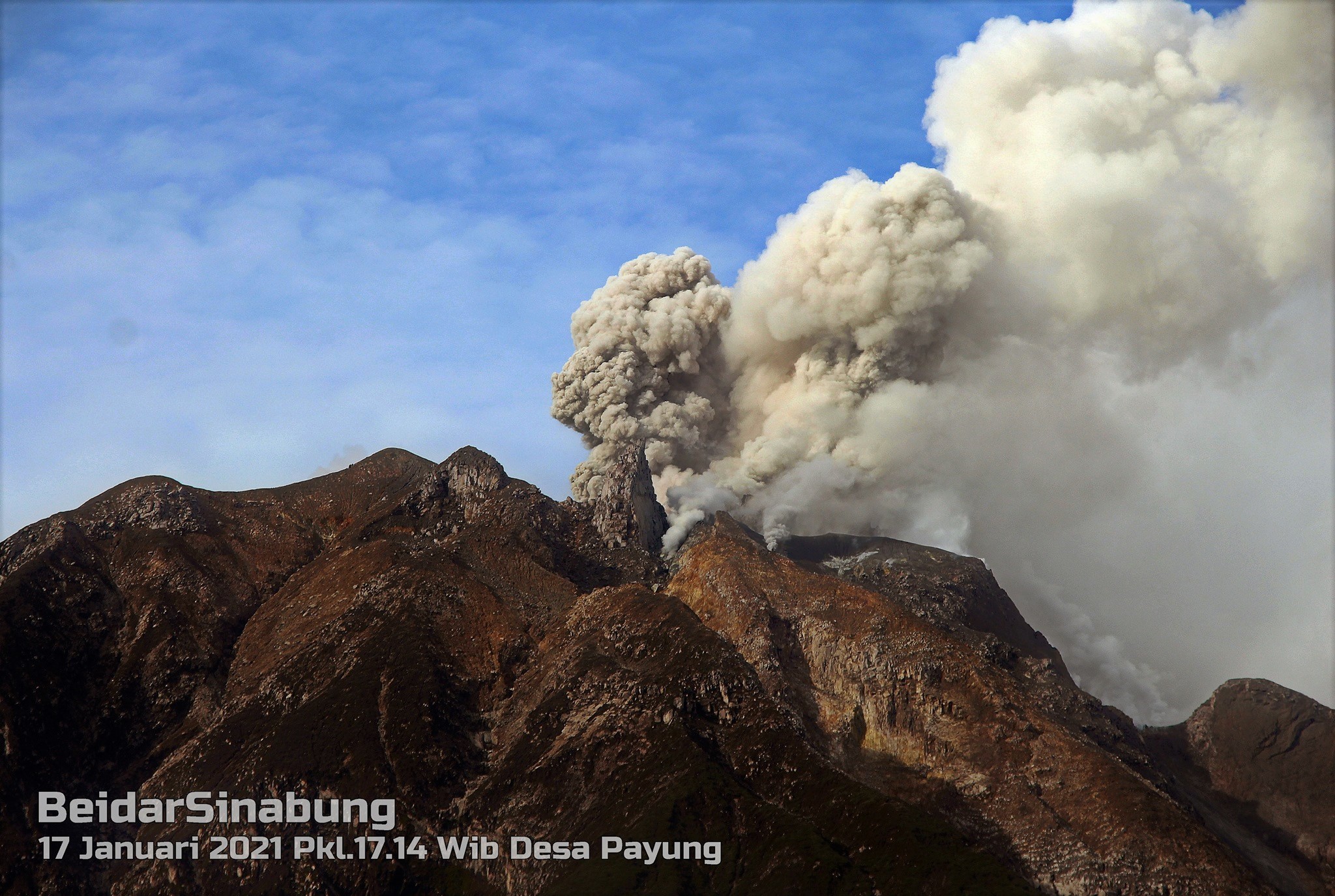
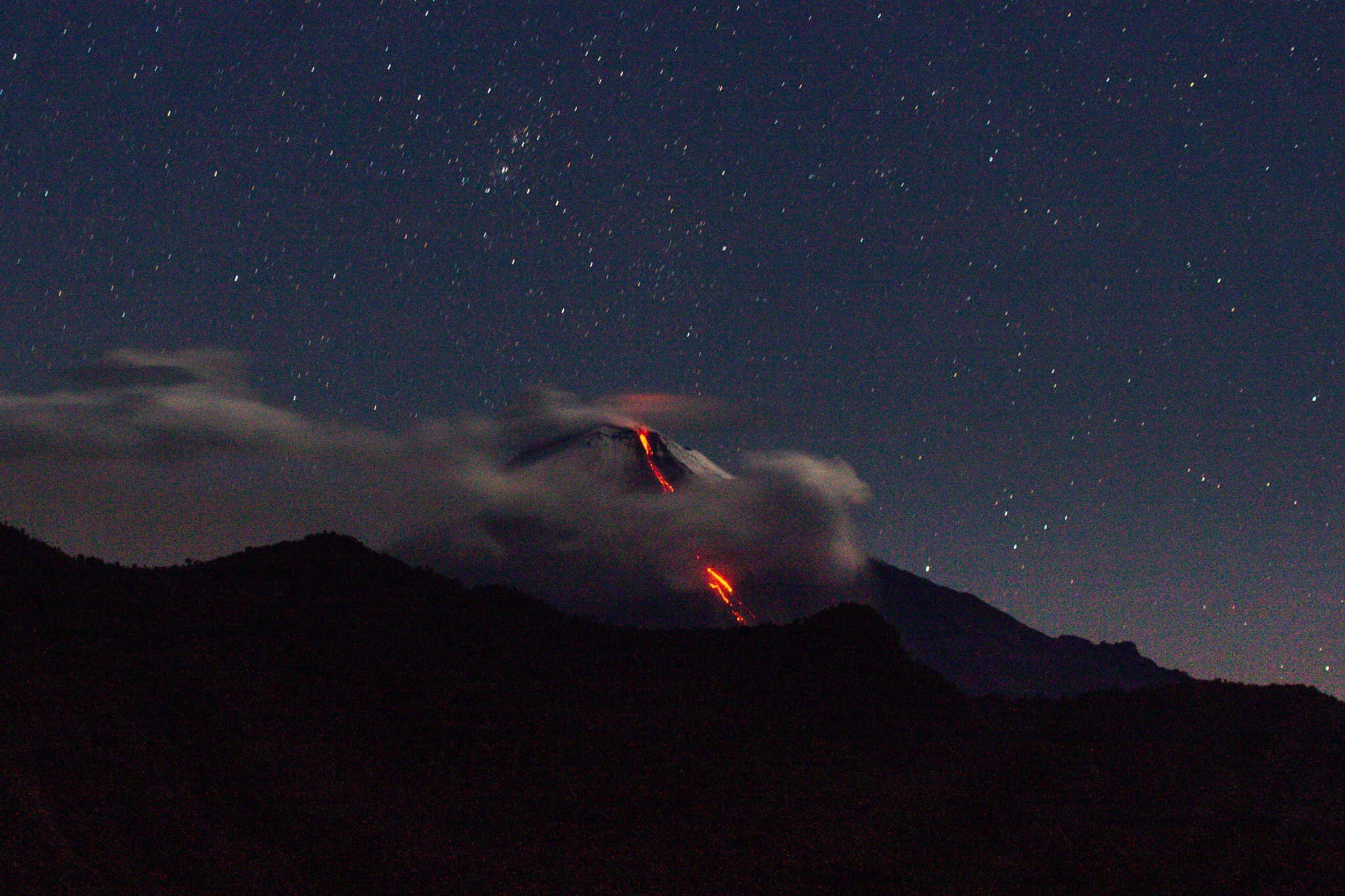
Indonesia , Sinabung :
The activity level has been at level III (SIAGA) since May 20, 2019 at 10:00 a.m. WIB. Mount Sinabung (2460 m above sea level) has been erupting since 2013.
The volcano was clearly visible until it was covered in fog. The crater emits thick, white smoke with a moderate height of around 100 to 500 meters above the summit. The weather is cloudy to rainy, with light to moderate winds in the North, South, South-West, West and North-West.
According to the seismographs of January 29, 2021, it was recorded:
• 1 eruption / explosion earthquake
• 82 avalanche earthquakes
• 15 earthquakes of emissions
• 2 non-harmonic tremor earthquakes
• 11 hybrid / multi-phase earthquakes
• 4 distant tectonic earthquakes.
Recommendation:
• Communities and visitors / tourists should not carry out activities in villages that have been displaced, as well as within a radial radius of 3 km around the summit of Mount Sinabung, as well as within a sector radius of 5 km for the South-East sector and 4 km for the North-East.
• In the event of ash rain, people are advised to wear masks when leaving the house to reduce the health effects of volcanic ash. Secure drinking water facilities and clean the roofs of houses from dense volcanic ash so that it does not collapse.
• People who live near rivers that originate on Mount Sinabung should remain alert to the dangers of lahars.
VONA:
The last VONA message sent had the color code ORANGE, published on January 27, 2021 at 6:24:00 PM WIB. Volcanic ash was observed at an altitude of 2,960 m above sea level or about 500 m above the summit.
Source : PVMBG.
Photo : Beidar Sinabung.
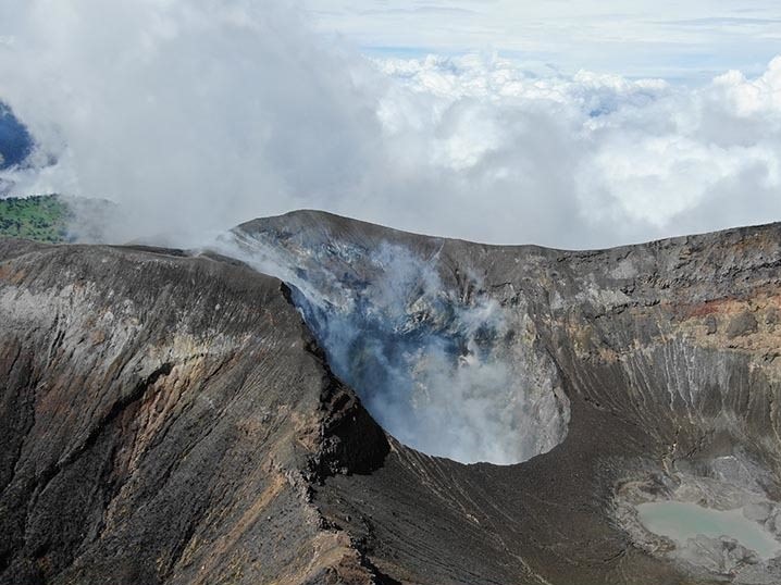
Ecuador , Sangay :
DAILY REPORT OF THE STATE OF SANGAY VOLCANO, Friday January 29, 2021.
Surface activity level: High, Surface trend: Increasing.
Internal activity level: High, Internal trend: Increasing.
Seismicity: From January 28, 2021, 11:00 a.m. to January 29, 2021, 11:00 a.m .:
Long period type events (LP): 40
Explosions (EXP): 30
Emission tremor (TREMI): 4
Rains / lahars:
Rains have been recorded in the area.
** In the event of heavy rains, they could re-mobilize the accumulated materials, generating mudslides and debris that would descend the sides of the volcano and flow into the adjacent rivers. **
Ash Emission / Column: There is no direct observation of the emissions due to the cloudy weather conditions that do not allow it, however, the Washington VAAC has published 3 reports of ash emissions observed through the satellite surveillance, with heights of up to 500 meters above crater level, facing west
Other monitoring parameters: For this report, no thermal alert has been recorded by the satellites during the last 24 hours for the Sangay volcano.
Observations: The climatic conditions of the area prevented direct observations of surface activity. At the end of this bulletin, there was no report of an ash fall. Seismic statistics are incomplete due to transmission issues from 7:30 PM TL yesterday to 4:30 AM TL today.
Alert level: yellow.
Sources : INSTITUT GÉOPHYSIQUE / ÉCOLE NATIONALE DE POLYTECHNIQUE.
Photo : TopMotor Storee
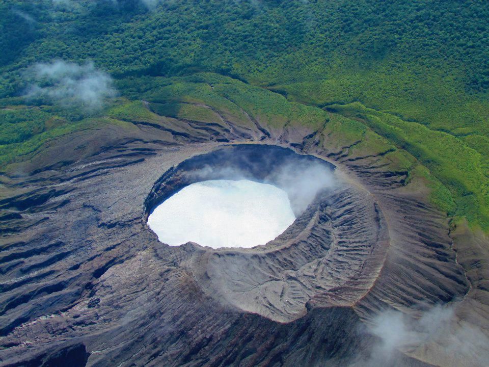
Costa Rica , Turrialba / Poas / Rincon de la Vieja / Irazu :
Turrialba volcano
Lat: 10.025 ° N; Long: 83.767 ° W;
Height: 3340 m.s.n.m.
Current activity level: 2 (active volcano)
Potentially associated hazards: gas, ash emission, proximal ballistic projections.
No ash emission was observed. Between 45 and 65 volcanic earthquakes are recorded daily, but no prolonged tremor is recorded. A subsidence of the volcanic building is still observed. The CO2 / SO2 and H2S / SO2 ratios are approximately 27.1 ± 5.2 and 0.4 ± 0.1 respectively (weekly averages) which are values similar to those of the previous week. No thermal anomaly was detected by the MODIS analysis.
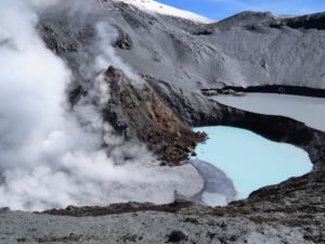
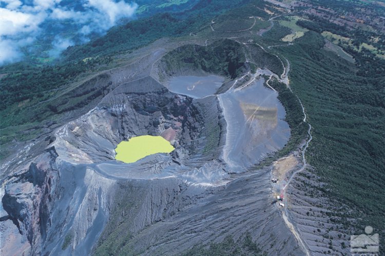
Poas volcano
Lat: 10.2 ° N; Long: 84.233 ° W;
Height: 2780 m.s.n.m.
Current activity level: 2 (active volcano)
Potentially associated hazards: gas, phreatic eruptions, proximal ballistic projections.

The level of the lake is high and stable. No eruption was detected. Volcanic earthquakes are recorded with large fluctuations varying between 10 and 200 per day. There are no volcanic tremors. The GPS equipment did not detect any significant deformation of the volcano. The CO2 / SO2 and H2S / SO2 ratios are respectively 1.4 ± 0.3 and 0.06 ± 0.01 (weekly averages) which are values similar to those of the previous week. No thermal anomaly was detected by MODIS Analysis.
Rincon de la Vieja volcano
Lat: 10.83 ° N; Long: 85.324 ° W;
Height: 1895 m.s.n.m.
Current activity level: 2 (active volcano)
Potentially associated hazards: gas, phreatic eruptions, proximal ballistic projections.
No eruption has been detected since early December. A narrowband tremor is recorded with frequencies between 2 and 6 Hz, with variations in its amplitude. The deformation of the volcano is minimal. The geochemical monitoring parameters of the Santuarium water source are stable. No thermal anomaly was detected by the MODIS analysis.
Irazu volcano
Lat: 9.979 ° N; Long: 83.852 ° W;
Altitude: 3432 m.s.n.m.
Current activity level: 1 (active)
Potentially associated hazards: landslides.
Low magnitude proximal volcano-tectonic earthquakes are recorded north of the active crater. The main landslide in the western sector of the volcano is stable with speeds of between 10 and 20 cm per year in the vertical and horizontal direction. The CO2 concentration on the north flank of the volcano was around 497 ± 8 ppm (weekly average), similar to last week.
Source : Ovsicori .
Photos : G. Avard / Ovsicori , Raul Mora / RSN / UCR , RSN/ Jean Paul Calvo , Parque-Nacional .