October 24 , 2020.
Italy / Sicily , Etna :
COMMUNICATION ON THE ACTIVITY OF ETNA [UPDATE n. 88], October 23, 2020.
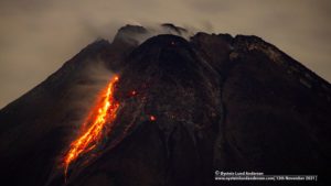
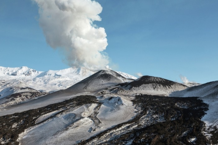
The National Institute of Geophysics and Volcanology, Osservatorio Etneo, announces that the increase in explosive activity at the New Southeast Crater (NSEC), reported in the previous press release (Etna ‘Update n.87 of 06: 41 UTC), is no longer observable as well as the associated ash cloud. However, strombolian activity of varying intensity persists at the New Southeast Crater, which fuels sporadic and light ash emissions that are rapidly dispersed in the summit area. Sporadic and light ash emissions can also be observed from the crater of Bocca Nuova (BN).
The « Bocca della Sella » of the South-East crater. Etna Sud on October 23, 2020
The temporal trend of the mean amplitude of the volcanic tremor and the location of its source, like the infrasound activity, did not show any significant changes compared to the previous press release (Etna press release, update update no.87).
Signals from soil deformation monitoring stations do not show significant changes.
Further updates will be communicated shortly.
Source : INGV.
Photo : Gio Giusa .
Russia / Kuril Islands , Ebeko :
VOLCANO OBSERVATORY NOTICE FOR AVIATION (VONA).
Issued: October 23 , 2020
Volcano: Ebeko (CAVW #290380)
Current aviation colour code: ORANGE
Previous aviation colour code: orange
Source: KVERT
Notice Number: 2020-195
Volcano Location: N 50 deg 41 min E 156 deg 0 min
Area: Northern Kuriles, Russia
Summit Elevation: 3791.68 ft (1156 m)
Volcanic Activity Summary:
A moderate explosive eruption of the volcano continues. According to visual data by volcanologists from Severo-Kurilsk, explosions sent ash up to 2.5 km a.s.l.; ash cloud drift to the north of the volcano.
A moderate eruptive activity of the volcano continues. Ash explosions up to 19,700 ft (6 km) a.s.l. could occur at any time. Ongoing activity could affect low-flying aircraft and airport of Severo-Kurilsk.
Volcanic cloud height:
8200 ft (2500 m) AMSL Time and method of ash plume/cloud height determination: 20201023/0042Z – Visual data
Other volcanic cloud information:
Distance of ash plume/cloud of the volcano: 3 mi (5 km)
Direction of drift of ash plume/cloud of the volcano: N
Time and method of ash plume/cloud determination: 20201023/0042Z – Visual data
Source : Kvert .
Photo : RIA Novosti Alexander Piragis.
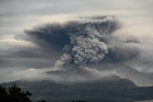
Indonesia , Semeru :
VOLCANO OBSERVATORY NOTICE FOR AVIATION – VONA.
Issued : October 24 , 2020
Volcano : Semeru (263300)
Current Aviation Colour Code : ORANGE
Previous Aviation Colour Code : orange
Source : Semeru Volcano Observatory
Notice Number : 2020SMR107
Volcano Location : S 08 deg 06 min 29 sec E 112 deg 55 min 12 sec
Area : East java, Indonesia
Summit Elevation : 11763 FT (3676 M)
Volcanic Activity Summary :
Eruption with volcanic ash cloud at 00h18 UTC (07h18 local)
Volcanic Cloud Height :
Best estimate of ash-cloud top is around 13363 FT (4176 M) above sea level, may be higher than what can be observed clearly. Source of height data: ground observer.
Other Volcanic Cloud Information :
Ash-cloud moving to southwest
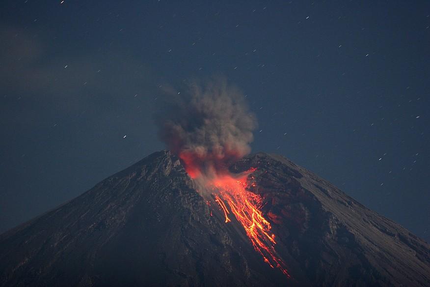
Level of activity at level II (WASPADA). The Semeru (3,676 m above sea level) is continuously erupting. There are explosive and effusive eruptions, leading to lava flows towards the southern and south-eastern slopes, as well as projections of incandescent rocks around the summit crater. The last eruption occurred on October 20, 2020 with an unobserved eruption column height.
The volcano is clearly visible until it is covered in fog. Smoke from the crater was not observed. The weather is sunny to cloudy, with weak winds to the North, North-East, South and South-West. The air temperature is around 24-31 ° C.
According to the seismographs of October 23, 2020, it was recorded:
– 32 eruption earthquakes
– 13 earthquakes of emissions
– 3 harmonic earthquakes
– 4 distant tectonic earthquakes.
Recommendation:
1. The community must not carry out activities within a radius of 1 km and in an area of up to 4 km in the sector of the South-South-East slope of the active crater which is the area of the active opening of the crater of Mount Semeru (Jongring Seloko) as a flow of hot clouds.
2. Be aware of the presence of the lava dome in Jongring Seloko Crater.
Source : Magma Indonésie .
Photo : M. Rietze , wikipedia , licence creative common .
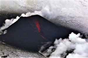
Hawaii , Kilauea :
19°25’16 » N 155°17’13 » W,
Summit Elevation 4091 ft (1247 m)
Current Volcano Alert Level: NORMAL
Current Aviation Color Code: GREEN
KĪLAUEA INFORMATION STATEMENT
ACTIVITY SUMMARY
Kīlauea Volcano is not erupting. A small swarm of shallow seismicity over the past 24 hours has occurred near the Ka’ōiki fault system, northwest of Kīlauea’s summit. Other Kīlauea monitoring data streams remain stable and show no signs of increased activity.
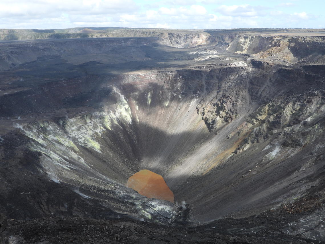
No major changes have been observed recently at Kīlauea’s summit water lake, and the water level continues to slowly rise. Today, the lake was measured to be approximately 46 m (153 ft) deep. USGS photo by M. Patrick.
OBSERVATIONS
On October 22–23, 2020, the US Geological Survey Hawaiian Volcano Observatory (HVO) has recorded over 130 earthquakes beneath the northeastern tip of the Ka’ōiki fault system, about 1 mile (less than 2 km) west of Nāmakanipaio Campground. These earthquakes are occurring in a cluster about 1 mi (2 km) wide and 1–3 mi (2–5 km) below the surface.
The largest event in the sequence was a magnitude-3 earthquake, with the bulk of the events being less than magnitude-2 and not reported widely felt by residents. Reported felt events were described as weak shaking, with a maximum Intensity of III on the Modified Mercalli Intensity Scale.
Clustering of shallow earthquakes in this region does not mean an eruption is imminent. HVO has recorded shallow earthquakes in this area for many decades across several eruptive cycles at both Kīlauea and Mauna Loa. Other monitoring data streams for Kīlauea and Mauna Loa, including ground deformation, gas, and imagery, show no signs of increased activity.
HVO continues to closely monitor geologic changes, seismicity, deformation, and gas emissions at Kīlauea and Mauna Loa volcanoes.
Source : HVO.
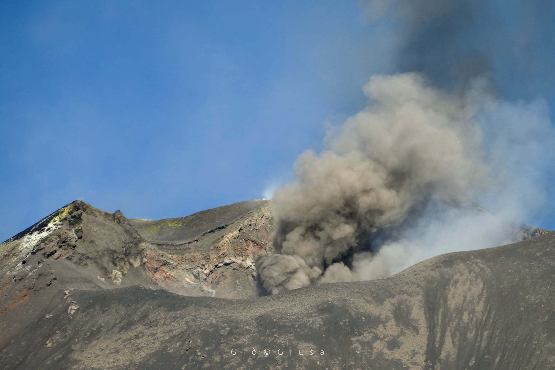
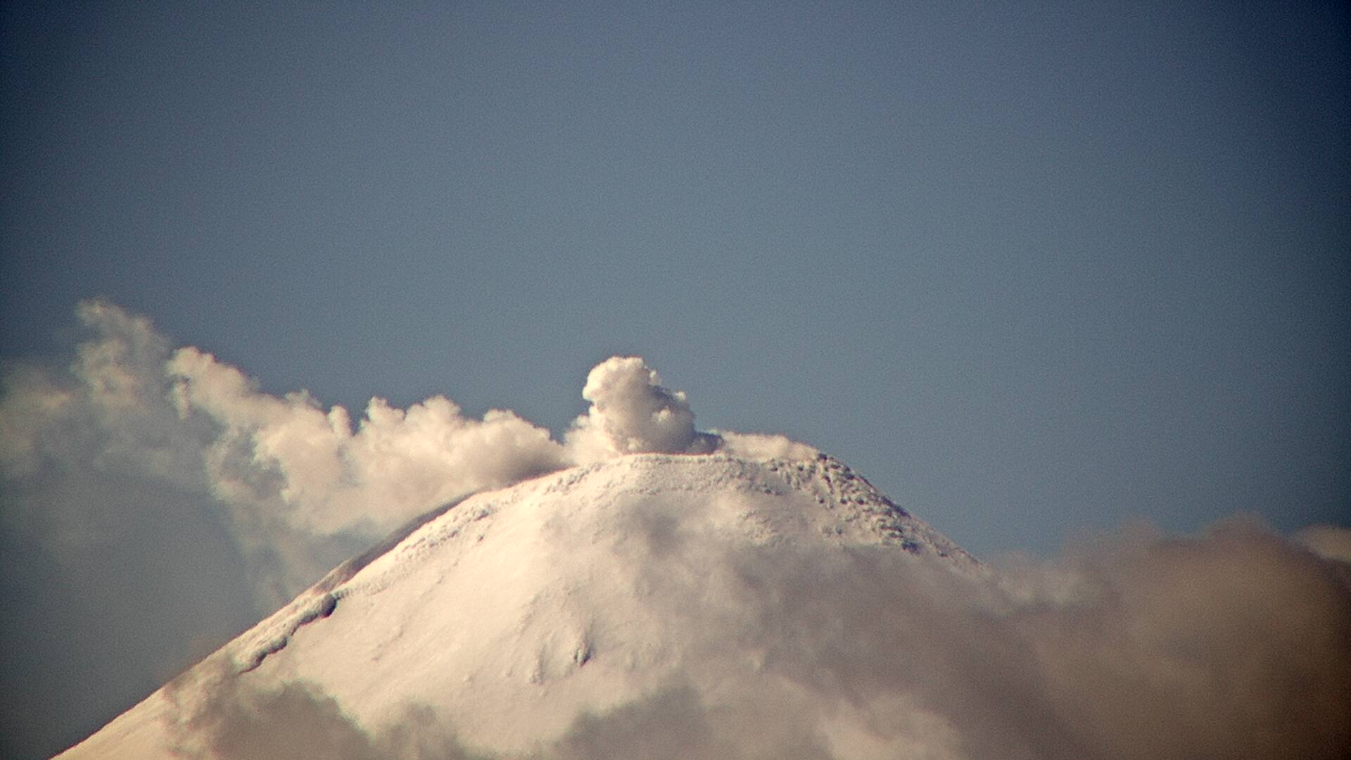
Argentina / Chile , Villarica :
Special Volcanic Activity Report (REAV), La Auracania and Los Rios region, Villarica volcano, October 23, 2020 at 11:20 a.m. local time (Continental Chile).
The National Service of Geology and Mines of Chile (Sernageomin) discloses the following PRELIMINARY information, obtained through the monitoring equipment of the National Volcanic Monitoring Network (RNVV), processed and analyzed at the Volcanological Observatory of the South Andes (OVDAS ):
On Friday, October 23, 2020 at 10:41 a.m. local time (13:41 UTC), the monitoring stations installed near the Villarica volcano recorded a long period (LP) type earthquake, associated with a moderate explosion at the level of the active crater, with reduced displacement values (DR) equal to 4.1 cm2.
The characteristics of the LP earthquake are as follows:
TIME OF ORIGIN: 10:41 a.m. local time (13:41 UTC)
REDUCED DISPLACEMENT: 4, 1 (cm2)
The characteristics of the surface activity are as follows:
MAXIMUM HEIGHT OF THE COLUMN: 180 m
DIRECTION OF DISPERSAL: Est.
The volcanic technical alert is maintained at the YELLOW level.
For the period evaluated, the quantity and energy of events associated with the movement of fluids inside the volcano (LP) showed an increase compared to the previous period. The continuous tremor signal exhibited stable behavior, with a spectral content varying between 0.7 and 1.6 Hz.
When weather conditions permitted, it was possible to detect gaseous emissions up to a height of 450 m, above the level of the crater. Explosive events with the presence of particulate matter were also recorded, the maximum column height recorded for these cases being 900 m, above the crater level.
During the period evaluated, it was possible to observe a nocturnal incandescence.
Two (2) thermal anomalies were recorded with maximum values of 2 MW.
In turn, four (4) thermal alerts associated with the crater were recorded on October 05, 10, 12 and 15, thanks to Sentinel 2-L2A image processing.
Ballistic emissions have been identified with an estimated range of 900 m from the edge of the crater.
Source : Sernageomin , Segemar .
Photo : Segemar .