October 01 , 2020 .
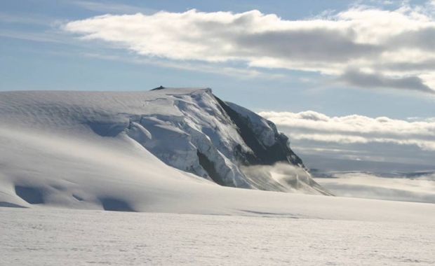
Iceland , Grímsvötn :
The Aviation Color Code for Grímsvötn changed from green to yellow .30.9.2020
The Icelandic Met Office has changed the aviation color code for Grímsvötn volcano from green to yellow. Volcanic activity at Grímsvötn has been gradually increasing over time as indicated by several regularly monitored geophysical and geochemical parameters that are now above the known background level:
The seismicity during the past month has been above average
Geothermal activity has increased over the past months with clear signs of deepening cauldrons in several places around the caldera
The surface deformation has exceeded the level it was at prior to the 2011 eruption
Magmatic gases were measured in the geothermal emissions this summer.
In addition, the water height in the subglacial lake is comparable to the level prior to the floods in 2004 and 2010, increasing the likelihood for a flood in the coming months.
Multiple datasets now indicate that Grímsvötn volcano has reached a level of unrest, comparable to that observed prior to historic eruptions.
For these reasons, the aviation color code has changed from green to yellow. This does not mean that an eruption is imminent. However, an eruption could be triggered by depressurization if the subglacial lake inside the caldera will drain and cause a flood or occur regardless, possibly with very weak precursory activity and short warning time, as seen in the eruption of 2011.
The conditions at the volcano may change at any given time and the volcano may return to normal background conditions without further escalation.
The Civil Protection meets regularly with the Icelandic Meteorological Office and is informed about the situation. So far, there are no reasons to change the alert level of civil protection due to Grímsvötn
Source : Vedur Is .
Photo : ICE-SAR.
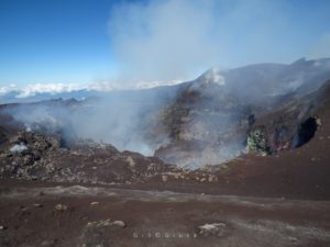
Italy / Sicily , Etna :
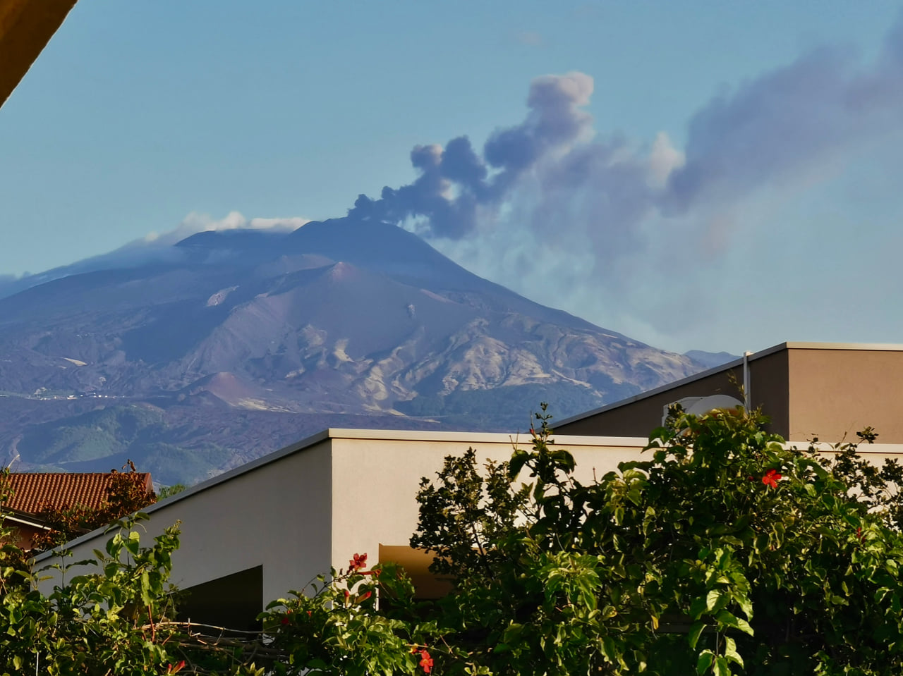
ETNA PRESS RELEASE [UPDATE n. 80], 01 October 2020.
The National Institute of Geophysics and Volcanology, Osservatorio Etneo announces that as of 8:00 GMT there is an increase in explosive activity at the New Southeast Crater.
The explosive activity is of varying intensity and produces an eruptive cloud about 4.5 km above sea level which disperses eastward.
The amplitude of the volcanic tremor, slightly increasing, is still at average levels.
The signals of the GPS network and tilt-meter of the INGV OE network do not show significant variations.
Further updates will be communicated shortly.
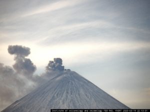
VOLCANO OBSERVATORY NOTICE FOR AVIATION (VONA).
Issued:October 1 , 2020
Volcano: Etna 211060
Current Color Code: RED
Previous Color Code: orange
Source: Etna Volcano Observatory
Notice Number: 2020/0060/06E20
Volcano Location: 3744N 01500E
Area: Italy
Summit Elevation: 3300 m
Volcanic Activity Summary:
EXPLOSIVE ACTIVITY IS INCREASED AT NEW SE
CRATER (NSEC) SUMMIT VENT – SIGNIFICANT ASH
EMISSION OCCURS
Volcanic cloud height: ABOUT 4.5 KM A.S.L
Other volcanic cloud information: DARK CLOUD GROWING ABOVE VOLCANO SUMMIT
Remarks: THE PHENOMENON IS OBSERVED BY
VIDEOSURVEILLANCE CAMERAS
Source : INGV
Photo : Jackie Zwahlen.
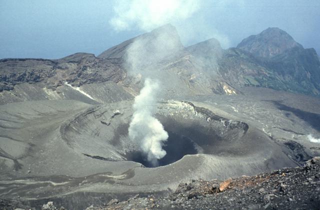
Japan , Suwanosejima :
29.638°N, 129.714°E
Elevation 796 m
JMA reported nighttime incandescence at Suwanosejima’s Ontake Crater during 18-25 September. An explosion at 0923 on 25 September generated a gray-white ash plume that rose 600 m above the crater rim and disappeared into weather clouds. Ashfall was reported in Toshima village, 4 km SSW. The Alert Level remained at 2 (on a 5-level scale).
The 8-km-long, spindle-shaped island of Suwanosejima in the northern Ryukyu Islands consists of an andesitic stratovolcano with two historically active summit craters. The summit is truncated by a large breached crater extending to the sea on the east flank that was formed by edifice collapse. Suwanosejima, one of Japan’s most frequently active volcanoes, was in a state of intermittent strombolian activity from Otake, the NE summit crater, that began in 1949 and lasted until 1996, after which periods of inactivity lengthened. The largest historical eruption took place in 1813-14, when thick scoria deposits blanketed residential areas, and the SW crater produced two lava flows that reached the western coast. At the end of the eruption the summit of Otake collapsed forming a large debris avalanche and creating the horseshoe-shaped Sakuchi caldera, which extends to the eastern coast. The island remained uninhabited for about 70 years after the 1813-1814 eruption. Lava flows reached the eastern coast of the island in 1884. Only about 50 people live on the island.
Source: Japan Meteorological Agency (JMA). , GVP.
Photo : Yukio Hayakawa, 1998 (Gunma University).
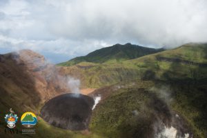
Chile / Argentina , Laguna del Maule :
36.058°S, 70.492°W
Elevation 2162 m
SERNAGEOMIN reported that during 1-15 September inflation continued to be detected at the Laguna del Maule Volcanic Complex, although at a lower rate of 0.7 cm per month which is below the 2 cm per month average for this year. Seismicity in the S sector was low in both number and magnitude of events. The Alert Level remained at Yellow, the second lowest color on a four-color scale, as activity remained above baselines. ONEMI recommended restricted access within a radius of 2 km from the emission center.

The 15 x 25 km wide Laguna del Maule caldera contains a cluster of small stratovolcanoes, lava domes, and pyroclastic cones of Pleistocene-to-Holocene age. The caldera lies mostly on the Chilean side of the border, but partially extends into Argentina. Fourteen Pleistocene basaltic lava flows were erupted down the upper part of the Maule river valley. A cluster of Pleistocene cinder cones was constructed on the NW side of the Maule lake, which occupies part of the northern portion of the caldera. The latest activity produced an explosion crater on the E side of the lake and a series of Holocene rhyolitic lava domes and blocky lava flows that surround it.
Sources: Servicio Nacional de Geología y Minería (SERNAGEOMIN), Oficina Nacional de Emergencia-Ministerio del Interior (ONEMI)
Photo : Dr Katie Keranen.
La Réunion , Piton de la Fournaise :
After a decrease in the number of earthquakes, the seismic crisis (in the strict sense of the term), which began on September 28, 2020 at 12:04 p.m. local time, ended around 12:00 p.m. local time on September 30. On the other hand, the seismicity still persists with on average over the last hours, 4 earthquakes or landslides / hour. Given the sharp decrease in the number of earthquakes, the term « seismic crisis » is therefore no longer applicable at the present time.
Between September 28 and September 30 (12 p.m. local time), around 2300 earthquakes (1551 superficial summit volcano-tectonic earthquakes, 472 deep volcano-tectonic earthquakes, 48 long periods, and 217 earthquakes classified as « undetermined » because of low magnitudes) and 543 landslides / superficial collapses were recorded by the OVPF. This seismicity was located under the summit and under the eastern flank of the volcano (between 1.6 and 5.2 km deep).
Source : Clicanoo .
Photo : Nath Duverlie