June 06 , 2020.
Alaska , Cleveland :
52°49’20 » N 169°56’42 » W,
Summit Elevation 5676 ft (1730 m)
Current Volcano Alert Level: WATCH
Current Aviation Color Code: ORANGE
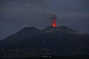
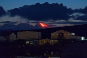
Activity renewed at Cleveland Volcano this week. Regional infrasound sensors recorded an explosion Monday night at about 06:32 UTC June 2 (10:32 PM AKDT June 1). A small ash cloud was observed at 22,000 ft asl drifting to the south. The eruption blew out the January 2019 dome and a large amount of material from summit crater. Volcanic debris flows also extended ~2.9 km (1.8 miles) down the eastern flank of the volcano and more than 2.7 km (1.7 miles) down the northern flank. Since the explosion, cloudy to partly cloudy satellite views have showed no significant volcanic activity, with no elevated surface temperatures and only a small steam plume. No activity has been detected on regional geophysical networks. Due to this increase in activity, the Alaska Volcano Observatory raised the Aviation Color Code for Cleveland Volcano to ORANGE and the Volcano Alert Level to WATCH on Monday, June 1.
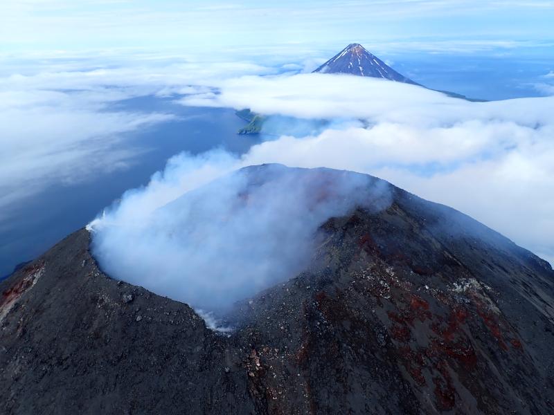
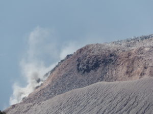
Summit of Cleveland Volcano, in the Islands of Four Mountains group of the Aleutian chain. Mild degassing from the summit vent obscures the crater and the plume drifts lazily off to the NNW. Carlile Island volcano lies in the background.
Local seismic, infrasound, and web camera data have been unavailable due to an equipment failure in a remote facility. Nonetheless, monitoring of Cleveland continues with regional seismic and infrasound stations on nearby islands. These, along with lightning and satellite data, should allow AVO to detect future ash-producing eruptions.
Additional episodes of lava effusion and explosions could occur without advance warning. Explosions that have occurred over the last few years are normally short duration and only present a hazard to aviation in the immediate vicinity of the volcano. Larger explosions that present a more widespread hazard to aviation are possible, but less likely and/or frequent.
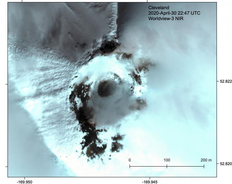
Cleveland volcano forms the western portion of Chuginadak Island, a remote and uninhabited island in the east central Aleutians. The volcano is located about 75 km (45 mi) west of the community of Nikolski, and 1500 km (940 mi) southwest of Anchorage. The most recent significant period of eruption began in February, 2001 and produced 3 explosive events that generated ash clouds as high as 39,000 ft above sea level. The 2001 eruption also produced a lava flow and hot avalanche that reached the sea. Since then, Cleveland has been intermittently active producing small lava flows, often followed by explosions that generate small ash clouds generally below 20,000 ft above sea level. These explosions also launch debris onto the slopes of the cone producing hot pyroclastic avalanches and lahars that sometimes reach the coastline.
Source : AVO.
Photos : Kaufman, Max , Loewen, Matt .
Indonesia , Merapi :
Activity report of the Merapi volcano, from May 29 to June 4, 2020
OBSERVATION RESULTS
Visual
The weather around Mount Merapi is generally sunny in the morning and at night, while the day until evening is foggy. There is a white smoke, from thin to thick with low pressure. A maximum smoke height of 400 m was observed from the Mount Merapi observation post in Kaliurang on May 29, 2020 at 9:00 a.m.
Morphological analysis of the crater area based on photos of the Southeast sector showed no change in the morphology of the dome. The volume of the lava dome based on measurements using aerial photos with drones on February 19, 2020 was 291,000 m3.
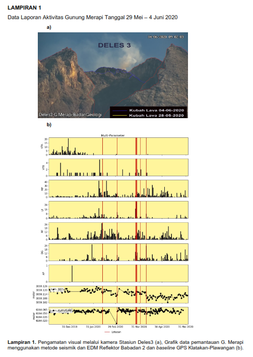
Seismicity:
During this week, the seismic recordings of Mount Merapi showed:
37 emission earthquakes (DG),
28 multiple phase earthquakes (MP),
8 low frequency earthquakes (LF),
4 avalanche earthquakes (RF),
12 tectonic earthquakes (TT).
The intensity of the seismicity this week is higher than last week.
Deformation:
Deformation information from G. Merapi monitored by EDM and GPS this week did not show significant changes.
Rain and lahars:
This week, there was rain at the Mount Merapi observation post with the highest rain intensity of 33 mm / hour for 240 minutes at the Babadan post on May 31, 2020. There were no lahars no additional flow in the rivers that descend from Mount Merapi.
Conclusion:
Based on the results of the visual and instrumental observations, it was concluded that:
1. The lava dome is currently in a stable state.
2. The volcanic activity of Mount Merapi is still quite high and is determined by the level of activity « WASPADA ».
Source : BPPTKG.
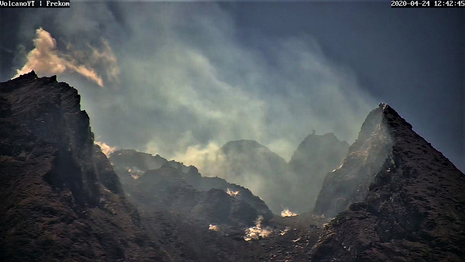
Photos : BPPTKG , Frekom .
Hawaii , Mauna Loa :
19°28’30 » N 155°36’29 » W,
Summit Elevation 13681 ft (4170 m)
Current Volcano Alert Level: ADVISORY
Current Aviation Color Code: YELLOW
Activity Summary:
Mauna Loa Volcano is not erupting. Rates of deformation and seismicity have not changed significantly over the past week and remain above long-term background levels.
Observations:
During the past week, HVO seismometers recorded 65 small-magnitude earthquakes on the volcano’s summit and upper-elevation flanks. Most of these earthquakes occurred at shallow depths of less than 8 kilometers (~5 miles) below sea level. The largest earthquake was a magnitude 3.2 (M3.2) event that occurred below the volcano’s Southwest Rift Zone on June 2.
Global Positioning System (GPS) measurements show long-term slowly increasing summit inflation, consistent with magma supply to the volcano’s shallow storage system.
Gas concentrations and fumarole temperatures at both the summit and the Sulphur Cone on the Southwest Rift Zone remain stable.
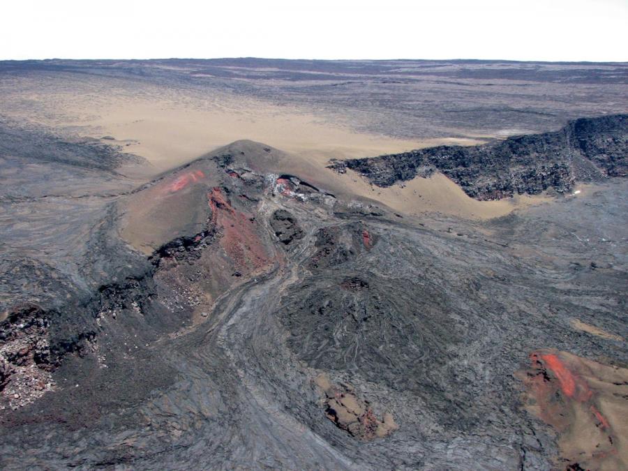
Source et photo : HVO.
El Salvador , Santa Ana (Ilamatepec) :
Location: shared by the departments of Santa Ana and Sonsonate
Altitude: 2381 meters above sea level
Type of volcano: Stratovolcan
Type of activity: Vulcanienne- Strombolienne
Last eruption: October 1, 2005.
The seismic vibration of the volcano was maintained between 18 and 21 RSAM units, on average per day, this being a normal range. As for sulfur dioxide (SO2) emissions, measured with DOAS equipment, they fluctuated between 160 and 284 tonnes per day, with an average of 212 tonnes per day, the threshold being 300 tonnes per day.
Park wardens monitoring the area did not report any plumes of gas emerging from the crater. Despite the above parameters, the activity of the volcano remains at its normal level, like all active volcanoes.
Source : MARN.
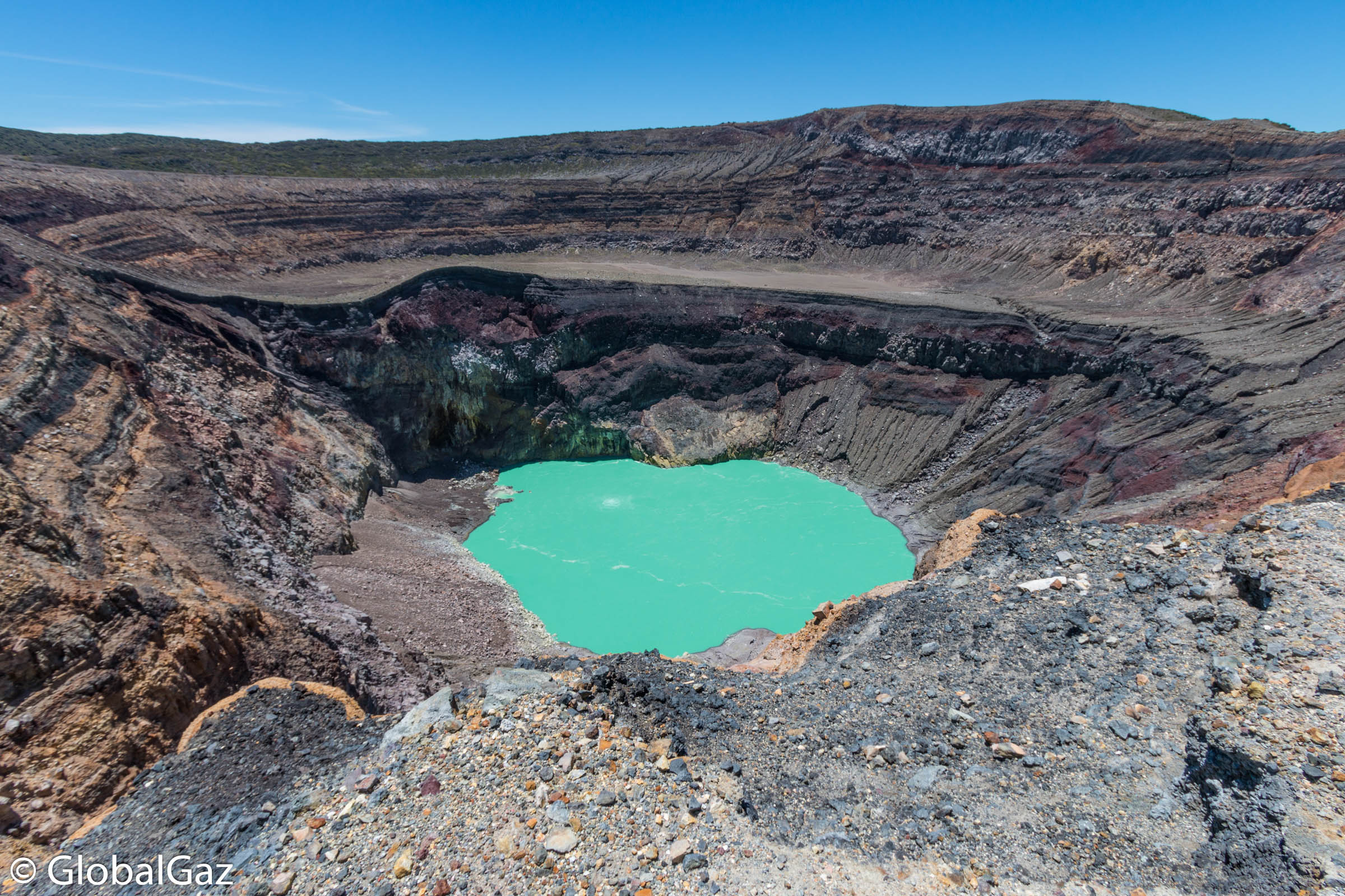
Photo : globalgaz
Mexico , Popocatepetl :
June 05, 11:00 a.m. (June 05, 4:00 p.m. GMT)
In the past 24 hours, the Popocatépetl volcano monitoring system has identified 344 exhalations accompanied by water vapor, volcanic gases and small amounts of ash. The ash emissions were dispersed in the South, South-West (S-SO) sector. Two moderate explosions were also detected yesterday at 11:00 p.m. and 11:02 p.m. (Local). In addition, 453 minutes of tremors were recorded.
During the night, continuous emissions of water vapor, gas and small amounts of ash were observed.
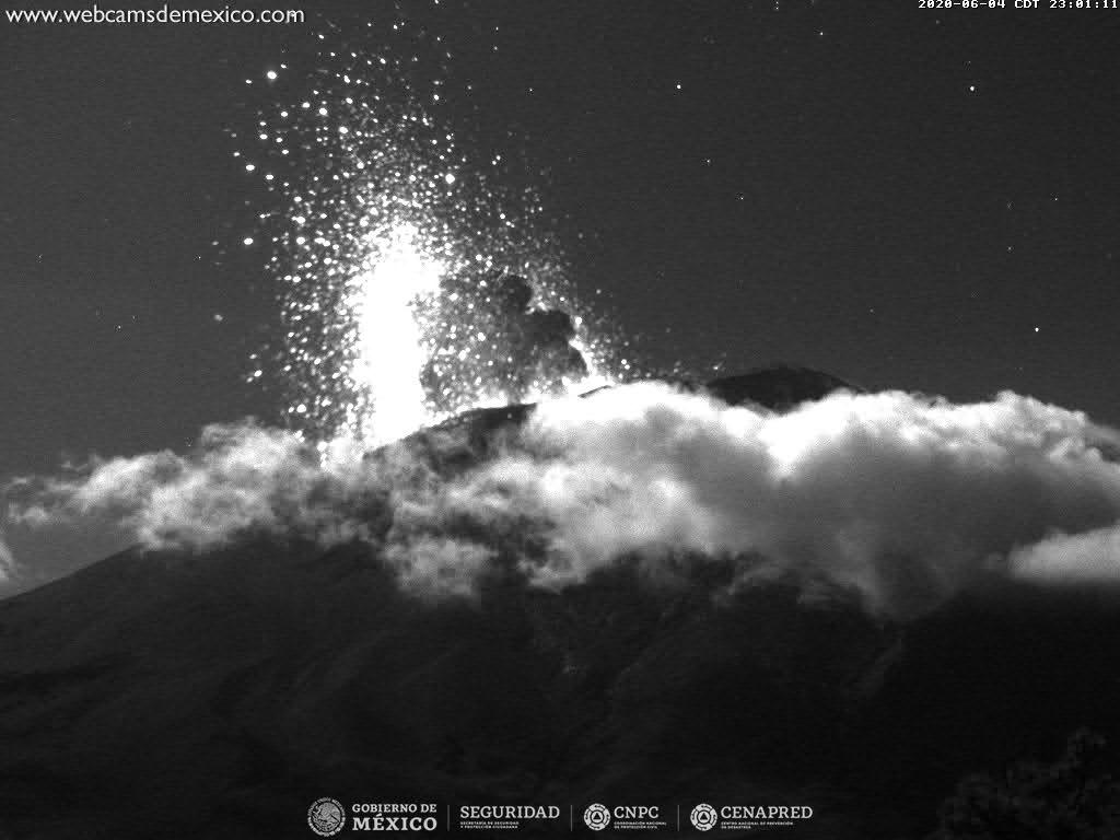
At the time of this report, there is visibility. During the morning, there were volcanic gas emissions and small amounts of ash dispersed in the Southwest (SW).
CENAPRED urges not to get near the volcano and especially the crater, because of the danger involved in the fall of ballistic fragments and, in the event of heavy rain, to move away from the bottom of the ravines because of the danger of mud and debris.
The Popocatépetl volcanic alert signaling light is in YELLOW PHASE 2.
Source : Cenapred.