May 01 , 2020.

A touch of happiness in this cruel world .
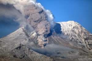
Alaska , Shishaldin :
54°45’19 » N 163°58’16 » W,
Summit Elevation 9373 ft (2857 m)
Current Volcano Alert Level: ADVISORY
Current Aviation Color Code: YELLOW
Unrest continues at Shishaldin with slightly elevated surface temperatures at the summit crater indicated in satellite images and minor steaming visible in some web camera images. Although unrest is currently at low levels, activity could escalate with little warning, and additional eruptive activity within the summit crater, lava flows, lahars, and ash-producing eruptive events could occur.
Shishaldin is monitored by local seismic and infrasound sensors, satellite data, web cameras, a telemetered geodetic network, and distant infrasound and lightning networks.
Source : AVO.
Photo : Jacob, Ben David.
Costa Rica , Irazú :
Here is a sequence of satellite images and oblique photos taken from the field and with drones obtained by the personnel of the RSN and the CNE. We can see there as since last year, the level of the crater lake of the Irazú volcano drop until it disappears in the first months of 2020.
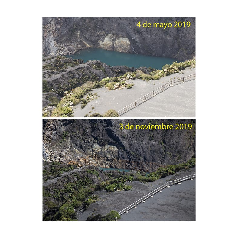
The comparative images between May and November 2019 were taken from the same site near the Higher Observatory.
The image of April 2020 was taken by the CNE and shows the lake completely dry, in addition we observe from the eastern sector, the landslide that happened a year ago.
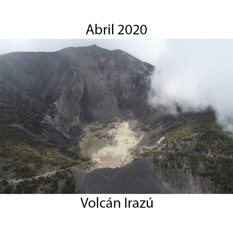
The drop in water level until its disappearance could be mainly attributed to water infiltration processes by fractures, because the evaporation processes are not intense in this lake, as they are on the volcano Poás.
Source : RSN.
Hawaii , Mauna Loa :
19°28’30 » N 155°36’29 » W,
Summit Elevation 13681 ft (4170 m)
Current Volcano Alert Level: ADVISORY
Current Aviation Color Code: YELLOW
Activity Summary:
Mauna Loa Volcano is not erupting. Rates of deformation and seismicity have not changed significantly over the past week and remain above long-term background levels.
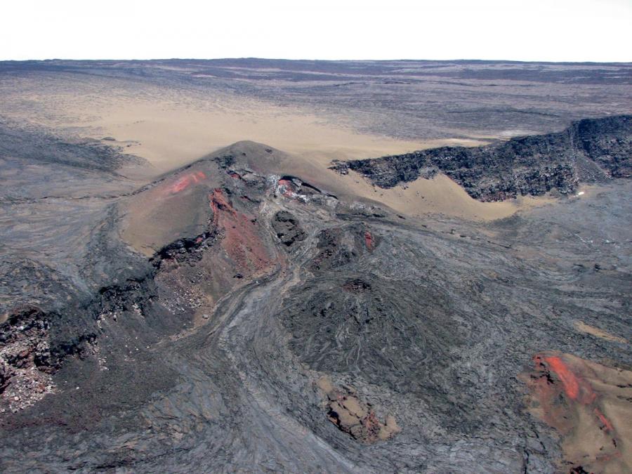
Cinder cone and lava flows of 1949.
Observations:
During the past week, HVO seismometers recorded 62 small-magnitude earthquakes on the volcano’s summit and upper-elevation flanks. Most of these earthquakes occurred at shallow depths of less than 8 kilometers (~5 miles) below ground level.
Global Positioning System (GPS) measurements show continued slow summit inflation, consistent with magma supply to the volcano’s shallow storage system.
Gas concentrations at the Sulphur Cone monitoring site on the Southwest Rift Zone remain stable. Fumarole temperatures as measured at both Sulphur Cone and the summit have not changed significantly.
Source : HVO
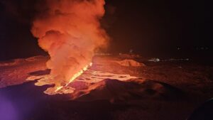
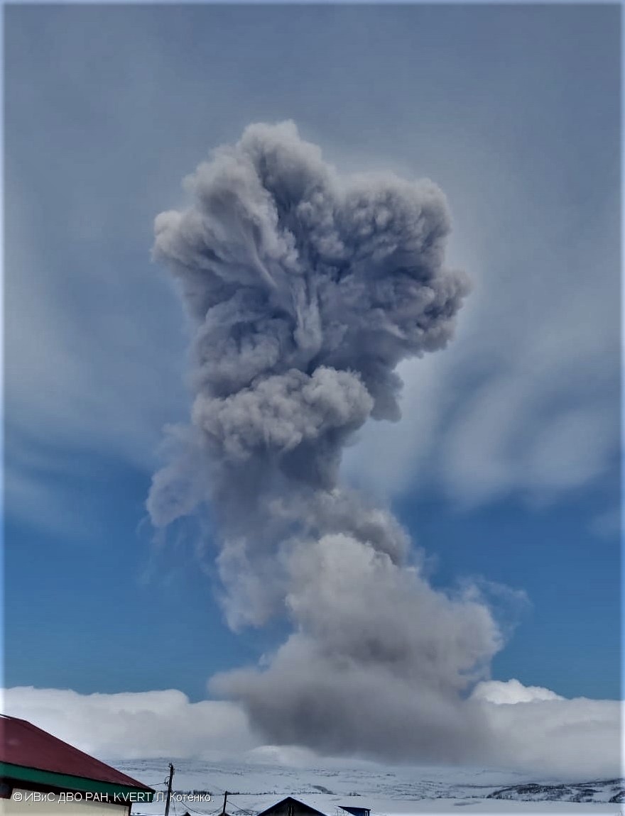
Russia / Northern Kuriles , Ebeko :
VOLCANO OBSERVATORY NOTICE FOR AVIATION (VONA).
Issued: May 01 , 2020
Volcano: Ebeko (CAVW #290380)
Current aviation colour code: ORANGE
Previous aviation colour code: orange
Source: KVERT
Notice Number: 2020-69
Volcano Location: N 50 deg 41 min E 156 deg 0 min
Area: Northern Kuriles, Russia
Summit Elevation: 3791.68 ft (1156 m)
Volcanic Activity Summary:
A moderate eruptive activity of the volcano continues. According to visual data by volcanologists from Severo-Kurilsk, explosion sent ash up to 2.6 km a.s.l., an ash cloud is drifting to the north of the volcano.
This activity continues. Ash explosions up to 19,700 ft (6 km) a.s.l. could occur at any time. Ongoing activity could affect low-flying aircraft and airport of Severo-Kurilsk.
Volcanic cloud height:
8200-8528 ft (2500-2600 m) AMSL Time and method of ash plume/cloud height determination: 20200501/0302Z – Visual data
Other volcanic cloud information:
Distance of ash plume/cloud of the volcano: 3 mi (5 km)
Direction of drift of ash plume/cloud of the volcano: N
Time and method of ash plume/cloud determination: 20200501/0302Z – Visual data
Source : Kvert.
Video : A. Belousov, M. Belousova, T. Walter ( 15/7/2019 ).
Photo : L. Kotenko, IVS FEB RAS, KVERT ( 28/4/2020 ).
Mexico , Popocatepetl :
April 30, 11:00 a.m. (April 30, 4:00 p.m. GMT)
During the last 24 hours, 46 exhalations and 856 minutes of tremors have been identified thanks to the monitoring system of the Popocatépetl volcano, these events have been accompanied by the emission of volcanic gases and light amounts of ash which have dispersed towards the South-East sector.
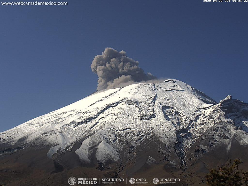
At the time of this report, there is partial visibility, however, in the morning, constant emissions of gas and sometimes slight amounts of ash were observed in a south-easterly direction.
CENAPRED urges NOT to get close to the volcano and especially the crater, because of the danger involved in the fall of ballistic fragments, and, in the event of heavy rain, to move away from the bottom of the ravines because of the danger of flows mud and rubble.
The Popocatépetl volcanic alert signaling light is in YELLOW PHASE 2.
Source : Cenapred .