March 19 , 2020 .
Italy , Stromboli :
Weekly bulletin from 09/03/2020 to 15/03/2020 (date of issue 17/03/2020)
SUMMARY OF ACTIVITY STATUS
In light of the monitoring data, it is highlighted:
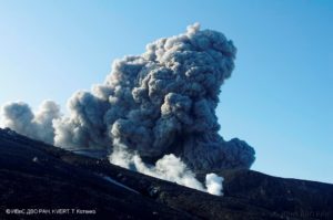
1) VOLCANOLOGICAL OBSERVATIONS: During this period, normal explosive activity of the strombolian type was observed accompanied by degassing activities. The hourly frequency of explosions fluctuated between medium-high values (16 events / h on March 10) and high values (22 events / h on March 12 and 14). The intensity of the explosions was mainly medium-low in the area of the North crater and medium-high in the area of the Center-South crater.
2) SEISMOLOGY: The seismological parameters do not show significant variations.
4) DEFORMATIONS: Stromboli soil deformation monitoring networks did not show any significant variation to report for the period considered.
5) GEOCHEMISTRY: SO2 flux is at an average level The last value of the CO2 / SO2 ratio is at an average value (last update of 02/09/2020). There are no other updates. The value of the isotopic ratio of helium dissolved in the aquifer is at low-medium levels (last update of 09/03/2020).
VOLCANOLOGICAL OBSERVATIONS
The analysis of the images recorded by the cameras placed at an altitude of 400m, at an altitude of 190m and at Punta dei Corvi made it possible to characterize the eruptive activity of Stromboli. During the reporting period, the explosive activity was mainly produced by at least 3 (three) eruptive vents located in the area of the North crater and by at least 3 (three) eruptive vents located in the area of the Center-South crater . All the vents are located inside the depression which occupies the crater terrace.
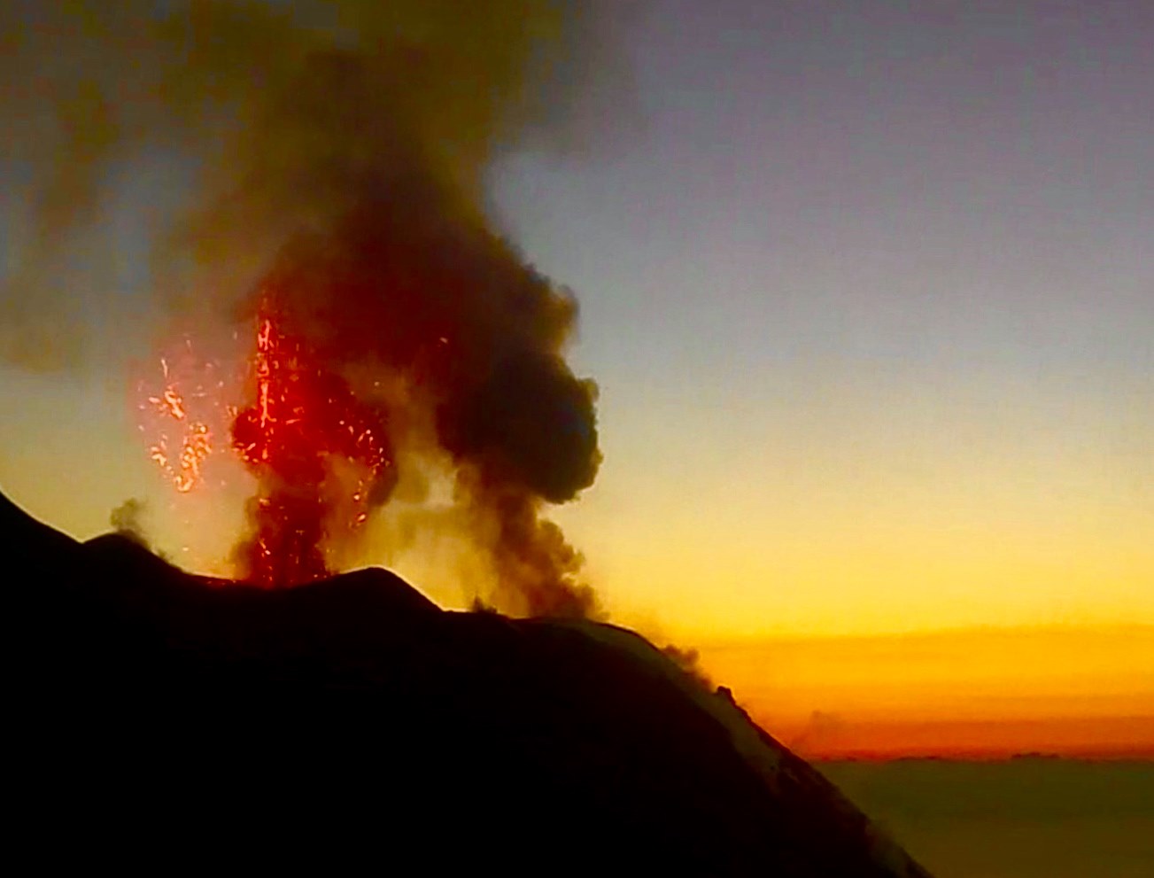
Due to unfavorable weather conditions, the visibility of the crater terrace was not sufficient for a correct description of the eruptive activity on March 11, while due to a technical error, the video signal was absent at 9:32 p.m. UTC from March 14 until the end of the observed period (March 15). In the northern zone, the explosions were mainly of variable intensity, from low (less than 80 m in height) to high (more than 150 m in height), emitting coarse materials (lapilli and bombs). In numerous explosions, the abundant fallout covered the outer slopes of the area overlooking the Sciara del fuoco and the blocks rolled until they reached the coast. The average frequency of explosions in the North zone varied between 8 and 11 events / h. The explosive activity of the Center-South zone produced explosions of mainly fine materials (ash) sometimes mixed with coarse materials of medium intensity (less than 150 m high) sometimes high (the products exceeded 250 m in height) . The frequency of explosions in the Center-South zone varied between 6 and 14 events / h. …/…
Source : INGV.
Read the whole article : file:///C:/Users/Utilisateur/AppData/Local/Packages/Microsoft.MicrosoftEdge_8wekyb3d8bbwe/TempState/Downloads/BollettinoStromboli20200317%20(1).pdf
Photos : INGV.
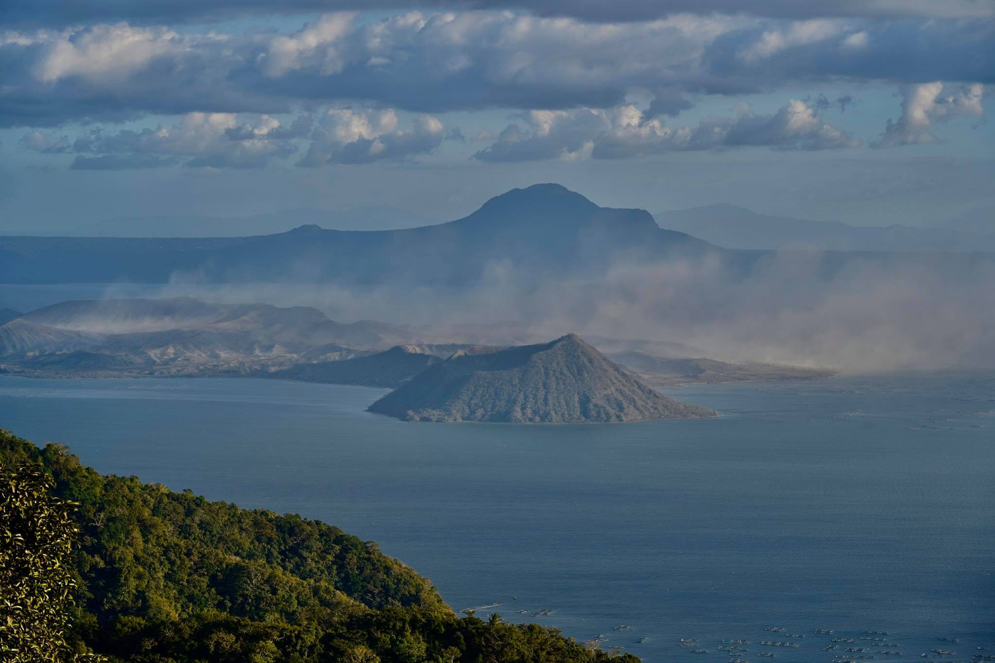
Philippines , Taal :
TAAL VOLCANO BULLETIN: 19 March 2020 08:00 AM
This serves as a notice for the lowering of Taal Volcano’s status from Alert Level 2 (Decreased Unrest) to Alert Level 1 (Abnormal).
Taal Volcano’s condition in the succeeding four (4) weeks after step-down to Alert Level 2 on 14 February 2020 has been characterized by low-level volcanic earthquake activity, stabilizing ground deformation of the Taal Caldera and Taal Volcano Island (TVI) edifices and weak surface activity at the Main Crater and the Daang Kastila fissure. These observations are supported by the following monitoring parameters:
1. Taal Volcano Network (TVN) recorded a decline in the daily average of volcanic earthquakes from 141 events/day between 26 January and 14 February to 31 events/day between 14 February and today. The majority of these earthquakes were associated with rock-fracturing processes and only six (6) low frequency events associated with magmatic or hydrothermal activity were detected until 6 March. These parameters are consistent with degassing ponded magma rather than active magma transport to and from the shallow magma reservoir beneath TVI.
2. Continuous Global Positioning System (GPS) monitoring from 14 February to 16 March recorded very slow and slight uplift of the northern sector of Taal Caldera but continuing subsidence of the southern sector of the caldera and southern TVI. Such motions describe the overall ground deformation behavior of Taal Volcano since 13 January and are broadly consistent with post-eruptive relaxation of the Taal edifice.
3. Sulfur dioxide or SO2 flux based on Flyspec campaign averaged 56 tonnes/day between 14 and 17 February before falling below detection limits in the succeeding days. Such low concentrations are consistent with a weakly degassing shallow magma source and absorption or “scrubbing” of volcanic gas by a recovering lake within the Main Crater and by TVI’s recovering hydrothermal system.
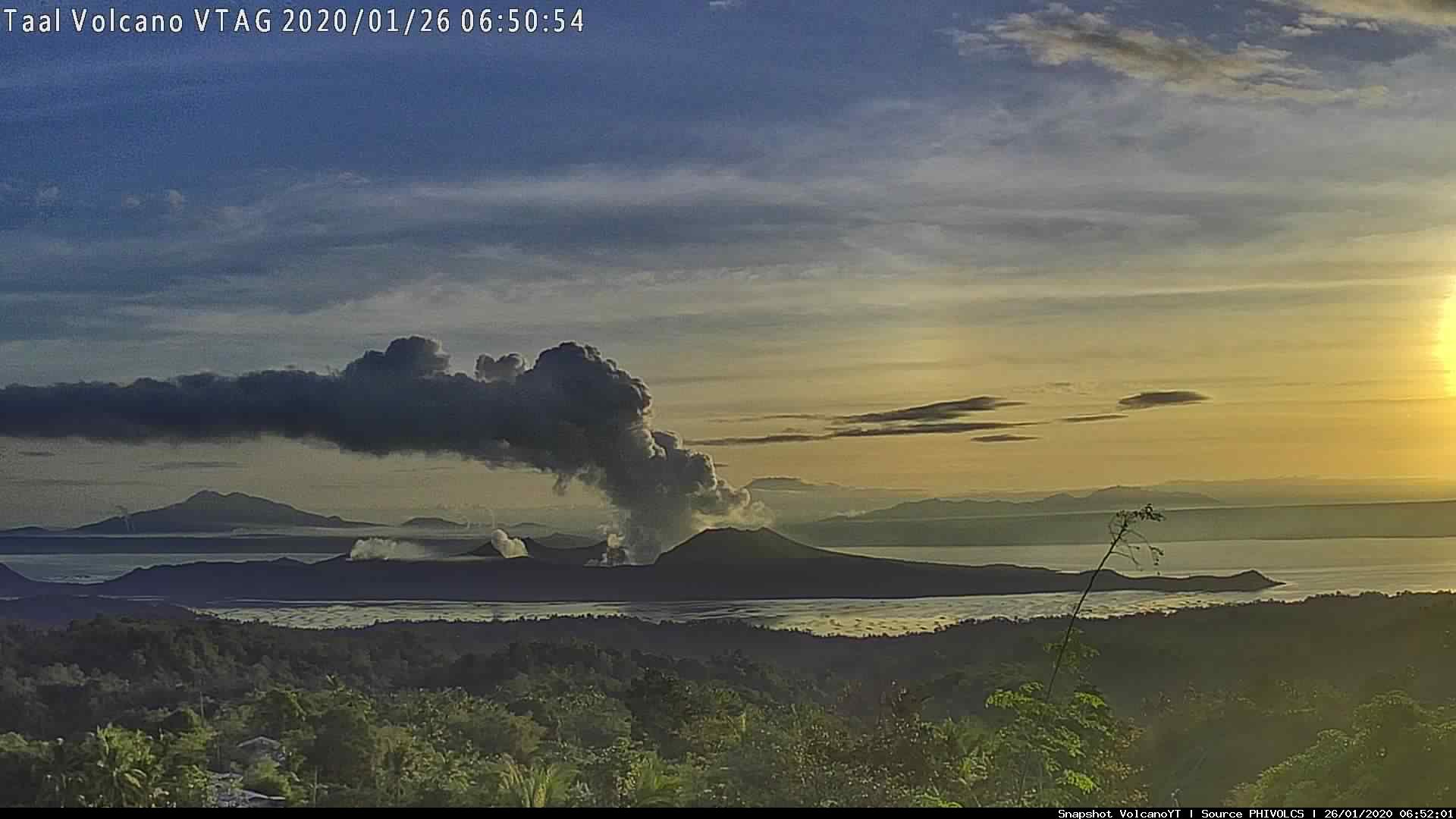
4. Surface activity has abated to weak emission of 50-100-meter tall steam-laden plumes from fumaroles or active gas vents on the Main Crater and along the Daang Kastila fissure on the northern flank of TVI. The last significant activity from the Main Crater occurred on 26-27 February and generated 300-meter tall steam-laden plumes for six hours. Since then, background fumarolic activity and the regrowth of the Main Crater Lake have been quietly transpiring.
In view of the above, DOST-PHIVOLCS is lowering the alert status of Taal Volcano from Alert Level 2 to Alert Level 1 to reflect the overall decreasing trend in the level of monitoring parameters. Alert Level 1 means that the volcano is still in abnormal condition and should not be interpreted that unrest has ceased or that the threat of an eruption has disappeared. Should an uptrend or pronounced change in monitored parameters forewarn of renewed unrest, the Alert Level may be raised back to Alert Level 2. Residents of areas at high risk to base surges who have returned after the step-down to Alert Level 2 on 14 February must, therefore, remain vigilant and always be prepared for a quick and organized evacuation. Conversely, should there be a return of monitoring parameters to baseline levels after a sufficient observation period, the Alert Level will be further lowered to Alert Level 0.
Source : Phivolcs.
Photos : Web cam , Rafy Tima .
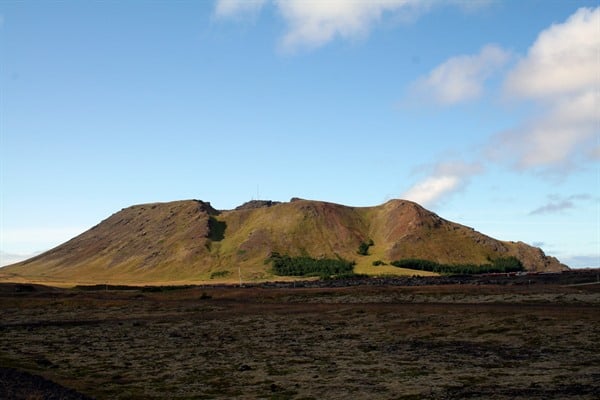
Iceland , Reykjanes Peninsula :
63.85°N, 22.566°W
Elevation 140 m
On 18 March IMO raised the Aviation Color Code for Reykjanes to Yellow noting that recent InSAR and GPS data indicated that during the second week of March deformation had restarted. The uplift was concentrated in the same place as that recorded in January-February, though at a slower rate. The cause of the deformation was likely an intrusion of magma at 4.5 km depth.
A large (M 4.6) earthquake was recorded on 12 March and located 3.5 km NE of Thorbjorn, possibly connected to the inflation. A sequence of aftershocks lasted for a few days and was characterized by eight earthquakes over M 3 and about 80 events with magnitudes between 2 and 3. Since the large event a total of 850 earthquakes were recorded in the area.
Source : GVP , IMO.
Photo : Visit Reykjanes
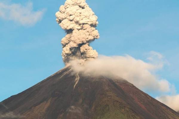
Guatemala , Fuego :
Type of activity: Vulcanian
Morphology: composite stratovolcano
Location: 14 ° 28’54˝ Latitude N; 90 ° 52’54˝ Longitude W.
Altitude: 3763 m
Atmospheric conditions: Clear
Wind: northeast at 6 km / h.
Precipitation: 0.0 mm.
The Fuego volcano observatory reports low to moderate explosions, in a range of 5 to 6 per hour, accompanied by columns of gray ash, at a height of 4400 to 4500 m above sea level (14.436 to 14.764 feet) which disperse to the west, for about 12 kilometers. There are reports of fine ash falls in San Pedro Yepocapa, Morelia, Panimaché, Sangre de Cristo, La Cruz, Santa Sofía, Palo Verde and others in this area. The explosions generate moderate rumblings with shock waves, which vibrate the roofs and windows of houses in villages near the crater volcano. Sounds similar to locomotives are heard for periods of 2 to 3 minutes. At night, the crater was observed with incandescent pulses of 200 and 300 meters high, accompanied by avalanches of weak to moderate blocks, in the direction of the ravines of Taniluyá, Ceniza, Las Lajas, Trinidad, Seca and Honda. Some of these blocks reach the edge of the vegetation. There is a FLOW OF WASHER 400 METERS LENGTH IN THE DIRECTION OF THE CANYON OF CENIZA. (Note, what is described above corresponds to the activity described in the special bulletin # 3-2020 generated at 00:30 local time on 2020-03-16).
Source : Insivumeh.
Video : Volcanobot.
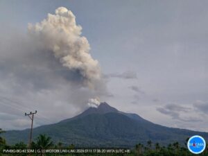
Ecuador , Reventador :
TUESDAY 17 MARCH 2020
The Geophysical Institute of the National Polytechnic School reports that:
Today March 17, the UMEVA Sucumbíos reports an ash fall in the San Rafael sector, located southeast of the Reventador volcano. This phenomenon is characteristic of the current eruptive period of the volcano. The winds are currently heading southwest, so it is recommended to take the appropriate measures and not to be exposed for long periods to the fall of the ashes. Daily forecast of ash fall and dispersion available at: (https://www.igepn.edu.ec/reventador-sim-ceniza)
The Geophysical Institute of the National Polytechnic School monitors activity on the volcano and will inform of any changes that may be recorded.
DAILY REPORT OF THE STATE OF THE VOLCANO REVENTADOR, Wednesday March 18, 2020.
Information Geophysical Institute – EPN.
Surface activity level: High, Surface trend: No change.
Internal activity level: High, Internal trend: No change.
Seismicity: From March 17, 2020, 11:00 a.m. to March 18, 2020, 11:00 a.m .:
Long Period Type (LP): 29 events
Explosions (EXP): 14 events
Emission limits: (TE): 12.
Harmonic tremors: (TA): 3.
Rains / lahars: Not recorded.
Emission / ash column: No emissions were identified. However, in the satellite images, an emission alert was recorded with a height of 1938 m above the level of the crater and the direction of the Southeast.
Other monitoring parameters: no change.
Observations: The area was cloudy most of the time, the program was recorded at dawn. Yesterday afternoon, a fall of ash was reported in the area of San Rafael, in the province of Sucumbíos.
Source : IGEPN.
Photo : metro ecuador