June 24 , 2022 .
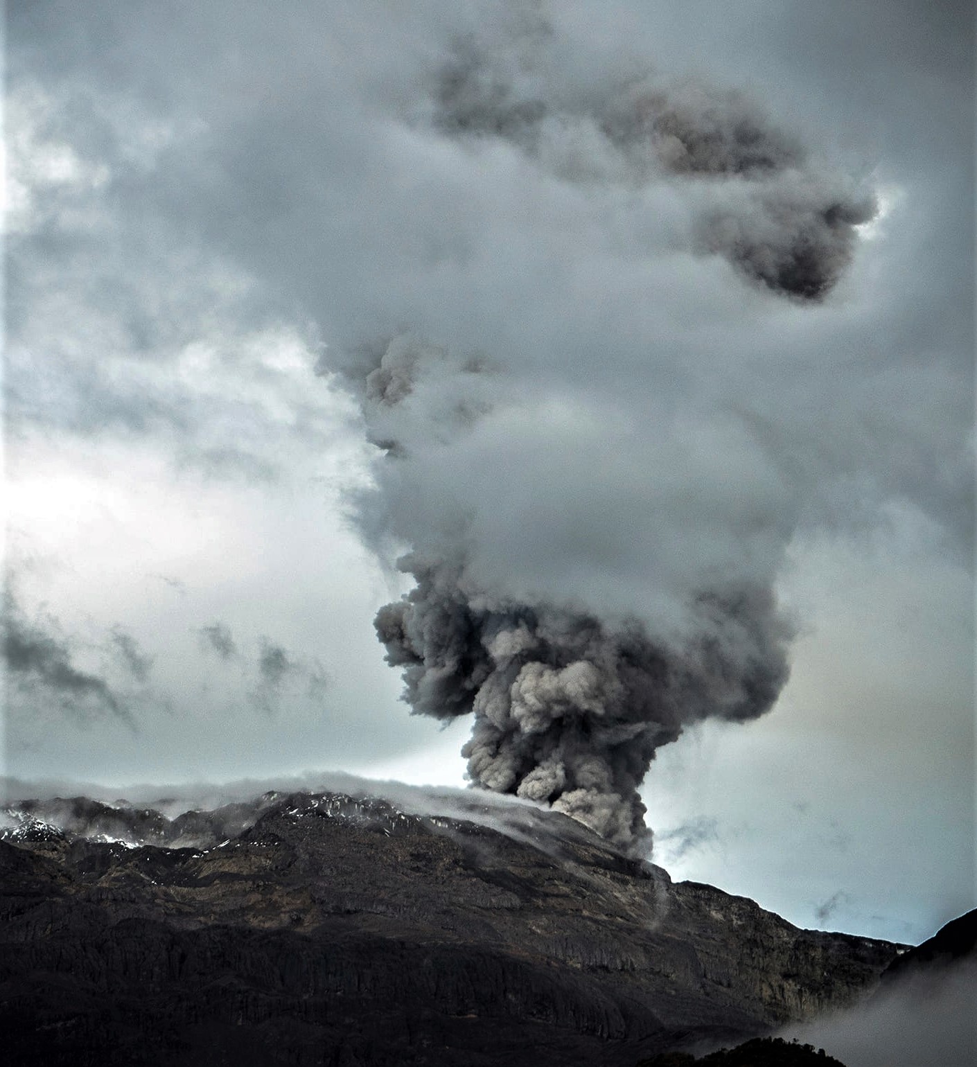
Russia / Kuril Islands , Ebeko :
VOLCANO OBSERVATORY NOTICE FOR AVIATION (VONA)
Issued: June 24 , 2022
Volcano: Ebeko (CAVW #290380)
Current aviation colour code: ORANGE
Previous aviation colour code: yellow
Source: KVERT
Notice Number: 2022-54
Volcano Location: N 50 deg 41 min E 156 deg 0 min
Area: Northern Kuriles, Russia
Summit Elevation: 1156 m (3791.68 ft)
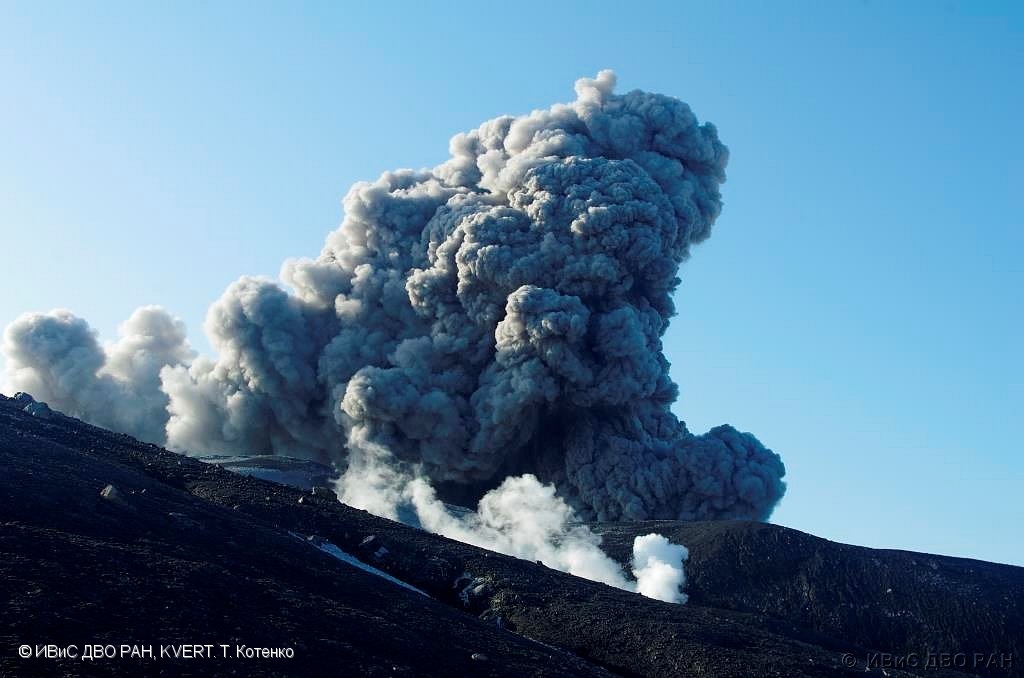
Volcanic Activity Summary:
A moderate activity of the volcano continues. An ash plume about 3.5 km a.s.l. was observed, ash ash plume in extending to the south-east from the volcano.
A moderate activity of the volcano continues. Ash explosions up to 6 km (19,700 ft) a.s.l. could occur at any time. Ongoing activity could affect low-flying aircraft and airport of Severo-Kurilsk.
Volcanic cloud height:
3000-3500 m (9840-11480 ft) AMSL Time and method of ash plume/cloud height determination: 20220624/0310Z – Visual data
Other volcanic cloud information:
Distance of ash plume/cloud of the volcano: 5 km (3 mi)
Direction of drift of ash plume/cloud of the volcano: SE
Time and method of ash plume/cloud determination: 20220624/0310Z – Visual data
Start time of explosion and how determined: 20220624/0310Z – Visual data
Source : Kvert .
Photo : T. Kotenko, IVS FEB RAS / KVERT.
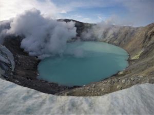
Colombia , Nevado del Ruiz :
Nevado del Ruiz volcano activity bulletin.
The activity level continues at the yellow activity level or (III): changes in the behavior of volcanic activity.
Regarding the monitoring of the activity of the Nevado del Ruiz volcano, the COLOMBIAN GEOLOGICAL SERVICE reports that:
Seismicity related to fluid dynamics within volcanic conduits increased in terms of the number of earthquakes and seismic energy released, compared to the previous week. This seismic activity was characterized by the occurrence of continuous volcanic tremors, tremor pulses, long and very long period earthquakes. In general, these signals exhibited moderate to low energy levels, variable spectral content, and were located primarily within Arenas Crater. Thanks to the cameras installed in the area of the volcano and the report of the officials of the National Natural Park of Los Nevados, the gas and ash emissions associated with some of these seismic signals have been confirmed. Likewise, thanks to the FLIR cameras (thermographic cameras) of the volcanic monitoring network, changes in the relative temperature of the emitted material have been observed.
Seismicity associated with rock fracturing increased in terms of the number of earthquakes and maintained similar levels in released seismic energy, compared to the previous week. Slight increases in this type of activity stand out on June 14 and 20. This seismic activity was located mainly in the Arenas crater and the North-West sector and, to a lesser extent, in the North-North-East, North-East and South-East sectors. The depth of the earthquakes varied between 0.4 and 7.5 km. The maximum magnitude recorded during the week was 1.7 ML (Local Magnitude), corresponding to the earthquake that occurred on June 20 at 12:17 p.m. (local time), located 5.0 km northwest of the Arenas crater, at a depth of 6.2 km.
It is important to mention that in the past few hours, seismic activity has been recorded in the southwest sector 3.3 km from the Arenas crater. This activity results in an increase in the number of earthquakes associated with rock fracturing. The maximum magnitude recorded during this increase is 1.0 ML (Local Magnitude), corresponding to the earthquake that occurred at 12:52 p.m. (local time), located 3.3 km southwest of the Arenas crater, at a depth of 3. 9km.
The recording of several episodes of low energy and short duration « drumbeat » type seismicity associated with rock fracturing and fluid seismicity on June 14, 15 and 18 stands out. This seismicity has been linked to the processes of ascent, emplacement-growth and evolution of a lava dome at the bottom of the Arenas crater.
Source : SGC
Photo : Álex Palacio
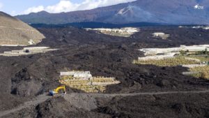
Hawaii , Kilauea :
19°25’16 » N 155°17’13 » W,
Summit Elevation 4091 ft (1247 m)
Current Volcano Alert Level: WATCH
Current Aviation Color Code: ORANGE
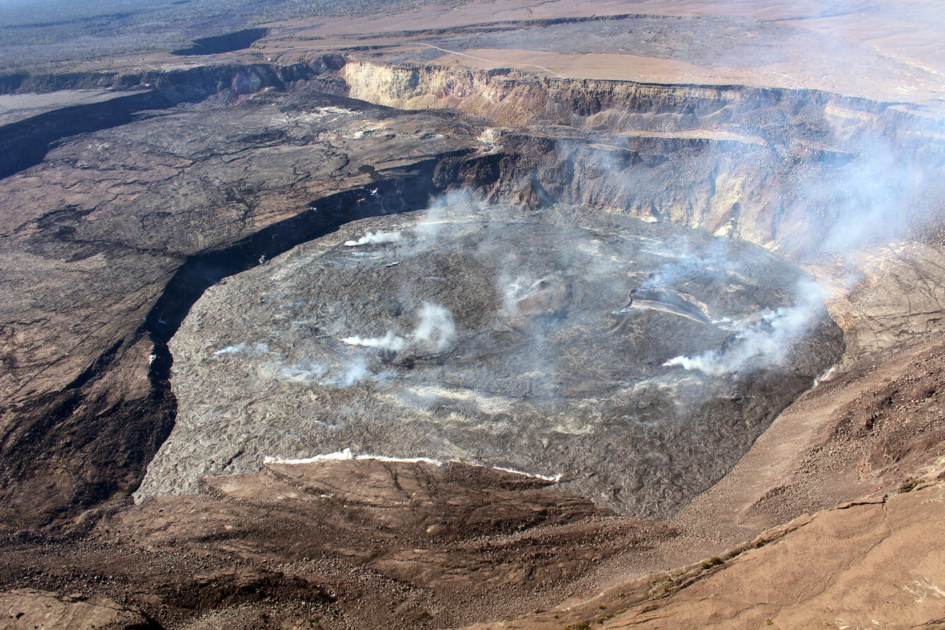
An image of Halema‘uma‘u taken during a Kīlauea summit helicopter overflight on the morning of June 17, 2022. There are several areas of degassing (the small white plumes) located across the lake surface, some of which are associated with hornitos. Hornitos are small, rootless cones that are fed by the tube network within the lava lake. The active portion of the lava lake is located on the western side of the lake (right side of the photograph). The Hawai‘i Volcanoes National Park eruption public viewing area at Keanakāko‘i can be seen in the upper left of the photograph.
Activity Summary:
The summit eruption of Kīlauea Volcano, within Halemaʻumaʻu crater, continued over the past 24 hours. All recent lava activity has been confined to the crater, and current data indicate that this scenario is likely to continue. No significant changes have been noted at the summit or in the East Rift Zone.
Halemaʻumaʻu crater Lava Lake Observations:
Eruption of lava from the Halemaʻumaʻu crater western vent into the active lava lake, and ooze-outs onto the crater floor, have continued over the past 24 hours. Lava ooze-out activity has continued along the eastern and southern edges of the crater floor. Overflight measurements on June 17, 2022, indicated that the crater floor had seen a total rise of about 120 meters (394 feet) .
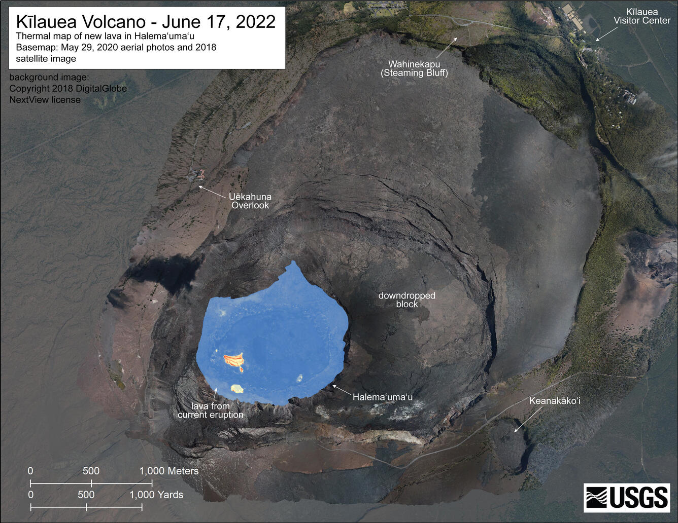
Un survol en hélicoptère le 17 juin 2022 a permis de collecter des images aériennes visuelles et thermiques du cratère Halema’uma’u au sommet du Kīlauea. La surface active du lac est limitée à la partie Ouest du cratère. L’échelle de la carte thermique va du bleu au rouge, avec des couleurs bleues indiquant des températures plus fraîches et des couleurs rouges indiquant des températures plus chaudes.
Observations du sommet :
Les inclinomètres du sommet ont enregistré une légère inflation au cours des dernières 24 heures. Un taux d’émission de dioxyde de soufre (SO2) d’environ 2 300 tonnes par jour (t/j) a été mesuré le 21 juin 2022.
Source : HVO
Photos : USGS / L. Gallant. USGS.
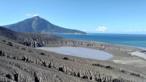
Indonesia , Semeru :
VOLCANO OBSERVATORY NOTICE FOR AVIATION – VONA
Issued : June 23 , 2022
Volcano : Semeru (263300)
Current Aviation Colour Code : ORANGE
Previous Aviation Colour Code : orange
Source : Semeru Volcano Observatory
Notice Number : 2022SMR162
Volcano Location : S 08 deg 06 min 29 sec E 112 deg 55 min 12 sec
Area : East java, Indonesia
Summit Elevation : 11763 FT (3676 M)
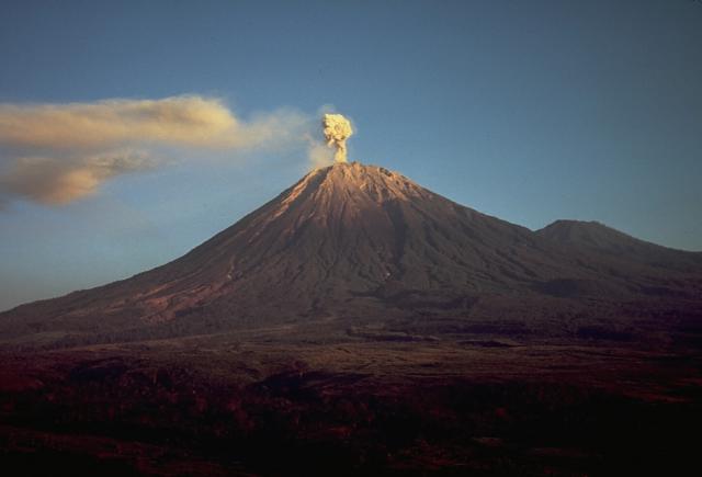
Volcanic Activity Summary :
Eruption with volcanic ash cloud at 23h28 UTC (06h28 local)
Volcanic Cloud Height :
Best estimate of ash-cloud top is around 14003 FT (4376 M) above sea level, may be higher than what can be observed clearly. Source of height data: ground observer.
Other Volcanic Cloud Information :
Ash-cloud moving to southwest
SEISMICITY OBSERVATION:
It was recorded:
22 eruption earthquakes/explosions with an amplitude of 10-22 mm and a duration of 70-100 seconds.
Source : Magma Indonésie .
Photo : Thomas J. Casadevall, USGS — Smithsonian – Global Volcanism Program.
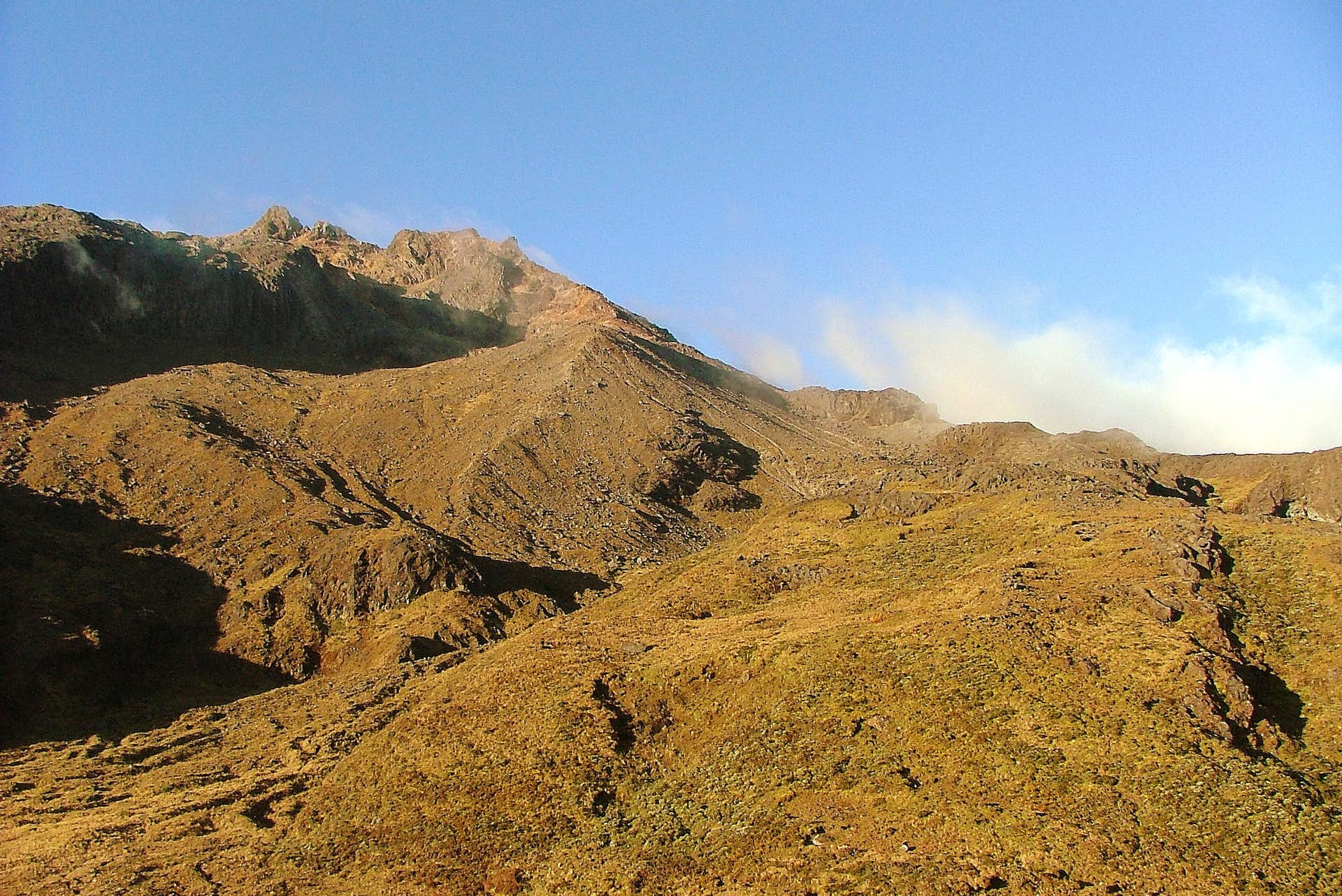
Colombia , Chiles / Cerro Negro :
Extraordinary bulletin of activity of the Chiles and Cerro Negro volcanoes
The activity level of volcanoes remains at: YELLOW LEVEL ■ (III): CHANGES IN THE BEHAVIOR OF VOLCANIC ACTIVITY
From monitoring the activity of the CHILES AND CERRO NEGRO VOLCANOES, the COLOMBIAN GEOLOGICAL SERVICE (SGC) reports that:
On June 21, 2022, at 11:50 p.m., a seismic event of a Volcano Tectonic nature occurred, with a local magnitude of 4.4, which was reported as felt by the inhabitants of the municipalities of Cumbal, Túquerres, Ipiales, Ricaurte and Pasto ; and on the Ecuadorian side, in the city of Tufiño.
This June 22, 2022, at 3:30 a.m., an event of local magnitude 3.5 occurred, which was reported as felt from the Mayasquer Indigenous Reservation (municipality of Cumbal). These earthquakes are part of a recent seismic swarm process reported since May 27, 2022, with a total of nearly 40,950 events associated with crustal material fracture, most of low energy, standing out in this period, the recording of 30 earthquakes of local magnitude between 2.0 and 4.4. This activity was accompanied by some surface deformation changes in the epicentral regions of this seismicity. The other monitoring parameters show no changes.
In this context, for June 21, there were a total of 3,557 events; and to date, June 22, up to 4:00 p.m., some 4,160 earthquakes have been recorded. Recent earthquakes have been located mainly south of the Chiles volcano at distances less than 4 km and at depths of up to 6 km from the height of the summit of the Chiles volcano (reference level at 4700 m). altitude). For today, the occurrence of 7 earthquakes is also highlighted, at 02:21, 02:38, 03:33, 06:22, 08:45, 09:32. and at 3:50 p.m., with local magnitudes between 2.0 and 2.4, of which no reports were received of being felt.
In general, this activity has a behavior similar to what has been recorded in the Chiles – Cerro Negro volcanoes region since the end of 2013, with the recording of relevant seismic episodes, which mainly involve low level events. energy, but also some important in their energy that can be felt, mainly, by the inhabitants who reside in the areas of influence of these volcanoes, both on the Colombian and Ecuadorian side.
Based on the current behavior of this seismicity and what has been recorded historically in this active volcanic region, it is recommended that civil and indigenous authorities be attentive to official communications, inform their communities of what is happening and in cases where there are houses or buildings with conditions of structural vulnerability, take preventive measures to avoid conditions that generate risks for its inhabitants. Appropriate management of communication with communities will avoid falling into situations of alarm or misinformation.
Source : SGC.
Photo : Boriss Andean / summit post.