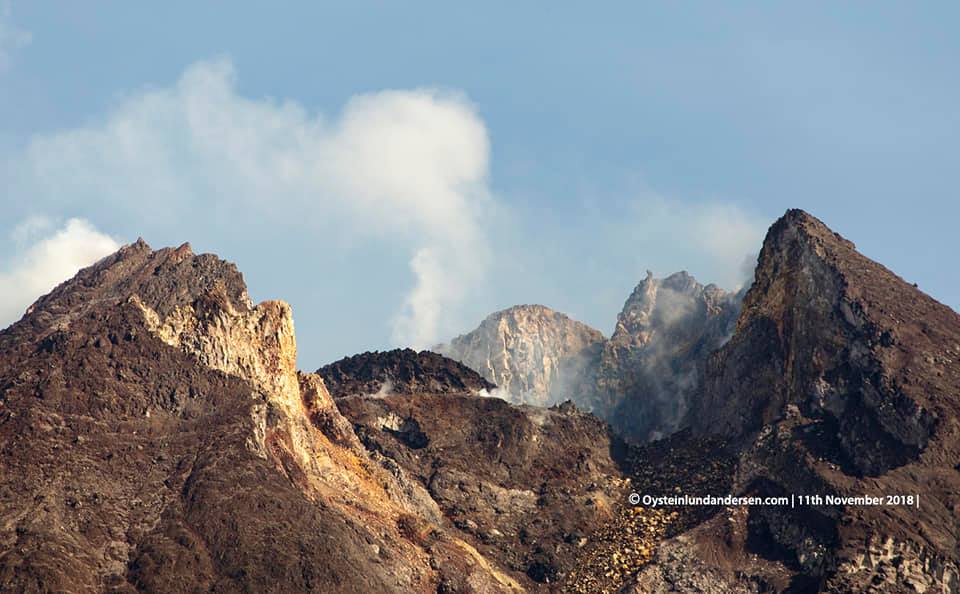
November 12 , 2018.
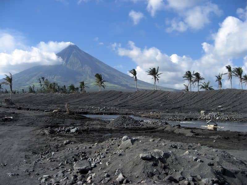
Indonesia , Merapi :
ACTIVITY REPORT OF MONT MERAPI November 2 to 8, 2018
I. RESULTS OF OBSERVATIONS
Visual:
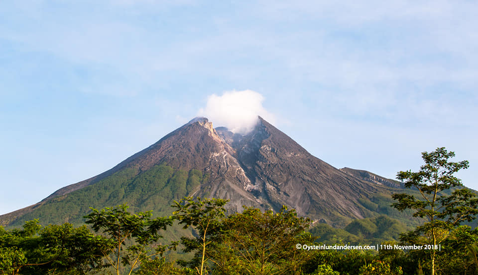
The weather is sunny in the morning and in the evening, the afternoons and evenings are foggy. The smoke observed from the crater is white, thick, with low gas pressure. The maximum height of 100 m is observed from the observation post of Mount Merapi at Kaliurang on November 8, 2018.
Dome of lava and morphology of the peak:
Photo-based analysis of the Southeast sector showed morphological changes in the form of dome growth.
The lava dome volume at November 7, 2018 was 273,000 m3 with an average growth rate of 3,500 m3 / day, higher than the previous week. Currently, the lava dome is still stable with a low growth rate (<20,000 m3 / day).
Seismicity:
During this week, the seismographs of Mount Merapi recorded 33 emission earthquakes (DGs), 1 shallow volcanic earthquake (VTB), 11 multiphase earthquakes (MPs), 242 avalanche events (RF) , 38 Low Frequency (LF) earthquakes and 8 tectonic earthquakes (TT). The seismicity of type MP and type LF this week is higher than the previous week. Appendix 1. presents a graph of the earthquake on Mount Merapi.
Deformation:
Measuring the EDM from the fixed point to the reflector gives a range of distances from 4.044.829 m to 4.044.838 m.
The deformation of G. Merapi, controlled by EDM and GPS this week, showed no significant change.
SO2 emissions:
During this week, the DOAS (Differential Optical Absorption Spectroscopy) measurement yielded an average value of maximum SO2 emissions from Mount Merapi of 79.63 tonnes / day, still within normal limits.
Rain and lahars:
This week, it rained at the Mount Merapi observation post, with a rainfall intensity of 30 mm / hour for 10 minutes. There was no lahars signal or flow increase in the rivers downstream of Mount Merapi.
II. CONCLUSION AND RECOMMENDATION:
Conclusion:
Based on the results of the visual and instrumental observations, it was concluded that:
1. The lava dome is currently in a stable state with a relatively low growth rate.
2. The volcanic activity of Mount Merapi is still quite high and is at the activity level « WASPADA ».
Recommendation:
With the level of activity of G. Merapi « WASPADA », to the stakeholders in the disaster management of Mount Merapi, it is recommended to:
• A radius of 3 km around the summit of Mount Merapi should be prohibited for the activities of the population and climbing.
• People need to know more about G. Merapi’s activities.
• In the event of a significant change in Mount Merapi activity, the status of Mount Merapi activity will be re – examined.
• It is recommended that local authorities socialize the current state of Mount Merapi.
Source : BPPTKG
Photos : Oystein Lund Andersen.
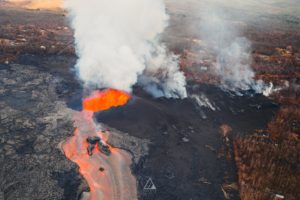
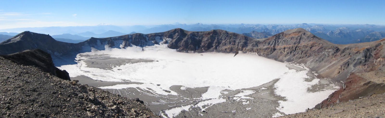
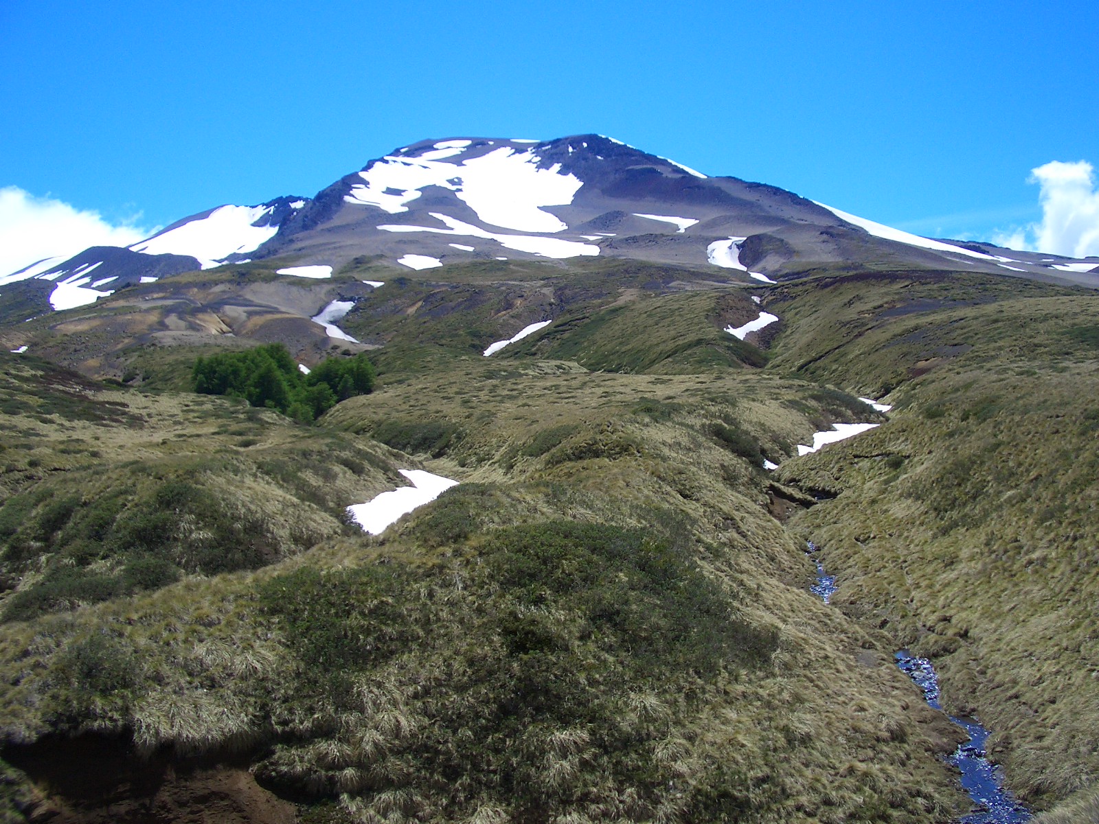
Chile , Puyehue – Cordon Caulle :
During the period evaluated, a total of 115 seismic events were recorded, of which 2 were classified as long period (LP), in relation to the dynamics of the fluids within the volcanic edifice. The event of greater energy had a reduced displacement value (DRc) equal to 7.5 cm2. Also, 113 volcano-tectonic earthquakes (VT), associated with fracturing processes of rocks, were recorded. The event of greatest energy had a local magnitude (ML) equal to M 1.8, and was located 3.5 km east-southeast of the transmitter center of 2011, at a depth of 4 , 1 km.
The images provided by the IP cameras installed around the volcano do not show any superficial changes.
According to the data provided by three GNSS stations, we observe that the inflationary process reported previously is continuing. The maximum rate of horizontal variation recorded by the permanent network is 0.53 cm / month and the vertical rate of 0.91 cm / month for the station closest to the point of maximum deformation. It should be noted that the calculated annual velocity remains generally constant over time except for slight occasional variations.
No sulfur dioxide (S02) emissions have been reported in the area’s atmosphere near the volcanic building, according to data published by the Ozone Observatory Sulfur Dioxide Group (http: // mon2.gsfc.nasa.gov/). ) and the National Information and Satellite Data Service on the Environment (NESDIS) (http://satepsanoine.nesdis.noaa.gov).
No thermal warning was reported in the area associated with the volcanic complex during the period, according to data processed by the mean infrared observation of volcanic activity (MIROVA) (http://www.mirovaweb.it /) and Temporal Thermal Monitoring of global hot spots (MODVOLC) (http://modis.higp.hawaii.edu/).
The seismicity remained at levels considered weak suggest a relative stability of the volcanic system.
Because of the above, the volcanic warning is kept at the level:
GREEN LEVEL: Changes in the behavior of volcanic activity – Probable time for an eruption: WEEKS / MONTH.
Source : Sernageomin .
Photo : aupabicho.blogspot.com , lasuperdigital.com.ar .
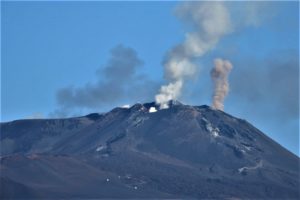
Colombia , Nevado del Huila :
Subject: Weekly activity bulletin of the Nevado del Huila volcano
The level of activity of the volcano continues in: level of yellow activity or (III): changes in the behavior of volcanic activity.
Based on the analysis and evaluation of the information obtained through the surveillance network of the Nevado del Huila volcano, from 30 October to 5 November 2018, the COLOMBIAN GEOLOGICAL SERVICE – Volayological and Volayan Observatory informs that:
• During the evaluated period, 356 seismic events were recorded, 128 related to rock fracturing processes (type VT) and 228 to fluid dynamics in volcanic canals. Of these, 216 were classified as long-period type events (LP type), 10 as low energy tremor pulses, and two (2) were related to fracture processes and fluid dynamics, and have been classified as hybrid type (HB type).
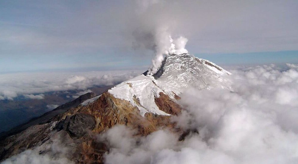
• The images obtained during the week by the web cameras of Caloto, Tafxnú, Maravillas and La Palma showed very low levels of degassing of the volcanic system.
Therefore, it is concluded that the volcano exhibited stable behavior during the evaluated period. The Colombian geological service is attentive to the evolution of the volcanic phenomenon and will inform in good time on the changes which could occur.
Source : SGC.
Philippines , Mayon :
MAYON VOLCANO BULLETIN 12 November 2018 09:45 A.M.
Mayon Volcano’s seismic monitoring network did not detect any volcanic earthquake during the past 24 hours. A small, short-lived brownish ash plume, associated with degassing, was observed around 7:39 AM today near the summit area that drifted towards the SW direction. There was no accompanying seismic and infrasound record from this event. Moderate emission of white steam-laden plumes that crept downslope before drifting southwest, west-southwest and west-northwest was observed. Fair crater glow from the summit could be observed at night. Sulfur dioxide (SO2) emission was measured at an average of 2281 tonnes/day on 11 November 2018. Precise leveling data obtained on 22-31 October 2018 indicate inflation of the edifice in the southeast sector while the north sector indicate short-term deflation relative to 30 August to 3 September 2018. The volcano generally remains inflated relative to 2010 baselines. Electronic tilt data further show pronounced inflation of the mid-slopes beginning 25 June 2018, possibly due to aseismic magma intrusion deep beneath the edifice.
Alert Level 2 currently prevails over Mayon Volcano. This means that Mayon is at a moderate level of unrest. DOST-PHIVOLCS reminds the public that sudden explosions, lava collapses, pyroclastic density currents or PDCs and ashfall can still occur and threaten areas in the upper to middle slopes of Mayon. DOST-PHIVOLCS recommends that entry into the six kilometer-radius Permanent Danger Zone or PDZ and a precautionary seven kilometer-radius Extended Danger Zone or EDZ in the south-southwest to east-northeast sector, stretching from Anoling, Camalig to Sta. Misericordia, Sto. Domingo must be strictly prohibited. People residing close to these danger areas are also advised to observe precautions associated with rockfalls, PDCs and ashfall. Civil aviation authorities must advise pilots to avoid flying close to the volcano’s summit as airborne ash and ballistic fragments from sudden explosions and PDCs may pose hazards to aircrafts.
Source : Phivolcs
Guatemala, Fuego :
Type of activity: Vulcanian
Morphology: Composite Stratovolcano
Geographical location: 14 ° 28’54˝ N Latitude; 90 ° 52’54˝ Longitude O.
Height: 3,763msnm
Weather conditions: Clear weather
Wind: North East 2 km / h
Precipitation: 28.6 mm
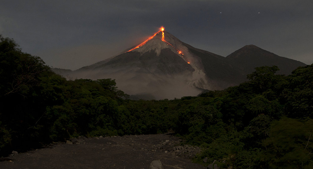
Activity:
Maintains a low white outgassing at a height of approximately 4,500 m above sea level, dispersed in a westerly and southwesterly direction. There are 14 to 17 explosions per hour, with light to moderate characteristics, projecting ash columns at an approximate height of 4,600 to 4,800 meters (15,092 to 15,748 feet), moving 15 to 20 km to the east. West and Southwest. Explosions are accompanied by low to moderate rumblings. Degassing sounds are reported with time intervals of 4 to 8 minutes. At night and early in the morning, incandescence was observed in the crater at an approximate height of 200 to 300 meters above the crater, causing weak to moderate avalanches on the crater contour, some reaching long distances to vegetation towards the Seca, Taniluyá, Ceniza, Trinidad, Honda and Las Lajas ravines. Lava flows advance towards the Ceniza Canyon, over a length of 1000 m, avalanches occur at the front of the flow. Ash falls are reported in Panimaché, El, Porvenir, Morelia, Santa Sofia, Sangre de Cristo, Finca Palo Verde, San Pedro Yepocapa, among others.
Source : Insivumeh
Photo : Auteur inconnu