October 31 , 2018.
Nicaragua , Momotombo :
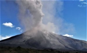
The Momotombo volcano has gas emanations.
OCTOBER 29, 2018. Momotombo volcano, culminating at 1,280 meters, in the municipality of La Paz Centro, Department of León, currently produces gas emissions.
This volcano has remained active since 2015, almost at the same time that it experienced its first major eruption after a relative calm of 110 years.
The Nicaraguan government remains vigilant against the signs of activity of the volcano.
The Momotombo forced the transfer of the city of León in 1610, while it was under the administration of the Spanish crown. Its activity in 1886 overshadowed western Nicaragua for 23 days, according to Ineter’s records.
The national system of attention, prevention and mitigation of disasters (Sinapred), does not report any affectation of the population of the surrounding communities, but nevertheless intensified the permanent observation of the degassing process of the volcano.
According to the authorities, the gas did not affect the population of the department of León.
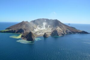
Momotombo is a young stratovolcano that rises prominently above the NW shore of Lake Managua, forming one of Nicaragua’s most familiar landmarks. Momotombo began growing about 4500 years ago at the SE end of the Marrabios Range and consists of a somma from an older edifice that is surmounted by a symmetrical younger cone with a 150 x 250 m wide summit crater. Young lava flows extend down the NW flank into the 4-km-wide Monte Galán caldera. The youthful cone of Momotombito forms an island offshore in Lake Managua. Momotombo has a long record of Strombolian eruptions, punctuated by occasional stronger explosive activity. The latest eruption, in 1905, produced a lava flow that traveled from the summit to the lower NE base. A small black plume was seen above the crater after a 10 April 1996 earthquake, but later observations noted no significant changes in the crater. A major geothermal field is located on the south flank.
This volcano is located within the Ruins of Leon Viejo, a UNESCO World Heritage property.
Source : La Jornada, GVP.
Peru , Ticsani :
The IGP records a new and important seismic activity in the Ticsani volcano area.
On October 26, around 10 am, the National Seismic Network and the Southern Volcanic Network operated by the Geophysical Institute of Peru (IGP) recorded the beginning of the occurrence of three seismic events in the vicinity of the Ticsani volcano, which produced more than a hundred micro-earthquakes located at the south-east end of the volcano. This unusual activity originates in the sporadic reactivation of moderate length faults present in this region where significant tectonic deformation is observed.
The first seismic swarm lasted about 3 hours; the second, from the first hours of October 27, lasted five hours, of which the larger event was 3.3 ML. Finally, the third swarm started at 9 am the same day, observing an event of magnitude 3.7 ML. This last episode lasted more than 10 hours. It should be noted that these seismic swarms are the largest in the region this year. However, they produced less micro-seismicity than those observed in 2015 and 2016.
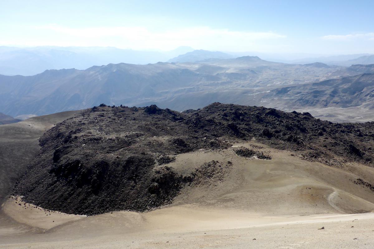
What’s going on with the volcano?
The area where the Ticsani volcano is located is considered a very active and complex tectonic-volcanic environment. The Geophysical Institute of Peru has witnessed this since 2005, the year of the installation of local seismic networks, to better understand all the dynamic processes typical of the region.
This last increase of activity, as well as those observed in recent years on this volcano, allow us to conclude that movements occur inside the magmatic chamber of the Ticsani which, when they exert a pressure on the volcanic system, produce or reactivate existing faults present in the volcano environment.
Source : IGP
Colombia , Chiles / Cerro Negro :
Weekly activity bulletin of volcanoes Chiles and Cerro Negro.
The activity level of the volcanoes is maintained at the level: YELLOW LEVEL ■ (III): CHANGES IN THE BEHAVIOR OF THE VOLCANIC ACTIVITY
Following the activity of the CHILE volcanoes and CERRO NEGRO, the COLOMBIAN GEOLOGICAL SERVICE (SGC) reports that:
Between 23 and 29 October 2018, seismic activity in the Chile – Cerro Negro volcano region showed an increase in the number of earthquakes corresponding to about 22% compared to the previous week. The predominant seismicity remains that related to the fracturing of the volcanic building (volcano-tectonic earthquakes).
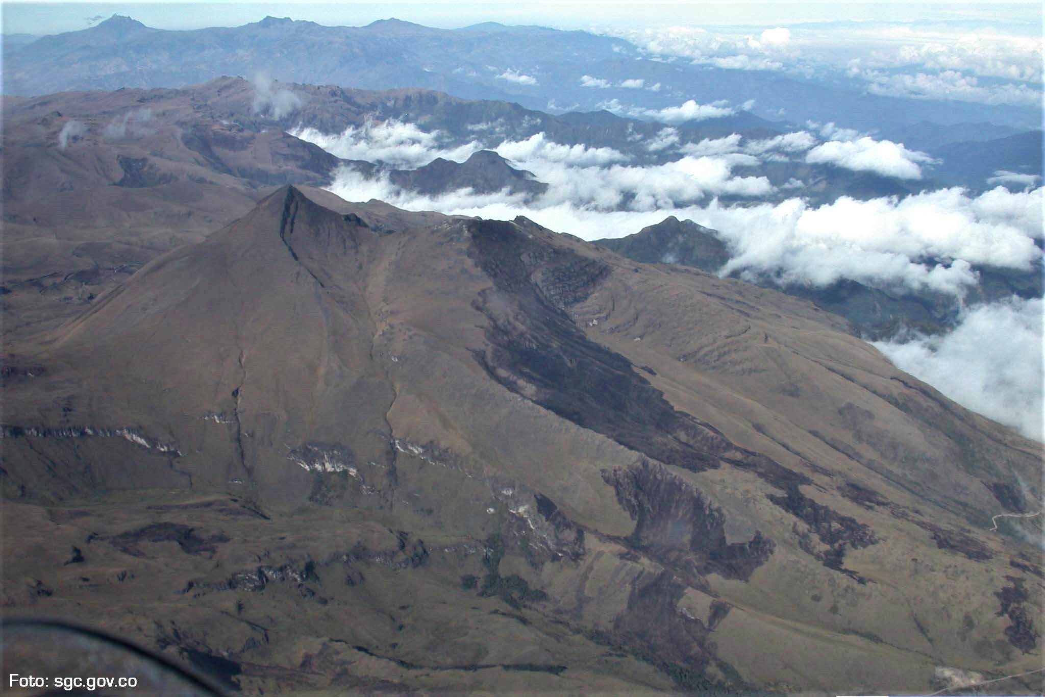
The vast majority of these events occurred south and southwest of the Chiles volcano, with epicentral distances between 0.5 and 8 km from this volcano. with depths of up to 6 km from the summit (4700 m) and local magnitudes up to M3 on the Richter scale. The earthquake that occurred on October 29 at 3:56. located 1.3 km south-southwest of Chiles, at a depth of 4 km and a local magnitude of M3 on the Richter scale, was reported as felt by the inhabitants. .
The Colombian Geological Service and the Institute of Geology of the National Polytechnic School of Ecuador closely monitor the evolution of this seismic activity and the volcanic phenomenon and inform in a timely manner on the detected changes.
Source : SGC
Costa Rica , Turrialba :
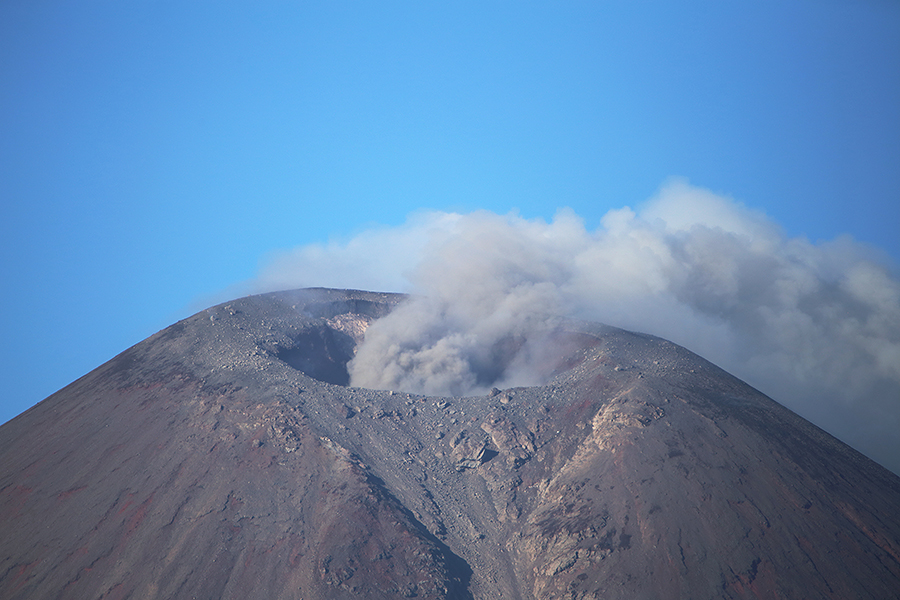
The Volcanological and Seismological Institute of Costa Rica (Ovsicori) announced that the Turrialba volcano in Cartago had erupted for more than four minutes on 30 October.
Geoffroy Avard, a volcanologist at Ovsicori-UNA, explained that the activity had occurred at 14:06. and this has been recorded by the monitoring system.
« Its column was 500 meters above the crater height and 3840 meters above sea level (meters above sea level) (12595.2 ft).
Duration of the activity: 4 minutes.
The winds blow from the west. No drop of ash or smell of sulfur is reported.
https://www.facebook.com/turrialbalodge/videos/2107719709488850/
Turrialba Volcano Activity Report, October 30, 2018
On 2018-10-30 at 14:06 local time, there is an eruption in the Turrialba volcano, with a column that rises 500 meters above the crater and 3840 meters above sea level. (Meters above sea level) (12595.2 ft).
Duration of the activity: 4 minutes.
The winds blow to the west.
Fall of ash is reported in: No ash drop
Sulfur odor reported in: No sulfur odor reported
Source : Diarioextra, Ovsicori.
Video : Turrialbalodge
Indonesia , Anak Krakatau :
The Pandeglang earthquake does not affect Anak Krakatau.
Bandung – The Pandeglang earthquake has been declared without impact on the activity of Gunung Anak Krakatau. « The information from the Anak Krakatau observation post, so far, shows that the activity of the mountain has not changed, » said Akhmad Solikhin, head of the sub-department of earthquake mitigation. land in the Western Region of the Geological Disaster Mitigation Center (PVMBG), Wednesday, October 31, 2018.
According to him, the current level of activity of Anak Krakatau is still at level II (WASPADA). The situation is the same as before the Pandeglang earthquake, whose epicenter was in the Sunda Strait region.

A M5.0 magnitude tectonic earthquake occurred in the Sunda Strait on Tuesday, October 30, 2018 at 4:19 am He shook the Pandeglang area until he felt weakened Ciputat, South Tangerang. The earthquake did not trigger a tsunami.
The Meteorological Climate Agency (BMKG) noted that the epicenter was located at coordinates 6.97 LS and 104.92 BT. « Located precisely at sea at a distance of 126 kilometers southwest of Pandeglang City, in Pandeglang Regency, Banten Province, » said the head of the information division on early warning BMKG earthquakes and tsunamis, Daryono, in a written statement on Tuesday, October 30, 2018.
The magnitude of the earthquake that was updated to M = 5.0 (originally M 5.2) came from a depth of 65 km. The earthquake that occurred was a type of medium-depth earthquake. « The cause of the earthquake is the activity of the Indo-Australian plate that is subject to control of the Eurasian plate, » said Daryono.
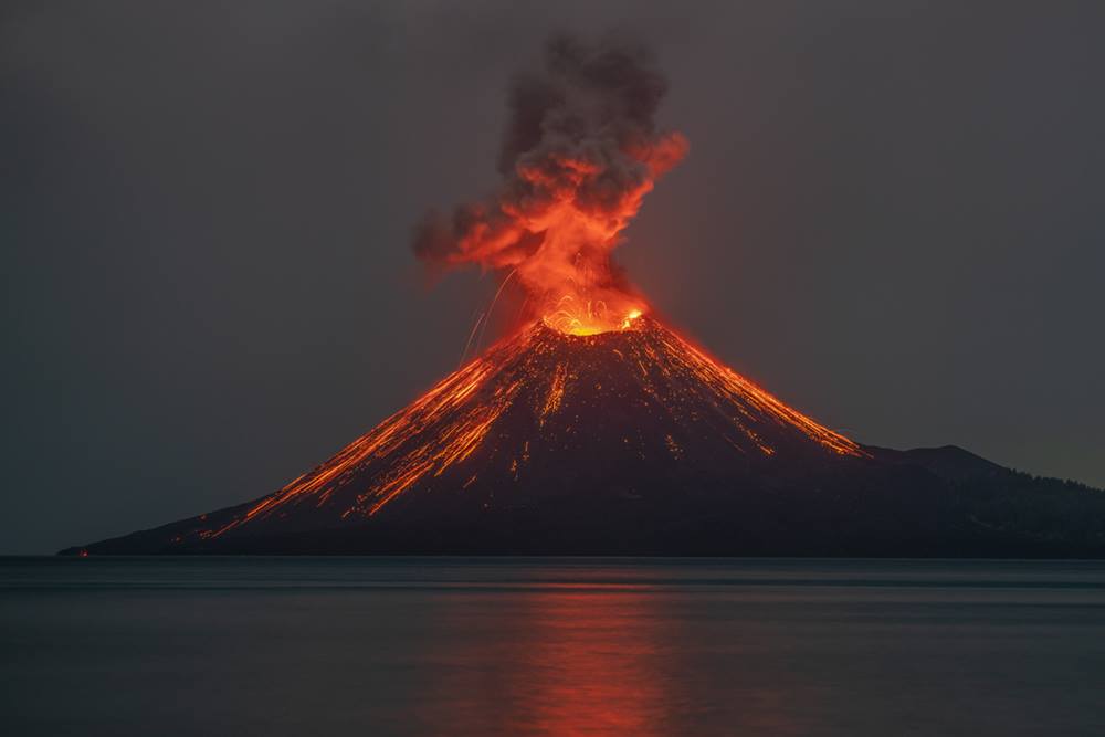
Level of Activity at Level II (WASPADA). G. Anak Krakatau (338 m above sea level) has increased its volcanic activity since June 18, 2018. Since yesterday and until this morning, the volcano was visually covered with fog. The smoke from the crater is not observed. The wind is weak in the east and southwest.
The seismographs, October 30, 2018 recorded:
15 earthquakes of eruption
14 deep volcanic earthquakes.
52 shallow volcanic earthquakes
25 earthquake emission
1 distant tectonic earthquake
A tremor is recorded continuously with an amplitude of 1 – 28 mm (dominant value 5 mm)
Recommendation:
People / tourists are not allowed to approach the crater within 2 km.
Source : TEMPO.CO .
Photos : Martin Rietze . www.mrietze.com/