August 11 , 2018.
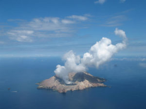
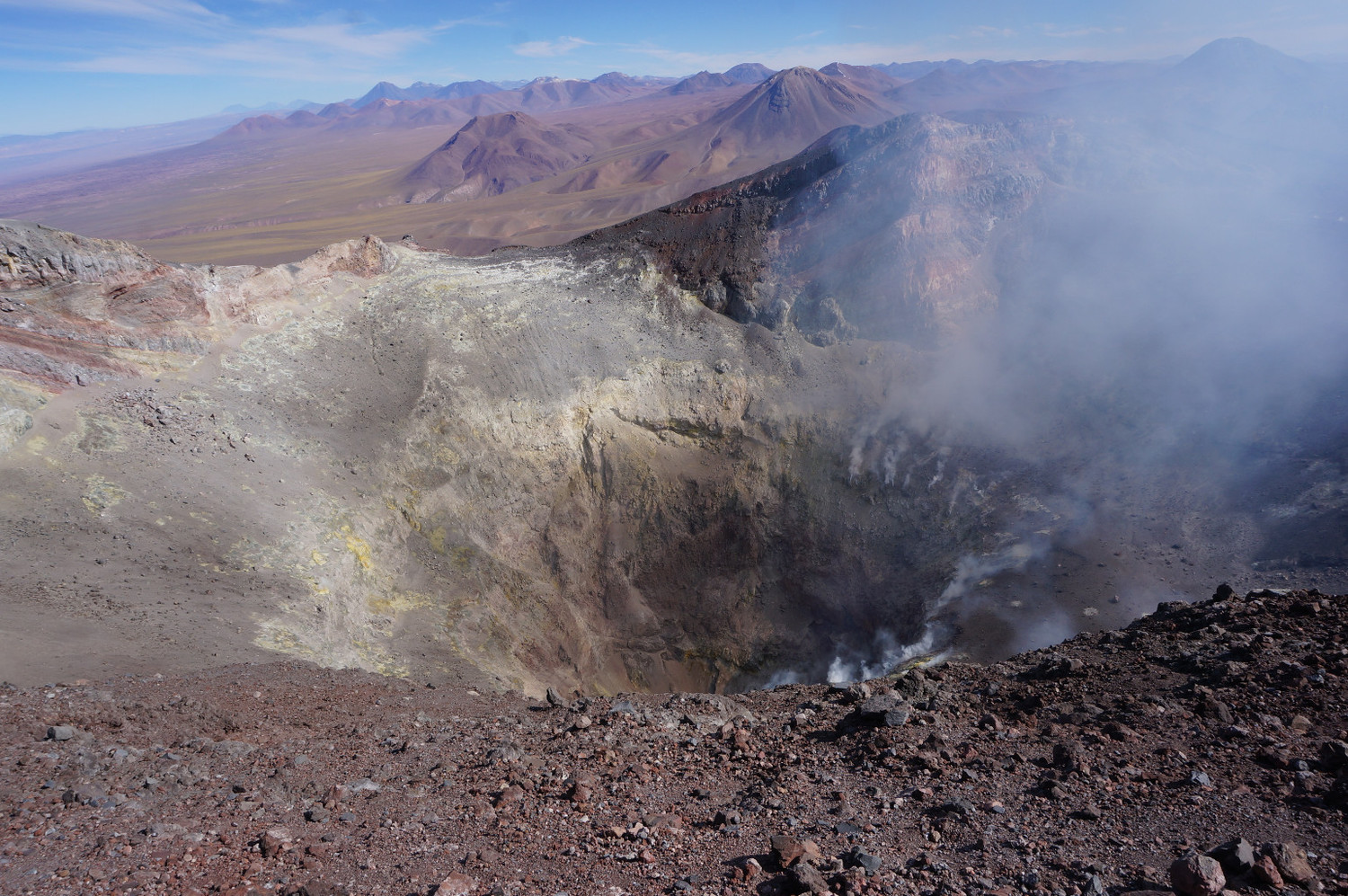
Chile , Lascar :
During this first week, a total of nine hundred and eighty-eight (988) seismic events were recorded, of which 943 were classified as volcano-tectonic (VT) earthquakes, associated with processes. breaking of rigid materials. The higher energy earthquake showed a local magnitude (Ml) of 2.5 and was located in the active crater at a depth of 1.5 km. Between 25 and 27 July, a seismic swarm of 903 VT type events was recorded with surface features.
Similarly, forty-two (42) earthquakes, called long-period type (LP), related to fluid dynamics within the volcano, with reduced displacement values (RDC) of less than 6.1 cm2 have been registered. In addition, three (3) long-period earthquakes, called « Tornillos » (TO), were recorded, characterized by a long duration and quasi-harmonic character in their spectral content, with reduced displacements (DRC) of 1 , 2 cm2.
The images obtained by the IP camera showed degassing from the main crater, reaching a maximum height close to 300 m above the level of the active crater.
From the data of three (3) GNSS stations located on the volcano, a stability of the components is observed, it is therefore determined that there is no evidence of deformation for the evaluated period.
The sulfur dioxide (SO 2) emissions recorded by the Differential Absorption Spectrometry (DOAS) equipment had an average value during the first half of 2380 ± 218 t / d and a maximum daily value of 5132 t / d on 29 July S02 emissions are at moderate to high levels for this volcano, showing a gradual increase over previous months.
A thermal alert has been reported in the area associated with the volcanic edifice, with a 0.3 MW Volcanic Radiated Power (PVR), considered low.
Continuation of surface seismic activity in the active crater in conjunction with an increase in magmatic gas release and thermal anomaly, indicating a dynamic in a magma body located in the conduit at shallow depths, which could lead to the volcanic system to an imbalance It is recalled that in previous periods, this type of activity was associated with minor phreatic explosions. In this context, the probability of occurrence of minor explosions is maintained.
Therefore, the level of volcanic alert remains at the level:
YELLOW LEVEL: Changes in the behavior of volcanic activity – Probable time for an eruption: WEEKS / MONTH.
Observation: It is considered as a danger zone an area of 2 kilometers around the active crater.
Observation: Il est considéré comme une zone de danger une zone de 2 kilomètres autour du cratère actif.
Source : Sernageomin
Photo : Amazing place of our planet , Camp to camp ( https://www.camptocamp.org )
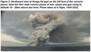
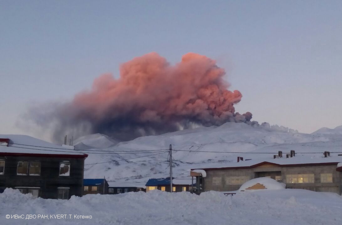
Kamchatka, Ebeko :
VOLCANO OBSERVATORY NOTICE FOR AVIATION (VONA).
Issued: August 10 , 2018.
Volcano:Ebeko (CAVW #290380)
Current aviation colour code:ORANGE
Previous aviation colour code:orange
Source:KVERT
Notice Number:2018-69
Volcano Location:N 50 deg 41 min E 156 deg 0 min
Area:Northern Kuriles, Russia
Summit Elevation:3791.68 ft (1156 m)
Volcanic Activity Summary:
A moderate explosive activity of the volcano continues. Satellite data by KVERT showed an ash cloud in size 11×14 km drift for about 26 km to the east-south-east from the volcano.
A moderate gas-steam with some amount of ash activity of the volcano continues. Ash explosions up to 19,700 ft (6 km) a.s.l. could occur at any time. Ongoing activity could affect low-flying aircraft and airport of Severo-Kurilsk.
Volcanic cloud height:
6560-8200 ft (2000-2500 m) AMSL Time and method of ash plume/cloud height determination: 20180810/2130Z – Himawari-8
Other volcanic cloud information:
Distance of ash plume/cloud of the volcano: 16 mi (26 km)
Direction of drift of ash plume/cloud of the volcano: ESE / azimuth 118 deg
Time and method of ash plume/cloud determination: 20180810/2130Z – Himawari-8
Source : Kvert
Photo : T. Kotenko, IVS FEB RAS, KVERT, 19/1/2017 .
Iceland , Katla :
The sleeping giant volcano Katla trembles: a violent earthquake in the caldera.
Katla, a giant volcano hidden under the icecap of Mýrdalsjökull in southern Iceland, which dominates the city of Vík, has been relatively quiet and silent for several months. Following signs of increasing activity in recent years, seismic activity on the Katla is taken very seriously. The volcano is under close surveillance as it erupts very regularly every 60 to 80 years. The last eruption occurred in 1918, making Katla long overdue for an eruption.
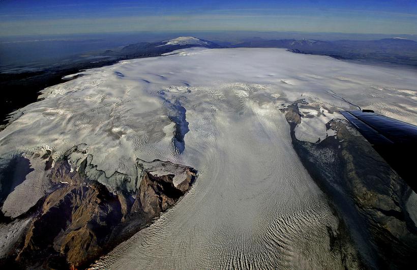
The National Seismic Monitoring System of the Icelandic Meteorological Office recorded a swarm of earthquakes last night. The largest of the two dozen earthquakes was an earthquake of magnitude M3.1 at 21:39 (21:39). This earthquake had an epicenter 6.5 km east-north-east of Goðabunga Peak (29 km / 18 miles north-northwest of Vík) at a depth of 100 meters (330 ft). The initial tremor was followed by nearly a dozen smaller tremors.
Source : icelandmag
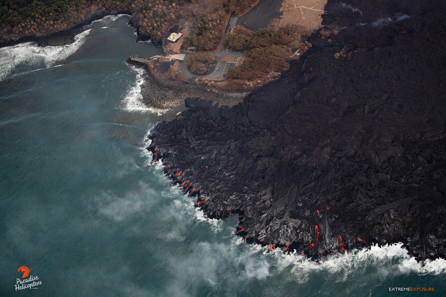
Hawaï , Kilauea :
Friday, August 10, 2018, 1:17 PM HST (Friday, August 10, 2018, 23:17 UTC)
19°25’16 » N 155°17’13 » W,
Summit Elevation 4091 ft (1247 m)
Current Volcano Alert Level: WARNING
Current Aviation Color Code: ORANGE
Kīlauea Volcano Lower East Rift Zone (LERZ)
A small lava pond remains in the Fissure 8 cone. Observations yesterday (August 9) show the pond to be largely crusted over with only minor areas of incandescence. Fissure 8, and the channel leading from Fissure 8, show no sign of reactivation. Fissures 9, 10, and 24 up-rift of Fissure 8, and the down-rift Fissures 13, 23, 3, 21 and 7 continue to steam, but are not incandescent. Lava is oozing at several points along the Kapoho Bay and Ahalanui coastline creating wispy laze plumes.
The Unmanned Aircraft Systems (UAS) team flew over fissure 8 today, providing this aerial view into the cinder cone. The pond of lava within the vent has receded, and was about 40 m (130 ft) below the highest point on the cinder cone’s rim today.
Although the lull in LERZ activity continues, it is common for eruptions to go through periods of diminished output, or to pause completely, only to return with renewed vigor days or weeks later, or longer. Resumption of the activity on the LERZ could occur at any time, and residents should remain informed and heed Hawaii County Civil Defense messages and warnings.
Gas Emissions
SO2 emissions from the summit, Pu῾u ῾Ō῾ō , and the Lower East Rift Zone are all at low levels. LERZ emissions on August 5-6 were ~ 200 tons/day; Pu῾u ῾Ō῾ō emissions on August 6-7 were 200-300 tons/day, and Summit emissions when last measured on July 19 were around 100 tons/day. This SO2 release represents the lowest SO2 emitted from Kīlauea for over a decade.
Despite the low emission rates, SO2 plumes were blown toward populated areas in east Hawai’i by SE winds on August 9, and many individuals reported detecting the smell of sulfur. Weather conditions contributed to this, but in addition, as the eruption vents cool down, small amounts of H2S are generated. The human nose can detect H2S at very low levels, adding to the overall perception of increased sulfur emission.
Kīlauea Volcano Summit
It has been over a week since the most recent collapse event at the summit on August 2. Summit seismicity continues to be low over the last 24 hrs, with less than 5 located earthquakes per hour and a maximum magnitude of M2.0. Summit deflation is negligible.
Source : HVO
Photos : HVO , Bruce Omori.
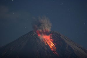
Mexico , Popocatepetl :
August 10, 11:00 am (August 10, 16:00 GMT)
In the last 24 hours, thanks to the monitoring systems of the Popocatepetl volcano, 37 low intensity exhalations accompanied by water vapor and gas have been identified. One of the most important events recorded today at 6:38 pm, produced an emission of water vapor and other gases, with a height of about 800 m, which was scattered in the South direction -Where is . In addition, a volcano-tectonic earthquake was recorded at 4:10 am with a magnitude of 1.8 M.
During the night, an incandescence was observed in the crater area, which increased during a few episodes accompanied by emissions of water vapor and other gases that remained until around 8:00 am today.
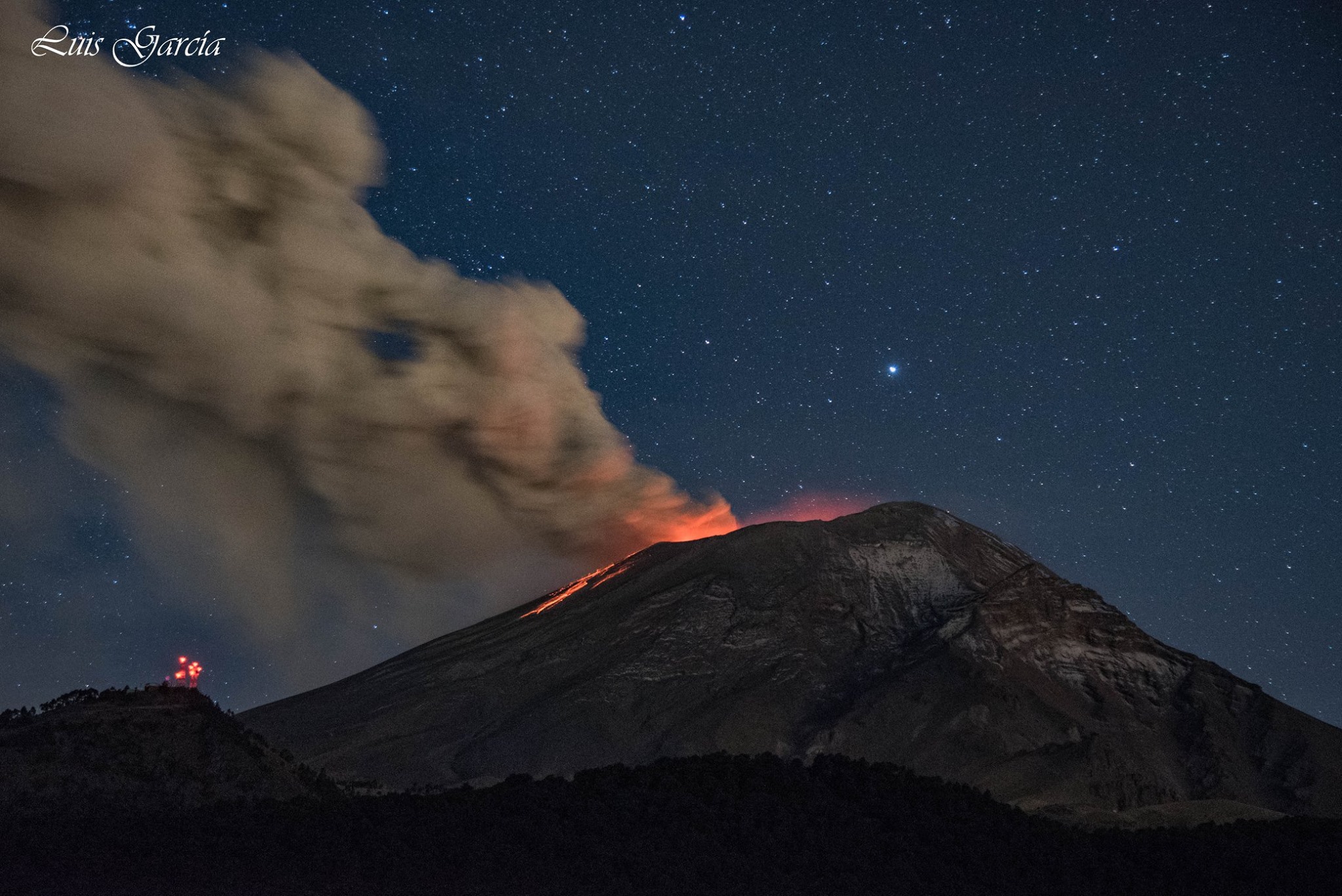
At the time of writing, there is no visibility on the volcano, but the seismic activity remains stable.
CENAPRED asked not to approach the volcano and in particular the crater, because of the risk of falling of projectiles and in case of heavy rain to stay away from the bottom of the ravines because of the danger of landslides and mudslides .
The alert level of Popocatepetl is located at Amarillo Phase 2.
Source : Cenapred.
Photo : Luis Garcia.