June 20 , 2024.
Iceland : Reykjanes Peninsula :
The eruption has been going on for over three weeks. Risk assessment unchanged
Updated June 20 at 1:05 p.m.
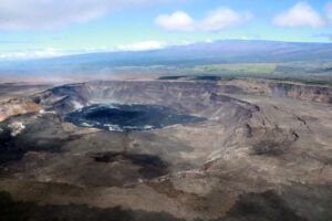
A crater continues to erupt just east of Sundhnúk
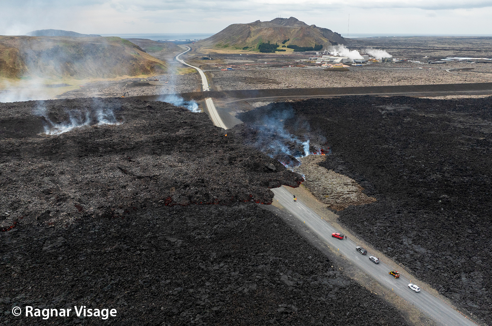
The flow north of Sýlingarfell continues to thicken. The lava that gushed out crossed a dike on June 18
land uplift is measured at a constant rate at Svartsengi, even though the eruption is ongoing
Risk assessment is unchanged
The eruption that began in the Sundhnúks crater series on May 29 has now lasted for just over three weeks and continues from a crater just east of Sundhnúks. The lava flow north of Sýlingarfell continues to thicken, but on Tuesday June 18, the lava flowing from it crossed the L1 defense wall, which is located northeast of Svartsengi, but did not go far.

As in recent days, the uprising continues at a constant pace in Svartsengi, although the eruption is still ongoing. This can be interpreted as the fact that the flow of magma from the depths continues and is greater than that from the crater, and the accumulation of magma under Svartsengi continues as before.
Today’s weather forecast is South and later South East at 3-8 m/s. The gas moves north and northwest towards Reykjanesbær and Vogur. Tomorrow (Friday), the wind will be East and later North-East 3-8 m/s, the gas will move towards the West and South-West. Slow change of direction tomorrow afternoon, gas pollution can be observed in many parts of the South-West corner.
The risk assessment has been updated and remains unchanged. It is valid until next Tuesday, June 25.
Source : IMO
Photo : Ragnar Visage ( archive )
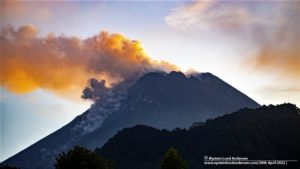
Indonesia , Ibu :
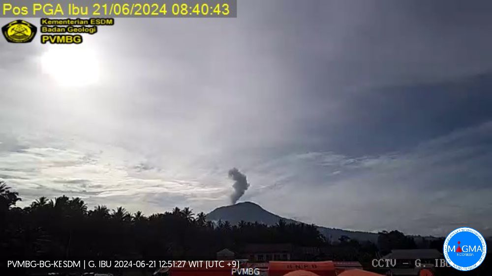
An eruption of Mount Ibu occurred on Thursday, June 20, 2024 at 9:16 p.m. WIT with the height of the ash column observed at ±500 m above the summit (±1825 m above sea level). The ash column was observed to be gray to black in color with medium to thick intensity, oriented towards the North-East and East. This eruption was recorded on a seismograph with a maximum amplitude of 6.5 mm and a duration of 131 seconds.
Observation of seismicity:
1 eruption earthquake with an amplitude of 9 mm and a seismic duration of 57 seconds.
6 emission earthquakes with an amplitude of 2 to 16 mm and duration of the earthquake from 25 to 50 seconds.
89 Shallow volcanic earthquakes with an amplitude of 2 to 17 mm and an earthquake duration of 6 to 20 seconds.
7 deep volcanic earthquakes with an amplitude of 2 to 24 mm, and an earthquake duration of 5 to 18 seconds.
RECOMMENDATION
1. Communities around Mount Ibu and visitors/tourists should not carry out activities within a radius of 4 km, with a sectoral extension of 7 km towards the crater opening in the northern part of the active Mount Ibu crater .
2. In the event of falling ash, people who carry out activities outside the home are advised to wear nasal, oral (mask) and eye (glasses) protection.
Source et photo : Magma Indonésie
Tonga Archipelago , Home Reef :
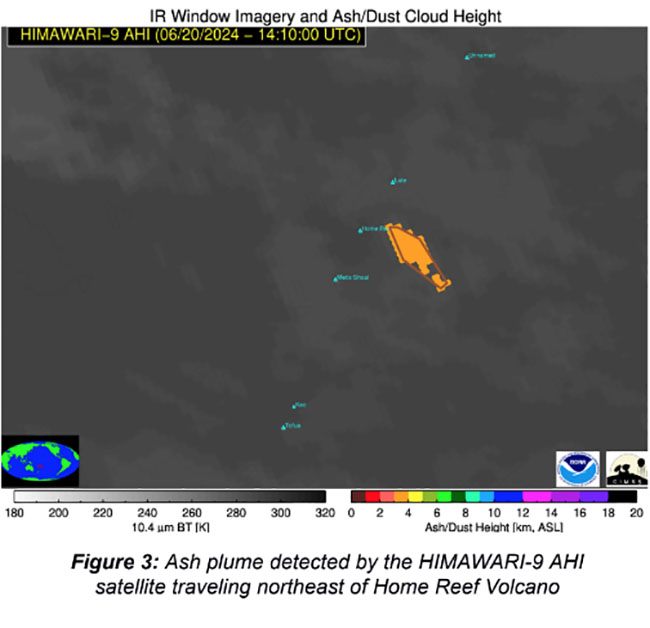
An ash plume drifting northeast of Home Reef around ~1:30 AM today June 21, was detected by the HIMAWARI-9 AHI satellite, Tonga Geological Services reported.
This Volcano Watch Team monitoring the volcanic activities at Home Reef Volcano, issued Public Notice No.7 at 9:00 this morning.
“Home Reef Volcano continues to be closely monitored due to ongoing volcanic activity. Over the past 16 hours since the last Public Notice, VOLCAT has detected a total of five (5) thermal anomalies. The most recent anomaly was observed at 4:56 AM this morning . Recent MODIS-MIROVA satellite imagery indicates a slight decrease in Volcanic Radiative Power (VRP), represented by qualitative changes . Additionally, the HIMAWARI-9 AHI satellite detected an ash plume drifting northeast of Home Reef around ~1:30 AM .”
“The volcanic activity poses a low risk to the Vava’u and Ha’apai Communities. However, all Mariners are advised to sail beyond 4 km from Home Reef until further notice.
“The public is at this moment advised to adhere to these restrictions for safety purposes,” advised Tonga Geological Services.
Monitoring of the volcano is ongoing daily on the status of the current eruption.
Home Reef is located 25 km southwest of Late Island, 22 km northeast of Lateiki (Metis Shoal), and 75 km northwest of Mo’unga’one Island at Latitude and Longitude 18.992°S & 174.775°W
Source : Matangitonga
Photo : Himawari
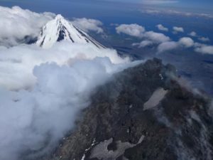
Colombia , Galeras :
San Juan de Pasto, June 18, 2024, 3:30 p.m.
Weekly activity bulletin: Galeras Volcano
Regarding the monitoring of the activity of the GALERAS VOLCANO, the COLOMBIAN GEOLOGICAL SERVICE (SGC), an entity attached to the MINISTRY OF MINES AND ENERGY, reports that:
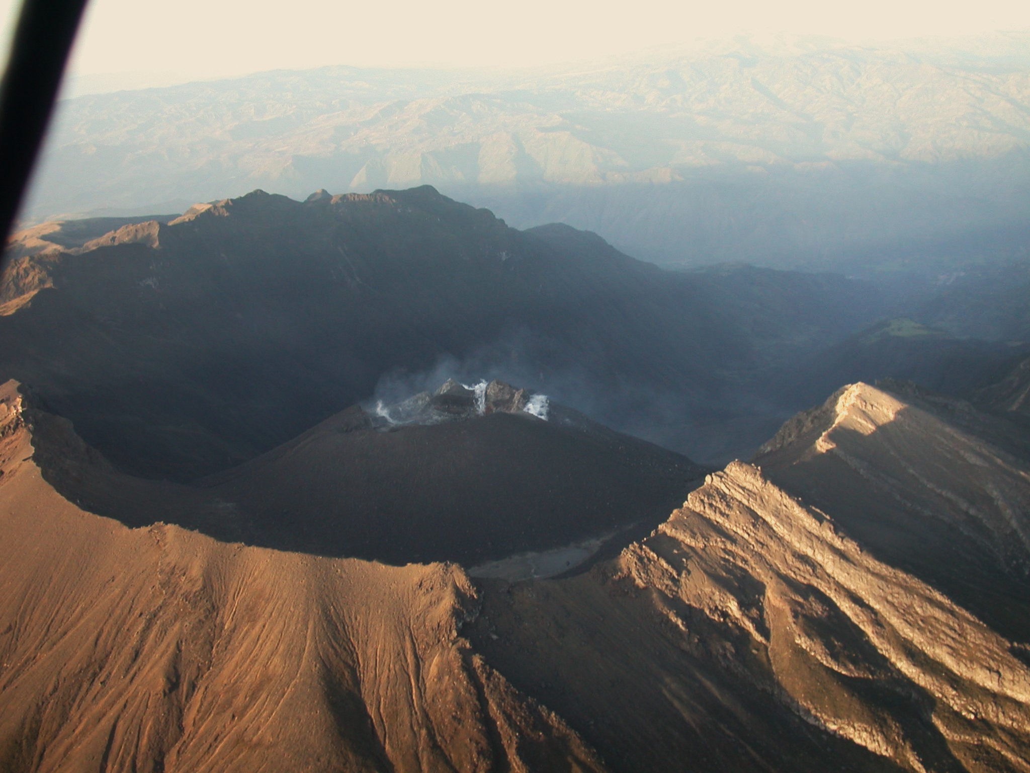
During the period evaluated between June 11 and 17, 2024 and compared to previous weeks, an increase in seismic occurrence was observed, maintaining similar levels of energy released, with the predominance of seismicity associated with the fracture of rocks within the volcanic system and recording of seismicity related to fluid dynamics within the volcanic system. The fracture earthquakes were located mainly near the active cone at distances less than 1 km and at depths less than 3 km relative to its summit (4,200 m altitude).
A few other events were located scattered across the volcanic region, at distances up to 14 km to the northeast, with depths less than 9 km and a maximum local magnitude of 1.1.
Gas emissions were recorded in the fumarole fields of Las Chavas, to the West, and El Paisita, to the North of the active cone, with small white columns, of low height and variable dispersion due to the action of the winds. The other geophysical and geochemical parameters of volcanic monitoring showed stability.
Volcanic activity remains in a YELLOW ALERT state: active volcano with changes in the behavior of the base level of monitored parameters and other manifestations.
Source et photo : SGC
Costa Rica , Poas :
Latitude: 10.20°N;
Longitude: 84.23°W;
Altitude: 2687 m
Current activity level: Warning
Possible manifestations: Small eruptions, bubbling or geysers, significant gas emission, temperature rise (incandescence), seismic swarms or volcanic tremor, slight inflation-extension of the volcanic edifice.
This week, seismic and acoustic activity has been very stable compared to previous weeks and is characterized by continuous tremors of moderate amplitude and LP type earthquakes. However, a sustained and progressive increase in tremor amplitude is observed. Between June 8 and 10, a sequence of high-frequency events occurred. These are recorded only at stations close to the crater. The magnitude of these events is small and they are observed with less intensity than tremors. It is not excluded that they are associated with fault movements under the active zone of the crater.
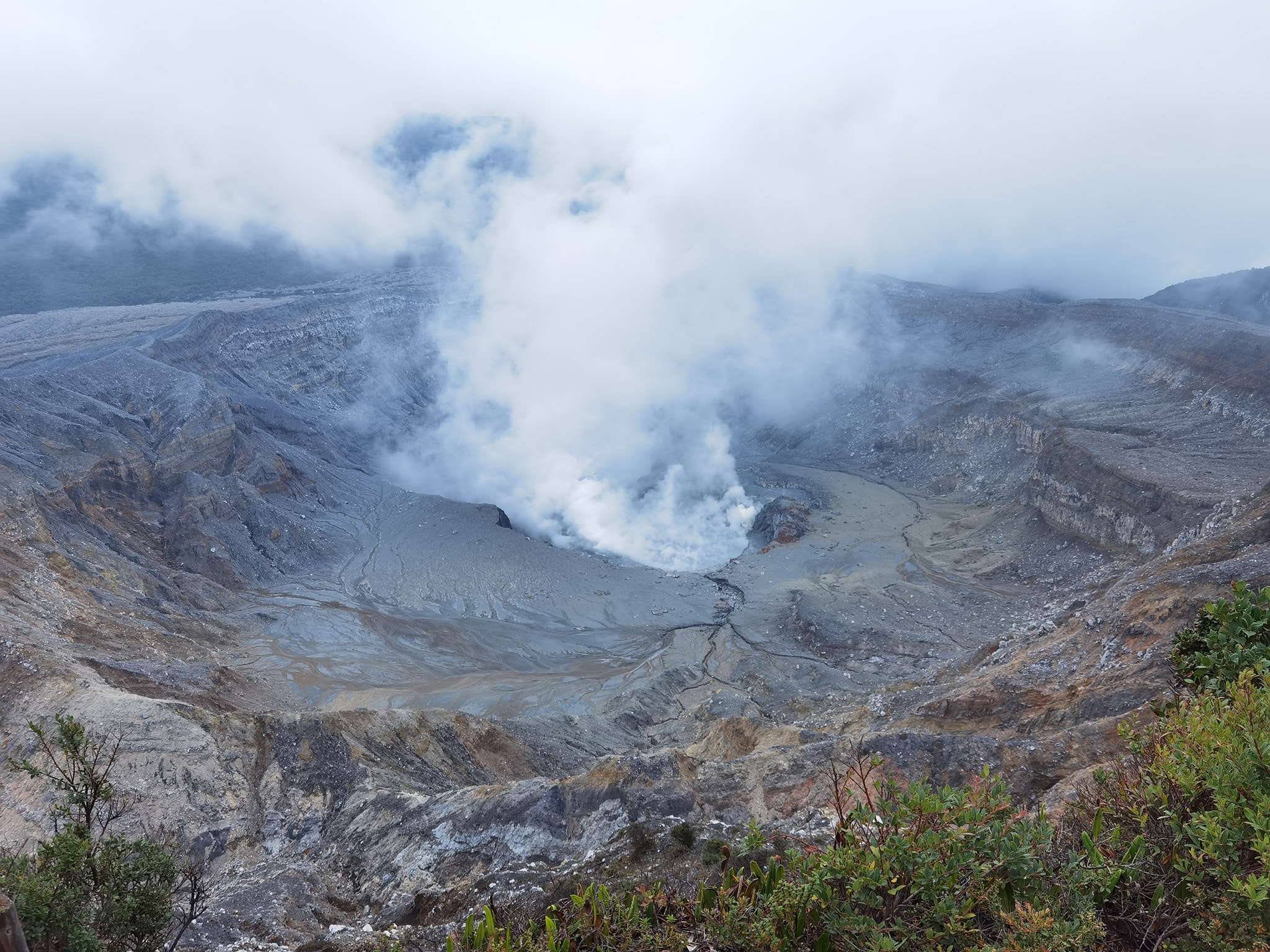
LP earthquakes are occurring in the dozens per day, with rates similar to last week. No acoustic bubbling signal has been detected since Tuesday May 28. In recent days, a contraction of the crater continues to be observed with a more pronounced subsidence of the massif to the north of the crater. The gas compositions highlight changes linked to the decrease in activity and the entry of water. The SO2/CO2 ratio has shown a downward trend in recent weeks, with an average of 1.0 ± 0.4 this week compared to weekly averages of between 1.8 and 2.4 in April-May. The H2S/SO2 ratio remains relatively stable with values close to 0.5.
The SO2 concentration recorded by the ExpoGAS station at the lookout reached a maximum of 7.4 ppm this week. The Sentinel satellite did not detect the SO2 plume in the atmosphere this week. The water level has risen by approximately 0.2 m this week.
Source : Ovsicori
Photo : Silvio Neels