September 28 , 2023.
Italy , Stromboli :
Press release on Stromboli activity, September 27, 2023, 3:02 p.m. (1:02 p.m. UTC).
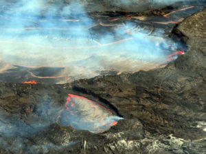
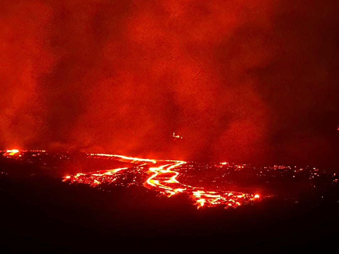
The National Institute of Geophysics and Volcanology, Osservatorio Etneo, communicates that from around 12:28 UTC, a lava overflow fed by the northern area of the crater is visible. For the moment, the overflow remains confined to the upper part of the Sciara del Fuoco.
From a seismic point of view, during the last 24 hours the average amplitude of the volcanic tremor has fluctuated between medium and high values and is currently at the high level. Furthermore, no significant changes were reported in the frequency of occurrence and amplitude of explosion earthquakes.
The available GNSS and inclinometer data do not show significant ground deformations.
Press release on Stromboli activity, September 27, 2023, 9:58 p.m. (7:58 p.m. UTC).
The National Institute of Geophysics and Volcanology, Osservatorio Etneo, communicates that according to the analysis of the INGV-OE surveillance cameras, we observe that the overflow in the area of the North crater continues to be well fed by an intense activity of variable projection and forms a lava flow directed along the Sciara del Fuoco. The lava flow front also rolls material down the Sciara del Fuoco.
Explosive activity in the South Central Crater area shows no change from previous days.
From a seismic point of view, the average tremor amplitude did not show significant variations compared to what was reported in the previous release, oscillating in the high value range. A moderate decrease in the amplitude of explosion earthquakes is observed.
Inclinometer and GNSS data from the last few hours do not show significant ground deformation during the overflow.
Further updates will be communicated shortly.
Source : INGV
Photo : Stromboli stati d’animo.
Ethiopia , Erta Ale :
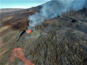
Two small thermal anomalies in Erta Ale’s S pit crater were identified in satellite images on 15 September. A 20 September image showed small anomalies in both the N and S pit craters, and a possible lava lake in the N pit crater that had mostly been crusted over. A large thermal anomaly in the SE part of the N pit crater was identified in a 25 September image. The anomaly suggested that lava had spilled over the SE rim of the crater and flowed short distances (possibly less than 400 m) E and SE.
The Erta Ale basaltic shield volcano in Ethiopia has a 50-km-wide edifice that rises more than 600 m from below sea level in the Danakil depression. The volcano includes a 0.7 x 1.6 km summit crater hosting steep-sided pit craters. Another larger 1.8 x 3.1 km wide depression elongated parallel to the trend of the Erta Ale range is located SE of the summit and is bounded by curvilinear fault scarps on the SE side. Basaltic lava flows from these fissures have poured into the caldera and locally overflowed its rim. The summit caldera usually also holds at least one long-term lava lake that has been active since at least 1967, and possibly since 1906. Recent fissure eruptions have occurred on the N flank.
Source : GVP
Photo : Seifegebreil Shifferaw
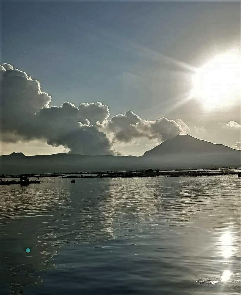
Philippines , Taal :
This is a notice of Volcanic Smog (VOG) over Taal Volcano.
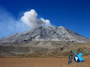
Since 12:30 PM today, volcanic smog or vog has been observed over Taal Lake by the Taal Volcano Network and has lingered over the region until present. Continuous upwelling persists at the Taal Main Crater Lake, generating steam plumes that rose to 2,400 meters before drifting to the west-southwest. In addition, a total of 4,569 tonnes/day of volcanic sulfur dioxide or SO2 gas emission from the Taal Main Crater was also measured today, 21 September 2023. Satellite monitors have also detected a large cloud of SO2 over and stretching west of Taal Lake today. Vog has been affecting the Taal Region since the first week of September 2023 as an average of 3,402 tonnes/day SO2 has been degassed from Taal Volcano for the month.
As a reminder, vog consists of fine droplets containing volcanic gas such as SO2 which is acidic and can cause irritation of the eyes, throat and respiratory tract with severities depending on the gas concentrations and durations of exposure. People who may be particularly sensitive to vog are those with health conditions such as asthma, lung disease and heart disease, the elderly, pregnant women and children.
PHIVOLCS reported ongoing unrest at Taal during 19-26 September. Upwelling gasses and hot fluids in the lake were visible during daily observations. Daily emissions of gas-and-steam rose from Main Crater Lake as high as 3 km and drifted in multiple directions. During 19-22 September there were 2-6 daily periods of volcanic tremor recorded by the seismic network, ranging from 4 minutes long to nearly 10 hours; no earthquakes were recorded during the rest of the week. Vog was reported almost daily, though conditions on 21 September prompted PHIVOLCS to issue a special notice. Starting at around 1230 on 21 September vog was present over Taal Lake. Sulfur dioxide emissions averaged 4,569 tonnes per day and a large sulfur dioxide cloud was identified in satellite images drifting W. PHIVOLCS noted that vog had been affecting the Taal region since the first week of September. The Alert Level remained at 1 (on a scale of 0-5), and PHIVOLCS reminded the public that the entire Taal Volcano Island was a Permanent Danger Zone (PDZ).
Source : GVP
Photo : Onin casal /Agoncillo ERT( archive).
Papua New Guinea , Ulawun :
Rabaul Volcano Observatory (RVO) reported that diffuse white emissions occasionally rose from the active vent at Ulawun’s summit crater from 14h30 on 19 September through most of 25 September. Weather conditions sometimes prevented visual observations. Seismicity was characterized as low during the beginning of the reporting period, dominated by low-level, continuous volcanic tremors that were punctuated by occasional, small, low-frequency, volcanic events. The pattern of seismicity changed just before 10h00 on 22 September with the emergence of very distinct, low-frequency volcanic earthquakes and short-duration, sub-continuous, volcanic tremors with increased amplitudes.
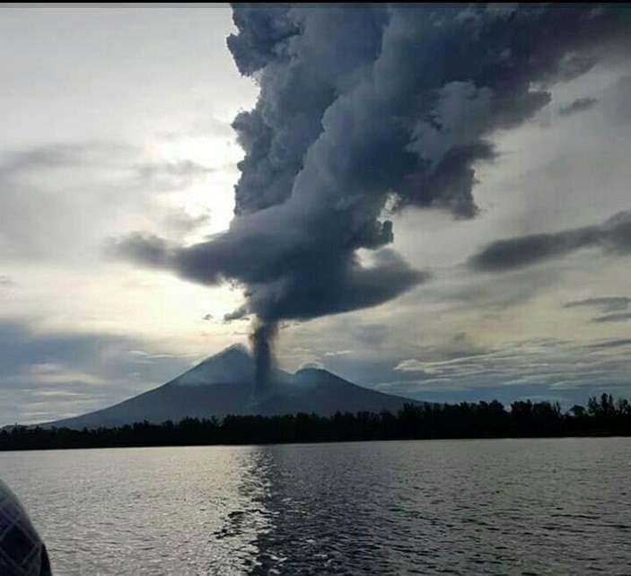
The amplitude of the continuous volcanic tremor fluctuated but slowly rose overall until about 13h00 on 25 September when the increase became rapid. At around 17h39 on 25 September a 4-5-km tall, white-to-pale-gray plume and minor incandescence at the summit vent were visible in webcam images. The incandescence intensified as the evening grew darker. The plume did not change and no ashfall was reported, suggesting low ash content. The incandescence intensified and became distinct in total darkness by 18h30. Incandescent lava fragments around the summit crater area and a possible small lava flow on the upper N flank were visible; rumbling and roaring sounds were heard. The eruption was over by 20h00. RSAM values peaked at 6,000 during the eruption; at the end of the activity seismicity decreased rapidly and was characterized by low levels of volcanic tremor. The Alert Level remained at Stage 1 (the lowest level on the four-level scale).
Source : GVP
Photo : Auther A Balisi
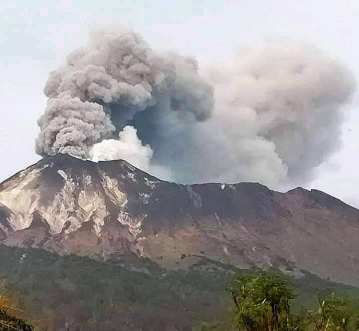
Indonesia , Ili Lewotolok :
An eruption of Mount Ili Lewotolok occurred on Thursday, September 28, 2023 at 09:03 WITA with an ash column height observed at ± 600 m above the summit (± 2023 m above sea level). The ash column was observed to be white to gray in color with thick intensity, oriented towards the West. This eruption was recorded on a seismograph with a maximum amplitude of 34 mm and a duration of 50 seconds.
VOLCANO OBSERVATORY NOTICE FOR AVIATION – VONA
Issued : September 28 , 2023
Volcano : Ili Lewotolok (264230)
Current Aviation Colour Code : ORANGE
Previous Aviation Colour Code : orange
Source : Ili Lewotolok Volcano Observatory
Notice Number : 2023LEW060
Volcano Location : S 08 deg 16 min 19 sec E 123 deg 30 min 18 sec
Area : East Nusa Tenggara, Indonesia
Summit Elevation : 4554 FT (1423 M)
Volcanic Activity Summary :
Eruption with volcanic ash cloud at 01h03 UTC (09h03 local).
Volcanic Cloud Height :
Best estimate of ash-cloud top is around 6474 FT (2023 M) above sea level or 1920 FT (600 M) above summit. May be higher than what can be observed clearly. Source of height data: ground observer.
Other Volcanic Cloud Information :
Ash cloud moving to west. Volcanic ash is observed to be white to gray. The intensity of volcanic ash is observed to be thick.
Remarks :
Eruption recorded on seismogram with maximum amplitude 34 mm and maximum duration 50 second.
PVMBG reported that the eruption at Lewotolok continued during 20-26 September. White-and-gray plumes of variable densities rose as high as 800 m above the summit and drifted in multiple directions on all days except 25 September when only white plumes were visible. A webcam image captured incandescent material being ejected above the summit at 2346 on 23 September. The Alert Level remained at 2 (on a scale of 1-4) and the public was warned to stay at least 2 km away from the summit crater.
Source : Magma Indonésie , GVP
Photo : kodi Setiawan