September 25 2020.
Philippines , Taal :
TAAL VOLCANO BULLETIN 25 September 2020 08:00 A.M.
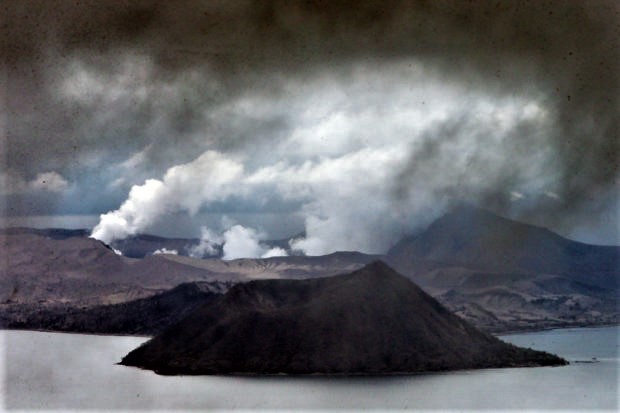
In the past 24-hour period, the Taal Volcano Network recorded six (6) volcanic earthquakes. Weak steaming or fumarolic activity rising 5 meters high before drifting southwest was observed from vents on the Main Crater vents and fissure vents along the Daang Kastila Trail.
Alert Level 1 (Abnormal) is maintained over Taal Volcano. DOST-PHIVOLCS reminds the public that at Alert Level 1, sudden steam-driven or phreatic explosions, volcanic earthquakes, minor ashfall, and lethal accumulations or expulsions of volcanic gas can occur and threaten areas within the Taal Volcano Island (TVI).
DOST-PHIVOLCS strongly recommends that entry into TVI, Taal’s Permanent Danger Zone or PDZ, especially the vicinities of the Main Crater and the Daang Kastila fissure, must remain strictly prohibited. Local government units are advised to continuously assess previously evacuated barangays around Taal Lake for damages and road accessibilities and to strengthen preparedness, contingency, and communication measures in case of renewed unrest. People are also advised to observe precautions due to ground displacement across fissures, possible ashfall, and minor earthquakes. Civil aviation authorities must advise pilots to avoid flying close to the volcano as airborne ash and ballistic fragments from sudden explosions and wind-remobilized ash may pose hazards to aircraft.
DOST-PHIVOLCS is closely monitoring Taal Volcano’s activity and any new significant development will be immediately communicated to all stakeholders.
Source : Phivolcs.
Photo : Edwin Bacasmas
Ecuador , Sangay :
Informative VOLCÁN SANGAY N ° 115, THURSDAY 24 SEPTEMBER 2020
Today, the SAGA seismic station has been recording from around 4.30 p.m. (TL) until now a high frequency signal, associated with the appearance of mudslides and debris (lahars) that descend through the ravines of the volcano. This phenomenon has been recurring since May 2019 and has its origin in the intense rains recorded on the volcano, which can remobilize the material accumulated throughout these days of activity. Proximity to rivers is not recommended.
The Geophysical Institute of the National Polytechnic School is keeping an eye on the activity of the volcano and will report on any changes that may be recorded.
SANGAY VOLCANO STATE DAILY REPORT, Thursday September 24, 2020.
Surface activity level: High, Surface trend: Increasing.
Internal activity level: High, Internal trend: Increasing.
Seismicity: From September 23, 2020, 11:00 a.m. to September 24, 2020, 11:00 a.m.
Long period type events: 5
Explosions: 12
Emission tremor: 1
Harmonic tremor: 1
Rains / lahars:
Last night in the morning, there were several episodes of rains in the area which generated signals associated with mudslides and debris.
** In case of heavy rains, lahars can be generated in the Volcán, Upano rivers and other tributaries **
Emission / ash column: No emission through the cameras was observed. The VAAC recorded 4 ash emission alerts, these emissions had heights of up to 1200 meters above crater level with a direction mainly to the West.
Other monitoring parameters: No change.
Observations: The climatic conditions of the area prevented direct observations of surface activity. The seismic reference station has been having transmission issues since around 1:10 TL today.
Niveau d’alerte: jaune.
Source et photo : IGEPN.
Colombia , Chiles / Cerro Negro :
Weekly activity bulletin of Chiles and Cerro Negro volcanoes
Volcanic activity continues at YELLOW LEVEL ■ (III): CHANGES IN THE BEHAVIOR OF VOLCANIC ACTIVITY.
From the monitoring of the activity of VOLCANS CHILES AND CERRO NEGRO, the COLOMBIAN GEOLOGICAL SERVICE (SGC) reports that:
During the period from September 15 to 21, 2020 and compared to the previous week, the seismic activity in the region of the Chiles – Cerro Negro volcanoes showed an increase, both in occurrence and in released energy. This seismicity was mainly related to the fracture of the rock inside the volcanic building.
Regarding their location, most of these earthquakes were located south-southwest of the Chiles volcano, at distances of up to 10 km and at depths less than 10 km from its summit (level of reference close to 4700 m.). Local magnitudes reached 2.5 on the Richter scale. No felt earthquake report has been received.
The changes recorded by the volcanic deformation sensors continue. No manifestation of surface activity was observed, nor significant variations in other volcanic monitoring parameters.
Source : SGC
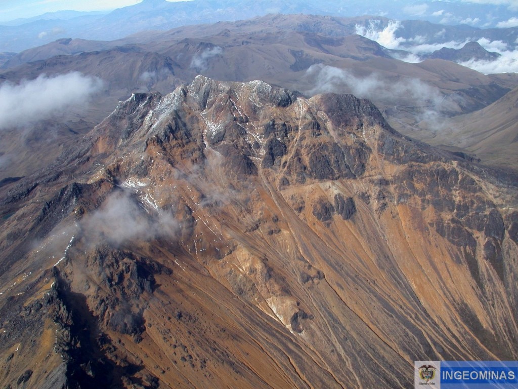
Photo : Ingeominas.
Guatemala , Fuego :
SPECIAL VOLCANOLOGICAL BULLETIN
Activity type: Vulcanian
Morphology: composite stratovolcano
Geographical location: 14 ° 28’54˝Latitude N; 90 ° 52’54˝Longitude W.
Height: 3763 meters above sea level.
MODERATE TO STRONG LAHAR IN THE LAS LAJAS AND EL JUTE RAVINES
The INSIVUMEH seismic network located on the Fuego volcano, records a high frequency seismic tremor from 4:13 p.m. on the south-eastern flank of the Fuego volcano, generated by volcanic materials transported by the rainwater that is currently occurring nearby of the volcanic building.
These lahars have moderate to strong characteristics and descend through the ravines of El Jute and Las Lajas.
Figure n ° 1 Seismogram of the FG12 station located at Finca La Réunion.
Heavy rains in the upper part of the volcanic complex can cause larger lahars to descend in these ravines and others in the volcano, such as Canyon Honda. Lahars can carry tree branches and volcanic material such as ash and boulders 1 to 2 meters in diameter that vibrate the ground. Pay special attention to the canyons mentioned at night and early in the morning.
Source : Insivumeh.
Hawaii , Mauna Loa :
19°28’30 » N 155°36’29 » W,
Summit Elevation 13681 ft (4170 m)
Current Volcano Alert Level: ADVISORY
Current Aviation Color Code: YELLOW
Activity Summary:
Mauna Loa Volcano is not erupting. Rates of deformation and seismicity have not changed significantly over the past week and remain above long-term background levels.
This aerial view of Mauna Loa’s summit shows the cinder-cone and lava flows that were erupted in 1949. The crack extending down the left side of the cone is the northeast-southwest trending 1984 fissure that bisected the southwest flank of the cone during the initial phase of the eruption. Light-brown tephra erupted from the 1949 cone thins to the west.
Observations:
Over the past week, HVO seismometers recorded approximately 103 small-magnitude earthquakes – all below M3.0 – beneath the volcano’s summit and upper-elevation flanks. The majority of these earthquakes occurred at shallow depths of less than 8 kilometers (approximately 5 miles) below ground level.
Global Positioning System (GPS) measurements continue to indicate slow, long-term summit inflation, consistent with magma supply to the volcano’s shallow storage system.
Gas concentrations and fumarole temperatures at both the summit and Sulphur Cone on the Southwest Rift Zone remain stable.
Webcam views have revealed no changes to the landscape over the past week.
Source : HVO.

