July 30 , 2021.
Italy / Sicily , Etna :
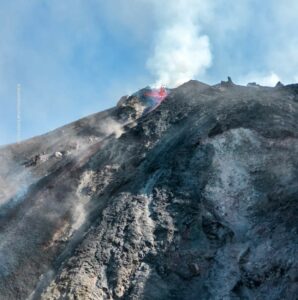
Press release on ETNA activity, July 29, 2021, 16:30 (14:30 UTC).
The National Institute of Geophysics and Volcanology, Osservatorio Etneo announces that from 21:18 UTC yesterday July 28, no other eruptive activity is observed at the level of the Southeast Crater.
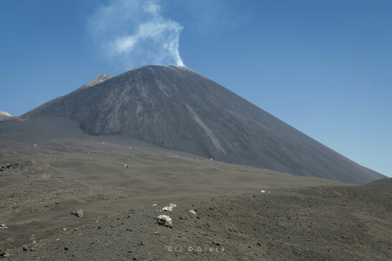
The time trend of the average amplitude of the tremor, which from the morning of the 29th is characterized by large fluctuations, currently remains in the range of average values. The location of the center of gravity of volcanic tremor sources is located in correspondence with the Southeast Crater at an altitude of about 2900 m above sea level. The rate of occurrence of infrasound events is medium. low with sources mainly located in the area of the Bocca Nuova Crater.
The distortion signals from the permanent GNSS and inclinometric networks do not show significant changes.
Further updates will be communicated shortly.
Source : INGV.
Photo : Gio Giusa .
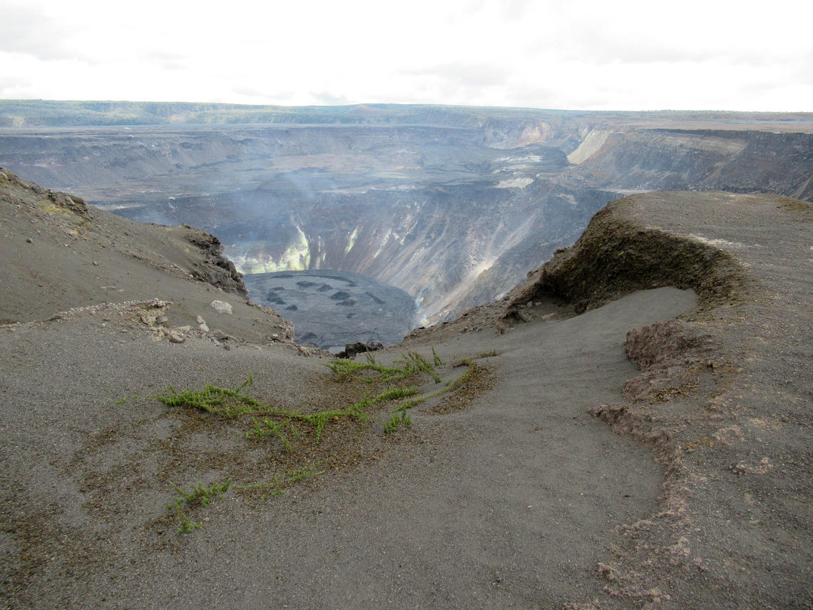
Hawaii , Kilauea :
19°25’16 » N 155°17’13 » W,
Summit Elevation 4091 ft (1247 m)
Current Volcano Alert Level: ADVISORY
Current Aviation Color Code: YELLOW
Activity Summary:
Kīlauea volcano is not currently erupting. No surface activity has been observed by field crews or in webcam images since May 23, 2021. Seismicity has deceased in the past week while summit inflation has continued over the past several months. Sulfur dioxide (SO2) emission rates are close to the low levels associated with the non-eruptive period from late 2018 to late 2020. It is possible that the Halema‘uma‘u vent could resume eruption or that Kīlauea is entering a longer period of quiescence prior to the next eruption.
Summit Observations:
The latest field visit to Halema‘uma‘u and Kīlauea caldera on July 22 confirmed continued fumarole degassing and no changes to the crater floor. SO2 emission rates continue to be low, consistent with a return to non-eruptive period from late 2018 to late 2020 (30-35 t/d) and are well below emission rates from mid-February to mid-April (~800 t/d). Summit tiltmeters recorded continued gradual inflation but no deflation-inflation events occurred in the past week. Continued inflation was also recorded by summit GPS instruments, a pattern that has persisted for several months. Seismicity decreased in the past week.
Halemaʻumaʻu Lava Lake Observations:
The lake’s surface is completely covered by solidified lava crust and no surface activity has been observed over the past week.
East Rift Zone Observations:
Seismicity persisted along the upper East Rift Zone at slightly elevated levels over the past week. Together with the geodetic monitoring the observations suggest that the summit and upper East Rift Zone continue to be replenished with magma. By contrast, the Lower East Rift Zone was mostly quiet.
Source : HVO.
Photo : J.M. Chang / USGS.
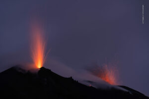
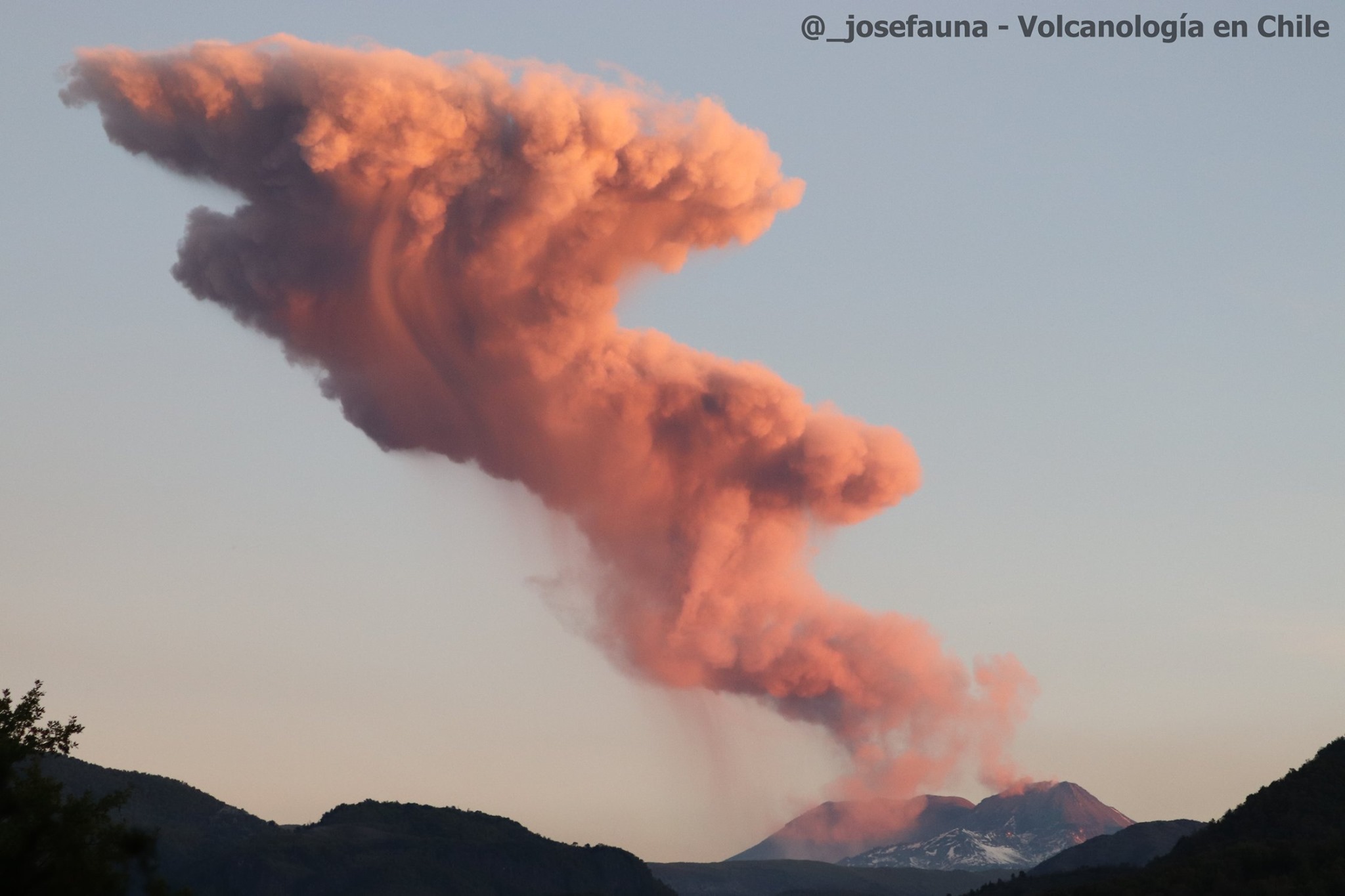
Chile , Nevados de Chillan :
Special Report on Volcanic Activity (REAV), Ñuble region, Nevados de Chillán volcanic complex, July 29, 2021, 07:20 a.m. local time (Continental Chile).
The National Service of Geology and Mines of Chile (Sernageomin) publishes the following PRELIMINARY information, obtained thanks to the monitoring equipment of the National Volcanic Monitoring Network (RNVV), processed and analyzed at the Volcanological Observatory of the Southern Andes ( Ovdas):
On Thursday, July 29, at 5:23 a.m. local time (9:23 a.m. UTC), monitoring stations installed near the Nevados de Chillán volcanic complex recorded four earthquakes associated with fluid dynamics (long period type) in the volcanic system.
The characteristics of earthquakes after their analysis are as follows:
ORIGINAL TIME: 05:23 local time (09:23 UTC)
REDUCED DISPLACEMENT: 573 (cm2)
ACOUSTIC SIGNAL: 1.4 Pascals (Pa) reduced to one km.
ORIGINAL TIME: 05:29 local time (09:29 UTC)
REDUCED DISPLACEMENT: 5793 (cm2)
ACOUSTIC SIGNAL: 1.1 Pascals (Pa) reduced to one km
TIME OF ORIGIN: 5:45 am local time (9:45 am UTC): The most energetic earthquake.
LATITUDE: 36.862 ° S
LONGITUDE: 71.375 ° W
DEPTH: 1.4 km
REDUCED DISPLACEMENT: 712 (cm2)
ACOUSTIC SIGNAL: not recorded.
TIME OF ORIGIN: 06:30 local time (10:30 UTC)
REDUCED DISPLACEMENT: 662 (cm2)
ACOUSTIC SIGNAL: not recorded.
The characteristics of the surface activity are as follows:
MAXIMUM HEIGHT OF THE COLUMN: 160 meters above the point of emission
OBSERVATIONS:
The surface seismic activity is maintained characterized by pulsatile emissions of incandescent pyroclastic materials in the crater area.
The volcanic technical alert remains at the Yellow level.
Source : Sernageomin.
Photo : @_josefauna, Volcanologia en Chile
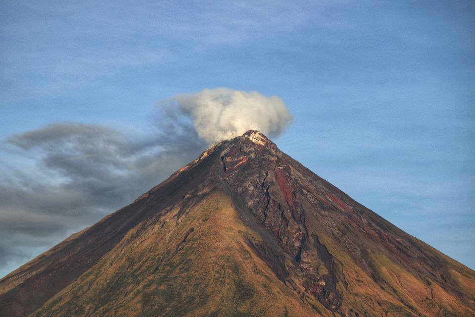
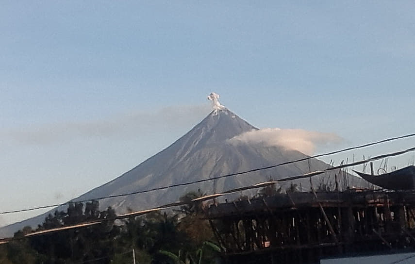
Philippines , Mayon :
MAYON VOLCANO ADVISORY 30 July 2021 08:00 A.M.
This serves as a notice for the lowering of the alert status of Mayon from Alert Level 1 (abnormal) to Alert Level 0 (normal).
Since the lowering of alert status of Mayon Volcano from Alert Level 2 to Alert Level 1 last 17 July 2020, there has been a continued decline in all monitoring parameters of Mayon Volcano. This is supported by the following observations;
1. Volcanic Earthquake Activity:
The frequency of volcanic earthquakes has declined to baseline levels (0-5 events/day) for the last 6 months. This indicates that rock-fracturing within the volcanic edifice associated with magmatic or hydrothermal activity has diminished.
2. Ground Deformation:
Data from Global Positioning Systems (GPS) and campaign Electronic Distance Measurement (EDM) and Precise Leveling (PL) monitoring collectively track a slight and decreasing rate of inflation of the Mayon edifice this year and continued deflation of its southwest slopes since lava flows were deposited on these in 2018. Electronic tilt monitoring also recorded slight inflation of the northwest slopes but localized deflation of the middle to lower slopes. The integrated GPS, EDM, PL and electronic tilt data indicate ground deformation that is more coherent with local tectonic processes rather than pressurization from a magmatic or hydrothermal source.
3. Gas Emission:
Sulfur Dioxide emission or SO2 flux from Mayon crater based on continuous gas spectrometry has declined below the baseline level of 500 tonnes/day since 14 July 2021. The latest flux was measured at 156 t/d on 14 July 2021 and no plume has been detected since. The relatively low levels of SO2 flux indicate that passive degassing from stored magma beneath the edifice is diminishing or increasingly scrubbed by Mayon’s hydrothermal system.
4. Visual Observation of the Summit:
Faint crater glow, or incandescence associated with superheated gas emission at the summit vent, continues to be observed but only through a camera. Its last visibility with the naked eye was in May 2021. Plume emission from the crater has been weak to moderate this year. In addition, no changes in the summit lava dome extruded in the final phase of the 2018 eruption have been observed for the past year. These observations are consistent with diminished magma degassing and the absence of magma intrusion within the edifice.
In view of the above, PHIVOLCS-DOST is now lowering the alert status of Mayon from Alert Level 1 to Alert Level 0. This means observational parameters have returned to baseline levels and no magmatic eruption is foreseen in the immediate future. However, in the event of a renewed increase in any one or combination of the above monitoring parameters, the alert status may step up once again to Alert Level 1. The public is still reminded to avoid entry into the 6-km Permanent Danger Zone or PDZ due to perennial hazards of rockfalls, avalanches, ash puffs and sudden steam-driven or phreatic eruption at the summit area which may occur without warning. Furthermore, people living in valleys and active river channels are cautioned to remain vigilant against sediment-laden streamflows and lahars in the event of prolonged and heavy rainfall brought about by the advent of the rainy season.
PHIVOLCS-DOST is closely monitoring Mayon Volcano’s activity and any new development will be immediately communicated to all concerned.
Source : Phivolcs
Photos : Erickson Banzuela Balderama ,manilla bulletin.
United-States , Pagan :
The CNMI government has dispatched two boats to evacuate 14 residents in Pagan as a precautionary measure. On Thursday there were reports of tremors and volcanic smoke centered on Mount Pagan. The Alaska Volcano Observatory has placed Pagan in the ‘Yellow’ level of concern. This is categorized as the volcano being restless and seismic activity is elevated.
It also indicates that a plume of gas and steam may rise several thousand feet above the volcano which may contain minor amounts of ash.
The last time a major eruption took place was in 1981.
n regional news The CNMI government is coordinating efforts to evacuate 14 residents that live in Pagan after reports of tremors and volcanic smoke Thursday afternoon. CNMI Governor Ralph DLG. Torres announced that the Office of Homeland Security and Emergency Management (HSEM) and the Department of Public Safety (DPS) are coordinating the evacuation an as a precautionary measure. Governor Torres adding that « Under the advisement of HSEM and our federal partners close to the situation, we are sending out a DPS boating team to Pagan to safely evacuate the residents on the island as we continue to monitor volcanic activity in the region.
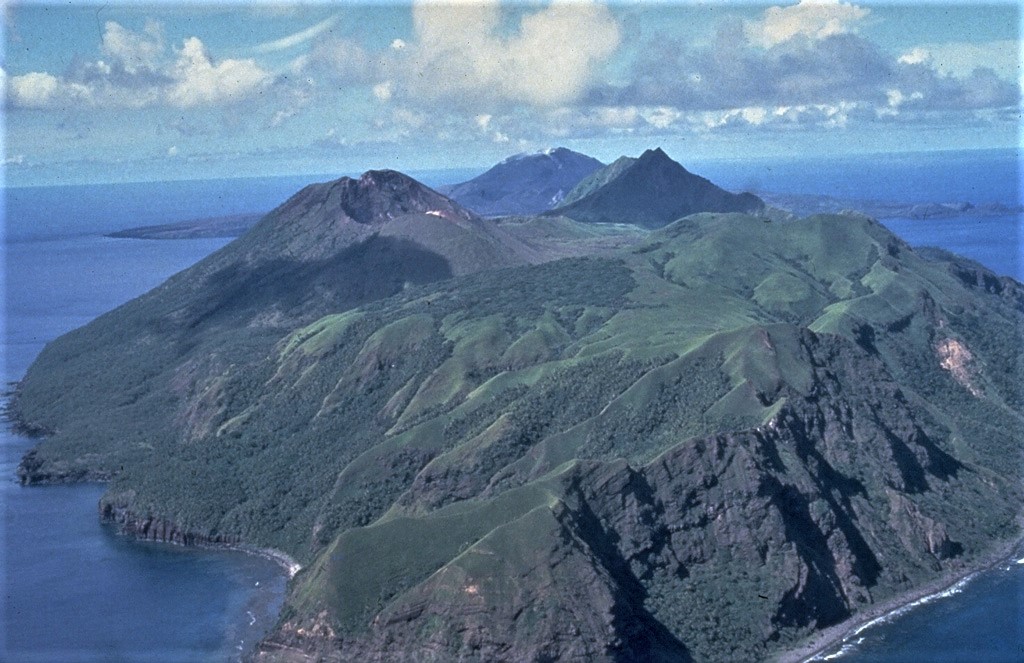
South Pagan volcano occupies the SW end of Pagan Island and has four craters. The ridge in the right foreground is the eroded rim of a 4-km-wide caldera containing the volcano. Eruptions volcano occurred during the 19th century, but it has been much less active than North Pagan, the peak at the far center on the NE tip of the island.
The safety and protection of our residents are a paramount priority, and we will continue to work closely with USGS on next steps forward. two boats have since been deployed.
Pagan Island, the largest and one of the most active of the Mariana Islands volcanoes, consists of two stratovolcanoes connected by a narrow isthmus. Both North and South Pagan stratovolcanoes were constructed within calderas, 7 and 4 km in diameter, respectively. North Pagan at the NE end of the island rises above the flat floor of the northern caldera, which may have formed less than 1,000 years ago. South Pagan is a stratovolcano with an elongated summit containing four distinct craters. Almost all of the recorded eruptions, which date back to the 17th century, have originated from North Pagan. The largest eruption during historical time took place in 1981 and prompted the evacuation of the sparsely populated island.
Source : kuam.com , GVP.
Photo : U.S. Navy, 1981