December 19 , 2020 .
Indonesia , Merapi :
Mount Merapi Activity Report, December 11-17, 2020
OBSERVATION RESULT
Visual
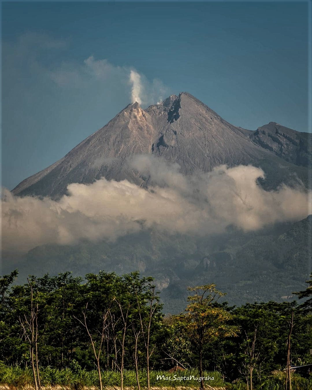
The weather around Mount Merapi is generally sunny in the morning, while the afternoon until evening is foggy. The smoke emitted by the crater is white, thin to thick with low pressure. A maximum smoke height of 150 m was observed from the Mount Merapi observation post in Ngepos on December 15, 2020 at 7:45 a.m. Avalanches were observed from the Mount Merapi observation post in Babadan with a distance of maximum slide of 1.5 km upstream of the Senowo River in the Northwest sector on December 14 at 08:42 WIB.
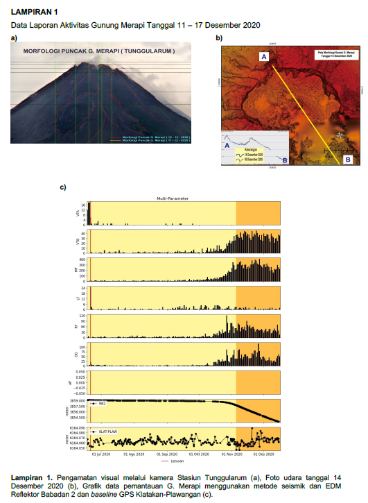
Morphological analysis of the summit area based on photos of the Southwest sector from December 15 to December 11, 2020 showed a slight change in the morphology of the peak area due to avalanche activity. From the drone data dated December 14, 2020, no new material was observed (new lava dome).
Seismicity
This week, the seismicity of Mount Merapi recorded:
217 shallow volcanic earthquakes (VTB),
1621 multi-phase earthquakes (MP),
6 low frequency earthquakes (LF),
284 avalanche earthquakes (RF),
303 emission earthquakes (DG)
9 tectonic earthquakes (TT).
The seismic intensity this week is lower than last week.
Deformation
The deformation of Mount Merapi which was monitored using EDM this week showed a shortening rate of 9cm / day.
Rain and lahars
This week, there was rain at Mount Merapi Observation Post with the highest rainfall intensity of 44mm / hour for 70 minutes at Kaliurang Post on December 11, 2020. There was no report lava or additional flow in the rivers that discharge from Mount Merapi.
Conclusion
Based on the results of visual and instrumental observations, it is concluded that:
The volcanic activity of Mount Merapi is still quite high, so the activity status is still at the « SIAGA » level.
Source : BPPTKG.
Photo : Mas Sapta Nugraha
Russia / Kurile Islands , Ebeko :
VOLCANO OBSERVATORY NOTICE FOR AVIATION (VONA).
Issued: December 19 , 2020
Volcano: Ebeko (CAVW #290380)
Current aviation colour code: ORANGE
Previous aviation colour code: orange
Source: KVERT
Notice Number: 2020-244
Volcano Location: N 50 deg 41 min E 156 deg 0 min
Area: Northern Kuriles, Russia
Summit Elevation: 3791.68 ft (1156 m)
Volcanic Activity Summary:
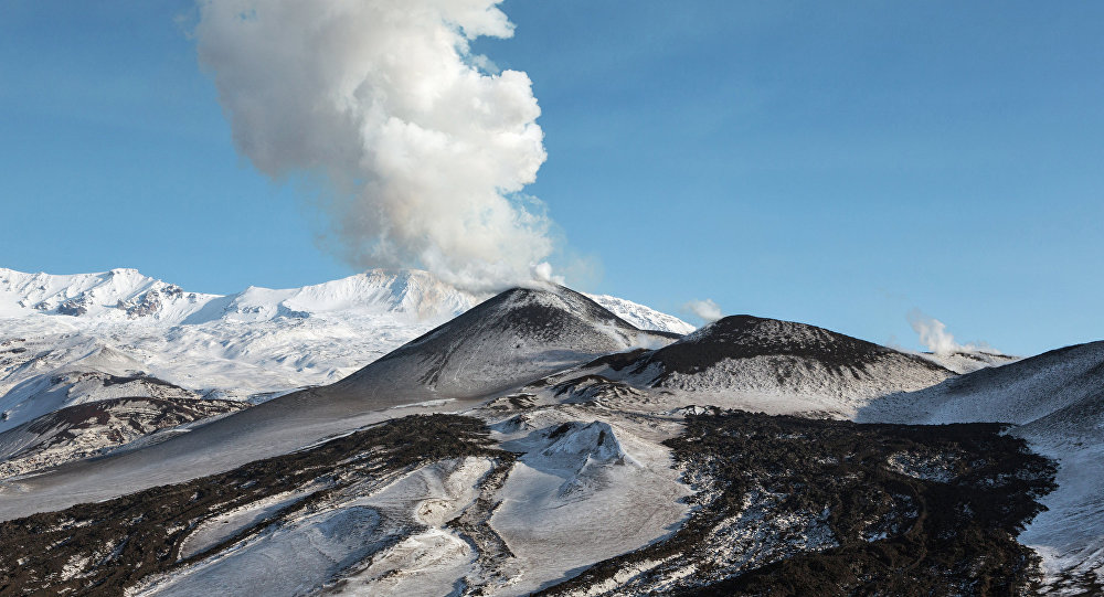
A moderate eruptive activity of the volcano continues. According to visual data by volcanologists from Severo-Kurilsk, explosion sent ash up to 4.0 km a.s.l., an ash cloud is drifting to the northeast of the volcano.
This activity continues. Ash explosions up to 19,700 ft (6 km) a.s.l. could occur at any time. Ongoing activity could affect low-flying aircraft and airport of Severo-Kurilsk.
Volcanic cloud height:
13120 ft (4000 m) AMSL Time and method of ash plume/cloud height determination: 20201219/0545Z – Visual data
Other volcanic cloud information:
Distance of ash plume/cloud of the volcano: 6 mi (10 km)
Direction of drift of ash plume/cloud of the volcano: NNE / azimuth 30 deg
Time and method of ash plume/cloud determination: 20201219/0555Z – Visual data
Source : Kvert .
Photo : Sputnik . Alexandre Peraguis.
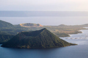
Island of Guadeloupe , La Soufrière :
Thursday December 17, 2020 at 6:00 p.m. (local time)
Sequence of earthquakes in the La Soufrière area of Guadeloupe – Basse Terre.
A sequence of volcanic earthquakes began on Thursday, December 17, 2020 at 2:02 a.m. local time (6:02 a.m. UT *) in the area of the La Soufrière volcano.
Since the start of this sequence, the OVSG-IPGP networks have recorded 90 very low magnitude earthquakes (M <1). No earthquakes were reported felt. The events are located at a depth of <2.5 km below the top of the dome of La Soufrière.
The alert level remains: yellow, vigilance.
Source : Direction de l’OVSG-IPGP.
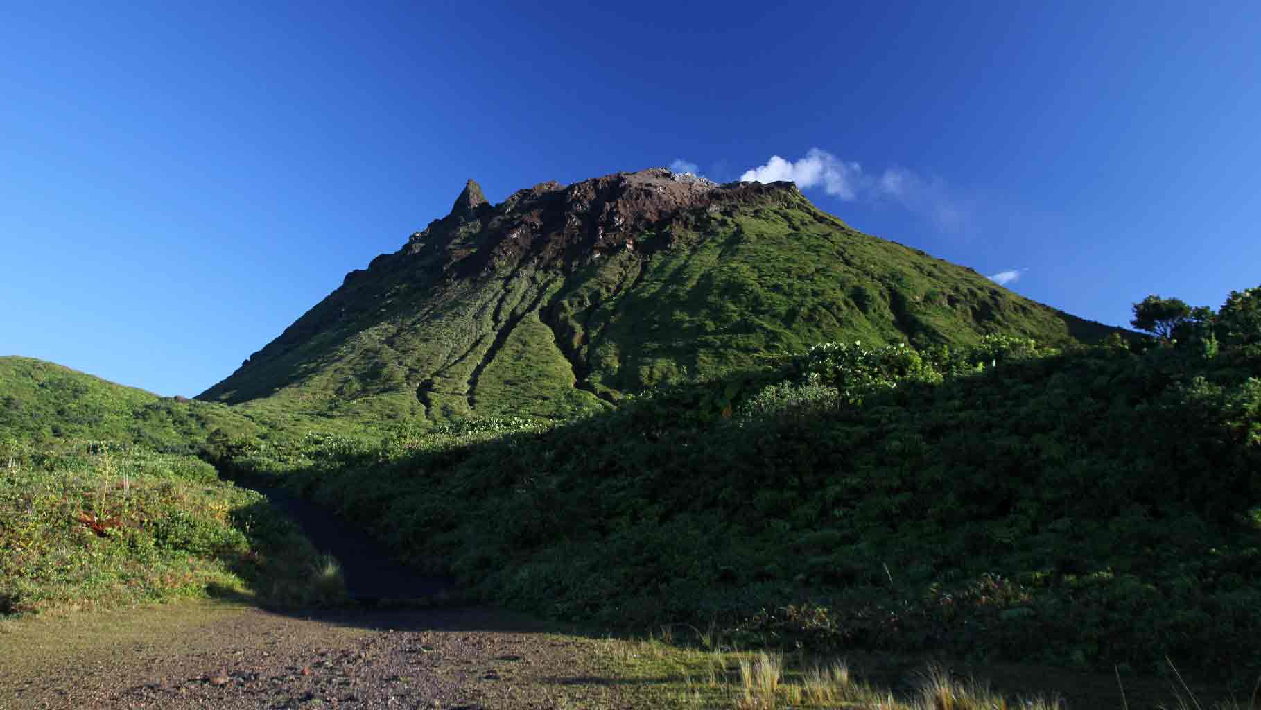
Photo : aide-voyage.com
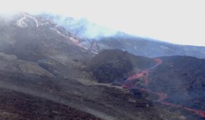
Costa Rica , Turrialba / Poas / Rincon de la Vieja / Irazu :
Daily report of the state of volcanoes. OVSICORI-UNA, Date: December 18, 2020
Turrialba volcano:
Lat: 10.025 ° N; Long: 83.767 ° W;
Height: 3340 m.s.n.m.
Current activity level: 2 (active volcano)
Potentially associated hazards: gas, ash emission, proximal ballistic projections
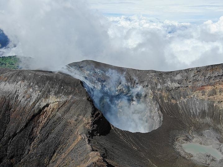
No ash emission was observed. Seismic activity has decreased to a level below its background level: the daily number of low frequency events has decreased, as has the occurrence of tremors. Geodesic measurements continue to show a contraction and subsidence of the volcanic massif. The H2S / SO2 ratio is stable, the CO2 / SO2 ratio decreases. The SO2 flow rate remains between 100 and 200 t / d, a slight upward trend is observed.
No thermal anomaly was detected by the MODIS analysis. The active crater has been filled from 5 to 10 m since February 2020 due to the destabilization of the walls (frequent landslides, in particular from the eastern and southern edge of the crater).
Seismic activity is similar compared to yesterday.
At the time of this report, the winds are blowing to the southwest.
Monitoring parameters are within normal ranges.
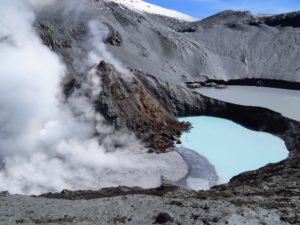
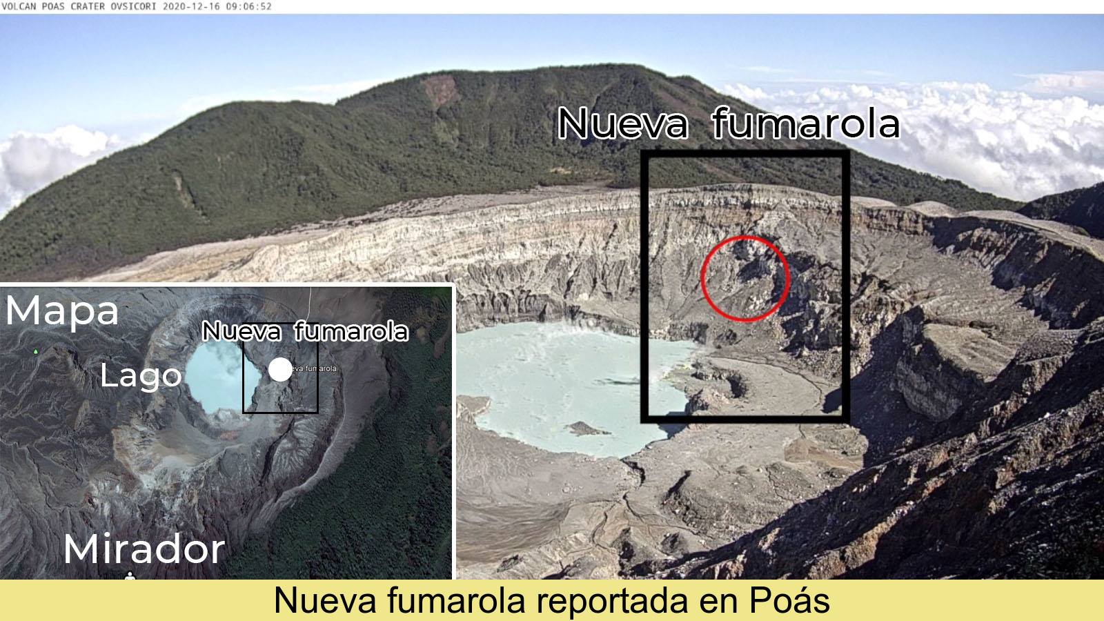
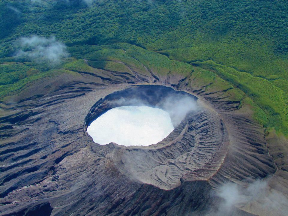
Poas volcano
Lat: 10.2 ° N; Long: 84.233 ° W;
Height: 2780 m.s.n.m.
Current activity level: 2 (active volcano)
Potentially associated hazards: gas, phreatic eruptions, proximal ballistic projections.
No eruption was detected. Seismic activity has decreased, with still a high number of daily LP type events (~ 200 events per day). A VT type event was recorded on December 1. There is no significant deformation of the volcano. The SO2 flow rate is less than 50 t / d. The level of the lake remained stable, the evaporation / infiltration rate remained low. The lake is still hot and acidic and has a Cl- / SO4 2-> 1 ratio, the maximum temperature measured remotely was 43 ° C. On November 23, a proximal thermal anomaly of similar amplitude to that of November 16, 2020 has was detected by MODIS analysis.
Seismic activity is similar compared to yesterday.
At the time of this report, the winds are blowing to the southwest.
A new fumarole was observed on the eastern side of the crater (reported by Danilo Umaña Castro). Today, visibility was limited by heavy cloud cover. Monitoring parameters are within normal ranges.
Rincon de la Vieja volcano
Lat: 10.83 ° N; Long: 85.324 ° W;
Height: 1895 m.s.n.m.
Current activity level: 3 (erupting volcano)
Potentially associated hazards: gas, phreatic eruptions, proximal ballistic projections, lahars.
The occurrence of eruptions decreased significantly to less than 1 per day. The RSAM continues to oscillate, but the tremor has almost disappeared. Distal TV-type events were recorded under the Borinquen area. Geodetic monitoring does not show any significant deformation, but perhaps a change in trend. No thermal anomaly was detected by the MODIS analysis. The oxidation parameters (ORP) and electrical conductivity in Ojo Santuario (hot spring north of the volcano) confirm a downward trend.
Seismic activity is lower compared to yesterday.
Wind direction is unknown at this time.
A continuous tremor with frequencies between 2 and 4 Hz is still detected but the amplitude is lower than yesterday.
Irazu volcano
Lat: 9.979 ° N; Long: 83.852 ° W;
Altitude: 3432 m.s.n.m.
Current activity level: 1 (active)
Potentially associated hazards: landslides.
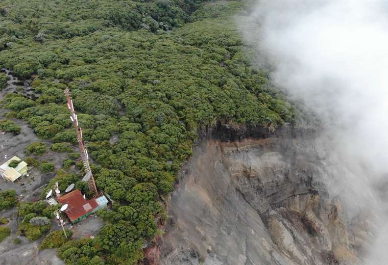
Seismic monitoring shows low activity with few distal, proximal events and small landslides. The main landslide in the western sector of the volcano exhibited deceleration followed by acceleration to return to a similar speed at the start of last week. The CO2 concentration is low, no H2S was detected. No thermal anomaly was detected by the MODIS analysis, nor by the thermal camera in the crater.
Source : Ovsicori.
Photos : G. Avard / Ovsicori , Ovsicori , Raul Mora / RSN / UCR , Teletica .