Décember 18 , 2020.
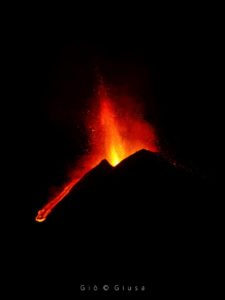
Italy / Sicily , Etna :
ETNA COMMUNICATION [UPDATE n. 99]
The National Institute of Geophysics and Volcanology, Osservatorio Etneo, reports that from the late morning of December 17, visual and thermal monitoring systems show low explosive activity at the easternmost vent. of the Southeast Crater. At 14:37 UTC (15:37 local) in the images of the thermal camera placed on the Montagnola (EMOT) an anomaly appeared in correspondence with the lava overflows of December 13-15, generated either by a resumption of the lava emission or of a collapse of still hot matter.
The dark deposit on the plateau in front of the Southeast crater is that of the pyroclastic flows of the evening of December 13, 2020; the two thin tabs at the bottom are the most advanced lava fronts
From the seismic point of view, the volcanic tremor, compared to the update n. 98, showed modest fluctuations in its amplitude, currently remaining on an average value. The position of the centroid of its sources is still located in the area of the Southeast Crater. Regarding infrasonic activity, he did not record any significant variation in the number and amplitude of infrasonic events; the sources are mainly located in the region of the Northeast Crater.
No significant variation is observed in the signals recorded by the permanent deformation measurement systems (inclinometric networks and GPS)
Further updates will be communicated shortly.
Source : INGV.
Read the article : http://www.ct.ingv.it/Dati/informative/vulcanico/ComunicatoETNA20201217165641.pdf
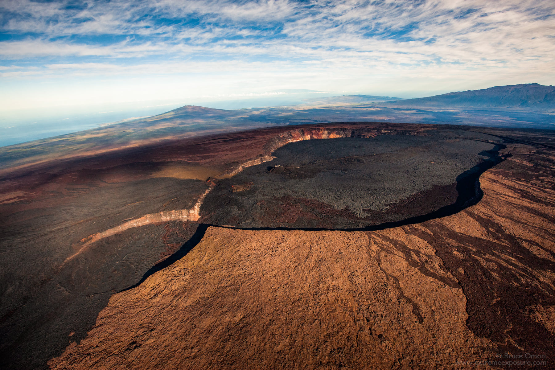
Hawaii , Mauna Loa :
19°28’30 » N 155°36’29 » W,
Summit Elevation 13681 ft (4170 m)
Current Volcano Alert Level: ADVISORY
Current Aviation Color Code: YELLOW
Activity Summary:
Mauna Loa Volcano is not erupting. Rates of deformation and seismicity have not changed significantly over the past week and remain above long-term background levels.
Observations:
During the past week, HVO seismometers recorded approximately 208 small-magnitude (below M2.5) earthquakes at Mauna Loa, 113 of which were beneath the volcano’s summit and upper flanks. The majority of these earthquakes occurred at shallow depths of less than 8 kilometers (~5 miles) below sea level.
Slightly increased earthquake activity continues on Mauna Loa’s northwest flank, which began on December 4, 2020. In the past week, HVO has recorded 98 earthquakes in this region, at depths from 1–9 km (1–6 miles) below the surface, over an area of less than 4 km (2 miles) and extending 6 km (4 miles) north. The bulk of the seismicity has been below magnitude-2, and deeper than 4 km (2 miles) beneath the surface. Elevated seismicity in this region continues at the time of this report. The largest event recorded was a M3.1.
Clustering of shallow earthquakes in this region is not unprecedented. Previous earthquake swarms at this location and depth occurred in October 2018, April 2017, July 2016, August 2015, and earlier.
Global Positioning System (GPS) measurements continue to show slow, long-term summit inflation, consistent with magma supply to the volcano’s shallow storage system.
Gas concentrations and fumarole temperatures at both the summit and Sulphur Cone on the Southwest Rift Zone remain stable.
Webcam views have revealed no changes to the landscape over the past week.
Source : HVO.
Photo : Bruce Omori .
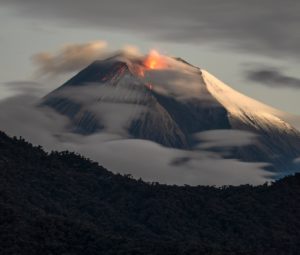
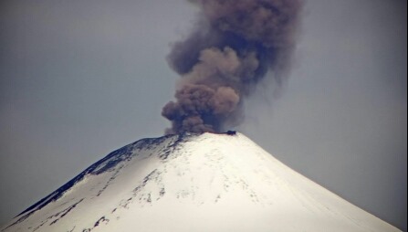
Chile , Villarica :
Special Report on Volcanic Activity (REAV), La Araucanía region, Villarrica volcano, December 17, 2020, 5:50 p.m. local time (Continental Chile).
The National Service of Geology and Mines of Chile (Sernageomin), on the basis of information obtained through the monitoring equipment of the National Volcanic Surveillance Network (RNVV), processed and analyzed in the Volcanological Observatory of the Southern Andes ( Ovdas), and in relation to the activity of the Villarrica volcano, reports the following:
On Thursday, December 17, at 5:16 p.m. local time (8:16 p.m. UTC), the IP cameras installed near the volcano recorded a pulse of particulate matter, associated with a long-period (LP) type earthquake.
The data obtained are as follows:
MAXIMUM COLUMN HEIGHT: 720 m with particle emission.
DISPERSAL DIRECTION: East-South-East (ESE)
REDUCED DISPLACEMENT: 7.7 cm 2
Observations:
At the time of publication of this report, the monitoring parameters do not show significant variations.
The volcanic alert remains at the Yellow level.
Source : Sernageomin .
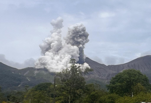
Ecuador , Sangay :
DAILY REPORT OF THE STATE OF SANGAY VOLCANO, Friday December 18, 2020.
Surface activity level: High, Surface trend: Increasing.
Internal activity level: High, Internal trend: Increasing.
Seismicity: From December 17, 2020, 11:00 a.m. to December 18, 2020, 11:00 a.m.
Long period type events (LP): 39
Emission tremor (TE): 1
Explosions (EXP): 109
Rains / lahars:
Several episodes of rains have been recorded which so far have not generated signals associated with mudslides and debris
** In case of heavy rains, lahars can be generated in the Volcán, Upano rivers and other tributaries **
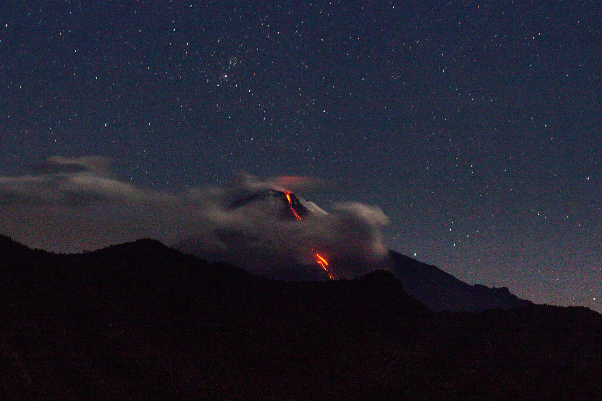
Emission / Ash Column: No emissions were observed using the cameras, however, the Washington VAAC reported 4 emissions alerts observed on the
images of the satellites, whose heights reached 900 meters above the level of the crater, scattered towards the west.
Other monitoring parameters: FIRMS recorded 28 thermal alerts on the Sangay in the last 24 hours.
MIROVA has recorded 1 moderate thermal alerts over the Sangay in the last 24 hours.
Observations: The climatic conditions of the area prevented direct observations of surface activity. The reference seismic station had transmission problems between around 20:15 TL yesterday and 03:48 TL today, which is why the seismic statistics are incomplete.
Alert level: yellow.
Sources : INSTITUT GÉOPHYSIQUE / ÉCOLE NATIONALE DE POLYTECHNIQUE.
Photo : TopMotor Storee.
Guatemala , Santiaguito :
Activity:
According to the analysis of station STG8 and the observations made by OVSAN on the activity of the volcanic complex of Santa María-Santiaguito, it is noted that weak to moderate explosions are recorded at an approximate height of between 3000 and 3300 m altitude (9843 to 10827 feet) accompanied by a constant extrusion of material.
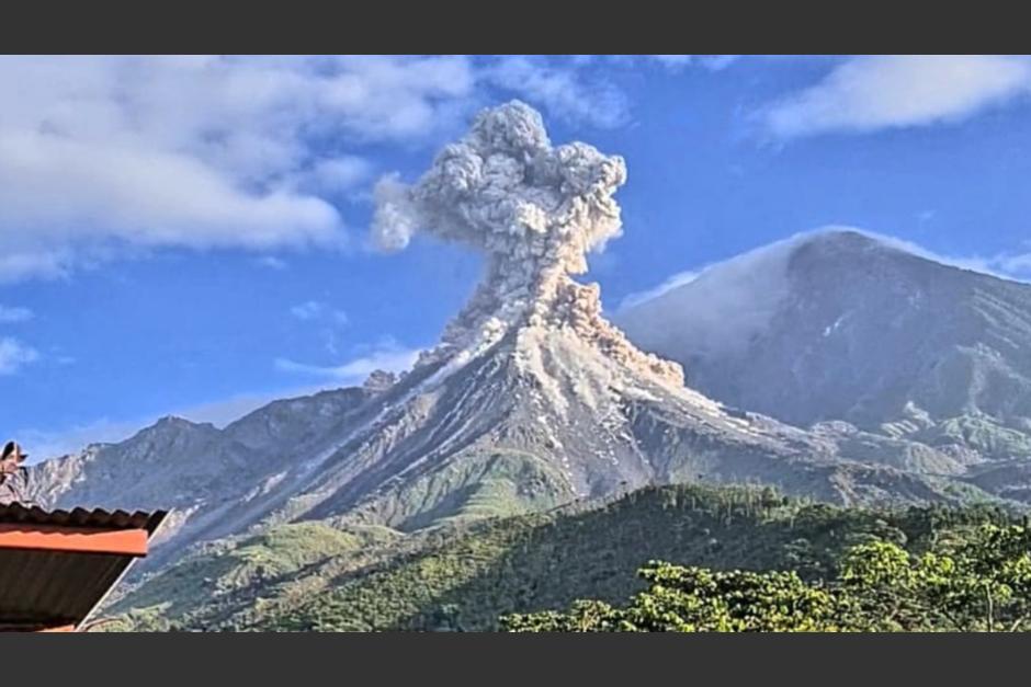
Extrusion of blocky material into the Caliente dome crater generates streams of boulders and ash that are directed to the Northwest, West – Southwest and East flanks, with the probability that pyroclastic flows are generated. While the Caliente dome is observed with a white fumarole and generates a degassing mainly of water vapor and magmatic gases. Due to the speed of the wind, this one moves towards the southwest of the volcanic complex. Ashes fall on the volcanic perimeter. (The recommendations of the special bulletin of the Santiaguito volcano 121-2020, remain valid)
Source : Insivumeh .
Photo : Conred.