October 15 , 2020.
Alaska , Pavlof :
AVO/USGS Volcanic Activity Notice
Current Volcano Alert Level: NORMAL
Previous Volcano Alert Level: ADVISORY
Current Aviation Color Code: GREEN
Previous Aviation Color Code: YELLOW
Issued: Wednesday, October 14, 2020, 9:54 AM AKDT
Source: Alaska Volcano Observatory
Location: N 55 deg 25 min W 161 deg 53 min
Elevation: 8261 ft (2518 m)
Area: Alaska Peninsula
Volcanic Activity Summary:
The periods of seismic tremor that prompted an increase in Pavlof’s alert level on September 21 have not been observed in the last two weeks. No eruptive activity or unusual surface temperatures have been observed in clear satellite and web camera images. The Alaska Volcano Observatory is returning the Aviation Color Code and Alert Level to GREEN/NORMAL to reflect these background conditions. Eruptions at Pavlof often occur with little or no precursory activity, and AVO will continue to monitor the volcano using seismic, infrasound, web camera, and satellite observations.
Recent Observations:
[Volcanic cloud height] None
[Other volcanic cloud information] None
[Lava flow/dome] None
[Lava flow] None
Remarks:
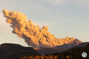
Pavlof Volcano is a snow- and ice-covered stratovolcano located on the southwestern end of the Alaska Peninsula about 953 km (592 mi) southwest of Anchorage. The volcano is about 7 km (4.4 mi) in diameter and has active vents on the north and east sides close to the summit. With over 40 historic eruptions, it is one of the most consistently active volcanoes in the Aleutian arc. Eruptive activity is generally characterized by sporadic Strombolian lava fountaining continuing for a several-month period. Ash plumes as high as 49,000 ft ASL have been generated by past eruptions of Pavlof, and during the March 2016 eruption, ash plumes as high as 40,000 feet above sea level were generated and the ash was tracked in satellite data as distant as eastern Canada. The nearest community, Cold Bay, is located 60 km (37 miles) to the southwest of Pavlof.
Source : AVO.
Photo : Fee, David
Japan , Suwanosejima :
29.638°N, 129.714°E
Elevation 796 m
JMA reported nighttime incandescence and intermittent eruptive activity at Suwanosejima’s Ontake Crater during 2-9 October. Ashfall was occasionally reported in Toshima village, 4 km SSW. An explosion at 1155 on 8 October generated an ash plume that rose more than 700 m above the crater rim. The Alert Level remained at 2 (on a 5-level scale).
The 8-km-long, spindle-shaped island of Suwanosejima in the northern Ryukyu Islands consists of an andesitic stratovolcano with two historically active summit craters. The summit is truncated by a large breached crater extending to the sea on the east flank that was formed by edifice collapse. Suwanosejima, one of Japan’s most frequently active volcanoes, was in a state of intermittent strombolian activity from Otake, the NE summit crater, that began in 1949 and lasted until 1996, after which periods of inactivity lengthened. The largest historical eruption took place in 1813-14, when thick scoria deposits blanketed residential areas, and the SW crater produced two lava flows that reached the western coast. At the end of the eruption the summit of Otake collapsed forming a large debris avalanche and creating the horseshoe-shaped Sakuchi caldera, which extends to the eastern coast. The island remained uninhabited for about 70 years after the 1813-1814 eruption. Lava flows reached the eastern coast of the island in 1884. Only about 50 people live on the island.
Source: Japan Meteorological Agency (JMA) , GVP.
Photo : Yukio Hayakawa, 1998 (Gunma University).
El Salvador , San Miguel ( Chaparrastique ) :
Location: San Miguel department
Altitude: 2130 meters above sea level
Type of volcano: Stratovolcano
Type of activity: Strombolian-Vulcanian
Last significant eruption: December 29, 2013
It is important to mention that during the months of June, July, August and September of this year, the San Miguel volcano exhibited a low level of activity. That is, he showed no signs of trouble.
During the month of September, the seismic vibration of the volcano in RSAM units remained low, oscillating between 49 and 67 RSAM units per day. No earthquake was perceived by the population living in the volcano region.
Sulfur dioxide (SO2) emissions remained fluctuating between 27 and 328 tonnes / d, a value below the threshold of 620 tonnes / d, indicating that no injection of magma took place in the internal system. Thus, in September, the volcano remained calm. However, it is not excluded that the subduction earthquakes, south of the volcano, may induce another magmatic rise and suddenly change the activity of the volcano, as happened on previous dates. It is therefore suggested that climbers and the general population avoid visiting the crater of the volcano.
Source : Marn .
Photo : Marn .
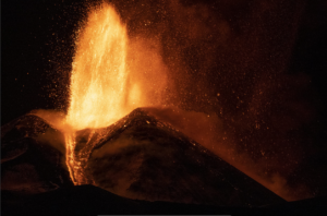
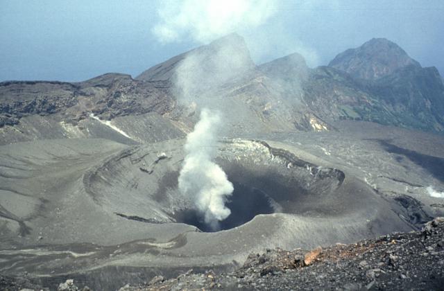
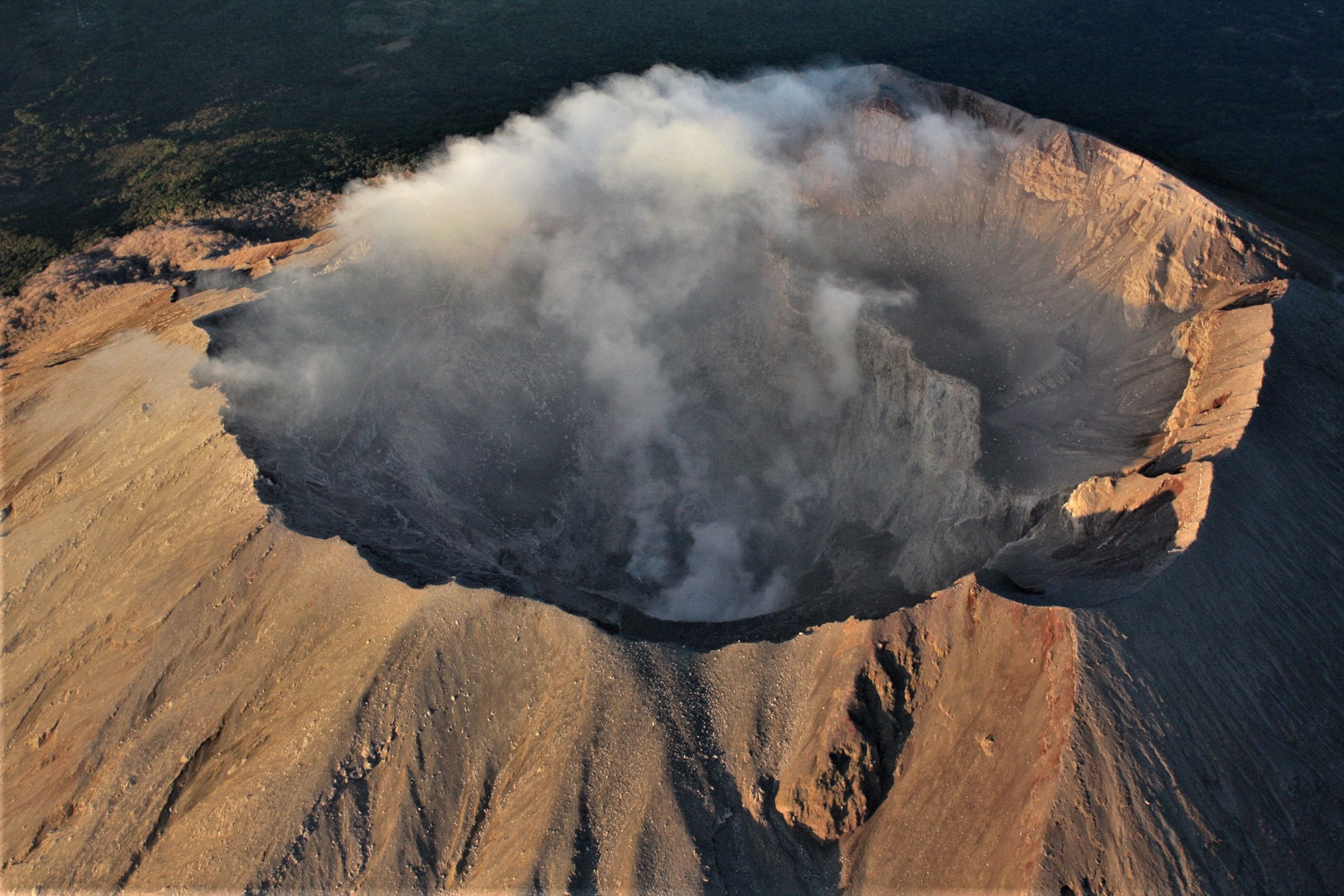
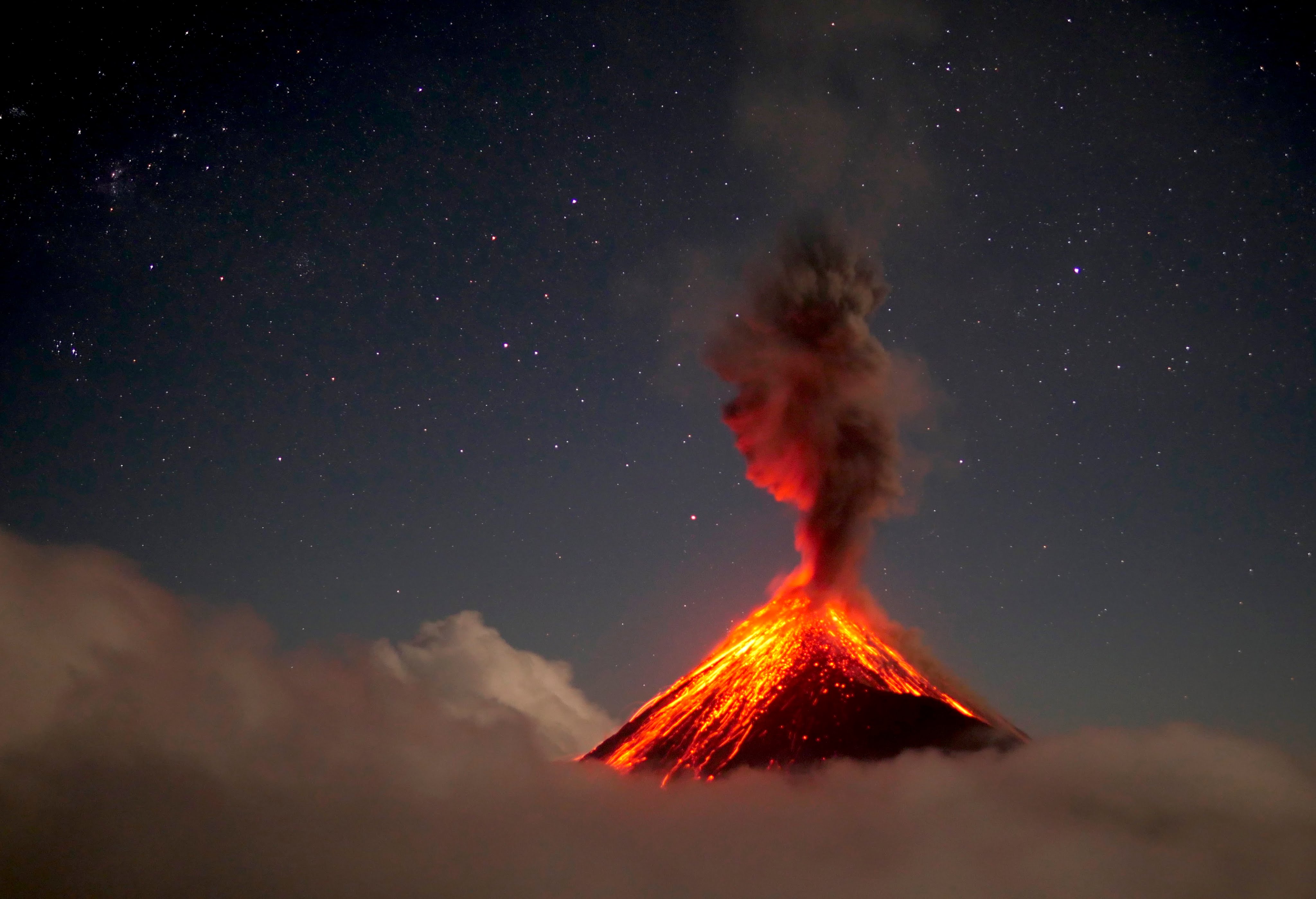
Guatemala , Fuego :
Special Volcanological Bulletin, Update on explosive activity:
Activity type: Vulcanian
Morphology: composite stratovolcano
Geographical location: 14 ° 28’54˝ Latitude N; 90 ° 52’54˝ west longitude
Altitude: 3763msnm.
During the month of September of this year, a total of 2306 explosions were recorded. For the month of October, 1037 events were recorded. The acoustic sensors located at the FG14 station, on the southwest flank of the volcano, record pressure amplitudes of 0.4 to 40 pascals. All those above 15 Pascal are classified as strong, according to what is observed in the field and the reports of the observers. In the last 18 hours, 5 strong explosions generated tall white / gray degassing columns up to 1000 meters above the crater. Due to factors such as the strong wind in the upper parts of the volcanic building and the materials accumulated in the ravines by the multiple avalanches, these weak to moderate explosions can generate material uplifts and cause large avalanches.
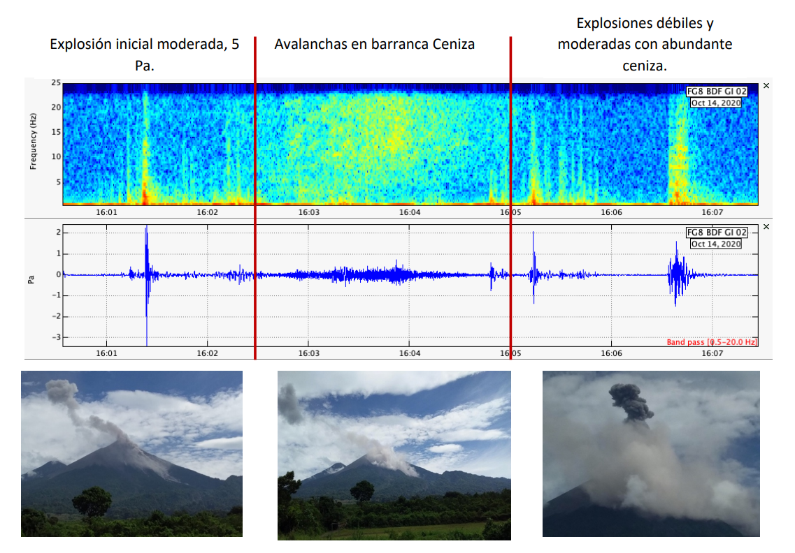
Figure 1: Acoustic waves and photographs obtained from the Fuego volcano observatory, showing explosive activity in the crater in recent hours.
Figure 1 describes an event observed today at 10 a.m. It was an explosion of moderate characteristics, with an acoustic amplitude of 5 pascals. This generated avalanches in the Ceniza ravine which were also recorded in the acoustic station with an amplitude of 0.2 Pa. Subsequent explosions were weak with abundant ash emissions.
• CONSIDERATIONS:
Fuego’s explosive activity features weak, moderate, and strong explosions. Usually 1 to 5 loud explosions are recorded daily. So this activity is considered within normal parameters.
The materials located in the canyons of Ceniza, Seca and Taniluyá, due to the avalanches produced by the volcanic explosions, can be easily remobilized by the strong wind and the explosions which generate instability in the crater.
The amount of ash and gas in the eruptive plume depends on several factors: amount of volatiles in the magma, viscosity of the magma, fragments of recent and ancient volcanic material in the crater, among others. All explosions will therefore not have the same characteristics.
The generation of shock waves at the time of the explosion will depend on the rate at which the gas is released and not strictly on the volume of gas expelled.
Thus, it will also be possible to perceive shock waves for weak and moderate explosions.
Source : Insivumeh .
Photo : 660citynews.com