September 26 , 2018.
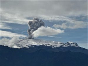
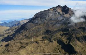
Chile , Puyehue – Cordon Caulle :
During the evaluated period, a total of 53 volcano-tectonic (VT) seismic events associated with rock fracturing processes were recorded. The event of greatest energy had a local magnitude (ML) equal to M 1.0, and was located 4.0 km west – northwest of the emission center of 2011, at a depth of 3 , 8 km.
The images provided by the IP cameras installed around the volcano do not show any superficial changes.
According to the data provided by three GNSS stations, we observe that the inflationary process reported previously is continuing. The maximum rate of horizontal variation recorded by the permanent network is 0.9 cm / month and the vertical rate of 0.5 cm / month for the station closest to the point of maximum deformation. What is observed is consistent with the lines of surveillance that cross the massif.
No sulfur dioxide (S02) emissions have been reported in the area’s atmosphere near the volcanic building, according to data published by the Ozone Observatory Sulfur Dioxide Group (http: // mon2.gsfc.nasa.gov/). ) and the National Information and Satellite Data Service on the Environment (NESDIS) (http://satepsanoine.nesdis.noaa.gov).
No thermal warning was reported in the area associated with the volcanic complex during the period, according to data processed by the mean infrared observation of volcanic activity (MIROVA) (http://www.mirovaweb.it /) and Temporal Thermal Monitoring of global hot spots (MODVOLC) (http://modis.higp.hawaii.edu/).
The seismicity remains similar to those recorded in recent months, the vast majority being under the last active center in 2011. The general picture developed in recent months, the signs of deformation of the volcanic construction and the presence of a residual magmatic body, set up during the 2011 superficial eruption, are indicators of the development of processes that can lead to the imbalance of the volcanic system.
Because of the above, the volcanic warning is kept at the level:
YELLOW LEVEL: Changes in the behavior of volcanic activity – Probable time for an eruption: WEEKS / MONTH.
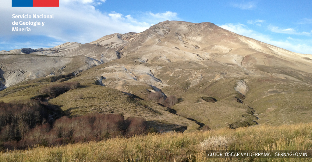
Source : Sernageomin.
Photo : O. Valderrama / Sernageomin
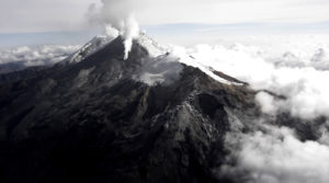
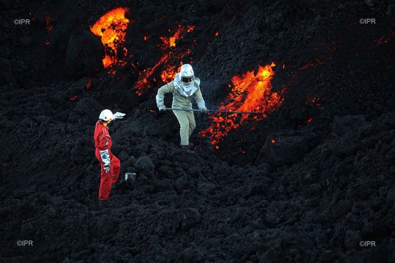
La Réunion , Piton de la Fournaise :
Activity Bulletin from Tuesday, September 25, 2018 to 17:00 (local time)
The eruption started on September 15th at 4:25 am local time continues. After a slight increase observed at the beginning of the day, the intensity of the volcanic tremor (indicator of the eruptive intensity at the surface) returned to a relatively stable level despite some subtle fluctuations (Figure 1).
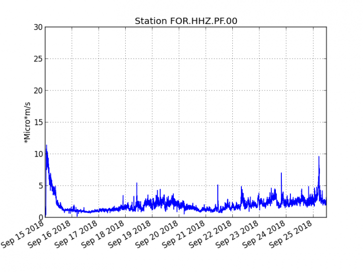
Figure 1: Evolution of RSAM (indicator of volcanic tremor and intensity of eruption) between 04:00 (00h UTC) on September 15 and 16:00 (12:00 UTC) on September 25th on the FOR seismic station, located near the crater Chateau Fort (2000 m altitude on the southeast flank of the terminal cone).
– No volcano-tectonic earthquake was recorded during the day of 24 September or during the current day.
– No significant deformation is noticeable.
– The surface flows were estimated from the satellite data, via the platform MIROVA (University of Turin) and HOTVOLC (OPGC – University Clermont Auvergne), and between 0.5 and 5.3 m3 / s on the day of 24 September.
– The cone continues its edification and remains still southward escaping a main flow well channeled to the south, then heading south-east.
– An outline of the flow could be determined by the platform OI2 (OPGC – University Clermont Auvergne) from the data of the Sentinel satellites acquired around 06:00 this morning (local time). These observations show that since the observations of September 18th, the various flows arms have progressed slightly (Figure 2) towards the south (direction of the rampart).
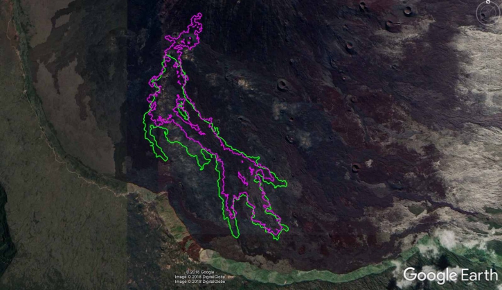
Figure 2: Contours of the flows determined from Sentinel satellite data, for the days of 18 September (red) and 25 September (green), made by the OI2 / UCA / OPGC service.
Alert level: Alert 2-2 – Eruption in the Enclos.
Source : OVPF
Photos : OVPF/Imaz press Réunion.
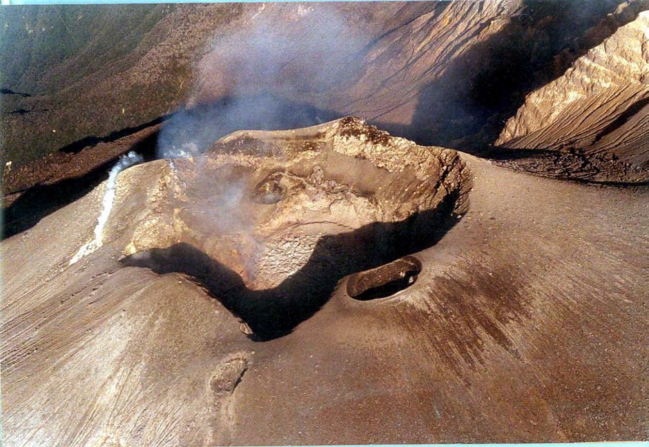
Colombia , Chiles / Cerro Negro :
Weekly activity bulletin of volcanoes Chiles and Cerro Negro.
The activity level of the volcanoes is maintained at level: YELLOW LEVEL ■ (III): CHANGES IN THE BEHAVIOR OF THE VOLCANIC ACTIVITY
Following the activity of the CHILE volcanoes and CERRO NEGRO, the COLOMBIAN GEOLOGICAL SERVICE (SGC) reports that:
During the period evaluated between September 18 and 24, 2018, there was a decrease in both occurrence and released energy from 4987 to 1745 events. All recorded events were associated with rock fracturing within the volcanic system.
The earthquakes continue to be located southwest of the Chiles volcano at distances up to 4 km and depths between 2 and 11 km from the upper Chiles volcano (4700 m). Other earthquakes were located southeast of the volcano up to a distance of 15 km and depths less than 10 km. The largest local magnitude earthquake was reported on September 22 at 1:12, located 2.1 km south of the Chiles volcano, at a depth of 4.54 km and at a magnitude of M2.6 on the Richter scale. this event has been reported as felt.
The Colombian Geological Survey and the Institute of Geophysics of the National Polytechnic School of Ecuador closely monitor the evolution of this seismic and volcanic activity and will report without delay on the changes detected.
Source : SGC
Alaska , Veniaminof :
56°11’52 » N 159°23’35 » W,
Summit Elevation 8225 ft (2507 m)
Current Volcano Alert Level: WATCH
Current Aviation Color Code: ORANGE
Eruption of a lava flow from Veniaminof volcano’s summit continues. Seismicity remains elevated with continuous tremor. Clear webcam images showed incandescence overnight. Webcam images from this morning have shown a gas plume from the summit, possibly containing minor amounts of ash, being blown to the northeast. Satellite data continue to show elevated surface temperatures. No significant ash emissions have been observed or reported.
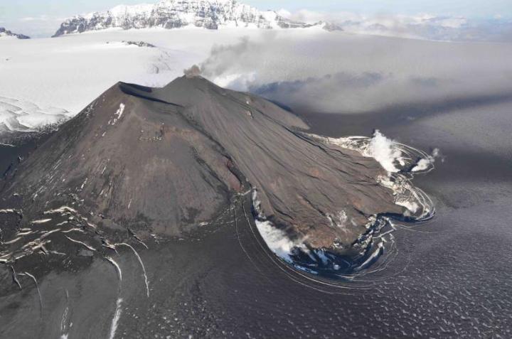
Veniaminof Volcano is monitored with a local real-time seismic network, which will typically allow AVO to detect changes in unrest that may lead to an explosive eruption. Rapid detection of an ash-producing eruption would be accomplished using a combination of seismic, infrasound, lightning, and satellite data.
Source : AVO
Photo : eurekalert