June 21 , 2019.
Guatemala , Santiaguito :
14.757°N, 91.552°W
Elevation : 3745 m
Activity:
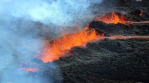
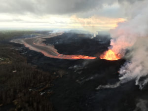
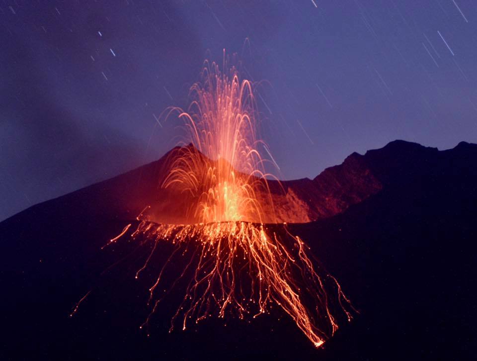
The Caliente Dome is observed with a moderate white fumarole, mainly water vapor, at a height of 800 above the crater which is dispersed to the west. The seismic stations recorded weak explosions, projecting columns of gray ash to 3,100 meters (10,170 feet) moving westward on the villages of Loma Linda and San Marcos Palajunoj. Constant activity is generated by the extrusion of lava blocks from the lower part of the Caliente Dome.
INSIVUMEH and CONRED reported that on 12 June lahars descended Santa María’s Cabello de Ángel (a tributary of Nima I) and San Isidro (tributary of El Tambor) drainages. The lahar in San Isidro was 15-17 m wide and 1.5 m deep, and carried shrubs, tree trunks, and blocks up to 2 m in diameter. On 16 June lahars again descended the San Isidro drainage.

During 15-18 June explosions at Caliente cone generated ash plumes that rose 400-800 m and drifted SW and E. Avalanches of material descended the E and SE flanks of the cone, and during 17-18 June reached the base of the cone. Minor ashfall was reported in San Marcos (10 km SW), Loma Linda (6 km WSW), and Palajunoj (18 km SSW) during 17-18 June.
Sources: Coordinadora Nacional for the Reducción De Desastres (CONRED), Instituto Nacional de Sismologia, Vulcanologia, Meteorologia, and Hidrologia (INSIVUMEH) , GVP.
Photos : G Vitton , Annie Winson , earthobservatory.sg
Japan , Aira ( Sakurajima)
31.593°N, 130.657°E
Elevation 1117 m
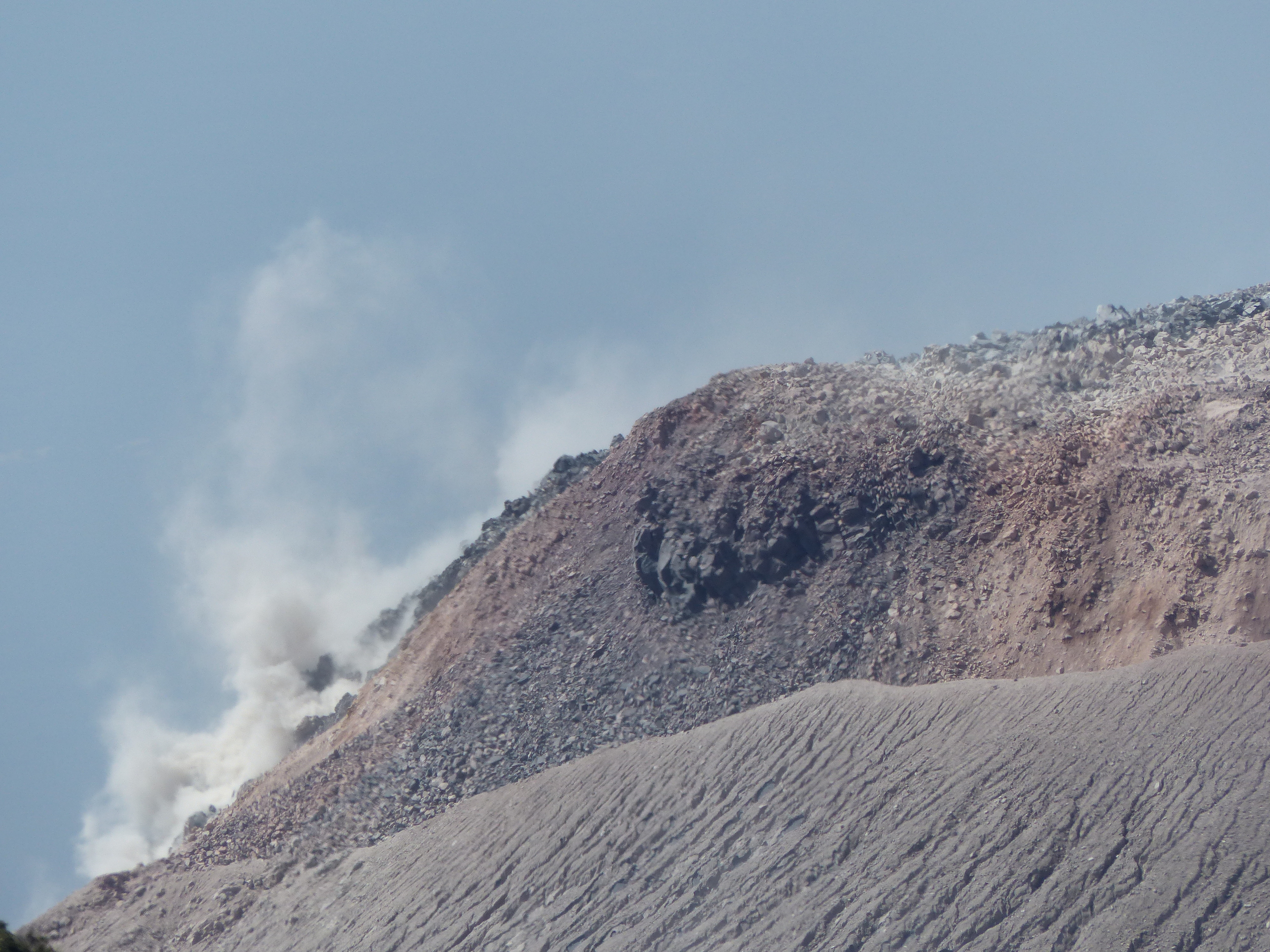
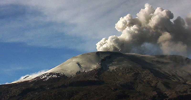
JMA reported that inflation at Minamidake crater (at Aira Caldera’s Sakurajima volcano) began at 05h00 on 11 June. At 14h31 an explosion ejected material 1.2 km from the crater and generated an ash plume that rose 2.2 km above the crater rim. An explosion at 09h21 on 13 June was followed by some deflation. Very small eruptive events were recorded during 14-17 June. The Alert Level remained at 3 (on a 5-level scale).
The Aira caldera in the northern half of Kagoshima Bay contains the post-caldera Sakurajima volcano, one of Japan’s most active. Eruption of the voluminous Ito pyroclastic flow accompanied formation of the 17 x 23 km caldera about 22,000 years ago. The smaller Wakamiko caldera was formed during the early Holocene in the NE corner of the Aira caldera, along with several post-caldera cones. The construction of Sakurajima began about 13,000 years ago on the southern rim of Aira caldera and built an island that was finally joined to the Osumi Peninsula during the major explosive and effusive eruption of 1914. Activity at the Kitadake summit cone ended about 4850 years ago, after which eruptions took place at Minamidake. Frequent historical eruptions, recorded since the 8th century, have deposited ash on Kagoshima, one of Kyushu’s largest cities, located across Kagoshima Bay only 8 km from the summit. The largest historical eruption took place during 1471-76.
Source: Japan Meteorological Agency (JMA) , GVP.
Photo : k. Arima
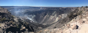
Colombia , Nevado del Ruiz :
Weekly activity bulletin of the Nevado del Ruiz volcano
The level of activity continues at the level: Yellow activity level or (III): Modifications of the behavior of the volcanic activity.
With regard to monitoring the activity of the Nevado del Ruiz volcano, the COLOMBIAN GEOLOGICAL SERVICE announces that:
During the past week, the Nevado del Ruiz volcano has had low levels of seismicity, similar to those recorded the previous week. The seismic activity caused by rock fracturing maintained the same levels in terms of the number of earthquakes and seismic energy released. The earthquakes were located mainly north-east, south and west of the volcano and, to a lesser extent, in the crater Arenas and north of the volcano, at depths between 1.1 and 8.1 km . The maximum magnitude recorded during the week was 0.8 ML (local magnitude), corresponding to the earthquake recorded on 16 June at 22:07 (local time), located 8.8 km west of Arenas crater and 8 , 1 km deep.
Seismicity related to fluid dynamics within volcanic ducts showed a slight decrease in the number of earthquakes and similar levels of released seismic energy compared to the previous week. This type of seismic activity was characterized by the presence of earthquakes of variable energy levels, of long period type (LP), very long period (VLP), pulses of volcanic tremor and continuous volcanic tremor. The earthquakes were mainly located in the crater Arenas and its surroundings. None of these signals were associated with gas and ash emissions.
Volcanic deformation measured from electronic inclinometers and Global Navigation Satellite System (GNSS) stations showed stability during the week, without recording significant deformation processes of the volcanic structure.
The volcano continues to emit water vapor and gases into the atmosphere, among which is the sulfur dioxide (SO2), as evidenced by the values obtained by the SCANDOAS stations installed in the region of the volcano. satellite image analysis. In tracking the information provided by the MIROVA and NASA FIRMS portals, no thermal anomalies were recorded during this week.
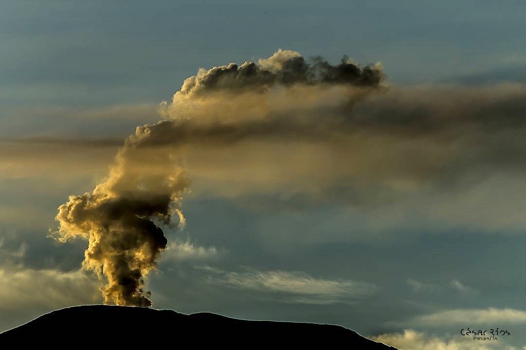
The column of gas and vapor reached a maximum height of 635 m, measured at the summit of the volcano on June 15. The direction of the dispersion of the column was governed by the direction of the wind in the region, which was directed towards the North-West and South-West of the volcano.
The Nevado del Ruiz volcano continues at the level of yellow activity.
Source : SGC
Photos : Unknown author. , C Rios .
Indonesia , Sangeang Api :
8.2°S, 119.07°E
Elevation : 1949 m
The Darwin VAAC reported that on 17 June multiple discrete emissions with increasing ash content over a period of about an hour rose from Sangeang Api to altitudes of 1.2-2.1 (4,000-7,000 ft) a.s.l. and drifted W and WNW, based on satellite images and weather models. A thermal anomaly was also visible. The Alert Level remained at 2 (on a scale of 1-4).
Sangeang Api volcano, one of the most active in the Lesser Sunda Islands, forms a small 13-km-wide island off the NE coast of Sumbawa Island. Two large trachybasaltic-to-tranchyandesitic volcanic cones, 1949-m-high Doro Api and 1795-m-high Doro Mantoi, were constructed in the center and on the eastern rim, respectively, of an older, largely obscured caldera. Flank vents occur on the south side of Doro Mantoi and near the northern coast. Intermittent historical eruptions have been recorded since 1512, most of them during in the 20th century.
Sources: Pusat Vulkanologi dan Mitigasi Bencana Geologi (PVMBG ) , GVP.
Photo : Unknown author.