July 27 , 2018.
La Réunion , Piton de la Fournaise :
Activity Bulletin from Thursday, July 26, 2018 at 16:30 (local time)
The seismic activity above the summit area of the Piton de la Fournaise, resumed significantly this day with 32 superficial volcano-tectonic earthquakes (<2 km deep) recorded between 04:00 and 16:00 local time, including 23 events between 12:00 and 13:00 local time.
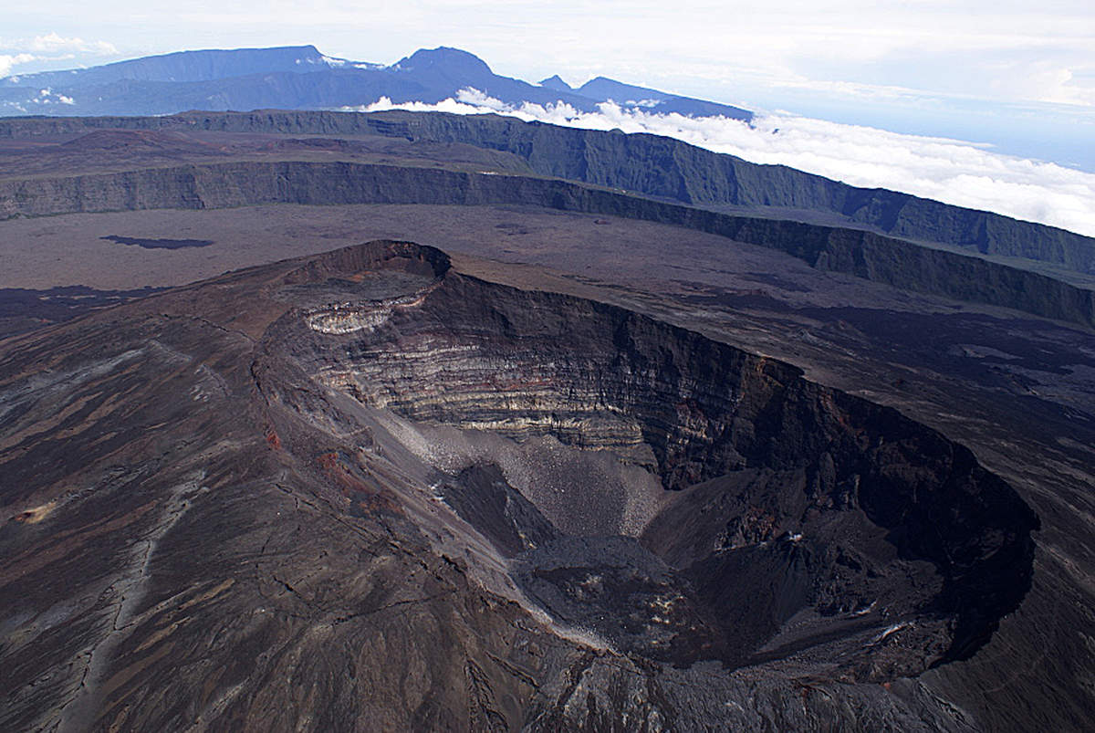
This significant increase in seismicity follows a resumption of inflation (swelling) of the volcano observed since the end of the eruption of July 13, 2018 (Figure 1) and synonymous with a deep recharge to magma and pressurization of the superficial magmatic reservoir.
The acceleration of the seismicity observed today shows that the pressurization of the reservoir accelerates and that the latter becomes weakened.
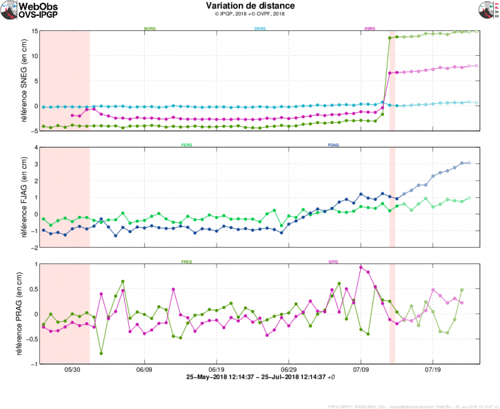
Figure 1: Illustration of the deformation over 2 months. Here are shown baselines (variation of distance between two GPS receivers) crossing the Piton de la Fournaise building, at the top (at the top), at the base of the terminal cone (in the middle) and in the far field (at the bottom ). A rise is synonymous with elongation and therefore swelling of the volcano; conversely, a decrease is synonymous with contraction and therefore deflation of the volcano. The periods colored in light pink correspond to eruptive periods. (© OVPF / IPGP)
Source : OVPF.
Chile , Lascar :
Special Report on Volcanic Activity (REAV), Antofagasta Region, Lascar Volcano.
July 26, 2018, 10:30 pm Local time (mainland Chile)
The National Geological and Mining Service of Chile (SERNAGEOMIN) describes the following preliminary information obtained by the monitoring teams of the National Volcano Monitoring Network (NVRN), processed and analyzed at the Volcanological Observatory of the South Andes (OVDAS):
Today Monday, July 26, the monitoring stations installed near the Lascar volcano recorded a volcanic-tectonic type seismic swarm event (VT), associated with fracturing processes of rigid materials and representative at 16:00, a average 40 earthquakes per hour. The major event had a local magnitude (ML) of 1.5 and was located 1 km southwest (SW) of the volcanic building at a depth of 1.5 km from the crater level.
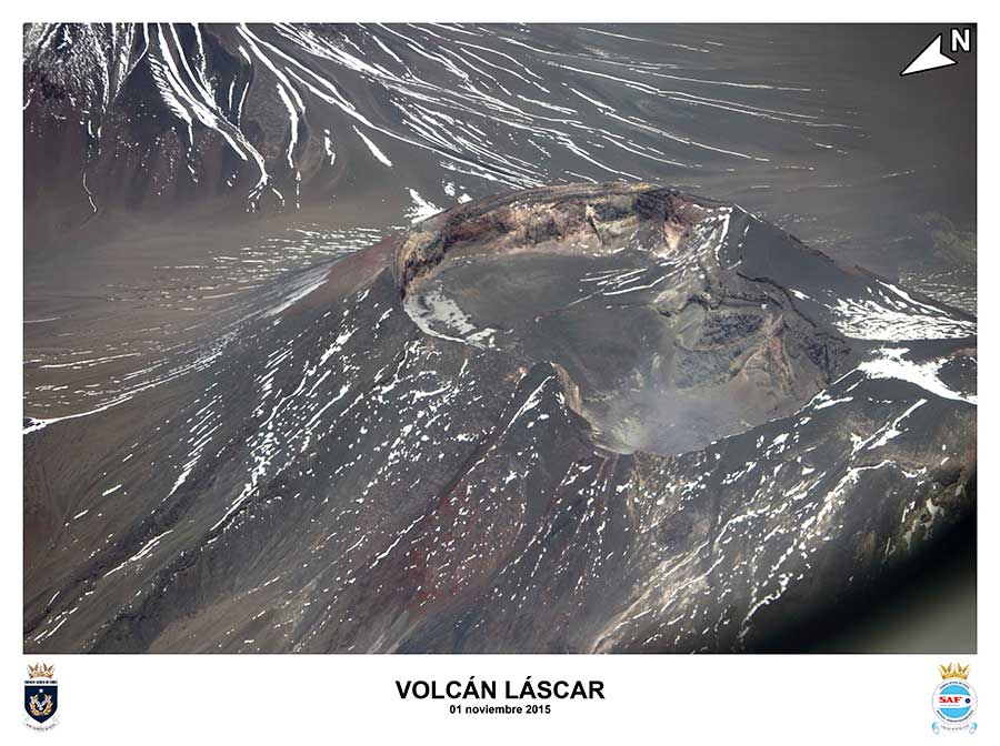
OBSERVATIONS
At the time of publication of the report, volcanic tectonic seismicity continues to be recorded.
The meteorological conditions do not allow to have however a visual of the volcano, but in the afternoon and yesterday one visualized a white fumarole, which would be associated mainly with the hydrothermal system.
There is no report from the authorities or the community in general about perceptions in neighboring areas.
The technical alert is maintained at the level:
YELLOW alert level
Sernageomin conducts online monitoring and will inform any changes in volcanic activity in the country in a timely manner.
Source : Sernageomin
Hawaï , Kilauea :
Thursday, July 26, 2018, 10:03 AM HST (Thursday, July 26, 2018, 20:03 UTC)
19°25’16 » N 155°17’13 » W,
Summit Elevation 4091 ft (1247 m)
Current Volcano Alert Level: WARNING
Current Aviation Color Code: ORANGE
Kīlauea Volcano Lower East Rift Zone
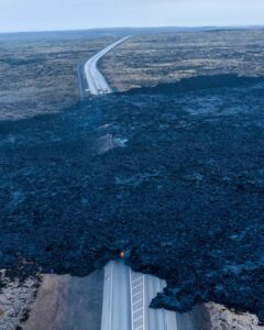
Fissure 8 continues to erupt lava into the channel leading northeastward from the vent. No new overflows were reported this morning. Lava movement in the channel seemed sluggish through, and levels were lower in, the lower part of the channel. At the coast, the lava flow in the Ahalanui area remains less than 0.1 miles from the Pohoiki boat ramp in Isaac Hale Park. The active ocean entry is still a few hundred yards to the east of this lava flow edge.
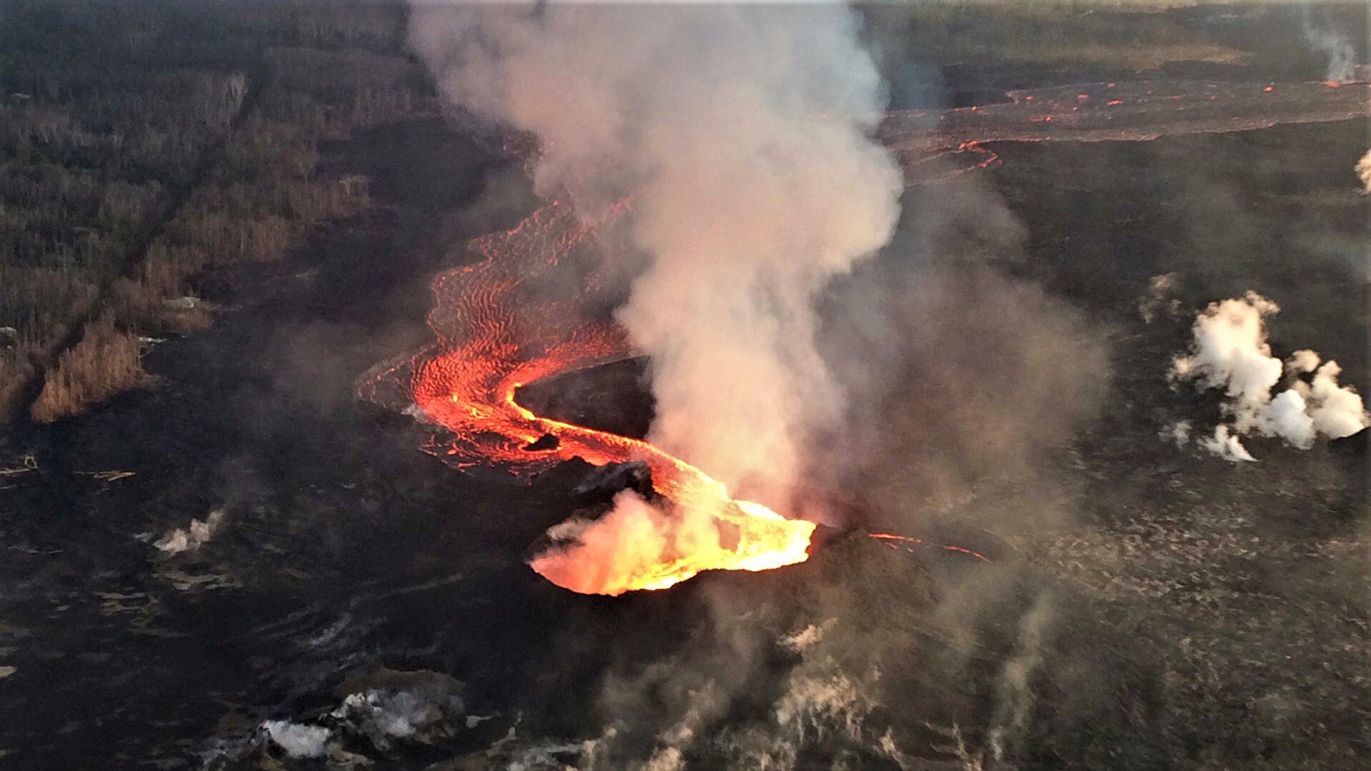
Fissure 8 continues to erupt lava into the channel leading northeastward from the vent. This north-facing view of the cone, vent, and proximal channel was taken during HVO’s overflight this Morning.
No other fissures are active this morning.
Kīlauea Volcano Summit
The most recent collapse event occurred at 6:41 AM HST July 24, and was similar in character and magnitude to previous events. Seismicity has increased steadily since then; since yesterday afternoon the number of events per hour has fluctuated between about 20 and 40. As of this posting, the last collapse event occurred more than 51 hours ago making this the longest interval between events since late May. The next collapse event is expected at any time.
Source : HVO.
Kamchatka , Sheveluch :
56.64 N, 161.32 E;
Elevation 10768 ft (3283 m),
the dome elevation ~8200 ft (2500 m)
Aviation Colour Code is ORANGE
A moderate gas-steam activity of the volcano continues. Ash explosions up to 32,800-49,200 ft (10-15 km) a.s.l. could occur at any time. Ongoing activity could affect international and low-flying aircrafts.
A moderate gas-steam activity of the volcano continues. Satellite data by KVERT showed a weak thermal anomaly over the volcano on 19 and 21-22 July; the volcano was obscured by clouds in the other days of Week.
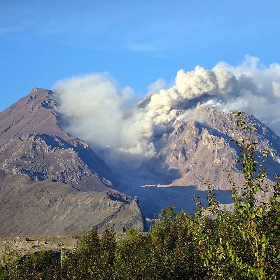
The volcano is located on the crossing of the Kurile-Kamchatkan and Aleutian Arcs, at a distance of 50 km from Klyuchi and of 450 km from Petropavlovsk-Kamchatsky.Sheveluch is one of the biggest volcanic structures in Kamchatka. The volcano includes three main units: Stary Sheveluch, the old caldera and active apparatus Molodoy Sheveluch. The lava dome of Molodoy Sheveluch elevation is 2500 m.
Moderate potential hazards are caused by ash plumes, ash falls, pyroclastic flows, hot avalanches and lahars.
The volcano constitutes a potential hazard to international and local airlines at Kamchatka because its eruptive clouds can rise to a height of 3-20 km a.s.l. and extend for hundreds of kilometers from the volcano.
Ash falls possible at:
Klyuchi (50 km to the south-west from the volcano)
Ust’-Kamchatsk (90 km to the east-southeast from the volcano)
Ust’-Khairyuzovo (280 km to the west-northwest from the volcano)
Source : Kvert.
Photo : Nadezhda Novikova