November 11 , 2019.
Alaska , Shishaldin :
54°45’19 » N 163°58’16 » W,
Summit Elevation 9373 ft (2857 m)
Current Volcano Alert Level: WATCH
Current Aviation Color Code: ORANGE.
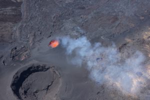
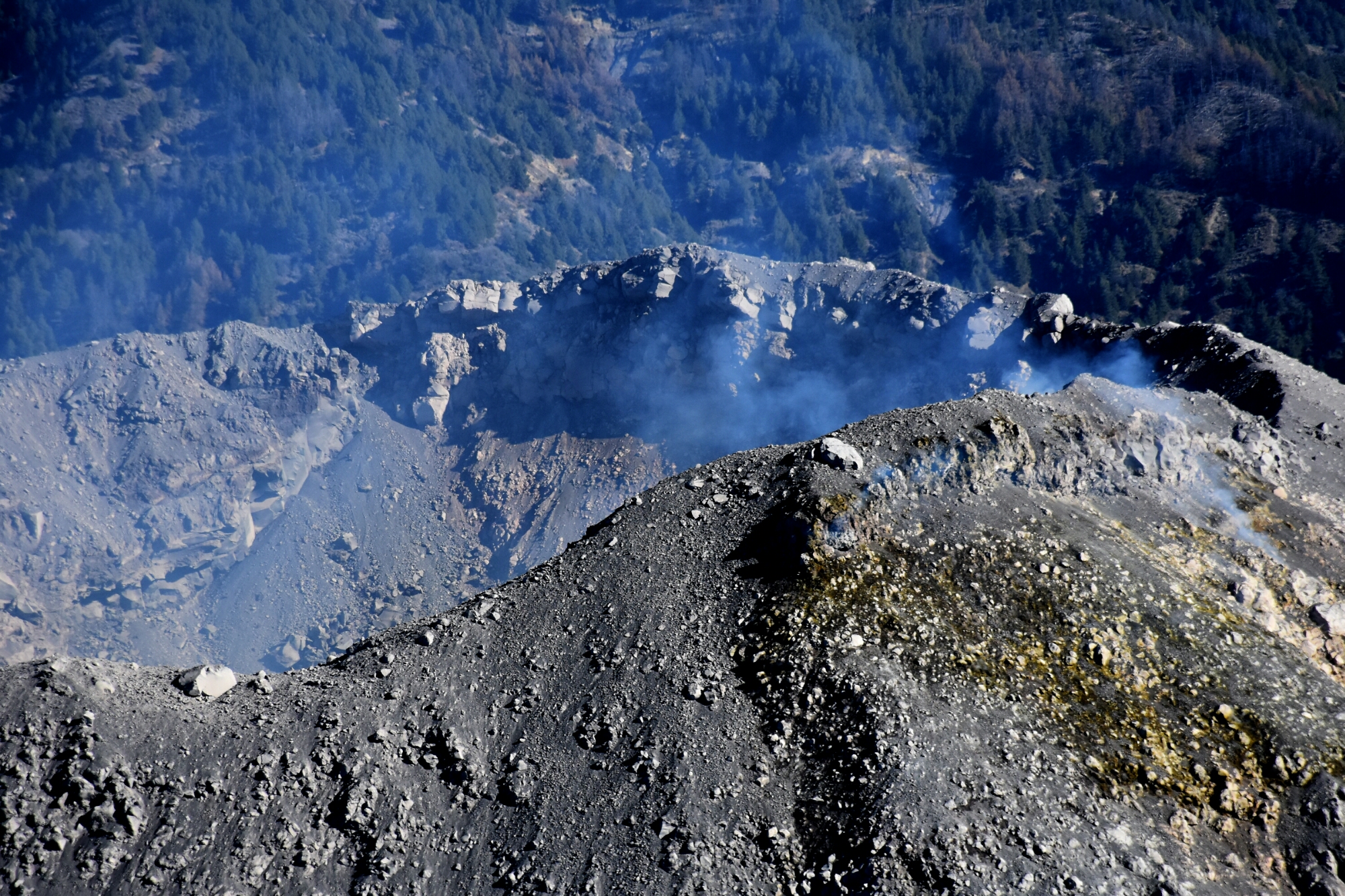
Aerial view of Shishaldin Volcano with Isanotski Volcano in the background taken from a helicopter overflight during geology field work.
A low-level eruption continues at Shishaldin. Seismic tremor has increased over the past day. Satellite and web camera observations were partly obscured by clouds over the past day but elevated surface temperatures in the summit crater were observed in several clear views. These observations are consistent with elevated unrest, but active lava effusion is less likely to be occurring. No significant ash emissions observed in satellite or infrasound data, although there may have been brief periods of minor ash emissions in the immediate vicinity of the summit crater.
Shishaldin is monitored by local seismic and infrasound sensors, satellite data, a web camera, a telemetered geodetic network, and distant infrasound and lightning networks.
Source : AVO.
Photo : Loewen, Matt
Mexico , Colima :
Weekly technical bulletin of the activity of the volcano of Colima, Date: November 8, 2019, Bulletin n ° 146.
Seismic activity
During the last week, 7 high frequency events (HF), 6 landslides and 4.8 min of low amplitude tremor were automatically recorded.
Visual observations
Intermittent steam and gas emissions on the northeast side of the crater continue to be recorded during the reporting period, although fumaroles were also observed in the western part. When clouds allowed, the fixed thermal camera located south of the volcano recorded thermal anomalies related to the fumaroles activity.
Geochemistry
The flow of SO2 was not measured during the week.
Remote Perception
No thermal anomalies detected by the MIROVA satellite system were observed during the last week.
Diagnostic
The volcano maintains an explosive activity of low intensity. The occurrence of these events indicates that the gas probably associated with the moving magma has reached surface levels. This activity can continue and increase in intensity over the following days, weeks or months. The staff in charge of monitoring the volcano monitors any changes and developments in the activity.
Source : UCOL
Photo : Protección Civil Jalisco Uepcbj.
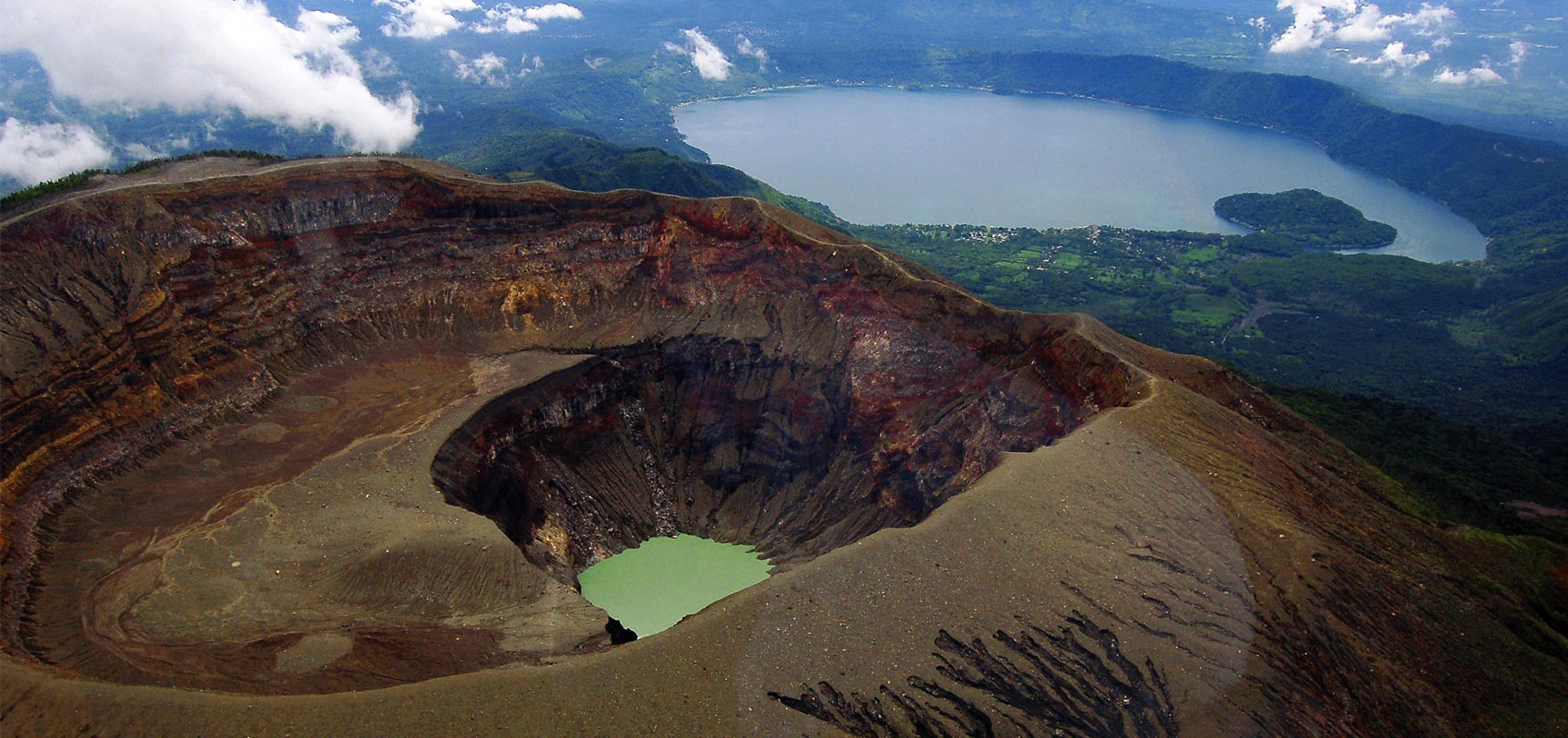
El Salvador , Santa Ana ( Llamatepec ) :
Location: shared by the departments of Santa Ana and Sonsonate
Altitude: 2381 meters above sea level
Type of volcano: Stratovolcano
Type of activity: Vulcanian- Strombolian.
Last eruption: October 1, 2005.
The seismic vibration of the volcano remained between 16 and 20 RSAM units per day, that is to say in the normal range. In September, a total of 75 earthquakes related to fluid circulation in the volcanic system were recorded. With regard to earthquakes associated with the rupture of solid environments, an event was recorded and was located on the southern flank of the volcano crater, with a depth of less than 8 kilometers and a magnitude less than 1.5. Due to its small magnitude, no resident of the region felt it. According to the monitoring, the activity of the volcano remains normal.
With regard to sulfur dioxide (SO2) emissions, they fluctuated between 52 and 555 tonnes per day, with an average of 296 t / d, the alert threshold being 300 t / d.
Source : Marn .
Photo : kaytetours.com.
Indonesia , Karangetang :
Level of Activity at Level III (SIAGA). G. Karangetang (1,784 m above sea level) has been re-erupted since November 25, 2018.
The volcano is clearly visible until it is covered with fog. The smoke from the main crater is observed to be white in color with a high intensity and thick at about 50 meters above the summit. The weather is sunny / rainy with moderate to east winds. The temperature of the air around 24 ° -29 ° C. Lava flows are noted from the top of the main crater towards the gullies of Pangi, Nanitu and Sense, over a distance of 1000-1500mn. The two craters emit incandescent projections, 25 meters high and 10 meters high respectively. The lava falls from the top of the main crater to the Nanitu and Sense rivers over 500 to 1500 m, towards the Pangi River over 1000 to 1500 m.
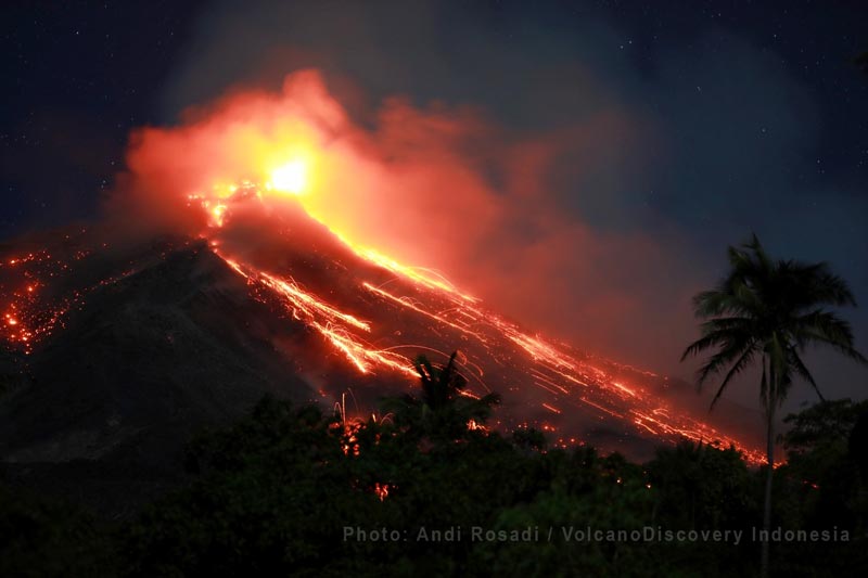
Active lava flow and incandescent stone falls from Karangetang Crater 1 (image: Andi Rosadi / VolcanoDiscovery Indonesia)
The seismograph of November 10, 2019 recorded:
57 avalanche earthquakes.
2 earthquakes of explosion.
1 multiple phase earthquake
4 shallow volcanic earthquakes
1 local tectonic earthquake
1 distant tectonic earthquake.
Continuous tremor, amplitude 0.5-3 mm (dominant 0.25 mm)
Recommendation:
As of August 27, 2019, the technical recommendations were as follows:
The public and visitors / tourists are advised not to travel within 2.5 km of the main crater (South) and crater II (North), as well as in the sectoral expansion zone of Crater II. northwest 4 km and from the main crater west up to 3 km.
Communities living around rivers that originate at the summit of Mount Karangetang need to be prepared for the potential threat of lahars and sudden floods that can spread to the coast.
Source : PVMBG.
Photo : Andi Rosadi / VolcanoDiscovery Indonesia