June 29 , 2024.
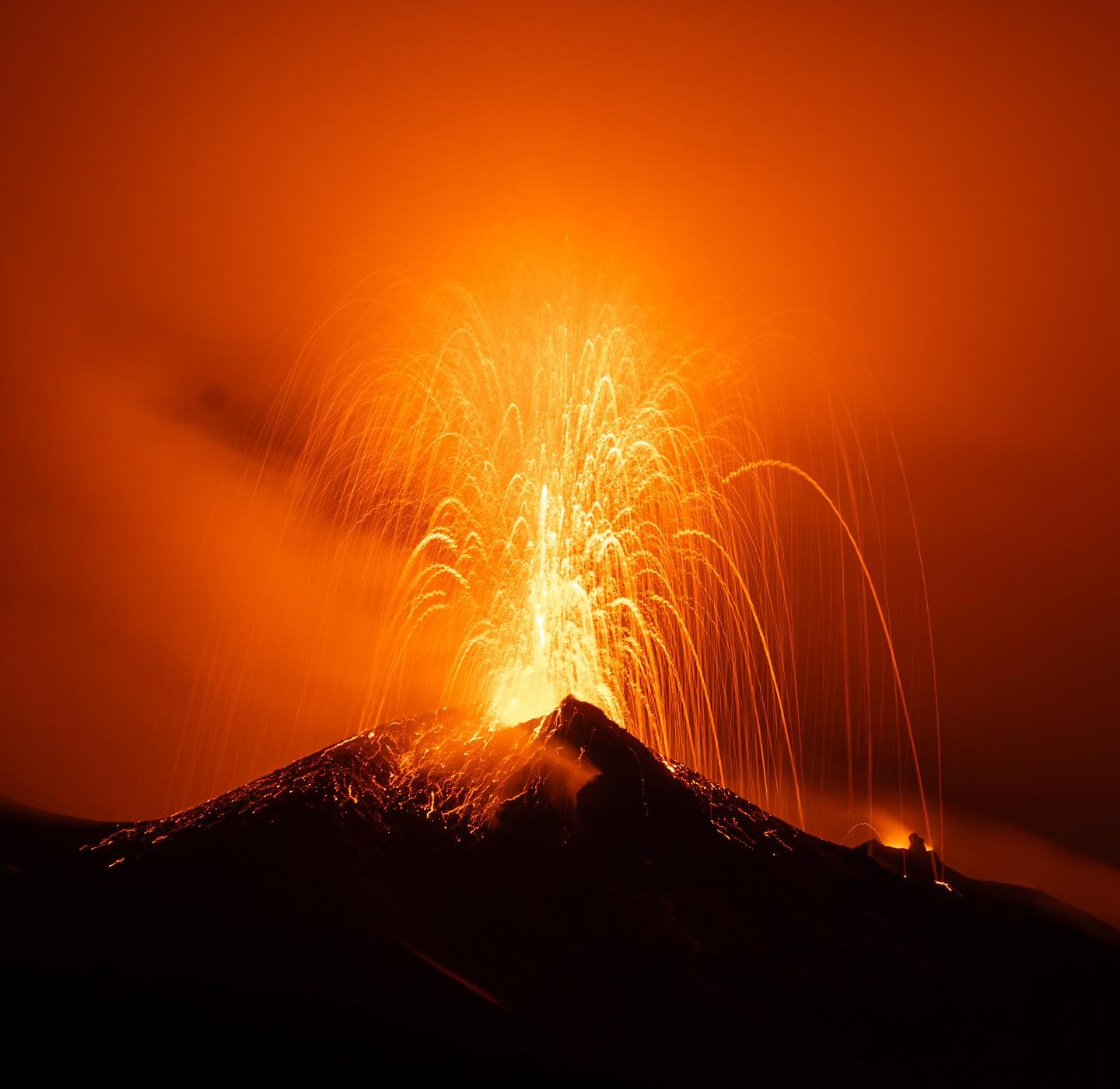
Italy , Stromboli :
Press release on the activity of Stromboli, June 28, 2024, 4:03 p.m. (2:03 p.m. UTC)
The National Institute of Geophysics and Volcanology, Osservatorio Etneo, communicates that the previously communicated lava overflow is cooling and is no longer fed.
Since the last update, the average volcanic tremor amplitude has shown a slight downward trend with oscillations between medium and high values.
The signals from the GNSS (HF) and inclinometer deformation monitoring networks do not show significant changes compared to the last press release.
Further updates will be communicated shortly.
Source : INGV.
Photo : Stromboli stati d’animo / Sebastiano Cannavo.
Iceland , Reykjanes Peninsula :
Land uprising in Svartsengi continues with increased pace
New magma flows and/or eruptions are likely in the coming weeks
Updated June 28 at 11:55 a.m.
The lava has an area of 9.3 km2 and its volume is approximately 45 million m3
The land uprising in Svartsengi continues to grow at an increasing speed
The data collected in the coming days/weeks will make it possible to assess the situation with more certainty.
Seismic activity in Svartsengi and Sundhnúk is very low and few small earthquakes have been recorded in recent days. Lava moving towards the north side of Sýlingarfell has continued to flow very slowly since the eruption ended on June 22 and has now stopped moving completely.
A team from the Institute of Natural Sciences and Cadastre of Iceland processed data collected by experts from Efla, Verkís and Svarm during a drone flight over the eruption centers on June 24. The data shows that the lava now has an area of 9.3 km2 and a volume of approximately 45 million m3.
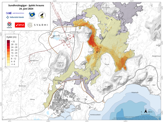
Map showing the extent and thickness of the lava bed that formed during the eruption that began on May 29. The map is the result of the collaboration of many parties, but is based on the measurements of Verkís, Efla and Svarma from June 24. The map shows where lava has accumulated in a lava pond southeast of Sýlingarfell (red area) and the lava stream flowing from it to the north of Sýlingarfell. Gray areas show lava that has flowed into the area since December 2023.
The latest deformation measurements (GNSS and InSAR satellite images) show that the elevation of the land beneath Svartsengi continues. The strain rate increased after the eruption ended and is now higher than that measured before the eruption that began on May 29. The deformation rate can be interpreted as the influx of magma into the magma sphere at a depth of 4–5 km.
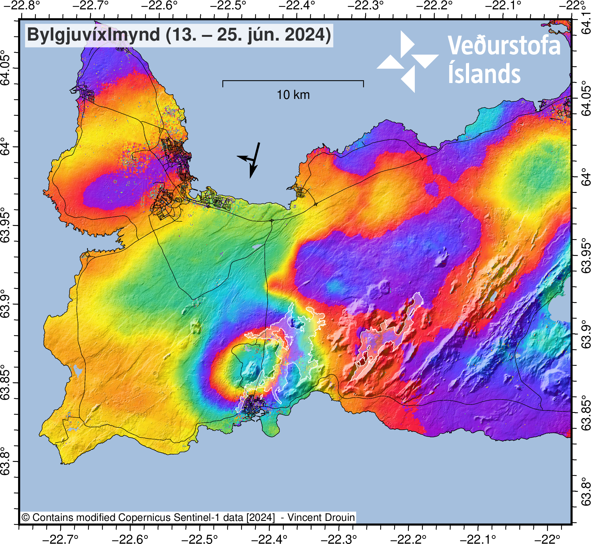
An interpolated waveform (InSAR) image for the period June 13-25 shows that the deformation during this period is about 3-4 cm where it is greatest. The image is based on data from the Sentinel-1 satellite. The lava from the Fagradalsfjall and Sundhnúks craters is marked with white outlines.
With these assumptions as a guide, it can be assumed that the system will behave the same as before and that a new magma intrusion and/or eruption will occur again in the Sundhnúks region in the coming weeks. At present, it is difficult to predict with certainty how the situation will develop. The data collected in the coming days/weeks will make it possible to assess the situation and possibly understand changes and trends within the magma system.
Source et photos : IMO
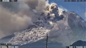
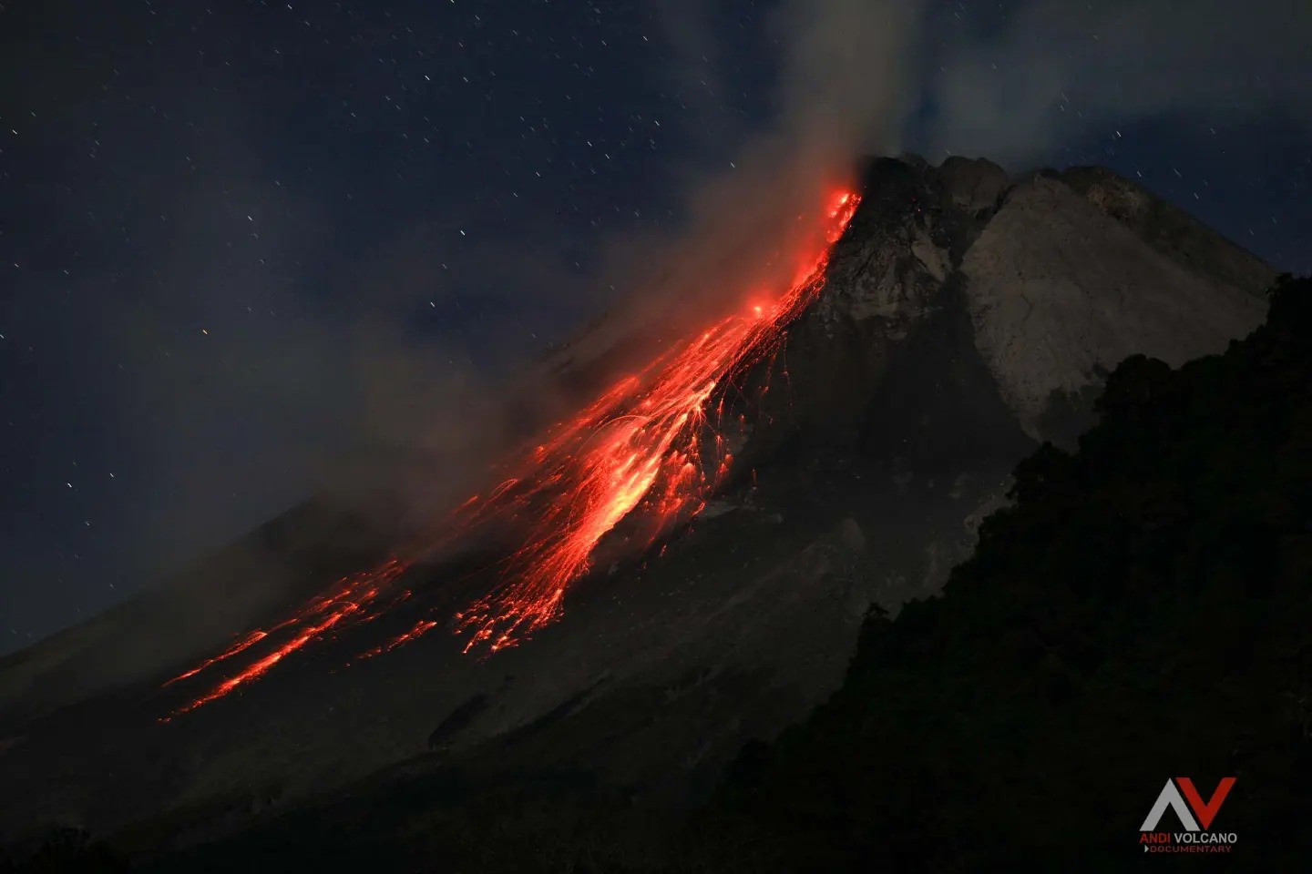
Indonesia , Merapi :
Published on June 28, 2024. MOUNT MERAPI ACTIVITY REPORT. from June 21 to 27, 2024
OBSERVATION RESULT
Visual
The weather around Mount Merapi is generally clear in the morning and night, while it is foggy from noon to evening. White smoke, thin to thick, low to moderate pressure and 100 m high was observed from the observation post of Mount Merapi Babadan on June 25, 2024 at 05:24 WIB. This week, lava avalanches were observed 86 times towards the South-West (upstream of the Bebeng River) up to a maximum of 2,000 m and once towards the West (upstream of the Batang River) up to ‘at 1,000 m. It was observed that the morphology of the southwest dome had changed due to dome growth activities and lava avalanches. The highest hot spot was observed at 243°C, relatively the same as the previous measurement temperature. To observe the morphology of the central dome, it is mainly covered with solfatara smoke. The highest hotspot was observed at 202.5°C, lower than the previous measurement temperature. Based on the analysis of aerial photos, the volume of the South-West dome was measured at 2,345,200 m3 and that of the Central dome at 2,362,800 m3.
Seismicity
This week, the seismicity of Mount Merapi recorded
71 superficial volcanic earthquakes (VTB),
266 multi-phase (MP) earthquakes,
9 times low frequency (LF) earthquakes,
381 avalanche earthquake(RF),
5 tectonic earthquakes (TT).
The intensity of earthquakes this week is higher than last week.
Deformation
The deformation of Mount Merapi monitored by EDM this week showed a shortening rate of 1.2 cm/day.
Rain and lahars
This week there was rain at Mount Merapi observation post with a rain intensity of 23 mm/hour for 90 minutes at Jrakah observation post on June 27, 2024. There were no reports of flows additional or lahar in the rivers which have their source on the Merapi.
Conclusion
Based on the results of visual and instrumental observations, it was concluded that:
Merapi’s volcanic activity is still quite high in the form of effusive eruptive activity.
The activity status is set to the “SIAGA” level.
Source : BPPTKG
Photo : Andi volcanist
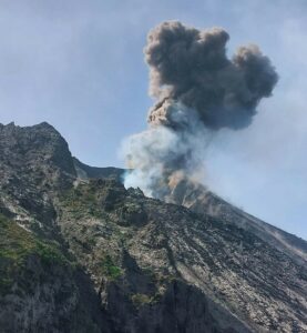
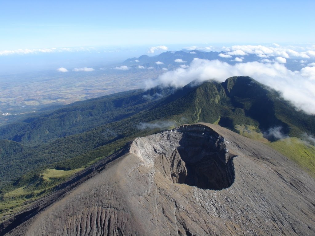
Philippines , Kanlaon :
KANLAON VOLCANO ADVISORY , 28 June 2024 , 6:15 PM
Notice of elevated volcanic SO2 gas flux at Kanlaon Volcano.
Volcanic sulfur dioxide (SO2) gas emission from the summit crater of Kanlaon based on campaign Flyspec measurements today, 28 June 2024, averaged 5,397 tonnes/day. This is the highest emission from the volcano recorded since instrumental gas monitoring began. Kanlaon has been degassing increased concentrations of volcanic SO2 this year at an average rate of 1,897 tonnes/day, but emission since the 3 June 2024 eruption has been particularly elevated at a current average of 3,175 tonnes/day. In addition, volcanic earthquake activity has persisted at an average of 10 events/day since the eruption. Ground deformation data from continuous GPS and electronic tilt measurements have been recording medium-term inflation of the Kanlaon edifice since March 2022 and a shorter-term inflation of the eastern flank since 2023, indicating slow but sustained pressurization within the volcano. The overall monitoring parameters indicate that magmatic processes beneath volcano may be driving current unrest, causing persistently high concentrations of volcanic gas emission, swelling of the edifice and occasional volcanic earthquake activity.
The public is reminded that Alert Level 2 (increasing unrest) prevails over Kanlaon. This means that there is current unrest driven by shallow magmatic processes that could eventually lead to explosive eruptions or even precede hazardous magmatic eruption at the summit crater. The public is strongly advised to be vigilant and avoid entry into the four (4) kilometer-radius Permanent Danger Zone (PDZ) to minimize risks from volcanic hazards such as pyroclastic density currents, ballistic projectiles, rockfall and others. In case of ash fall events that may affect communities downwind of Kanlaon’s crater, people should cover their nose and mouth with a damp, clean cloth or dust mask. Civil aviation authorities must also advise pilots to avoid flying close to the volcano’s summit as ash and ballistic fragments from sudden eruption can be hazardous to aircraft. Communities living beside river systems on the southern and western slopes, especially those that have already experienced lahars and muddy streamflows, are advised to take precautionary measures when heavy rainfall over the volcano has been forecast or has begun.
DOST-PHIVOLCS maintains close monitoring of Kanlaon Volcano and any new development will be immediately communicated to all concerned stakeholders.
Source : Phivolcs
Photo : Sunstar.
La Martinique , Montagne Pelée :
Weekly report, Paris Institute of Globe Physics / Martinique Volcanological and Seismological Observatory.
Activity on Montagne Pelée, Saint-Pierre, June 28, 2024 at 12:30 p.m. local time (GMT-4)
No earthquakes of volcanic origin were observed this week.
Between June 21, 2024 at 4:00 p.m. (UT) and June 28, 2024 at 4:00 p.m. (UT), the OVSM did not record any volcano-tectonic earthquakes.
The previous week, the OVSM had recorded 6 earthquakes of volcanic origin. As of June 28, 2024 and during the last 4 weeks, the OVSM has therefore observed a total of 9 volcanic earthquakes, or an average of 2 to 3 earthquakes per week.
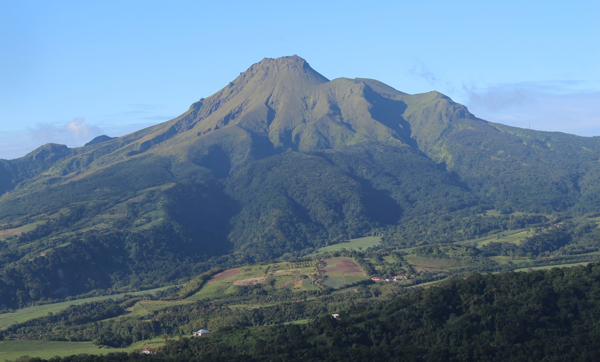
During phases of volcanic reactivation of volcanoes similar to Montagne Pelée, it is usual to observe seismic activity varying in intensity and frequency.
For more details on observations and interpretations of volcanic activity over the longer term, refer to the OVSM monthly bulletins.
The alert level is currently YELLOW: vigilance.
Source : Direction de l’OVSM-IPGP.
Photo : OVSM