June 11 , 2024.
Indonesia , Semeru :
Press release on glowing lava avalanches on G. SEMERU, EAST JAVA.
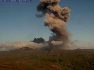
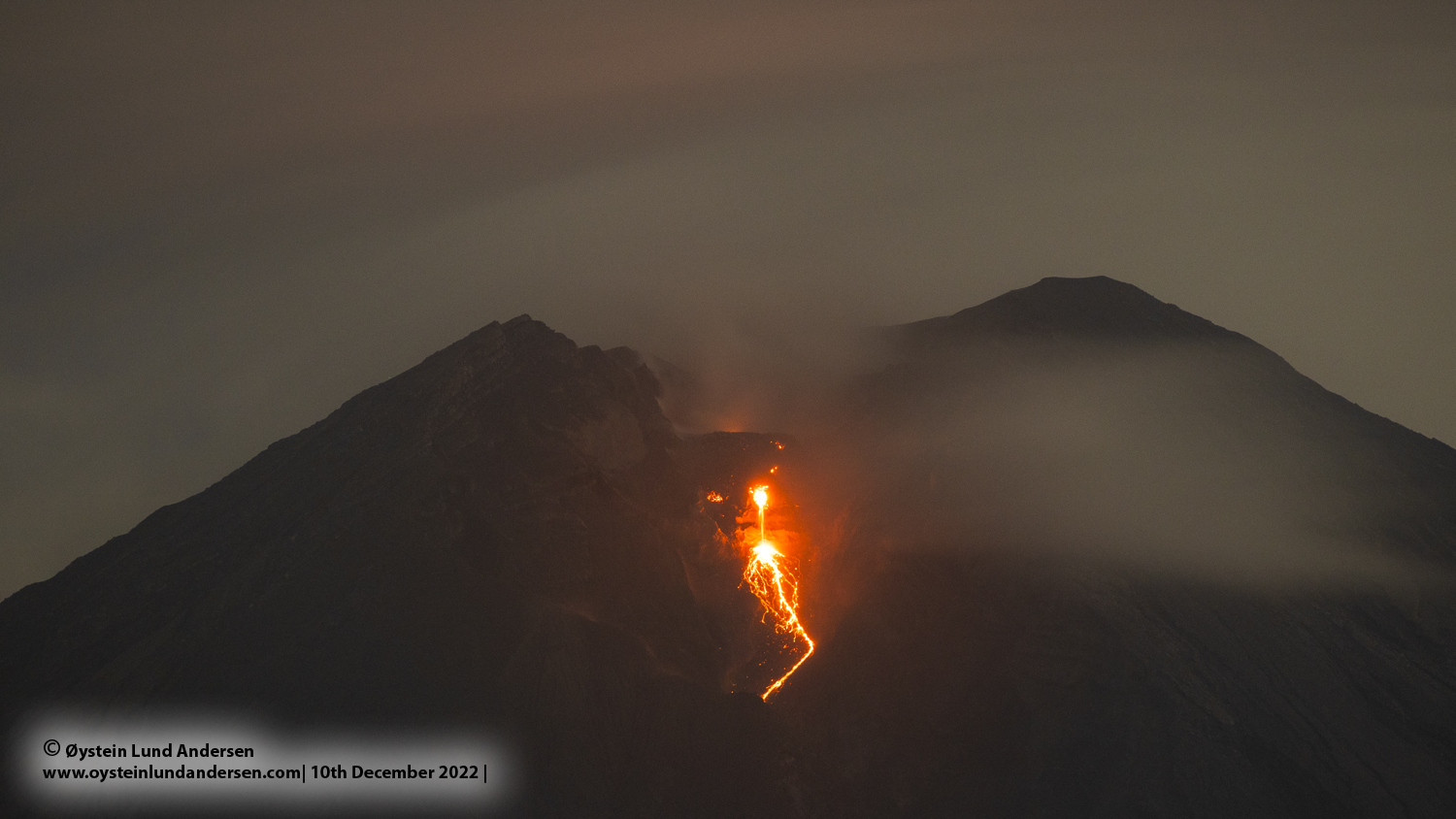
On Monday, June 10, 2024 at 00:42 WIB, glowing lava avalanches were observed on Mount Semeru, East Java with a sliding distance of 2500 meters in the direction of Besuk Kobokan. Visual observations on June 10, 2024, from 00:00 to 06:00 WIB showed that incidents of glowing lava avalanches were observed 28 times with a sliding distance of 1,000 to 2,500 meters in the direction of Besuk Kobokan.
The activity of Mount Semeru shows that eruptive activity, hot clouds and lava avalanches still occur, but they are rarely observed visually as they are hampered by foggy weather. Besides the risk of warm cloud formation, the potential for lahar flows is also still high given the fairly high rainfall on Mount Semeru. The accumulation of material resulting from eruptions (eruptions and lava flows) has the potential to turn into glowing lava avalanches, or hot clouds. Lava avalanches and/or hot clouds that have been deposited along streams that originate at the summit of Mount Semeru have the potential to turn into lahars if they interact with rainwater . Aside from this, the interaction of high-temperature deposits of lava avalanche material or hot clouds with river water presents the potential for secondary eruptions.
During this period, the number of recorded earthquakes shows that seismic activity on Mount Semeru is still high, including eruptions, avalanches and harmonic tremors. The deep volcanic and harmonic earthquakes that are still recorded indicate that there is still supply beneath the surface of Mt. Semeru as well as the release of materials to the surface and the process of accumulation of materials from the eruption around the Jonggring Seloko crater. Strain monitoring with a continuous inclinometer and GPS equipment at the end of the observation period was relatively flat, indicating that there was no increase in pressure. However, in May 2024, an inflation pattern was observed, indicating an increase in pressure on the volcanic body. This condition is correlated with the transfer of pressure from the interior of the volcanic body to the surface as well as the release of material during eruptions.
Based on the results of the analysis and assessment, the activity level of Mount Semeru remains at Level III (SIAGA) with recommendations tailored to the latest potential hazard threats. In connection with the level of activity of Mount Semeru at Level III (SIAGA) it is recommended:
People/visitors/tourists do not carry out any activities in the Southeast sector along Besuk Kobokan, 13 km from the summit (center of the eruption). Apart from this distance, people do not carry out activities within 500 meters of the river bank along Besuk Kobokan as they are likely to be affected by the expansion of hot clouds and lahar flows. up to a distance of 17 km from the summit.
People do not travel within a 5 km radius of the crater/summit of Semeru Volcano as it is prone to the danger of stone throwing.
The community is alert to the potential for hot clouds, lava avalanches and lahars along the rivers/valleys that originate at the summit of Semeru Volcano, particularly along Besuk Kobokan, Besuk Bang, Besuk Kembar and Besuk Sat, as well as the potential for lahars in small rivers that are tributaries of the Besuk Kobokan River.
Source : PVMBG
Photos : PVMBG , Oystein lund Andersen ( archive).
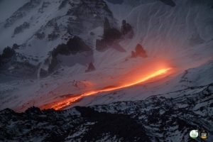
Alaska , Shishaldin :
Minor unrest at Shishaldin Volcano continues, with small, low-frequency earthquakes and tremor occurring throughout the past 24 hours. Steaming and gas emissions from the summit were observed in satellite data.
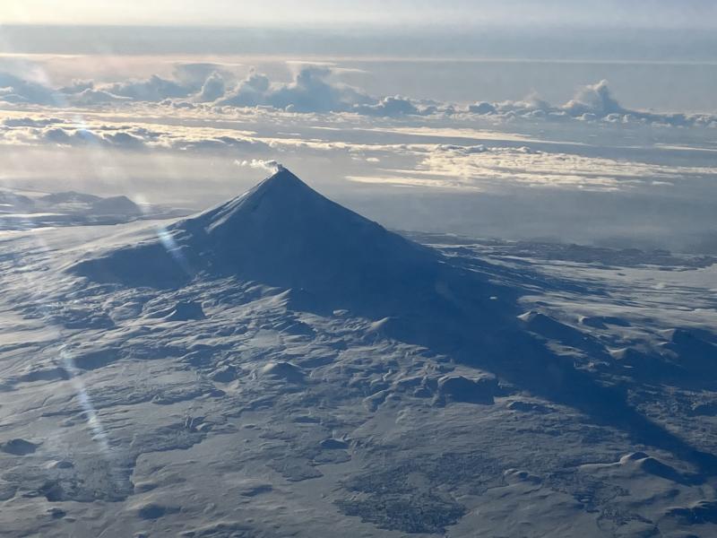
Minor rock falls associated with collapse events from the unstable ground in and near the summit crater may occur. The collapse events can generate small clouds of dust likely composed of fine-grained ash. The diffuse dust clouds dissipate quickly and can produce irregular-shaped deposits near the summit. The last significant ash-producing eruption occurred in November 2023.
Local seismic and infrasound sensors, web cameras, and a geodetic network are used to monitor Shishaldin Volcano. In addition to the local monitoring network, AVO uses nearby geophysical networks, regional infrasound and lighting data, and satellite images to detect eruptions.
Source : AVO
Photo : Beesley, Nick
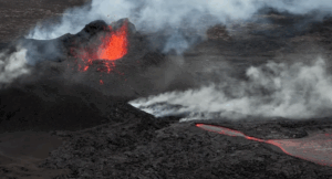
Colombia , Puracé :
Popayan, June 10, 2024, 4:00 p.m.
Monitoring the activity of the PURACE VOLCANO – LOS COCONUCOS VOLCANIC RANGE, the COLOMBIAN GEOLOGICAL SERVICE (SGC), an entity attached to the MINISTRY OF MINES AND ENERGY, reports that:
Until the moment of publication of this bulletin, and compared to what was recorded yesterday, the seismic activity associated with the movement of fluids and the fracturing of rocks inside the volcano, remains at levels similar to those observed in recent days, both in number of events and in energy released. The events of this seismic activity were located in the crater sector of the Puracé volcano, at depths less than 3 km.
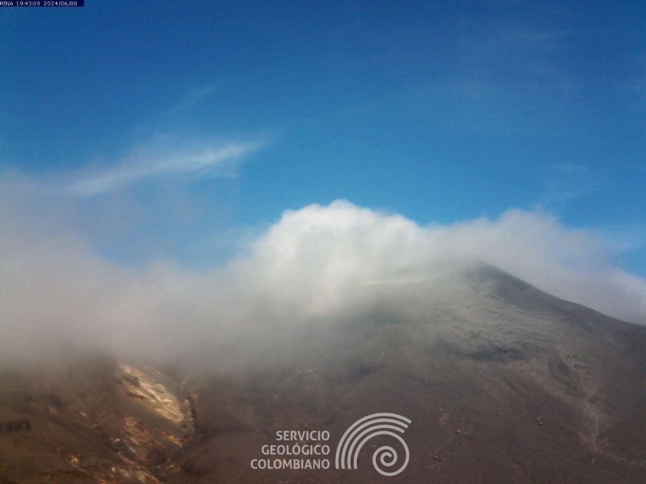
During the day, web cameras captured images showing degassing processes inside the crater and in the lateral fumarole, with white emissions that dispersed depending on the direction of the winds in the area. Due to strong winds in the upper part of the volcano, it was not possible to calculate the height of the gas column. On the other hand, the process of ground deformation and the concentrations of carbon dioxide (CO2) and sulfur dioxide (SO2) gases maintain the observed trend, with values that remain above the known baselines for this volcano.
The SGC confirms that the alert state of the PURACE VOLCANO continues at ORANGE: volcano with significant changes in the monitored parameters.
Source et photo : SGC
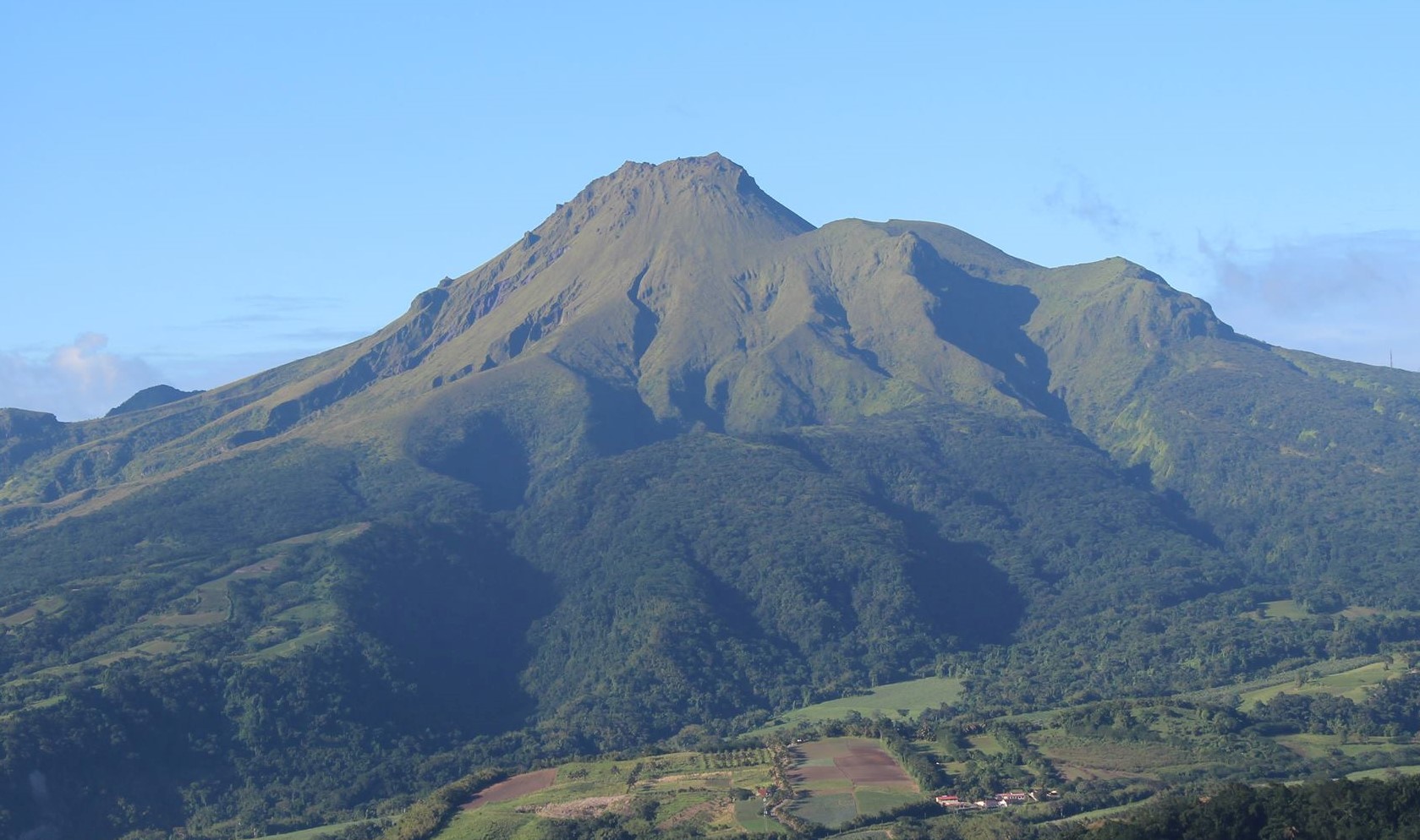
La Martinique , Montagne Pelée :
Weekly report, Paris Institute of Globe Physics / Martinique Volcanological and Seismological Observatory
Activity on Montagne Pelée, Saint-Pierre, June 7, 2024 at 2:00 p.m. local time (GMT-4)
No earthquakes of volcanic origin were observed this week.
Between May 31, 2024 at 4:00 p.m. (UT) and June 7, 2024 at 4:00 p.m. (UT), the OVSM did not record any volcano-tectonic earthquakes.
The previous week, the OVSM had recorded 16 earthquakes of volcanic origin. As of June 7, 2024 and during the last 4 weeks, the OVSM has therefore observed a total of 35 volcanic earthquakes, or an average of 8 to 9 earthquakes per week.
During phases of volcanic reactivation of volcanoes similar to Montagne Pelée, it is usual to observe seismic activity varying in intensity and frequency.
For more details on observations and interpretations of volcanic activity over the longer term, refer to the OVSM monthly bulletins.
The alert level is currently YELLOW: vigilance.
Source : Direction de l’OVSM-IPGP
Photo : OVSM IPGP.
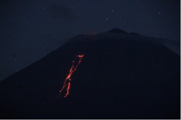
Guatemala , Santiaguito :
Weather conditions: Clear weather.
Wind: From the West.
Precipitation: 47.0 mm.
Activity:
The Santa María-Santiaguito Volcanic Complex Observatory reports volcanic activity on Dome Caliente. During the night and early morning, incandescence was observed intermittently on the dome and sides of the dome, a product of the constant extrusion of blocky lava. A few moderate explosions were observed that raised ash columns to heights of up to 700 meters above the dome, producing short-distance pyroclastic flows toward the west, southwest, and south flanks of the Caliente dome, stacking materials in promontories on the aforementioned flanks.

These explosions occur at a rate of 1 to 3 per hour and are accompanied by faint outgassing noises similar to those of an airplane turbine. Degassing is constant, with weak to moderate columns of water vapor and other magmatic gases at heights of 300 to 400 meters above the dome’s dome, which the wind moves toward the Southeast. In the afternoon and evening, forecast rains could cause lahars to descend in the channels that descend from the Caliente Dome. Activity remains at a high level, so it is possible that with explosions or under the effect of gravity, part of the accumulated materials collapse and that pyroclastic flows over long distances are generated towards the South. West, South and South-East.
Source : Insivumeh
Photo : Annie Winson , earthobservatory.sg