April 20 , 2024.
Indonesia , Ruang :
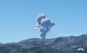
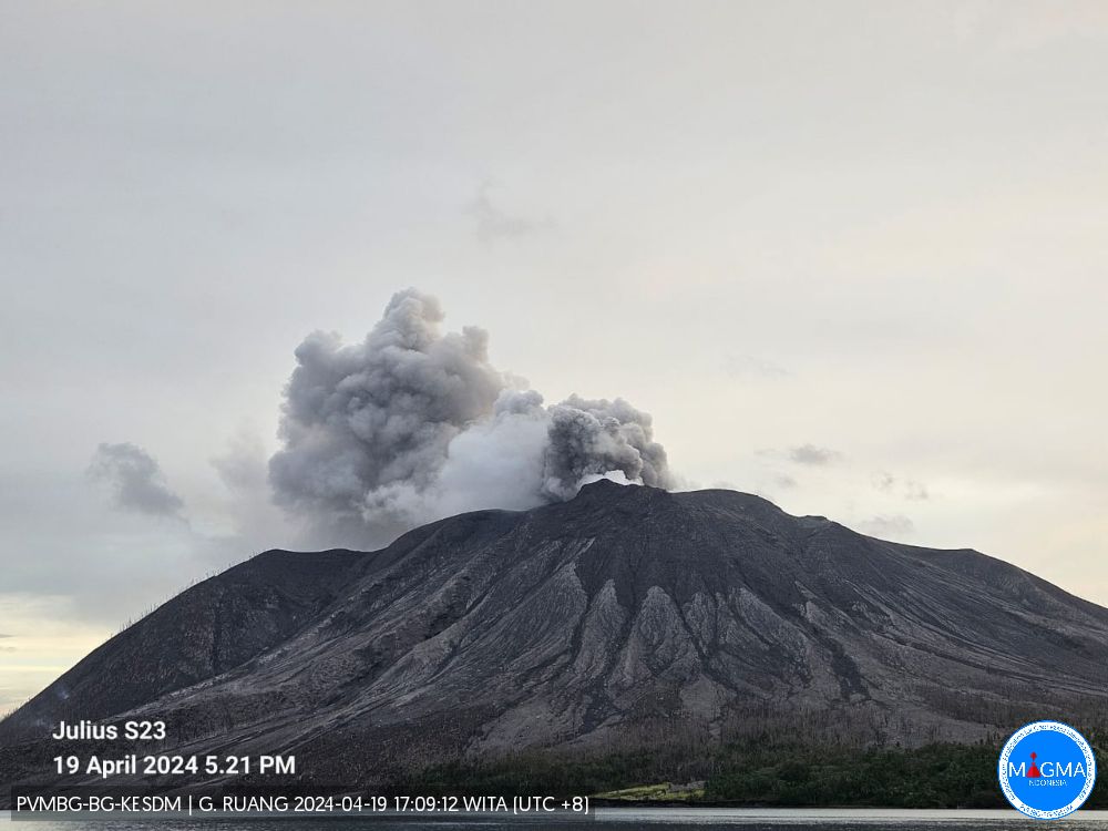
An eruption of Mount Ruang occurred on Friday, April 19, 2024, at 5:06 p.m. WITA. The height of the eruptive column was observed to be ± 400 m above the peak (± 1,125 m above sea level). The ash column was observed to be gray with thick intensity, oriented towards the South. At the time of writing, the eruption was still ongoing.
VOLCANO OBSERVATORY NOTICE FOR AVIATION – VONA
Issued : April 19 , 2024
Volcano : Ruang (267010)
Current Aviation Colour Code : ORANGE
Previous Aviation Colour Code : orange
Source : Ruang Volcano Observatory
Notice Number : 2024RUA004
Volcano Location : N 02 deg 18 min 11 sec E 125 deg 22 min 00 sec
Area : North Sulawesi, Indonesia
Summit Elevation : 2320 FT (725 M)
Volcanic Activity Summary :
Eruption with volcanic ash cloud at 09h06 UTC (17h06 local).
Volcanic Cloud Height :
Best estimate of ash-cloud top is around 3600 FT (1125 M) above sea level or 1280 FT (400 M) above summit. May be higher than what can be observed clearly. Source of height data: ground observer.
Other Volcanic Cloud Information :
Ash cloud moving to south. Volcanic ash is observed to be gray. The intensity of volcanic ash is observed to be thick.
An eruption of Mount Ruang occurred on Saturday, April 20, 2024 at 12:15 WITA with the height of the ash column observed at ±250 m above the summit (±975 m above sea level). The ash column was observed to be gray with thick intensity, oriented towards the South. At the time of writing, the eruption was still ongoing.
Source : Magma Indonésie.
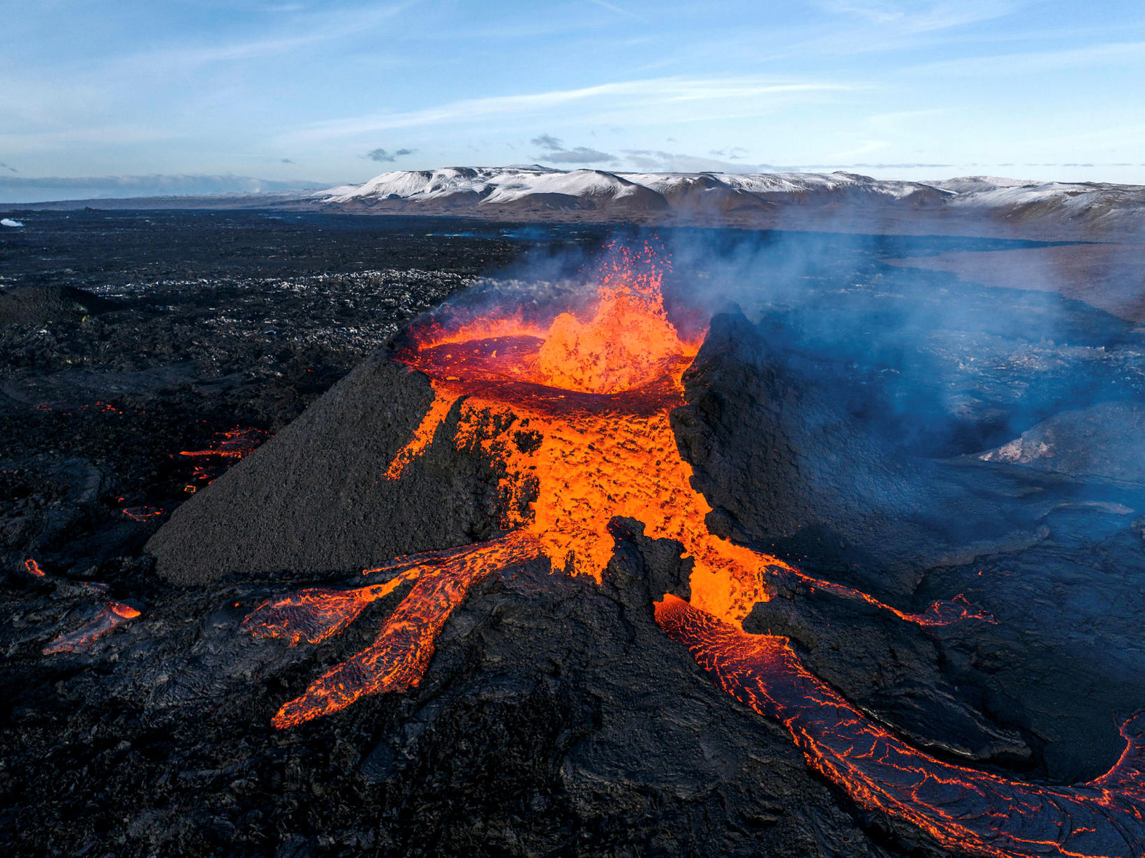
Iceland , Reykjanes Peninsula :
Continued ground uplift increases the likelihood of further spreading of magma even if an eruption is underway. More uncertainty about the evolution of activity in the days or weeks to come
Updated April 19 at 3:30 p.m. UTC
The uplift of the ground in Svartsengi continues at a constant pace.
Since April 5, only one crater has erupted and the lava flow coming out of it has remained relatively stable, at a little more than 3 m3/s.
Persistent danger from gas emissions. People are advised to monitor air quality.
The continued accumulation of magma beneath Svartsengi at the current rate increases the likelihood of further magma spreading in the coming days or weeks, despite the ongoing eruption.
When the eruption began on March 16, ground uplift at Svartsengi slowed significantly and almost stopped. This indicates a balance between the influx of magma into the magma reservoir beneath Svartsengi and towards the surface at the Sundhnúkur crater row.
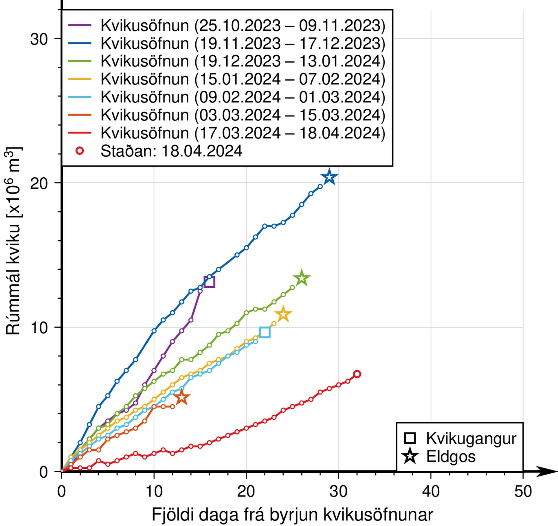
In early April, ground uplift began to increase again and a volume of magma similar to that accumulated in the reservoir beneath Svartsengi is now erupting at Sundhnúkur, causing an increase in magma pressure.
The current development is new, it is an ongoing volcanic eruption with a relatively stable lava flow at the Sundhnúkur crater at the same time as the ground rises at Svartsengi. There is therefore more uncertainty than before regarding the possible evolution of the event.
Model calculations indicate that more than 6 million m3 of magma have been added to the magma reservoir beneath Svartsengi since March 16. In previous events, magma spread from Svartsengi when between 8 and 13 million m3 were added to the reservoir since the last event.
More uncertainty regarding the evolution of activity in the coming days or weeks.
Until now, the general trend in the Sundhnúkur region has been an increased likelihood of magma spreading and even subsequent eruption. However, a new situation now appears to present itself: magma spreading could occur during an ongoing eruption. Recall that magma spreading is a sudden, large flow of magma spreading from a magma reservoir and can culminate with the magma reaching the surface. After the magma spread on March 2, which did not end in an eruption, a change in activity that had been somewhat cyclical since December.
If magma accumulation continues at a similar rate, the likelihood of further magma spreading increases in the coming days or weeks, even if an eruption is still underway. The spread of magma from the reservoir during an ongoing eruption has so far not been observed in the region. There is therefore more uncertainty about the evolution of activity in the coming days or weeks.
Probable scenario if magma propagation coincides with the current eruption:
Magma is spreading from the magma reservoir below Svartsengi to the Sundhnúkur crater row, as has happened for the last six times.
As a result of magma spreading, new eruptive fissures could open in the area between Stóra-Skógfell and Hagafell and/or the current eruptive crater could be enlarged due to a sudden increase in lava flow. This could happen at very short notice or without notice.
If spreading magma causes new volcanic fissures to open elsewhere above the magma dike formed on November 10, much longer notice is expected, most likely intense seismic activity, deformation and pressure changes in the boreholes.
It is also possible that magma propagation does not occur, but that the flow of the current eruption stops decreasing and begins to increase steadily until a new balance between the influx of magma from below and the flow towards the surface from the crater is reached.
However, if magma propagation results in the opening of a new eruptive fissure elsewhere than in the area between Stóra-Skógfell and Hagafell, such a scenario would most likely be accompanied by intense seismicity and much greater deformation. visible than previous eruptions.
Source : IMO
Photos : IMO , Hörður Kristleifsson
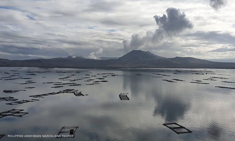
Philippines , Taal :
Notice of weak phreatic activity at Taal Volcano , 20 April 2024 , 11:00 AM
Two (2) minor successive phreatic or steam-driven events at the Taal Main Crater occurred this morning between 8:50 AM to 8:52 AM and 9:09 to 9:12 AM based on visual and seismic records of the Taal Volcano Network (TVN). The event produced white steam-laden plumes that rose 350 meters above the Main Crater before drifting west-southwest and southwest based on IP camera monitors. Sulfur dioxide (SO2) emissions have decreased last week and were last recorded at an average of 2,104 tonnes/day on 18 April 2024. Nonetheless, average SO2 emissions since January this year remain high at 9,698 tonnes/day. The phreatic events were likely driven by the continued emission of hot volcanic gases at the Taal Main Crater and could be succeeded by similar phreatic activity. The background levels of volcanic earthquake activity and ground deformation detected at Taal indicate that unrest is unlikely to progress into magmatic eruption.
DOST-PHIVOLCS reminds the public that Alert Level 1 prevails over Taal Volcano, which means that it is still in abnormal condition and should not be interpreted to have ceased unrest nor ceased the threat of eruptive activity. At Alert Level 1, sudden steam-driven or phreatic explosions, volcanic earthquakes, minor ashfall and lethal accumulations or expulsions of volcanic gas can occur and threaten areas within TVI. Furthermore, degassing of high concentrations of volcanic SO2 continues to pose the threat of potential long-term health impacts to communities around Taal Caldera that are frequently exposed to volcanic gas. DOST-PHIVOLCS strongly recommends that entry into TVI, Taal’s Permanent Danger Zone or PDZ, especially the vicinities of the Main Crater and the Daang Kastila fissure, must remain strictly prohibited. Local government units are advised to continuously monitor and assess preparedness of their communities and undertake appropriate response measures to mitigate hazards that could be posed by long-term degassing and related phreatic activity. Civil aviation authorities must advise pilots to avoid flying close to the volcano as airborne ash and ballistic fragments from sudden explosions and wind-remobilized ash may pose hazards to aircrafts.
DOST-PHIVOLCS is closely monitoring Taal Volcano’s activity and any new significant development will be immediately communicated to all stakeholders.
Source : Phivolcs
Photo : CNNPH , Marcello Teofilo ( archive).
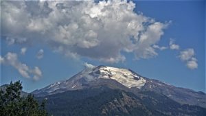
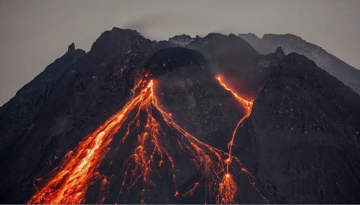
Indonesia , Mérapi :
MOUNT MERAPI ACTIVITY REPORT, from April 12 to 18, 2024. Published on April 20, 2024
OBSERVATION RESULT
Visual
The weather around Mount Merapi is generally clear in the morning and night, while it is foggy from noon to evening. White smoke, thin to thick in thickness, low to moderate pressure and with a height of 175 m was observed from the observation post of Mount Merapi Babadan on April 18, 2024 at 07:00 WIB. This week, there was a warm cloud avalanche towards the southwest (upstream of the Bebeng River) with a sliding distance of 1,000 m. Lava avalanches were observed 111 times towards the southwest up to a maximum of 1,700 m. The sound of avalanches was heard twice from the Babadan post with low to moderate intensity. It was observed that the morphology of the southwest dome had changed due to the activity of hot cloud avalanches and lava avalanches. The morphology of the median dome is relatively constant. Based on the analysis of aerial photos dated March 30, 2024, the volume of the southwest dome was measured at 2,054,600 m3 and that of the central dome at 2,358,200 m3.
Seismicity
This week, the seismicity of Mount Merapi recorded
1 warm cloud avalanche earthquake (APG),
85 superficial volcanic earthquakes (VTB),
382 multi-phase (MP) earthquakes,
22 low frequency (LF) earthquakes,
508 earthquakes (RF),
16 tectonic earthquakes (TT).
The intensity of earthquakes this week is still quite high.
Deformation
The deformation of Mount Merapi monitored by EDM this week showed a shortening rate of 1.1 cm/day.
Rain and lahars
This week there was rain at Mount Merapi lookout post with a rain intensity of 51 mm/hour for 35 minutes at Babadan lookout post on April 12, 2024. No additional flow or lahar was reported in the rivers that have their source on Mount Merapi.
Conclusion
Based on the results of visual and instrumental observations, it was concluded that: The volcanic activity of Mount Merapi is still quite high in the form of effusive eruptive activity. The activity status is set to the “SIAGA” level.
Source : BPPTKG
Photo : John Bamforth / FB.
Colombia , Cumbal :
Weekly activity bulletin: Cumbal Volcanic Complex
Regarding the monitoring of the activity of the CUMBAL VOLCANIC COMPLEX (CVC), the MINISTRY OF MINES AND ENERGY, through the COLOMBIAN GEOLOGICAL SERVICE (SGC), reports that:
In the period from April 9 to 15, 2024 and compared to what was reported the previous week, the seismic occurrence presented a significant decrease of almost 50%, reflected mainly in the decrease in events associated with fracture processes. Seismicity exhibited low energy levels. Some earthquakes were scattered around the CVC with magnitudes less than 1.
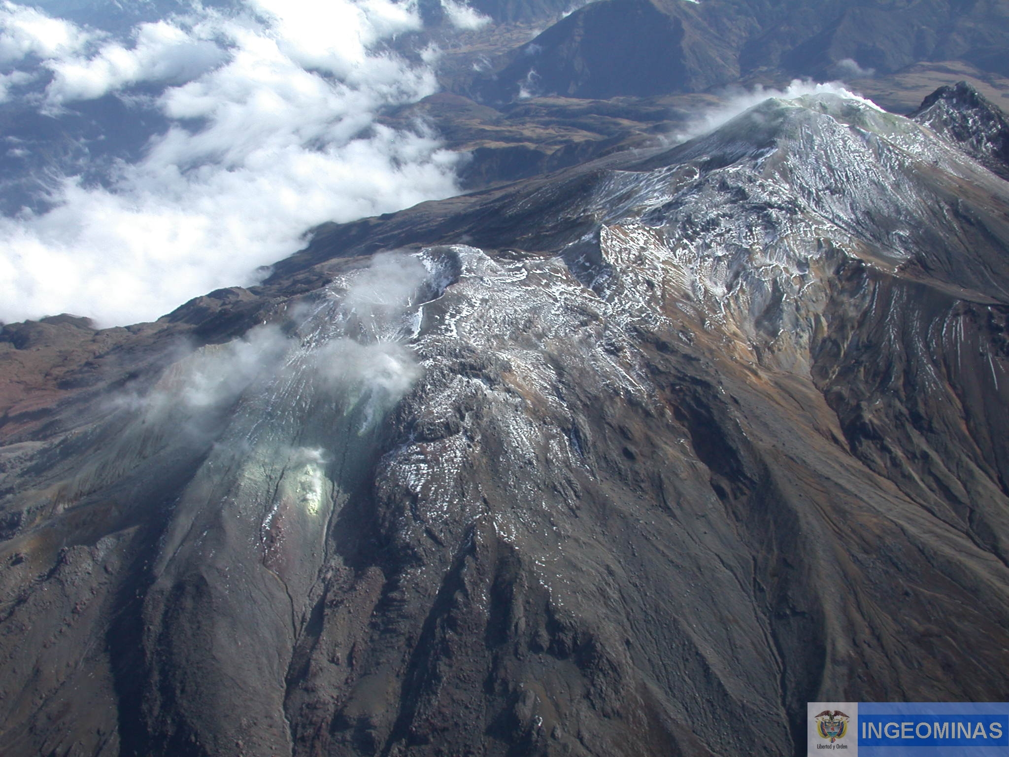
There was a record of columns of white gas emissions, with varying height and dispersion due to wind speed and direction. These emissions mainly came from the fumarole fields located northeast of the CVC (El Verde, Humeros-Fogones and La Rea), as well as other fumarole fields located southwest of the CVC (La Banda, Rastrojos and Boca Vieja). ).
No significant variation was observed in the other geophysical parameters of volcanic monitoring.
Volcanic activity remains in a YELLOW ALERT state: Active volcano with changes in the behavior of the base level of monitored parameters and other manifestations.
Source : SGC
Photo : Ingeominas