April 12 , 2024.
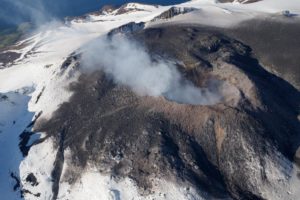
Philippines , Taal :
TAAL VOLCANO ADVISORY , 12 April 2024 , 9:00 AM
This is a notice of a phreatic eruption in Taal Volcano.
A phreatic or steam-driven eruption at the Taal Main Crater occurred in the early morning between 5:11 AM to 5:24 AM based on seismic, visual and infrasound records of the Taal Volcano Network (TVN). The event produced a white steam-laden plume 2400 meters tall that drifted southwest based on IP camera images. Sulfur dioxide (SO2) emission averaged 9,677 tonnes/day yesterday, 11 April 2024, and has been consistently elevated this year, averaging 10,248 tonnes/day since January 2024. The phreatic event was likely driven by the continued emission of hot volcanic gases at the Taal Main Crater and could be succeeded by similar phreatic activity. The background levels of volcanic earthquake activity and ground deformation detected at Taal indicate that unrest is unlikely to progress into magmatic eruption.
DOST-PHIVOLCS reminds the public that Alert Level 1 prevails over Taal Volcano, which means that it is still in abnormal condition and should not be interpreted to have ceased unrest nor ceased the threat of eruptive activity. At Alert Level 1, sudden steam-driven or phreatic explosions, volcanic earthquakes, minor ashfall and lethal accumulations or expulsions of volcanic gas can occur and threaten areas within TVI. Furthermore, degassing of high concentrations of volcanic SO2 continues to pose the threat of potential long-term health impacts to communities around Taal Caldera that are frequently exposed to volcanic gas. DOST-PHIVOLCS strongly recommends that entry into TVI, Taal’s Permanent Danger Zone or PDZ, especially the vicinities of the Main Crater and the Daang Kastila fissure, must remain strictly prohibited. Local government units are advised to continuously monitor and assess preparedness of their communities and undertake appropriate response measures to mitigate hazards that could be posed by long-term degassing and related phreatic activity. Civil aviation authorities must advise pilots to avoid flying close to the volcano as airborne ash and ballistic fragments from sudden explosions and wind-remobilized ash may pose hazards to aircrafts.
DOST-PHIVOLCS is closely monitoring Taal Volcano’s activity and any new significant development will be immediately communicated to all stakeholders.
Source : Phivolcs
Photo : Richard Langford (archive).
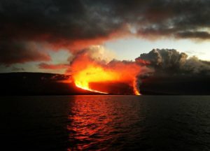
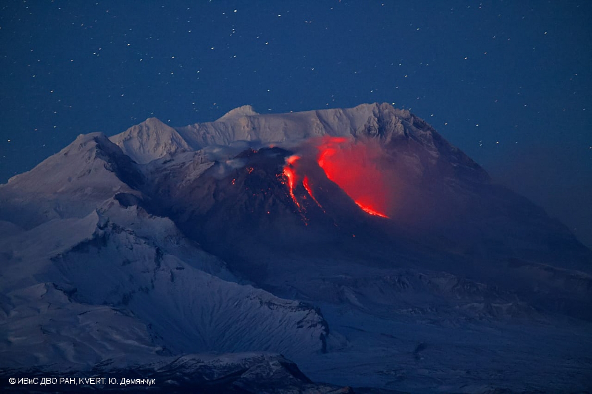
Kamchatka , Sheveluch :
VOLCANO OBSERVATORY NOTICE FOR AVIATION (VONA)
Issued: April 11 , 2024
Volcano: Sheveluch (CAVW #300270)
Current aviation colour code: ORANGE
Previous aviation colour code: orange
Source: KVERT
Notice Number: 2024-18
Volcano Location: N 56 deg 38 min E 161 deg 18 min
Area: Kamchatka, Russia
Summit Elevation: 3283 m (10768.24 ft), the dome elevation ~2500 m (8200 ft)
Volcanic Activity Summary:
Video and satellite data by KVERT shows a strong wind lifts ash from the southern slopes of Sheveluch volcano, and a plume of resuspended ash is extending about 40 km to the eastsouth-east of the volcano.
An extrusive-effusive eruption of the volcano continues. A danger of ash explosions up to 6 km (19,700 ft) a.s.l. remains. Ongoing activity could affect low-flying aircraft.
Volcanic cloud height:
2500-3000 m (8200-9840 ft) AMSL Time and method of ash plume/cloud height determination: 20240411/2145Z – Video data
Other volcanic cloud information:
Distance of ash plume/cloud of the volcano: 40 km (25 mi)
Direction of drift of ash plume/cloud of the volcano: ESE / azimuth 107 deg
Time and method of ash plume/cloud determination: 20240411/2110Z – Himawari-9 14m15
Remarks: resuspended ash
Source : Kvert
Photo : Yu. Demyanchuk, IVS FEB RAS, KVERT, (archive).
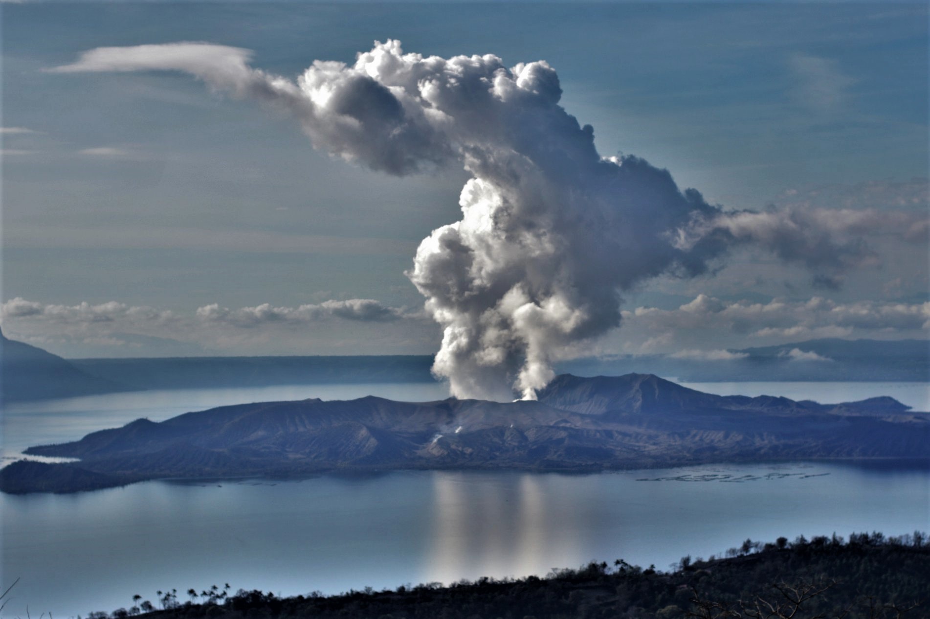
Indonesia , Ili Lewotolok :
An eruption of Mount Ili Lewotolok occurred on Friday, April 12, 2024 at 05:51 WITA with the height of the ash column observed at ±400 m above the summit (±1823 m above sea level). The ash column was observed to be gray with moderate intensity, oriented towards the East. This eruption was recorded on a seismograph with a maximum amplitude of 15.3 mm and a duration of 46 seconds.
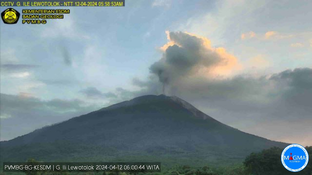
Communities around Mount Ili Lewotolok as well as visitors/climbers/tourists as well as residents of Jontona and Todanara villages are advised not to enter and carry out activities in the areas of the South and South-East sectors until ‘3 km from the activity center of Ili Lewotolok, and be aware of the potential threats of warm cloud avalanches and lahars coming from the South and Southeast of the summit/crater of Mount Ili Lewotolok.
PVMBG reported that the eruption at Lewotolok continued during 3-9 April. White-and-gray ash plumes rose as high as 350 m above the summit and drifted E and SE on 4 and 7 April. White emissions rose as high as 600 m above the summit and drifted in multiple directions on the other days. The Alert Level remained at 3 (on a scale of 1-4) and the residents of Lamawolo, Lamatokan, and Jontona were warned to stay 2 km away from the vent and 3 km away from the vent on the S and SE flanks.
Source : Magma Indonésie , GVP.
Chile , Villarica :
Seismology
The seismological activity of the period was characterized by the recording of:
A continuous tremor signal associated with the fluid dynamics inside the volcano, which during the period presented an energy variation, evaluated with the RSAM parameter, between 1.0 and 2.0 µm/s, values considered above their base level.
17 seismic events of type VT, associated with the fracturing of rocks (Volcano-Tectonics). The most energetic earthquake had a Local Magnitude (ML) value equal to 1.7, located 3.4 km east-southeast of the volcanic edifice, at a depth of 4.0 km compared to to the crater.
10,154 LP-type seismic events, associated with fluid dynamics inside the volcanic system (Long Period). The size of the largest earthquake evaluated from the Reduced Displacement (RD) parameter was equal to 35 cm2.
1954 seismic events of type TR, associated with the dynamics maintained over time of fluids inside the volcanic system (TRemor). The size of the largest earthquake evaluated from the Reduced Displacement (RD) parameter was equal to 31 cm2.
Fluid geochemistry
The sulfur dioxide (SO2) emissions data obtained by the differential optical absorption spectroscopy (DOAS) equipment, corresponding to the Los Nevados and Tralco stations, installed respectively at 10 km in an East-North-East direction and 6 km East-South-East of the active crater, presented an average value of 1,585 ± 254 t/d, which represents moderate values for this volcanic system. The maximum daily value was 3,800 t/d on March 18, considered an abnormal value for this system. 3 satellite anomalies were reported in atmospheric SO2 emissions in the area near the volcano, on March 21, 24 and 25, according to data published by the Tropospheric Monitoring Instrument (TROPOMI) and Mounts.

Thermal anomalies by satellites
During the period, 19 thermal alerts were recorded in the area associated with the volcano, with a maximum volcanic radiative power (VRP) of 48 MW on March 19, a value considered moderate according to data processed by Activity Observation volcanic in the mid-infrared (MIROVA,). Thanks to the analysis of Sentinel 2-L2A satellite images, 6 radiance anomalies were detected in the area associated with the crater during the evaluated period. The NHI tools platform detected a maximum area of anomalous radiance in the crater area of 34,400 m2. on March 25.
Satellite geomorphological analysis
Thanks to the photo-interpretation of Planet Scope, Sentinel 2 L2A and SkySat Collect satellite images, the interior of the crater was observed, where the permanence of a developing tephra ring is recognized, due to the accumulation of pyroclasts generated by recent activity, with an average diameter of 70 m. Inside, the lava lake is observed with sporadic surface variations due to the partial solidification of its surface, estimating an area of 192 m2
. On the other hand, fine fall deposits are identified with a range of 300 m to the east of the center of the crater.
The seismicity recording associated with fluid dynamics remains recurrent and a continuous signal with energy values above its base threshold. The RSAM values (measurement of the average amplitude by time intervals) show a trend towards stabilization with average values between 1.3 and 1.5 um/sec. At the same time, minor explosions propelling pyroclastic materials into the area near the crater, incandescences, anomalous values of SO2 fluxes and thermal anomalies continue to be observed. The monitoring parameters suggest the activity of a lava lake with variations in its level and its exposed area, with potential generation of explosive activity. In accordance with this context, the technical volcanic alert is maintained in:
YELLOW TECHNICAL ALERT: Changes in the behavior of volcanic activity
Source : Sernageomin
Photo : Marcela P Elgueda C
Colombia , Puracé – Chaîne volcanique Los Coconucos :
Weekly activity bulletin: Puracé Volcano – Los Coconucos volcanic chain
From the monitoring of the activity of the VOLCANIC CHAIN PURACE VOLCANO – LOS COCONUCOS, the MINISTRY OF MINES AND ENERGY, through the COLOMBIAN GEOLOGICAL SERVICE (SGC), reports that:
In the week of April 2 to 8, 2024, seismic activity presented levels similar to previous weeks, both in seismic energy released and in the number of events. The fracture earthquakes recorded were located mainly on the South-Eastern flank of the Puracé volcanic building, with depths between 1 and 4 km and magnitudes less than 0.9 ML; while the earthquakes associated with the fluids were located in two areas: one under the crater of the volcano, at depths less than 500 m, and another to the South-East of it, at depths between 1 and 6 km.
During the period evaluated, deformations continued to be recorded between the Puracé and Curiquinga volcanoes. Likewise, the concentration of carbon dioxide (CO2) continued to oscillate, being higher than the base values in this volcano and the increase in the flow of sulfur dioxide (SO2) detected in previous weeks continues to be observed.
Images obtained using installed cameras show that significant degassing of the volcanic system continues.
Other parameters measured for the assessment of volcanic activity showed no notable changes during the assessed period.
The alert status for volcanic activity remains at: YELLOW ALERT: ACTIVE VOLCANO WITH CHANGES IN THE BEHAVIOR OF THE BASE LEVEL OF MONITORED PARAMETERS AND OTHER MANIFESTATIONS.
Source et photo : SGC