April 06 , 2024.
Iceland , Reykjanes Peninsula :
Two craters still active . High SO2 levels continue to be detected occasionally around the eruption and in municipalities in the Reykjanes peninsula
Updated 4. April at 17:00 UTC
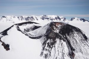
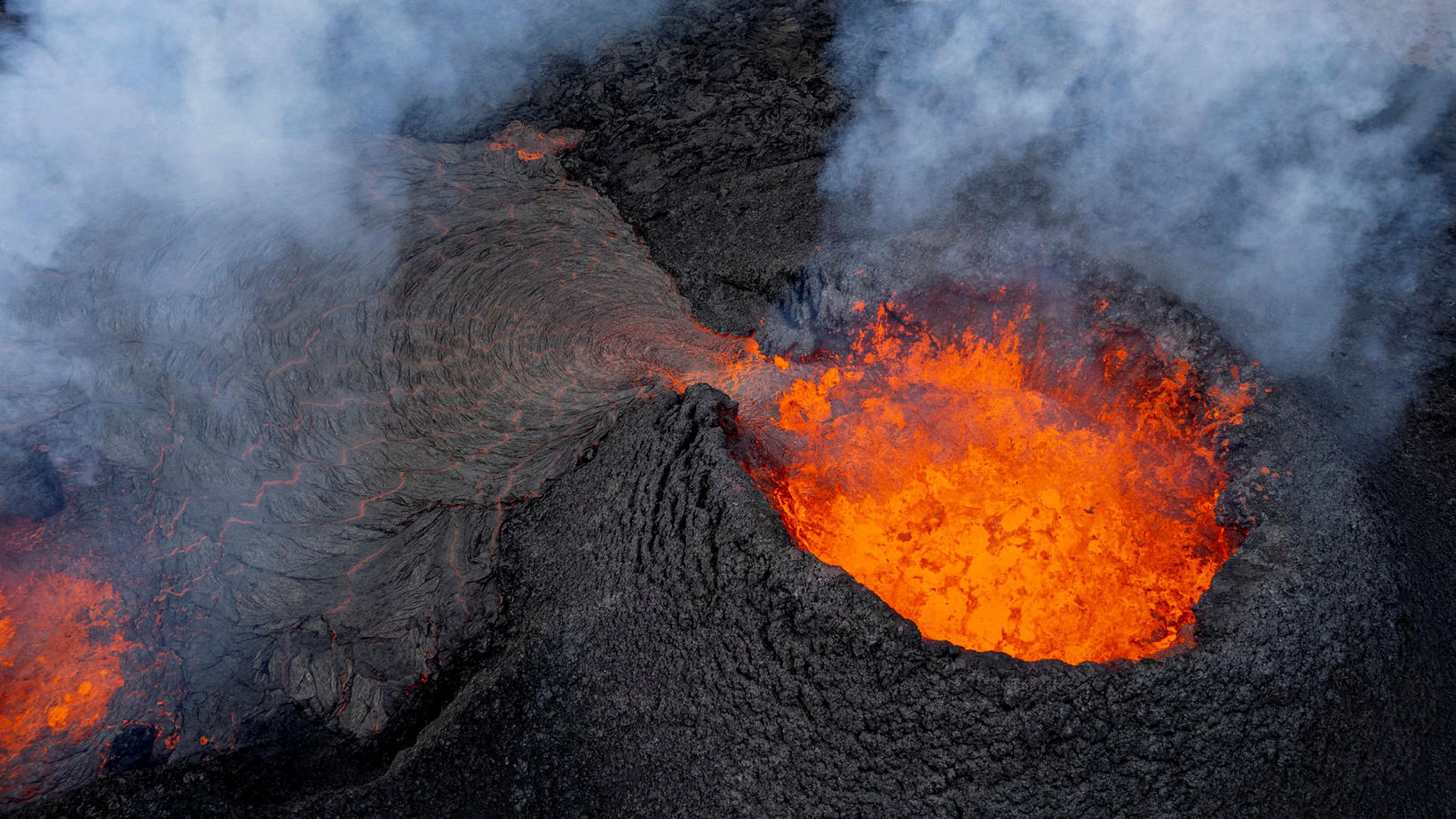
The eruption at the Sundhnúkur crater row continues and two craters are still active as in recent days. The northern crater is larger and most of the lava flow seems to be erupted from it, as can be seen in the image below which was taken last night, 3 April. Lava continues to flow south from the craters on top of the lava field formed in the first few days of this eruption. Last night there no clear signs of lava flow progressing alongside the lava barriers north of Grindavík, Southcoast road or Melhólsnáma mine.
Aerial image from a drone flight operated by Civil Protection last night, 3 April. The image shows the two craters and the lava flowing from them towards the south.
An interferogram covering the period 18 March – 3 April shows that land has risen about 3 cm in Svartsengi during that time. This is considerably slower deformation that was measured prior to the eruptions and dike propagations which have occurred in last months. Data from GPS measurements during the same period suggests that the rate of the land uplift has varied, but it difficult to estimate day-to-day deformation based on this data. Considering the GPS data for the same time period as the interferogram (18March – 3 April), the two datasets are consistent. Land uplift is detected in Svartsengi during the eruption, which has not been seen in the events that have occurred previously on the Sundhnúkur crater row. This indicates that the system is open, and magma continues to flow from considerable depth below Svartsengi to the surface in the Sundhnúkur crater row.
Gas measurements carried out last Tuesday, 2 April, estimate that approx. 37-41 kg/s of SO2 is emitted from the craters. Temporary high sulfur dioxide levels continue to be measured around the eruption site and in municipalities in the Reykjanes peninsula. Gas from the eruption is likely to cause pollution in the Reykjanes peninsula and we advise people in the area to monitor air quality at loftgaedi.is and familiarize themselves with the response to air pollution from volcanic eruptions.
The weather forecast today (Thursday) is southeast and southerly winds of 8-13 m/s at the eruption site, causing gas to be dispersed to the northwest and north, meaning gas could be detected in Vogar, Reykjanesbær and Suðurnesjabær. Easterly winds 5-10 m/s tomorrow (Friday), causing gas dispersion towards the west, for example to Svartsengi. Northesterly winds, 5-10 m/s late tomorrow causing gas pollution in the southwest and possibly in Grindavík.
Source : IMO
Photos : IMO , mbl.is / Kristinn Magnússon
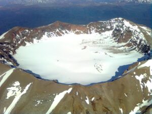
Indonesia , Merapi :
MOUNT MERAPI ACTIVITY REPORT, from March 29 to April 4, 2024. Published on April 5, 2024
OBSERVATION RESULT
Visual
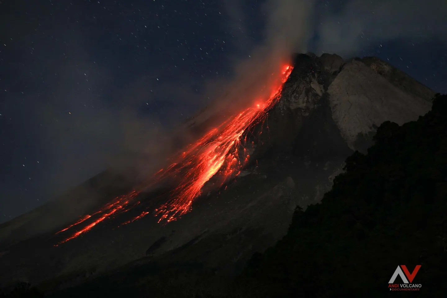
The weather around Mount Merapi is generally clear in the morning and night, while it is foggy from noon to evening. White smoke, thin to thick, low to moderate pressure and 150 m high was observed from the observation post of Mount Merapi in Kaliurang on April 4, 2024 at 07:35 WIB. This week, there was a warm cloud avalanche in the southwest (upstream of the Bebeng River) with a sliding distance of 1,700 m. It was reported that light ash rain occurred in the areas of Sewukan, Sengi and Keningar villages, Dukun district, Magelang regency. Lava avalanches were observed 49 times towards the southwest up to a maximum of 1,800 m. The sound of an avalanche was heard once from Pos Jrakah with low intensity. The figure shows the morphological analysis of the lava dome from a drone survey of March 30, 2024 in the form of thermal photos.
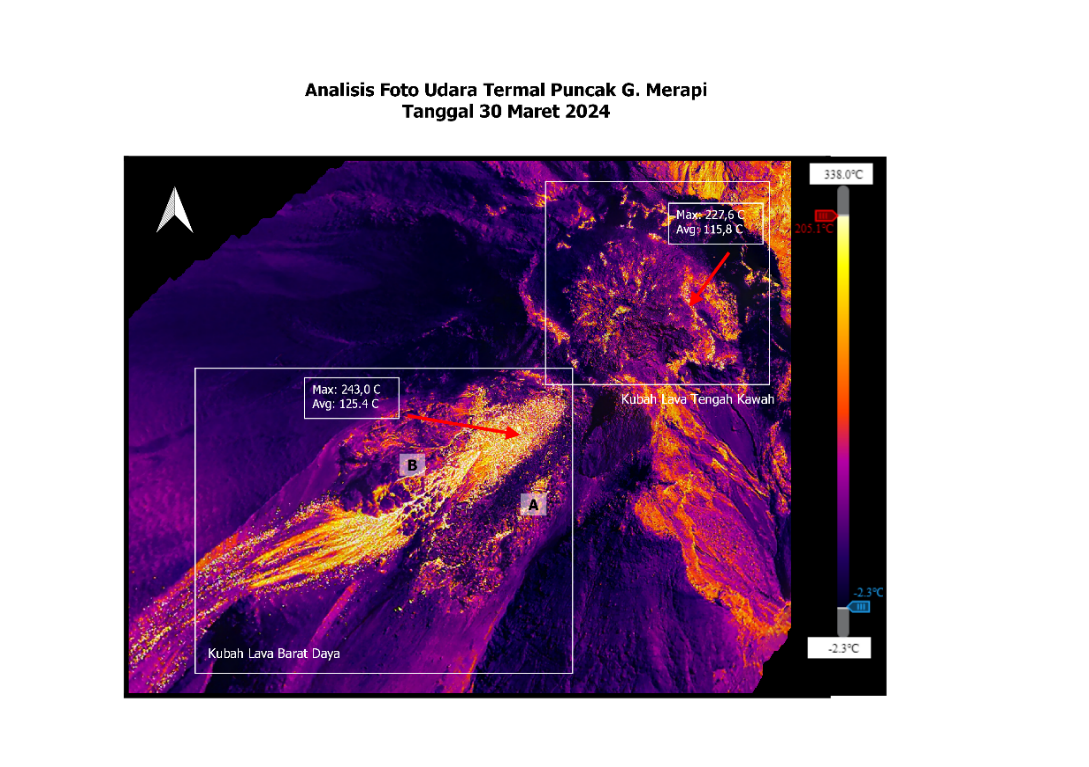
The morphology of the southwest dome was observed to change due to the activity of hot cloud avalanches and lava avalanches. The highest hot spot was observed at 243°C, lower than the previous measurement temperature. The morphology of the median dome is relatively constant. The highest hot spot was observed at 227.6°C, higher than the previous measurement temperature. Based on the analysis of aerial photos dated March 30, 2024, the volume of the southwest dome was measured at 2,054,600 m3 and that of the central dome at 2,358,200 m3.
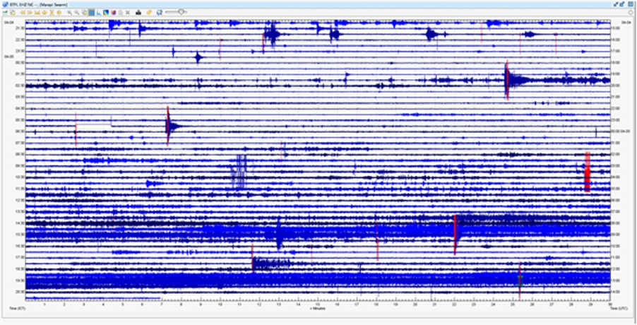
Seismicity
This week, the seismicity of Mount Merapi recorded:
1 warm cloud avalanche (APG) earthquake,
51 shallow volcanic earthquakes (VTB),
233 multi-phase (MP) earthquakes,
3 low frequency (LF) earthquakes.
326 avalanche earthquake (RF),
25 tectonic earthquakes (TT).
The intensity of earthquakes this week is higher than last week.
Deformation
The deformation of Mount Merapi monitored by EDM this week showed a shortening rate of 0.6 cm/day.
Rain and lahars
This week there was rain at Mount Merapi lookout post with a rain intensity of 99 mm/hour for 85 minutes at Kaliurang lookout post on April 2, 2024. No additional flow or lahar was reported in the rivers that have their source on Mount Merapi.
Conclusion
Based on the results of visual and instrumental observations, it was concluded that: The volcanic activity of Mount Merapi is still quite high in the form of effusive eruptive activity. The activity status is set to the “SIAGA” level.
Source : BPPTKG
Photos : BPPTKG , Andi volcanist
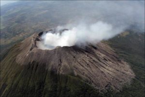
Alaska , Shishaldin :
Low-level unrest continues at Shishaldin Volcano. Seismicity was at low levels throughout the week with small volcanic earthquakes and weak seismic tremor observed. Weak infrasound was detected on a couple days in quiet conditions and likely results from gas bubbles bursting deep within the volcanic crater. Two stronger bursts of seismic tremor and infrasound signals occurred on March 30 and suggest low-level explosive activity was likely occurring within the volcanic crater. No ash emissions or new deposits were observed in partly cloudy satellite and webcam views during the week, but weak steam emissions were seen in clear webcam views.
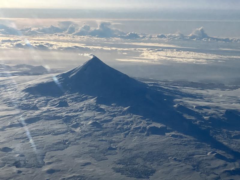
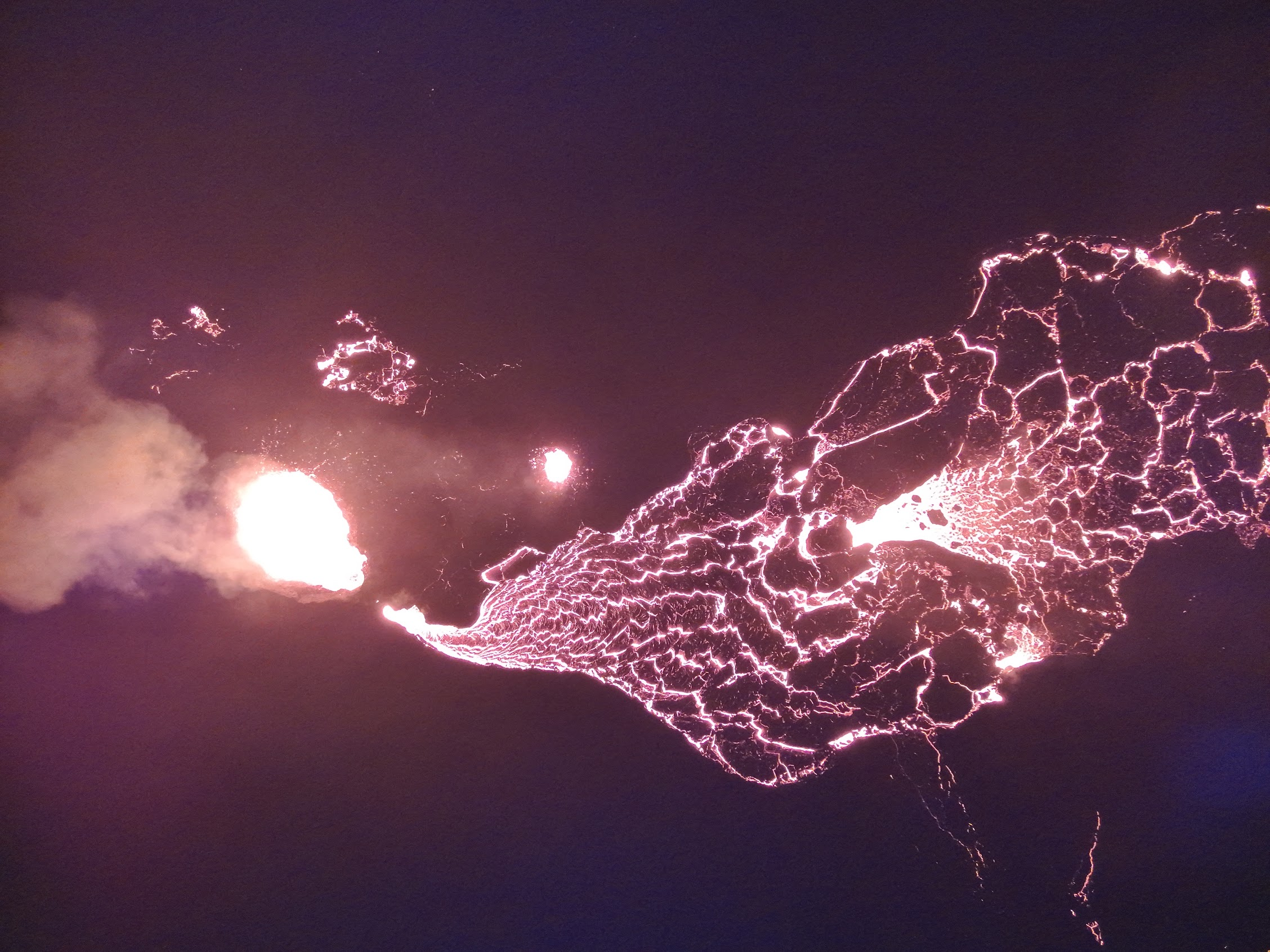
Images of the north side of Shishaldin Volcano on February 20, 2024 from a passing flight showing light steaming from the summit and a snow-free area over cooling deposits on a northeast drainage.
Satellite radar imagery from March 31 showed a small collapse inside of the summit crater. Minor rock falls associated with collapse events from the unstable ground in and near the summit crater remain likely. These events may generate very small clouds of fine-grained ash that dissipate quickly in the immediate vicinity of the summit.
No significant eruptive activity has occurred since November 2023.
Local seismic and infrasound sensors, web cameras, and a geodetic network are used to monitor Shishaldin Volcano. In addition to the local monitoring network, AVO uses nearby geophysical networks, regional infrasound and lighting data, and satellite images to monitor the volcano.
Source : AVO
Photo : Beesley, Nick.
Indonesia , Marapi :
CALLING THE PUBLIC TO STAY AWAY FROM THE COURSES/RIVER BEDS WHICH DOWN FROM THE TOP OF Mt. MARAPI
(G.) Marapi Volcano is administratively located in Agam Regency and Tanah Datar Regency, West Sumatra Province, with a maximum height of 2,891 meters above sea level at coordinates 0o 22 ‘ 47.72″ South latitude – 100o 28’ 16.71″ East longitude. The activity of Mount Marapi is monitored visually and instrumentally from the Marapi Volcano Observation Post (PGA).
The series of Mount Marapi eruptions have occurred repeatedly since December 3, 2023, to the present and have produced deposits of eruption materials varying in size from ash, lapilli to rocks /volcanic bombs in the summit area and slopes of Mount Marapi. When it rains, water fills the river flow and mixes with deposits of volcanic material to produce lahars that flow to low-lying areas, particularly following the flow of rivers that originate directly at the top of Mount Marapi.
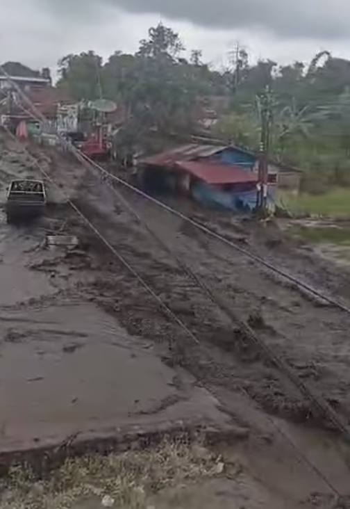
Based on seismograph records at PGA Post. Marapi, Bukittinggi, on Friday, April 5, 2024 between 2:00 p.m. and 3:30 p.m. WIB, vibrations/tremors were recorded from heavy rains that fell around the summit of Mount Marapi, which subsequently led to lahar flooding at the following locations:
Bukik Batabuah, Candung district (cutting the Bukik Batabuah – Lasi road);
Nagari Aia Angek, Sepuluh Koto district (cutting the Padang Panjang – Bukittinggi road);
Pua River District; And several rivers flow into the Batipuah district.
From around 6:30 p.m. WIB until the writing of this press release, seismographic records still indicated that rain was falling in the Mount Marapi area. In this regard, as a measure of vigilance against lahars, the public is once again called upon to temporarily stay away from the banks of streams/rivers that originate at the top of Mount Marapi.
Until now, the activity level of Mount Marapi remains at level III (SIAGA).
Source : PVMBG
Photos : Capture d’écran video Andi Volcanist , PVMBG.
Chile , Laguna del Maule :
Special Report on Volcanic Activity (REAV), del Maule regions, Laguna del Maule volcanic complex, April 6, 2024, 02:00 local time (mainland Chile)
The National Geology and Mining Service of Chile (Sernageomin) announces the following PRELIMINARY information, obtained through the monitoring equipment of the National Volcanic Monitoring Network (RNVV), processed and analyzed at the Southern Andean Volcano Observatory (Ovdas):
On Saturday April 6, 2024, at 1:28 a.m. local time (04:28 UTC), monitoring stations installed near the Laguna del Maule volcanic complex recorded an earthquake associated with the fracturing of rocks (volcano-tectonic).
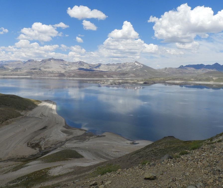
The characteristics of the largest earthquake after its analysis are as follows:
ORIGINAL TIME: 01:28 local time (04:28 UTC)
LATITUDE: 36.117° S
LONGITUDE: 70.568°W
DEPTH: 8.5 km
LOCAL MAGNITUDE: 3.1 (ML)
Observation :
Following the mentioned event, other events with similar characteristics, but of lower energy, were recorded. At the time of issuing this report, volcano-tectonic seismicity continues to be recorded.
The technical volcanic alert is maintained at YELLOW level.
Source et photo : Sernageomin