March 31 , 2024.
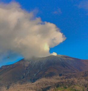
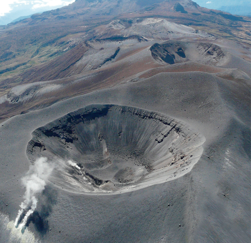
Indonesia , Merapi :
MOUNT MERAPI ACTIVITY REPORT from March 22 to 28, 2024. Published on March 29, 2024
OBSERVATION RESULT
Visual
The weather around Mount Merapi is generally clear in the morning and night, while it is foggy from noon to evening. White smoke, thin to thick, low to moderate pressure and 350 m high was observed from the observation post of Mount Merapi in Babadan on March 22, 2024 at 05:35 WIB. This week, lava avalanches were observed 46 times in the South and Southwest, including 2 times upstream of the Boyong River with a maximum distance of 800 m and 44 times upstream of the Bebeng River with a maximum distance of 1,500m. It was observed that the morphology of the southwest dome had changed due to the activity of hot cloud avalanches and lava avalanches. The morphology of the median dome is relatively constant. Based on the analysis of aerial photos dated March 21, 2024, the volume of the southwest dome was measured at 2,066,400 m3 and that of the central dome at 2,358,000 m3.
Seismicity
This week, the seismicity of Mount Merapi recorded:
1 shallow volcanic earthquake (VTB),
22 multi-phase (MP) earthquakes,
4 low frequency (LF) earthquakes,
346 avalanche earthquakes(RF),
49 tectonic earthquakes (TT).
The intensity of earthquakes this week is still quite high.
Deformation
Deformation of Mount Merapi monitored by EDM and GPS this week showed no significant changes.
Rain and lahars
This week there was rain at Mount Merapi lookout post with a rain intensity of 62 mm/hour for 135 minutes at Kaliurang lookout post on March 24, 2024. No additional flow or lahar was reported in the rivers that have their source on Mount Merapi.
Conclusion
Based on the results of visual and instrumental observations, it was concluded that: The volcanic activity of Mount Merapi is still quite high in the form of effusive eruptive activity. The activity status is at the “SIAGA” level.
Source : BPPTKG
Photo : John Bamforth / FB.
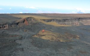
Colombia , Purace / Los Coconucos volcanic chain :
Weekly activity bulletin: Puracé Volcano – Los Coconucos volcanic chain
From the monitoring of the activity of the PURACE VOLCANO – LOS COCONUCOS VOLCANIC CHAIN, the MINISTRY OF MINES AND ENERGY, through the COLOMBIAN GEOLOGICAL SERVICE (SGC), reports that:
In the week of March 19 to 25, 2024, seismic activity presented levels similar to those of previous weeks, both in seismic energy released and in the number of events.
The fracture earthquakes recorded were located mainly on the southeast flank of the Puracé volcanic building, with depths between 2 and 4 km and magnitudes less than 1.1 ML; while the earthquakes associated with the fluids were located in two areas: one under the crater of the volcano, at depths less than 500 m, and another to the South-East of it, at depths between 1, 5 and 4.0 km.
During the period evaluated, deformations continued to be recorded between the Puracé and Curiquinga volcanoes. Likewise, the concentration of carbon dioxide (CO2) continued to oscillate and remains above reference values on this volcano. The increase in sulfur dioxide (SO2) flux detected in previous weeks continued to be recorded.
Images obtained using installed cameras show that significant degassing of the volcanic system continues.
Other parameters measured and used for the assessment of volcanic activity showed no notable changes during the period evaluated.
The alert status for volcanic activity remains at: YELLOW ALERT: ACTIVE VOLCANO WITH CHANGES IN THE BEHAVIOR OF THE BASE LEVEL OF MONITORED PARAMETERS AND OTHER MANIFESTATIONS.
Source et photo : SGC
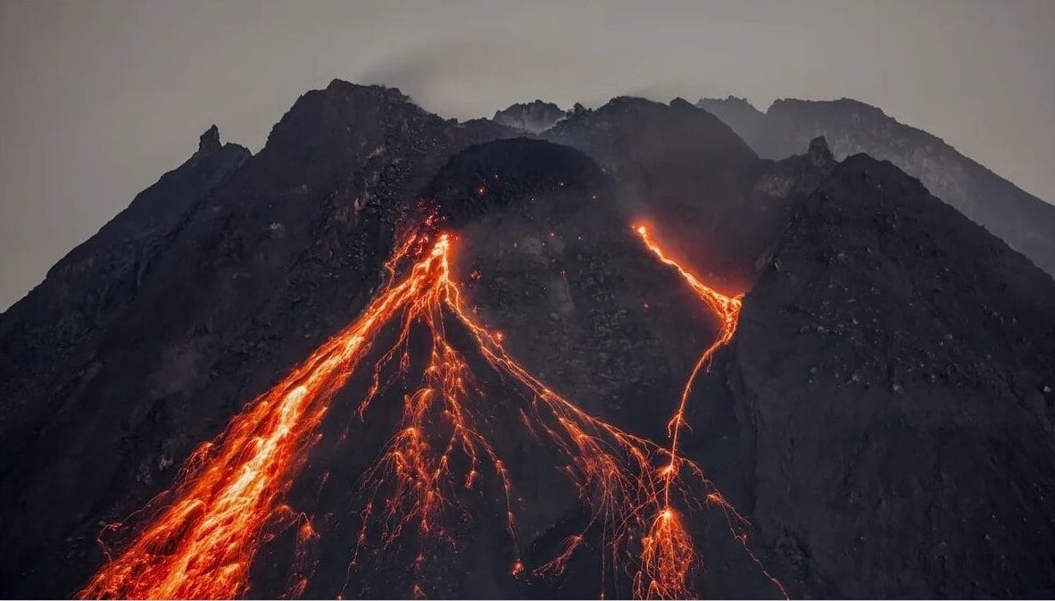
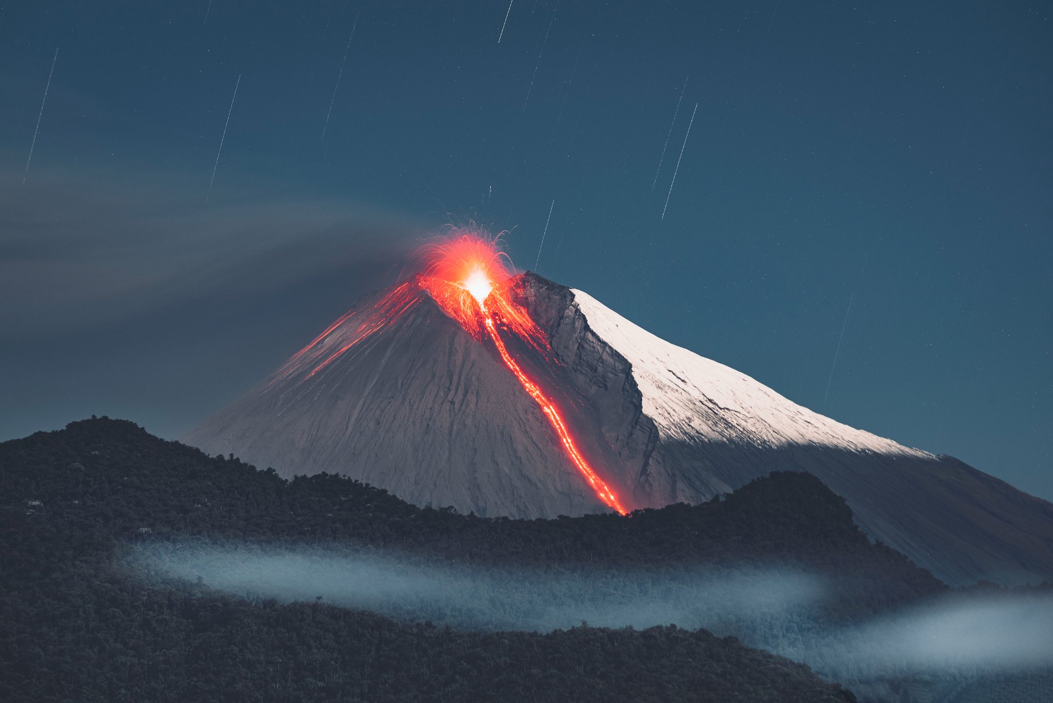
Ecuador , Sangay :
DAILY REPORT ON THE STATE OF THE SANGAY VOLCANO, Saturday March 30, 2024.
Information Geophysical Institute – EPN.
Surface activity level: High, Surface trend: No change
Internal activity level: High, Internal trend: No change
Seismicity: From March 29, 2024, 11:00 a.m. to March 30, 2024, 11:00 a.m.:
The number of seismic events recorded at the reference station over the past 24 hours is shown below. The level of seismic activity of the volcano remains high.
Explosion Event (EXP): 1451
Precipitation/Lahars:
No rain was recorded in the region. **Heavy rains could remobilize accumulated material and generate flows of mud and debris that would flow down the volcano’s flanks and flow into adjacent rivers.
Emissions/ash column:
Since yesterday afternoon and this morning, thanks to the surveillance camera system and GOES-16, several gas and ash emissions have been recorded, the heights of which varied between 500 and 2800 meters above the level of the crater in a direction North, North-East, West-North-West, North-West.
On the other hand, the VAAC agency in Washington reported 5 emissions of ash, with heights between 900 and 1,800 meters above the level of the crater, in the Northwest and Northeast directions. During this morning, a light ash fall was reported in the canton of Guamote.
Other monitoring parameters:
The FIRMS satellite system detected 91 thermal anomalies over the past 12 hours. The MIROVA-MODIS satellite system detected 3 thermal anomalies and the MIROVA-VIIRS satellite system recorded 1 thermal anomaly in the last 24 hours.
Observation:
Thanks to the surveillance camera system, the cloudy area was observed most of the time. In the early morning, the descent of incandescent material was observed up to 2000 meters below the level of the crater. At the time of this report, the volcano is completely cloudy.
Alert level: yellow
Source : IGEPN.
Photo : Lucas Scott / volcan Sangay
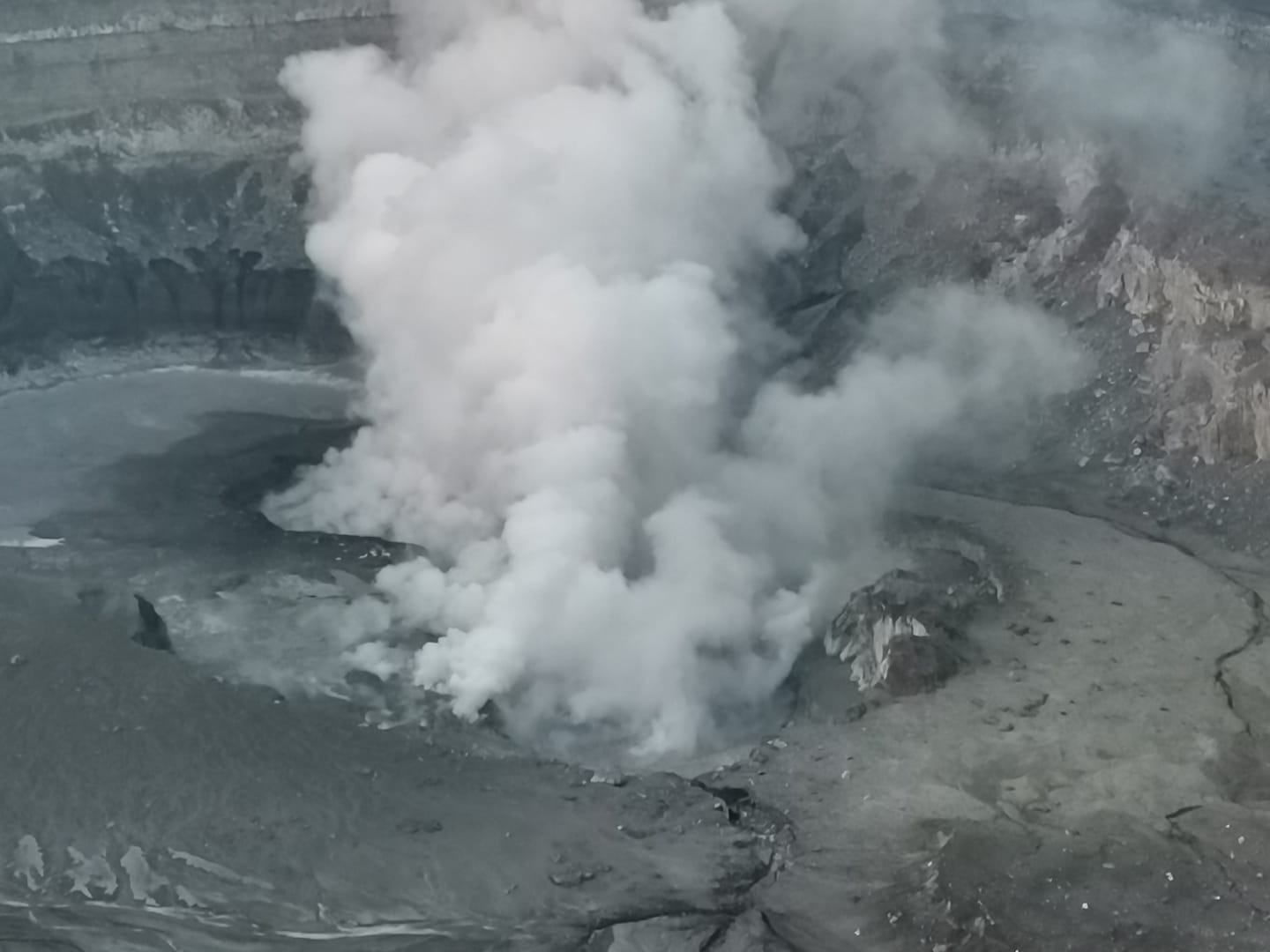
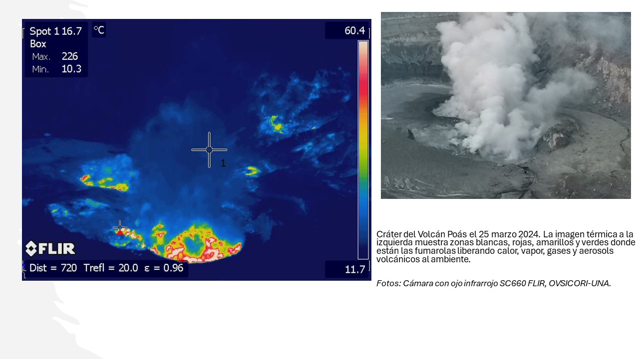
Costa Rica , Poas :
Latitude: 10.2
Longitude: -84,233
Altitude: 2,687 meters above sea level
Activity observed:
The network of seismographs and infrasound sensors continues to record signals associated with the vigorous outgassing of fumaroles through vents that lie at the nearly dry floor of the active crater. A seismic signal of volcanic tremor with frequencies between 0.7 and 4 Hz is recorded continuously over the past 24 hours, although a 1.5 Hz tremor band is recorded sporadically as fumaroles degas associated with the emission of ashes intensifies. Tremor in general is associated with the loud release of jets or jets of vapors, gases, aerosols, water and sediment (old ashes) through narrow fumarole ducts that produce a loud noise in the mouth fumaroles. Numerous small phreatic eruptions are observed at the central mouth of fumaroles at the crater floor, ejecting water and sediment from the crater floor and underground hydrothermal system. Most of the ejecta falls to the bottom of the crater, although the finest ash is transported by the wind to the west of the volcano.
The SO2 concentration at Visitor’s Viewpoint recorded a maximum of 2 parts per million in the ExpoGAS sensor this morning. On the other hand, the MultiGAS system located on the western edge of the crater indicates gas ratios around stable values, SO2/CO2=0.6 and H2S/SO2=0.6 and a concentration of SO2=11 parts per million. Residents of towns west of the Poás volcano have reported sulfur smells (Sucre San Carlos, Zarcero, Grecia, Sabana Redonda, San Pedro de Poás, Monte de la Cruz, San Rafael and San Isidro de Heredia) and some health effects. : headache, nausea, irritation of the mucous membranes (eyes, nose, mouth, skin), nosebleeds. Between yesterday and today, ash falls were reported in places such as: Sarchí, Grecia, Naranjo, San Ramón de Alajuela, Palmares, Atenas.
Environmental conditions:
The predominant wind direction is from the South-South-West with a speed of 50 km/h (IMN). The summit of Poás remains clear.
Activity Level: Warning (2)
Source : Ovsicori.
Photos : Maria Martinez , Ovsicori.
La Guadeloupe , La Soufrière :
Press release from the Paris Institute of Globe Physics, Volcanological and Seismological Observatory of Guadeloupe. Thursday March 28, 2024 at 9:00 a.m. (local time) – 1:00 p.m. UTC
Sequence of earthquakes in the La Soufrière area of Guadeloupe – Basse Terre
A sequence of earthquakes located above the volcano began on Tuesday March 26, 2024 at 5:00 p.m. local time (Tuesday March 26, 2024 at 9:00 p.m. UT) in the area of the La Soufrière volcano.
During this sequence, the OVSG-IPGP networks recorded 192 earthquakes of very low magnitude (M < 1).
No earthquakes were reported felt. The events are located at a depth of <2.5 km below the summit of the La Soufrière dome.
The alert level remains: yellow, vigilance.
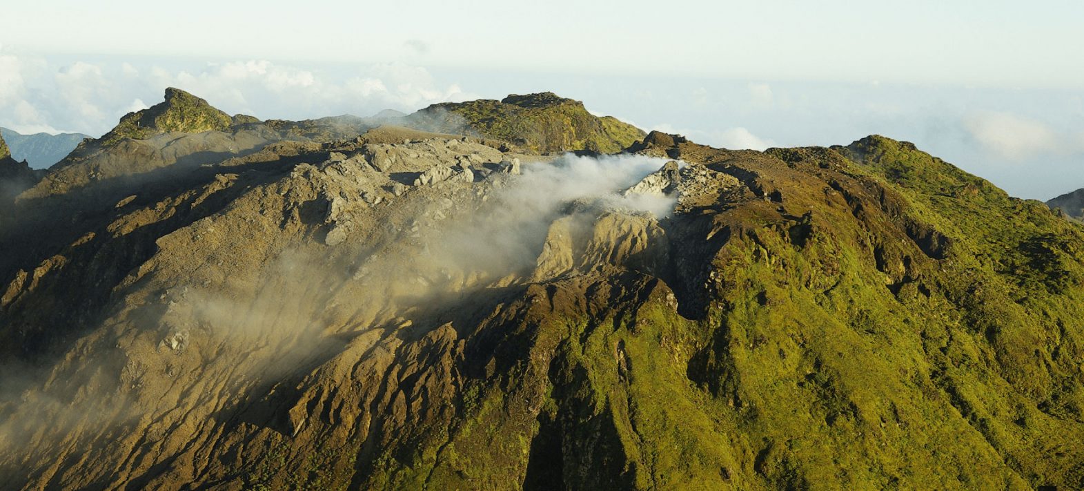
the Guadeloupe Volcanological and Seismological Observatory (OVSG) has responded to concerns about smoke observed at Soufrière volcano on the French Caribbean Island of Guadeloupe.
The Observatory in an online post on Friday said many people would have photographed Soufrière in recent days and are wondering about the “smoke”.
It explained these fumaroles have been present for years and, usually, they are hidden in the clouds and/or driven towards the South-South-West by the Trade Winds.
The Guadeloupe Volcanological and Seismological Observatory said the fumaroles have been clearly visible in recent days, thanks to exceptional weather conditions.
Sources : Direction de l’OVSG-IPGP , Caribbean.loopnews.com/
Photo : OVSG-IPGP