October 10 , 2023.
New Zealand , White Island :
Volcanic Activity Bulletin
Low level steam and gas emissions continue at Whakaari/White Island.
The Volcanic Alert Level remains at Level 2.
Published: Tue Oct 10 2023 12:00 PM
Based on gas and observation flights over the last few months, we conclude activity at Whakaari/White Island remains limited to minor steam and gas emissions. No eruptive activity was detected over the past few months, and changes in the active crater area have been minimal.
Recent observation and gas flights show steam and gas plumes continue to originate from the normal cluster of active vent locations on the west shore of the lake. Minor erosion continues to make small changes to the area. Measured gas discharge rates have remained within normal ranges over the last few months. Views from the Whakatāne webcam support these observations, although local atmospheric conditions can sometimes allow tall steam plumes to develop above the island (image below). The regular aerial views of the islands confirm steam and gas vents in the crater have shown no evidence of ash emission or eruptive activity.
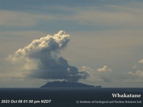
Elevated steam plume over Whakaari seen from Whakatāne on Sunday 8th of October, probably triggered by local atmospheric conditions.
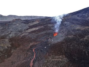
Measurements from regular observation flights have recorded a decline in the temperatures from the larger vents. In March, temperatures were higher than 240 °C, in June-August 120 to 123 °C, and now in October they are 95 °C.
During the 4th of October observation flight a rock fall was observed happening from Troup Head on the eastern end of the island. The fall propagated to the ridge crest and rocks fell to both the southern and northern sides of the ridge (see image below). Although unusual, there is evidence of past rock falls in this area.
Following the failure of our last two on-island monitoring sites, we now have no on-island monitoring capability.
Our webcam from Whakatāne continues to provide near-real time visual monitoring on the plume emitted from Whakaari, and we make regular observation and gas measurement flights. We also monitor the volcano from space. Satellite based ground deformation data retrieved approximately every 10 days allow us to observe long term ground deformation trends. Daily satellite-based Sulphur Dioxide (SO2) emission measurements using TROPOMI, although not as sensitive as our gas measurement flights, allows us to assess the amount of gas emissions. Neither of these satellite techniques have detected significant changes in the overall activity at the volcano over the past few months.
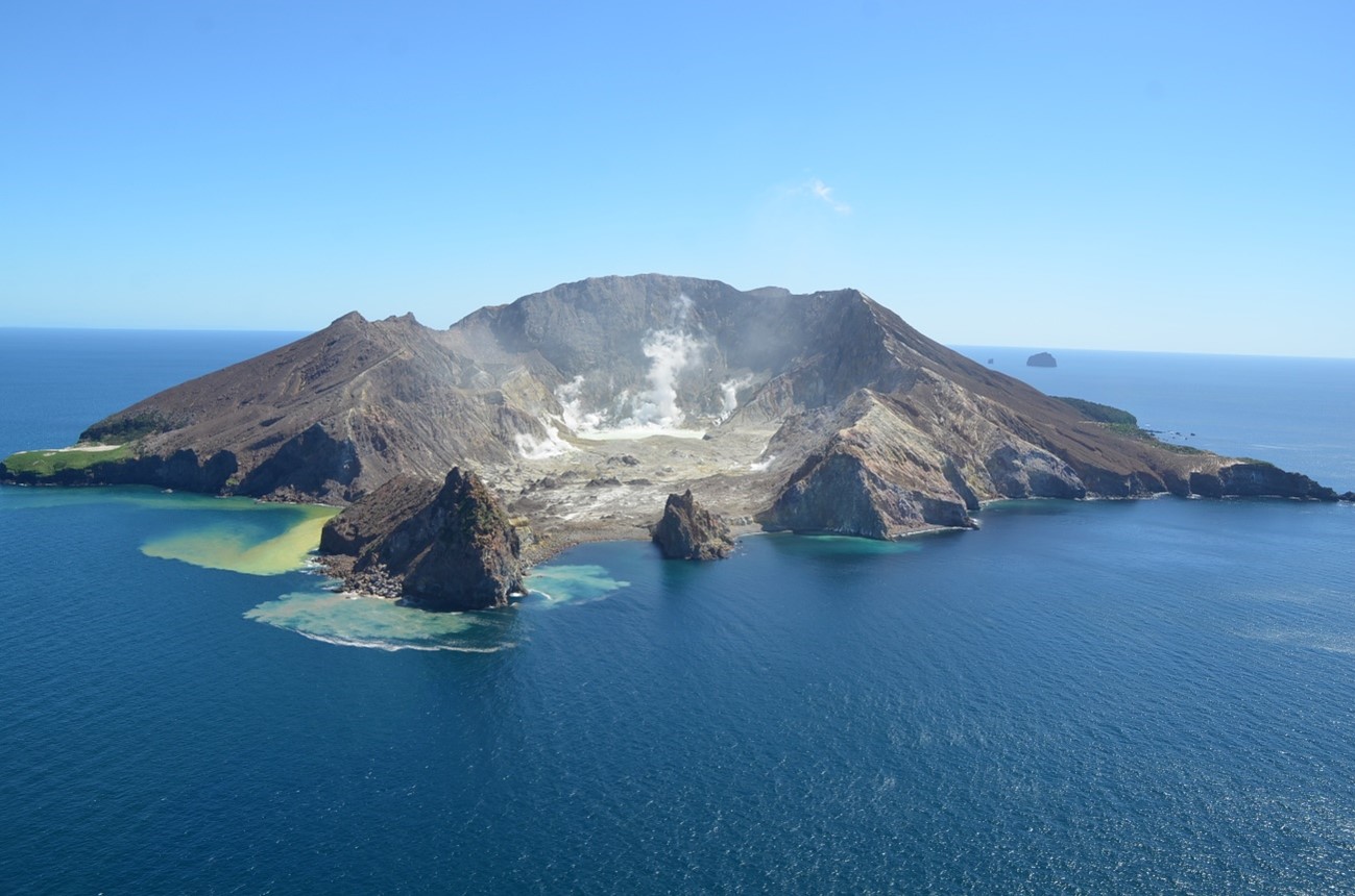
Aerial view of Whakaari/White Island, 4 October 2023 showing active steam and gas plumes from the main vent area (centre) and rock fall from Troup Head (centre left). Photograph credit: Brad Scott, GNS Science.
The Volcanic Alert Level remains at Level 2 (moderate to heightened unrest) and the Aviation Colour Code remains at Yellow, acknowledging the current level of activity, but also continuing to consider the greater level of uncertainty in our interpretation due to the current lack of consistent, useful real-time data.
Source : Geonet / Cameron Asher / Duty Volcanologist
Photos : Geonet , Brad Scott, GNS Science.
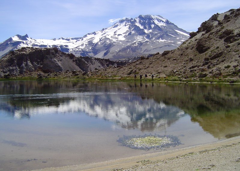
Chile , Descabezado Grande :
Special Report on Volcanic Activity (REAV), Maule region, Descabezado Grande volcanic complex, October 9, 2023, 7:45 a.m. local time (mainland Chile)
The National Geology and Mining Service of Chile (Sernageomin) announces the following PRELIMINARY information, obtained through the monitoring equipment of the National Volcanic Monitoring Network (RNVV), processed and analyzed at the Andes del Sud Volcanological Observatory ( Ovdas):
On Monday, October 9, 2023 at 7:11 a.m. local time (10:11 a.m. UTC), monitoring stations installed near the Descabezado Grande volcanic complex recorded an earthquake associated with the fracturing of rocks inside the volcanic system (VT volcano-tectonic type) .
The characteristics of the earthquake after its analysis are as follows:
ORIGINAL TIME: 07:11 local time (10:11 UTC)
LATITUDE: 35,575° S
LONGITUDE: 70,730°W
DEPTH: 4.8 km
LOCAL MAGNITUDE: 3.3 (ML)
Comments:
At the time of issuing this report, a lower energy aftershock was recorded. The monitoring parameters did not observe any changes following the event described. Images from IP cameras did not show superficial activity.
The technical volcanic alert remains at the Green level.
Source : Sernageomin.
Photo : Wikiheinz
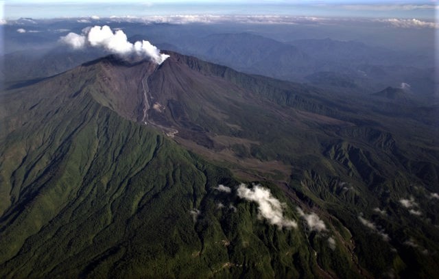
Ecuador , Reventador :
DAILY REPORT ON THE STATE OF THE REVENTADOR VOLCANO, Monday October 9, 2023.
Information Geophysical Institute – EPN.
Surface activity level: High, Surface trend: No changes
Internal activity level: Moderate, Internal trend: No changes
Seismicity: From October 8, 2023, 11:00 a.m. to October 9, 2023, 11:00 a.m.:
The following table shows the number of seismic events from the reference station in the last 24 hours.
Explosion (EXP) 25
Long Period (LP) 20
Transmitting Tremor (TREMI) 4
Harmonic Tremor (TRARM) 1
Precipitation/Lahars:
Rains were recorded in the volcano area without generating mudslides or debris. *In the event of heavy rains, these could remobilize the accumulated materials, generating mud and debris flows which would descend the sides of the volcano and flow into adjacent rivers.
Emissions/ash column:
Yesterday afternoon, thanks to the camera system, several gas and ash emissions were recorded with heights between 600 and 1000 meters above the level of the crater with West and North-West directions. This morning, an emission of gas and ash was recorded at a height of less than 200 meters above the level of the crater in the west direction. In addition, the VAAC in Washington reported an emission of gas and ash at a height of 1,010 meters above the level of the crater, in a northwest direction.
Observation:
The volcano remained mostly cloudy. Yesterday evening, thanks to the camera system, several episodes of incandescence were observed at the level of the crater with material descending along the flanks of the volcano up to 500 meters below the level of the crater. At the time of closing this report, the volcano remains cloudy.
Alert level: Orange.
Source : IGEPN.
Photo : Patricio Ramon, 2005 (Instituto Geofisca, Escuela Politecnica Nacional).
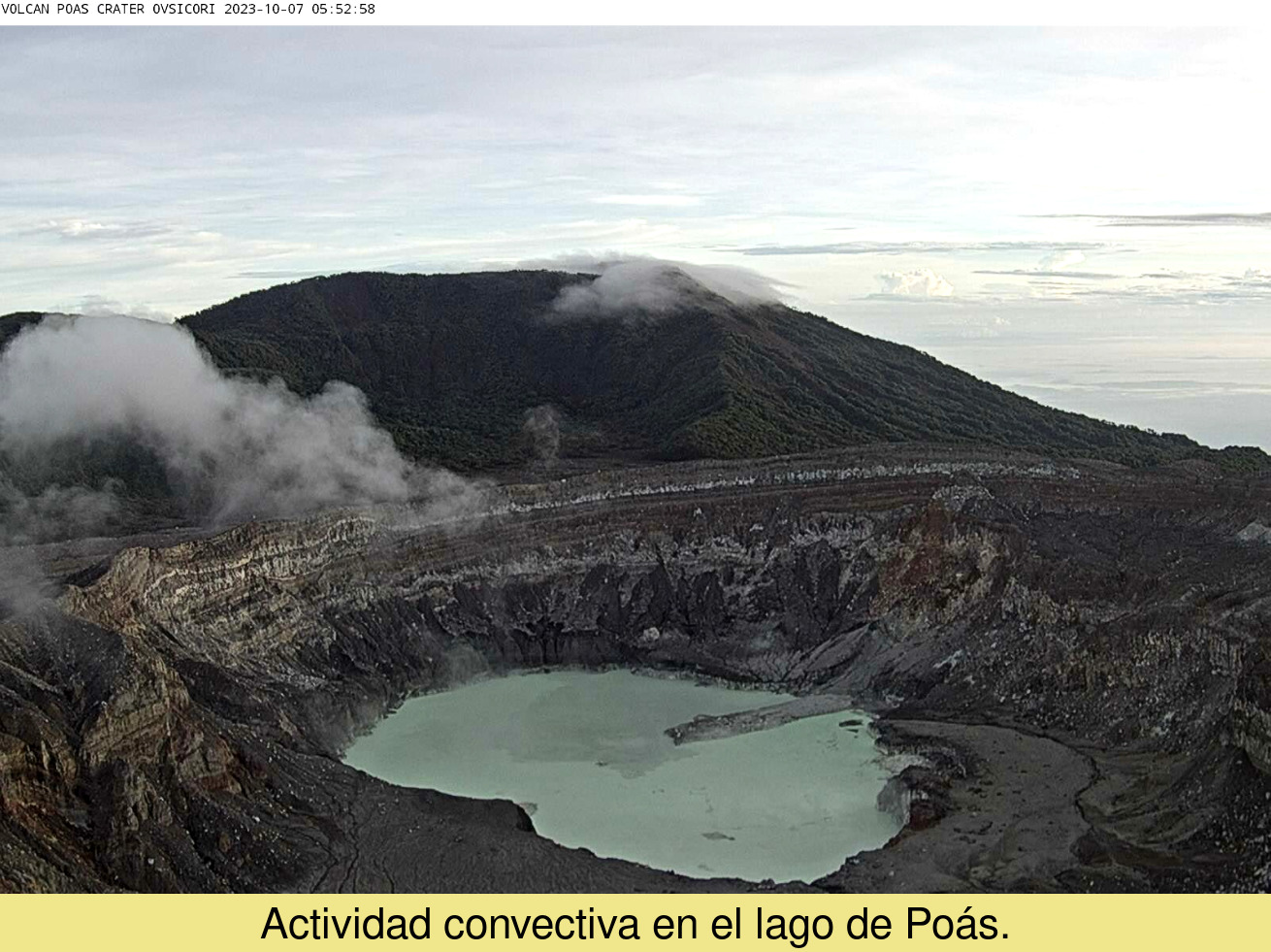
Costa Rica , Rincon de la Vieja / Poas / Turrialba :
Daily report on the state of volcanoes. Date: October 9, 2023, updated at: 10:39:00.
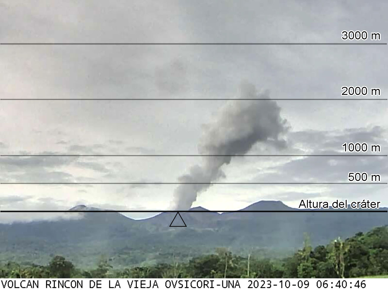
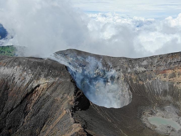
Rincón de la Vieja Volcano
Latitude: 10.83
Longitude:-85.324
Altitude: 1,916 meters above sea level
Activity observed:
Sometimes small eruptions of water vapor and magmatic gases are recorded with columns that rise up to 2,000 meters above the crater level. A moderate broad-spectrum tremor is maintained in a frequency band between 3 and 6 Hz. No volcanic or tectonic earthquakes associated with volcanic activity have been recorded. A slight uplift is recorded at the top of the volcano, while the flow of volcanic gases remains stable.
Environmental conditions:
The winds push the air masses towards the North-West and the summit is partly cloudy.
Activity Level: Caution (3)
Poas Volcano
Latitude: 10.2
Longitude: -84,233
Altitude: 2,687 meters above sea level
Activity observed:
No eruption is recorded. The tremor remains intense in a frequency band between 2.5 and 7.5 Hz. Weak fumarolic activity is observed within the crater lagoon. This morning, between 7 a.m. and 8 a.m., concentrations of SO2 gas in the air exceeded 5 parts per million, while the multi-service station recorded maximums below 10 parts per million. the CO2/SO2 and H2S/SO2 ratios remaining constant.
Environmental conditions:
The winds blow mainly from the North-West, with significant variations during the day. The summit is partly cloudy.
Activity Level: Warning (2)
Turrialba Volcano
Latitude: 10,025
Longitude: -83,767
Altitude: 3,325 meters above sea level
Activity observed:
No volcanic eruptions or earthquakes have been recorded. Seismic activity remains low, with occasional low frequency and very low amplitude volcanic earthquakes. The concentration values of volcanic gases appear to be low.
Environmental conditions:
The winds blow from the North-West and the summit remains partly cloudy.
Activity Level: Warning (2)
Source : Ovsicori
Photos : Ovsicori , G. Avard / Ovsicori
Indonesia , Semeru :
VOLCANO OBSERVATORY NOTICE FOR AVIATION – VONA
Issued : October 10 , 2023.
Volcano : Semeru (263300)
Current Aviation Colour Code : ORANGE
Previous Aviation Colour Code : orange
Source : Semeru Volcano Observatory
Notice Number : 2023SMR342
Volcano Location : S 08 deg 06 min 29 sec E 112 deg 55 min 12 sec
Area : East java, Indonesia
Summit Elevation : 11763 FT (3676 M)

Volcanic Activity Summary :
Eruption with volcanic ash cloud at 00h59 UTC (07h59 local).
Volcanic Cloud Height :
Best estimate of ash-cloud top is around 13363 FT (4176 M) above sea level or 1600 FT (500 M) above summit. May be higher than what can be observed clearly. Source of height data: ground observer.
Other Volcanic Cloud Information :
Ash cloud moving to north. Volcanic ash is observed to be white to gray. The intensity of volcanic ash is observed to be thick.
Remarks :
Eruption recorded on seismogram with maximum amplitude 22 mm and maximum duration 100 second.
Source : Magma Indonésie
Photo : Archive , unknown author.